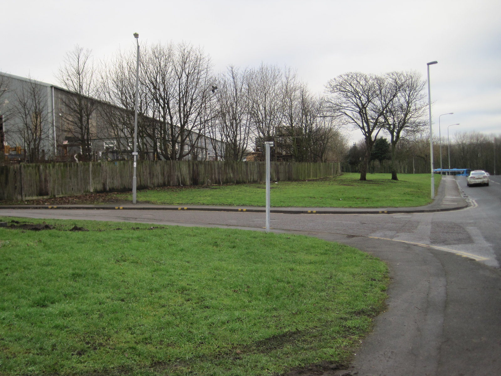
Ewe Hill

Hill, Mountain in Durham

England

Ewe Hill
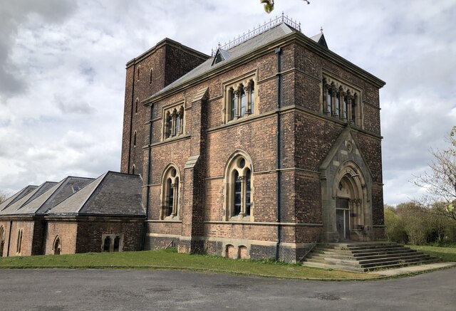
Dalton Pumping Station Grade II listed pumping station from the 1870s, designed by Thomas Hawksley. The pumping station was taken out of use in the 1940s, and the upper portion of the central tower was removed in the 1960s. After several abortive attempts to re-purpose the building, as of August 2021 it is in the process of being renovated as a wedding venue.
Dalton Pumping Station Credit: David Robinson

Ewe Hill is a prominent hill located in Durham, England. Standing at an elevation of approximately 200 meters (656 feet), it is part of the Pennines range and offers breathtaking views of the surrounding countryside. The hill is situated near the village of Wolsingham and is easily accessible for hikers and nature enthusiasts.

Ewe Hill is characterized by its rolling green slopes, which are covered in grass and scattered with a variety of wildflowers during the warmer months. The hill is also home to a diverse range of wildlife, including various bird species and small mammals. Many visitors are drawn to Ewe Hill for its tranquil atmosphere and the opportunity to spot rare and endangered species.

A network of footpaths and trails crisscrosses the area, making it an ideal destination for walkers and ramblers. The hill's gentle slopes and well-maintained paths cater to all levels of fitness, allowing visitors to explore at their own pace. Along the way, walkers can take advantage of strategically placed benches and picnic spots to rest and enjoy the scenery.

Ewe Hill's location within the North Pennines Area of Outstanding Natural Beauty ensures that it remains unspoiled and offers visitors a chance to experience the region's natural splendor. The hill's close proximity to Durham City makes it a popular day trip destination for locals and tourists alike.

Overall, Ewe Hill is a picturesque and accessible natural landmark, offering stunning views, diverse wildlife, and a peaceful environment for all those who visit.

If you have any feedback on the listing, please let us know in the comments section below.

Ewe Hill Images

Images are sourced within 2km of 54.827314/-1.3506672 or Grid Reference NZ4148. Thanks to Geograph Open Source API. All images are credited.

Dalton Pumping Station Grade II listed pumping station from the 1870s, designed by Thomas Hawksley. The pumping station was taken out of use in the 1940s, and the upper portion of the central tower was removed in the 1960s. After several abortive attempts to re-purpose the building, as of August 2021 it is in the process of being renovated as a wedding venue.
Dalton Pumping Station
Grade II listed pumping station from the 1870s, designed by Thomas Hawksley. The pumping station was taken out of use in the 1940s, and the upper portion of the central tower was removed in the 1960s. After several abortive attempts to re-purpose the building, as of August 2021 it is in the process of being renovated as a wedding venue.
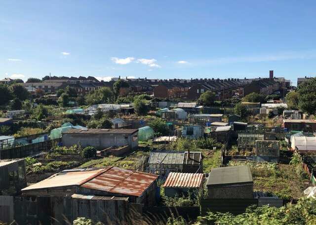
Allotments At Dawdon Allotment gardens in front of colliery rows at Dawdon. Dawdon Colliery was one of the last to close in the Durham coalfield.
Allotments At Dawdon
Allotment gardens in front of colliery rows at Dawdon. Dawdon Colliery was one of the last to close in the Durham coalfield.
Steel Statue "Tommy", Seaham, County Durham, Tommy is a statue of a First World War soldier by artist Ray Lonsdale, displayed close to Seaham war memorial, on Terrace Green by the seafront in Seaham, County Durham, in North East England.

The corten steel statue weighs 1.2 tonnes and is 9 feet 5 inches (2.87 m) tall, with a rusty red patina. It depicts a First World War soldier. 

<span class="nowrap"><a title="https://en.wikipedia.org/wiki/Tommy_(statue)" rel="nofollow ugc noopener" href="https://en.wikipedia.org/wiki/Tommy_(statue)">Link</a><img style="margin-left:2px;" alt="External link" title="External link - shift click to open in new window" src="https://s1.geograph.org.uk/img/external.png" width="10" height="10"/></span>
Steel Statue "Tommy", Seaham, County Durham,
Tommy is a statue of a First World War soldier by artist Ray Lonsdale, displayed close to Seaham war memorial, on Terrace Green by the seafront in Seaham, County Durham, in North East England. The corten steel statue weighs 1.2 tonnes and is 9 feet 5 inches (2.87 m) tall, with a rusty red patina. It depicts a First World War soldier. LinkExternal link
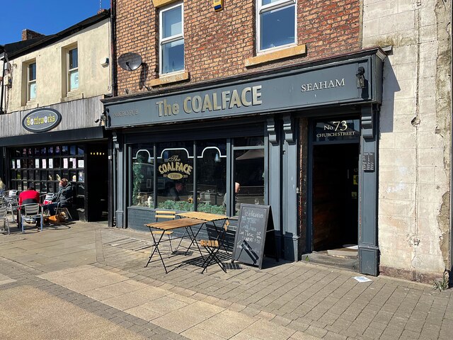
The Coalface Micro pub on Church Street, Seaham
The Coalface
Micro pub on Church Street, Seaham
The Wheel, Seaham Harbour Taken from a colliery winding engine.
The Wheel, Seaham Harbour
Taken from a colliery winding engine.
'Tommy' A sculpture by local artist Ray Lonsdale. It is entitled 'Eleven-O-One' (referring to the first minute of peace as the armistice came into force) but is affectionately known as 'Tommy' by the local community.
'Tommy'
A sculpture by local artist Ray Lonsdale. It is entitled 'Eleven-O-One' (referring to the first minute of peace as the armistice came into force) but is affectionately known as 'Tommy' by the local community.
Seaham marina. A short walk around the Harbour and Marina at Seaham.
Seaham marina.
A short walk around the Harbour and Marina at Seaham.
Seaham Marina
Seaham Marina
Church Street, Seaham
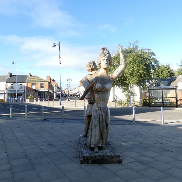
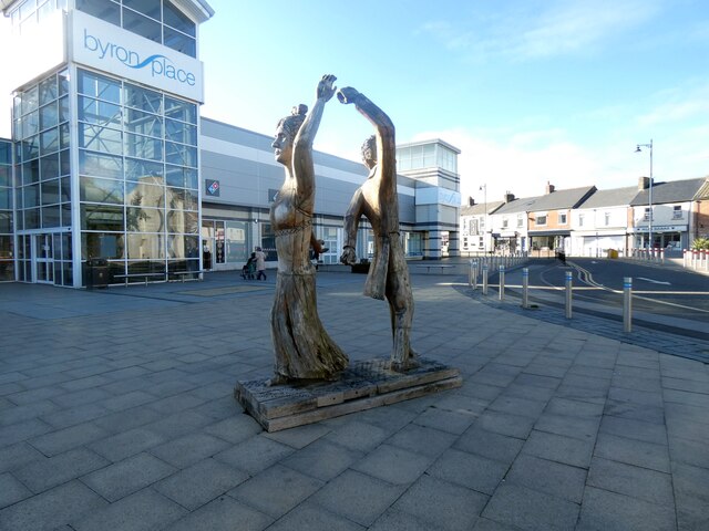
Byron carvings These wood carvings commemorate Lord Byron and his wife Anne Isabella Milbanke, who were married at nearby Seaham Hall in 1815. The carvings are by Seaham artist, David Gross and stand outside the Byron Place shopping centre and were unveiled in January 2016. Beyond, the pedestrianised Church Street leads up to St John's Parish Church.
Byron carvings
These wood carvings commemorate Lord Byron and his wife Anne Isabella Milbanke, who were married at nearby Seaham Hall in 1815. The carvings are by Seaham artist, David Gross and stand outside the Byron Place shopping centre and were unveiled in January 2016. Beyond, the pedestrianised Church Street leads up to St John's Parish Church.
Byron carvings These wood carvings commemorate Lord Byron and his wife Anne Isabella Milbanke, who were married at nearby Seaham Hall in 1815. The carvings are by Seaham artist, David Gross and stand outside the Byron Place shopping centre and were unveiled in January 2016.
Byron carvings
These wood carvings commemorate Lord Byron and his wife Anne Isabella Milbanke, who were married at nearby Seaham Hall in 1815. The carvings are by Seaham artist, David Gross and stand outside the Byron Place shopping centre and were unveiled in January 2016.
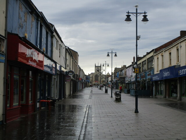
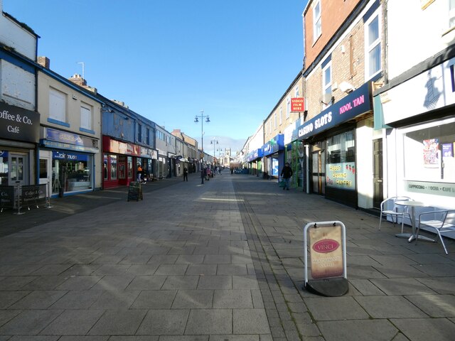
Church Street A wide pedestrianised street leading towards the Parish Church.
Church Street
A wide pedestrianised street leading towards the Parish Church.
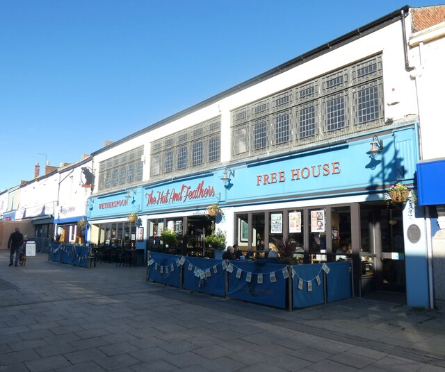
The Hat and Feathers Originally three shops, numbers 57 to 59 Church Street were a pawnbrokers, wardrobe dealer, and chemist and dentist during the 1890s. Following the turn of the century they went on to become a milliners – hat makers – confectioners and drapers. Then for almost 60 years, from 1923 to 1981, two of the shops were home to Doggarts family run department store, which sold furniture, clothes and fine hats with feathers. In 2013 after a £1.2m conversion the premises became a Wetherspoon pub. <span class="nowrap"><a title="https://cannybrew.com/media/photo-galleries/weatherspoons-turn-former-seaham-seaside-department-store-into-latest-pub-gallery/" rel="nofollow ugc noopener" href="https://cannybrew.com/media/photo-galleries/weatherspoons-turn-former-seaham-seaside-department-store-into-latest-pub-gallery/">Link</a><img style="margin-left:2px;" alt="External link" title="External link - shift click to open in new window" src="https://s1.geograph.org.uk/img/external.png" width="10" height="10"/></span>

<a href="https://www.geograph.org.uk/photo/7343974">NZ4249 : Sign of The Hat and Feathers</a>.
The Hat and Feathers
Originally three shops, numbers 57 to 59 Church Street were a pawnbrokers, wardrobe dealer, and chemist and dentist during the 1890s. Following the turn of the century they went on to become a milliners – hat makers – confectioners and drapers. Then for almost 60 years, from 1923 to 1981, two of the shops were home to Doggarts family run department store, which sold furniture, clothes and fine hats with feathers. In 2013 after a £1.2m conversion the premises became a Wetherspoon pub. LinkExternal link NZ4249 : Sign of The Hat and Feathers.
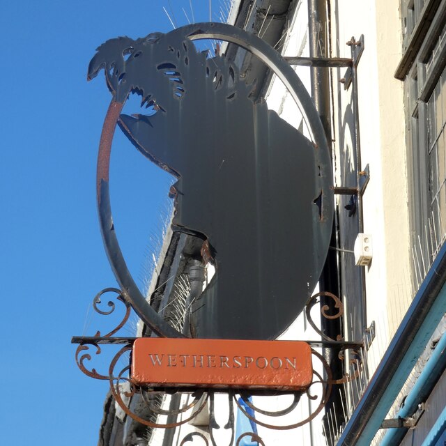
Sign of The Hat and Feathers Sign for The Hat and Feathers <a href="https://www.geograph.org.uk/photo/7343967">NZ4249 : The Hat and Feathers</a>.
Sign of The Hat and Feathers
Sign for The Hat and Feathers NZ4249 : The Hat and Feathers.
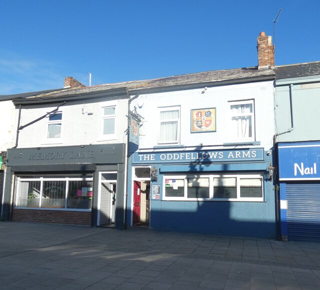
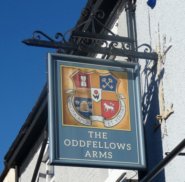
Memory Lane and Oddfellows Arms The Memory Lane bar opened in 2019 in premises previously occupied by Hutchinsons fruit and vegetable shop. At the same time the Oddfellows Arms next door was renovated.

<a href="https://www.geograph.org.uk/photo/7343996">NZ4249 : Sign of The Oddfellows Arms</a>.
Memory Lane and Oddfellows Arms
The Memory Lane bar opened in 2019 in premises previously occupied by Hutchinsons fruit and vegetable shop. At the same time the Oddfellows Arms next door was renovated. NZ4249 : Sign of The Oddfellows Arms.
Sign of The Oddfellows Arms Sign for The Oddfellows Arms <a href="https://www.geograph.org.uk/photo/7343990">NZ4249 : Memory Lane and Oddfellows Arms</a>.
Sign of The Oddfellows Arms
Sign for The Oddfellows Arms NZ4249 : Memory Lane and Oddfellows Arms.
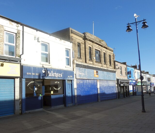
Valentes Seaham 
The cafe on Church Street was established in 1920 and was originally an ice cream parlour. Woolworths opened next door in 1936. It closed in 1989 and for a time was an Ethel Austin shop. More recently it has housed a charity shop.
Valentes Seaham
The cafe on Church Street was established in 1920 and was originally an ice cream parlour. Woolworths opened next door in 1936. It closed in 1989 and for a time was an Ethel Austin shop. More recently it has housed a charity shop.
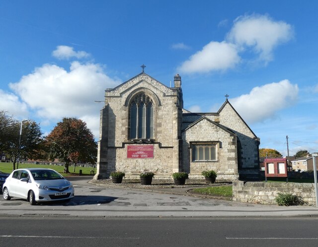
Parish Church of St John the Evangelist, Seaham 
The Grade II listed <span class="nowrap"><a title="https://historicengland.org.uk/listing/the-list/list-entry/1277262?section=official-list-entry" rel="nofollow ugc noopener" href="https://historicengland.org.uk/listing/the-list/list-entry/1277262?section=official-list-entry">Link</a><img style="margin-left:2px;" alt="External link" title="External link - shift click to open in new window" src="https://s1.geograph.org.uk/img/external.png" width="10" height="10"/></span> church by Thomas Prosser dates from 1840. The  north aisle was added in 1860 and the  choir and vicar's vestries were added by R.J.Johnson in 1885-6.

An historic timeline can be found on the church website: <span class="nowrap"><a title="https://stjohns-seaham.org.uk/church-history" rel="nofollow ugc noopener" href="https://stjohns-seaham.org.uk/church-history">Link</a><img style="margin-left:2px;" alt="External link" title="External link - shift click to open in new window" src="https://s1.geograph.org.uk/img/external.png" width="10" height="10"/></span>
Parish Church of St John the Evangelist, Seaham
The Grade II listed LinkExternal link church by Thomas Prosser dates from 1840. The north aisle was added in 1860 and the choir and vicar's vestries were added by R.J.Johnson in 1885-6. An historic timeline can be found on the church website: LinkExternal link
Show me another place!

Ewe Hill is located at Grid Ref: NZ4148 (Lat: 54.827314, Lng: -1.3506672)

Unitary Authority: County Durham

Police Authority: Durham

What 3 Words

///mothering.clipped.canny. Near Seaham, Co. Durham

Related Wikis

Deneside

Deneside is an area in Seaham, County Durham, in England. It is situated to the west of Seaham. == References == == External links == The most spectacular...

Stony Cut, Cold Hesledon

Stony Cut, Cold Hesledon is a Site of Special Scientific Interest in the Easington district of north-east County Durham, England. It consists of a shallow...

Dalton-le-Dale

Dalton-le-Dale is a small village in County Durham, in England. The parish population taken at the 2011 census was 1,546. It is situated on the old A19...

Seaham Harbour railway station

Seaham Harbour railway station was a railway station that served the town of Seaham Harbour in County Durham, North East England. For much of its existence...

Nearby Amenities

Located within 500m of 54.827314,-1.3506672
Traffic Calming: hump
Lat/Long: 54.8282748/-1.356417
Bus Stop
Shops
Naptan AtcoCode: 13003630C
Naptan Bearing: E
Naptan CommonName: Shops
Naptan Indicator: east bound
Naptan Landmark: Landmark not known
Naptan NaptanCode: duratjat
Naptan Notes: directly between no 49-50 parkside crescent situated on verge- seaham- sr7 7uz
Naptan Street: Parkside Crescent
Naptan Verified: no
Source: naptan_import
Lat/Long: 54.8273674/-1.3430984
Bus Stop
Shops
Naptan AtcoCode: 13003630G
Naptan Bearing: W
Naptan CommonName: Shops
Naptan Indicator: west bound
Naptan Landmark: Landmark not known
Naptan NaptanCode: duratjaw
Naptan Notes: 7.2m west of no 3 propety- infront opf comunity centre. heathway- seaham- sr7 7uh
Naptan Street: Parkside Crescent
Naptan Verified: no
Source: naptan_import
Lat/Long: 54.8267958/-1.3437459
Bus Stop
Heathway
Naptan AtcoCode: 13003631A
Naptan Bearing: N
Naptan CommonName: Heathway
Naptan Indicator: north bound
Naptan Landmark: Landmark not known
Naptan NaptanCode: duratjda
Naptan Notes: near roundabout heathway- seaham
Naptan Street: Heathway
Naptan Verified: no
Source: naptan_import
Lat/Long: 54.8238872/-1.3476687
Bus Stop
Fern Crescent
Naptan AtcoCode: 13003932A
Naptan Bearing: N
Naptan CommonName: Fern Crescent
Naptan Indicator: north bound
Naptan Landmark: Landmark not known
Naptan NaptanCode: durawama
Naptan Notes: fern crescent approx opposite no. 34- seaham- sr7 7un
Naptan Street: Street not known
Naptan Verified: no
Source: naptan_import
Lat/Long: 54.82504/-1.3448016
Bus Stop
Fern Crescent
Naptan AtcoCode: 13003932E
Naptan Bearing: S
Naptan CommonName: Fern Crescent
Naptan Indicator: south bound
Naptan Landmark: Landmark not known
Naptan NaptanCode: durawamd
Naptan Notes: fern crescent opposite junction for jasmine crescent- seaham
Naptan Street: Street not known
Naptan Verified: no
Source: naptan_import
Lat/Long: 54.8251901/-1.3443011
Power: pole
Lat/Long: 54.8303807/-1.3508654
Power: pole
Lat/Long: 54.8285743/-1.3545048
DS & GK Dhanda
Addr City: Seaham
Addr Country: GB
Addr Housenumber: 54-55
Addr Postcode: SR7 7UQ
Addr Street: Parkside Crescent
Fhrs Id: 301973
Shop: supermarket
Lat/Long: 54.826923/-1.3430565
Power: pole
Lat/Long: 54.8297107/-1.3558258
Power: pole
Lat/Long: 54.8290773/-1.3558258
Power: pole
Lat/Long: 54.8284121/-1.3558406
Power: pole
Lat/Long: 54.8275546/-1.355862
Power: pole
Lat/Long: 54.8265859/-1.3558835
Power: pole
Lat/Long: 54.8257021/-1.3558969
Power: pole
Lat/Long: 54.8249681/-1.3558969
Power: pole
Lat/Long: 54.8241708/-1.3559157
Power: pole
Lat/Long: 54.8311919/-1.3503021
Power: pole
Lat/Long: 54.8296746/-1.3522881
Power: pole
Lat/Long: 54.8291063/-1.353433
Power: pole
Lat/Long: 54.8267527/-1.3544853
Power: pole
Lat/Long: 54.8256341/-1.3544734
Power: pole
Lat/Long: 54.8246915/-1.3544633
Power: pole
Lat/Long: 54.8238571/-1.3544544
Parking
Lat/Long: 54.8265016/-1.3433962
Parkside
Place: suburb
Lat/Long: 54.8279121/-1.3441208
The data included in this document is from www.openstreetmap.org. The data is made available under ODbL.

Have you been to Ewe Hill?

Leave your review of Ewe Hill below (or comments, questions and feedback).