Glen of Quarff

Valley in Shetland

Scotland

Glen of Quarff

Clift Sound and the Clift Hills A fish farm in Clift Sound and a vertiginous burn incised into the steep slopes of the Clift Hills.
Clift Sound and the Clift Hills Credit: Mike Pennington

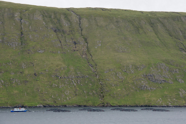
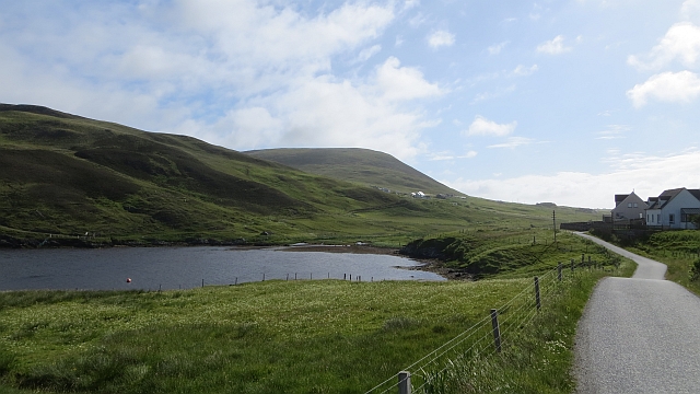
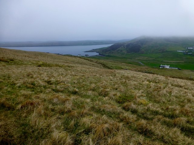
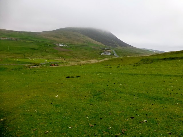
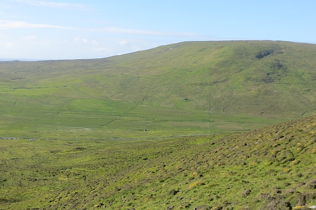
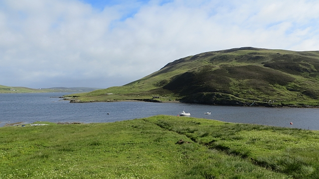
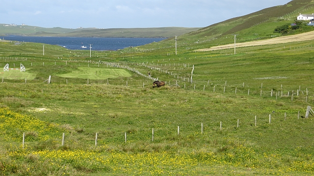
Glen of Quarff is a picturesque valley located in the Shetland Islands, Scotland. Nestled between rolling hills and surrounded by stunning natural beauty, this valley offers a tranquil escape from the bustling city life. It is situated in the parish of Quarff, about 10 miles south of the capital, Lerwick.

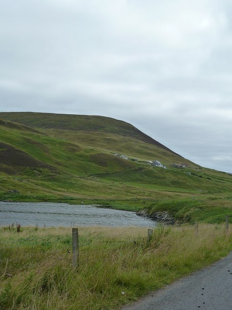
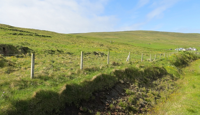
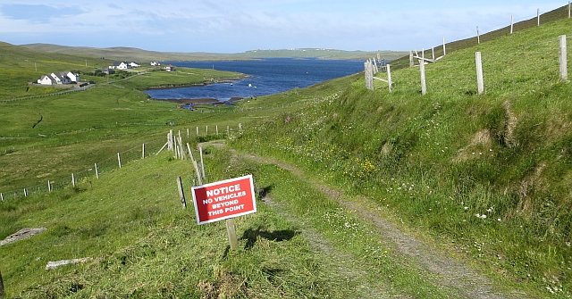
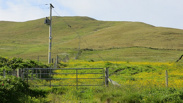
The valley is characterized by its lush green meadows, scattered with wildflowers, and its winding streams that flow through the landscape. The serenity of the Glen is further enhanced by the presence of several sheep farms, adding to the rural charm of the area. The valley is also home to a variety of bird species, making it a popular spot for birdwatchers.

At the heart of the Glen of Quarff lies the Quarff Kirk, a historic church that dates back to the 18th century. It is a beautiful example of Scottish architecture and features a traditional stone exterior and a quaint churchyard. The church holds regular services and is a gathering point for the local community.

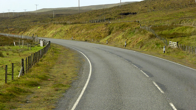
Visitors to the Glen can enjoy picturesque walks along the numerous trails that wind through the valley. These paths offer breathtaking views of the surrounding hills and provide an opportunity to spot wildlife in their natural habitat. The tranquil atmosphere of the valley makes it an ideal destination for those seeking peace and relaxation.

In conclusion, the Glen of Quarff is a hidden gem in the Shetland Islands, offering visitors a chance to immerse themselves in the beauty of nature. Its scenic landscapes, historic landmarks, and peaceful ambiance make it a must-visit destination for nature lovers and those seeking a break from the daily grind.

If you have any feedback on the listing, please let us know in the comments section below.

Glen of Quarff Images

Images are sourced within 2km of 60.083096/-1.2627282 or Grid Reference HU4133. Thanks to Geograph Open Source API. All images are credited.

Clift Sound and the Clift Hills A fish farm in Clift Sound and a vertiginous burn incised into the steep slopes of the Clift Hills.
Clift Sound and the Clift Hills
A fish farm in Clift Sound and a vertiginous burn incised into the steep slopes of the Clift Hills.
A970 between Quarff and Fladdabister The A970 runs for 71 miles across most of the length of the "Mainland" in the Shetland Islands. It is a good-quality single-carriageway road for most of its route. Travelling from south to north, the road begins at Grutness near Sumburgh Airport and winds around the many hills and inlets passing close to a number of small villages without going through any large ones before Lerwick. After looping around Lerwick, a short spur runs to Scalloway whilst the main route continues northwards towards Brae where it crosses the narrow isthmus of Mavis Grind. At Sandy Lochs the road splits and a four-mile spur goes through Urafirth to Hillswick. The main route continuing to the right towards its northern terminus at Isbister. This last part of the route tends to be narrower with passing places.

<span class="nowrap"><a title="https://www.sabre-roads.org.uk/wiki/index.php?title=A970" rel="nofollow ugc noopener" href="https://www.sabre-roads.org.uk/wiki/index.php?title=A970">Link</a><img style="margin-left:2px;" alt="External link" title="External link - shift click to open in new window" src="https://s1.geograph.org.uk/img/external.png" width="10" height="10"/></span>  SABRE
A970 between Quarff and Fladdabister
The A970 runs for 71 miles across most of the length of the "Mainland" in the Shetland Islands. It is a good-quality single-carriageway road for most of its route. Travelling from south to north, the road begins at Grutness near Sumburgh Airport and winds around the many hills and inlets passing close to a number of small villages without going through any large ones before Lerwick. After looping around Lerwick, a short spur runs to Scalloway whilst the main route continues northwards towards Brae where it crosses the narrow isthmus of Mavis Grind. At Sandy Lochs the road splits and a four-mile spur goes through Urafirth to Hillswick. The main route continuing to the right towards its northern terminus at Isbister. This last part of the route tends to be narrower with passing places. LinkExternal link SABRE
Fladdabister: postbox № ZE2 13 The postbox serving Fladdabister is outside the actual village, and up on the main road by the junction. It is emptied at 9 o'clock each morning except Sunday.
Fladdabister: postbox № ZE2 13
The postbox serving Fladdabister is outside the actual village, and up on the main road by the junction. It is emptied at 9 o'clock each morning except Sunday.
Beside West Voe of Quarff West Voe of Quarff is an inlet of Clift Sound. This view is looking inland towards the settlement of Wester Quarff with the southern end of the Clift Hills behind.
Beside West Voe of Quarff
West Voe of Quarff is an inlet of Clift Sound. This view is looking inland towards the settlement of Wester Quarff with the southern end of the Clift Hills behind.
Wester Quarff The west end of the Quarff Gap south of Wester Quarff Voe.  There is a view of Scrae Field.
Wester Quarff
The west end of the Quarff Gap south of Wester Quarff Voe. There is a view of Scrae Field.
Farmland, Wester Quarff
Road end, Wester Quarff The west end of the Quarff Gap.
Road end, Wester Quarff
The west end of the Quarff Gap.
Muskna Field First TuMP of a 12 TuMP day with Tricky Speirs bagged in variable mist.
Name: Muskna Field
Hill number: 7078
Height: 262m / 860ft
Area: 22: Shetland Islands
Class: sHu
Grid ref: HU404327 (est)
Drop: 98m
Col: 164m  HU398313
Muskna Field
First TuMP of a 12 TuMP day with Tricky Speirs bagged in variable mist. Name: Muskna Field Hill number: 7078 Height: 262m / 860ft Area: 22: Shetland Islands Class: sHu Grid ref: HU404327 (est) Drop: 98m Col: 164m HU398313
Small Lochan A small lochan on the drier than normal moorland on the way to bag Muskna Field.
Small Lochan
A small lochan on the drier than normal moorland on the way to bag Muskna Field.
West Voe of Quarff A moorland view back towards West Voe of Quarff while walking towards Muskna Field.
West Voe of Quarff
A moorland view back towards West Voe of Quarff while walking towards Muskna Field.
Sheens of Breitoe Second peaty TuMP on a misty morning with Tricky Speirs. Summit view south towards fence.
Name: Sheens of Breitoe
Hill number: 103805
Height: 224m / 735ft
Area: 22: Shetland Islands
Class: 2
Grid ref: HU419337 (est)
Drop: 49m
Col: 175m
Sheens of Breitoe
Second peaty TuMP on a misty morning with Tricky Speirs. Summit view south towards fence. Name: Sheens of Breitoe Hill number: 103805 Height: 224m / 735ft Area: 22: Shetland Islands Class: 2 Grid ref: HU419337 (est) Drop: 49m Col: 175m
View Towards Sheens of Breitoe A view from the fence north towards the moorland summit of Sheens of Breitoe.
View Towards Sheens of Breitoe
A view from the fence north towards the moorland summit of Sheens of Breitoe.
Moorland Terrain This is an example of the moorland terrain between Muskna Field and Sheens of Breitoe.  It is currently a lot drier than normal.
Moorland Terrain
This is an example of the moorland terrain between Muskna Field and Sheens of Breitoe. It is currently a lot drier than normal.
View Towards Scrae Field Descending from Sheens of Breitoe and now on improved sheep pasture with a view towards Scrae Field.
View Towards Scrae Field
Descending from Sheens of Breitoe and now on improved sheep pasture with a view towards Scrae Field.
South Snuckle Slopes above the Quarff Gap, seen from the opposite North Snuckle.
South Snuckle
Slopes above the Quarff Gap, seen from the opposite North Snuckle.
West Voe of Quarff Island sheltered inlet on the west side of the Quarff Gap.
West Voe of Quarff
Island sheltered inlet on the west side of the Quarff Gap.
Fields, Wester Quarff
Burn of Quarff Small fields, Wester Quarff.
Burn of Quarff
Small fields, Wester Quarff.
Show me another place!

Glen of Quarff is located at Grid Ref: HU4133 (Lat: 60.083096, Lng: -1.2627282)

Unitary Authority: Shetland Islands

Police Authority: Highlands and Islands

What 3 Words

///create.constrain.downs. Near Scalloway, Shetland Islands

Related Wikis

South Mainland

The South Mainland of the Shetland Islands is the southern peninsula of Mainland island. It lies south of Hellister (60° 14′N). The greater southern part...

East Burra

East Burra (Scots: East Burra; Old Norse: "Barrey") is one of the Scalloway Islands, a subgroup of the Shetland Islands in Scotland. It is connected by...

Quarff

Quarff is a small village on Mainland in the Shetland Islands in Scotland. It is located on the main A970 road, 5 miles (8.0 km) south of Shetland's only...

Cunningsburgh

Cunningsburgh, formerly also known as Coningsburgh (Old Norse: Konungsborgr meaning "King's castle"), is a new hamlet and ancient parish in the south of...

Related Videos

Shetland - South Mainland | An archaeological treasure trove

South Mainland, Shetland, is a narrow peninsula running 25 miles south from Lerwick. In this video we explore the archaeological ...

Have you been to Glen of Quarff?

Leave your review of Glen of Quarff below (or comments, questions and feedback).