Sheens of Breitoe

Hill, Mountain in Shetland

Scotland

Sheens of Breitoe

Quarff Leog between Quarff and Fladdabister
Quarff Leog between Quarff and Fladdabister Credit: Mike Pennington

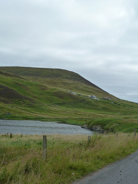
Sheens of Breitoe is a prominent hill located in the Shetland Islands, an archipelago in Scotland. Rising to an elevation of approximately 355 meters (1,165 feet), it is considered one of the highest points on the island of Shetland.

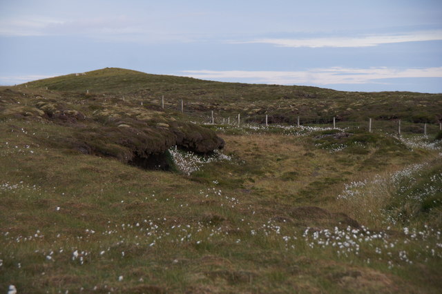
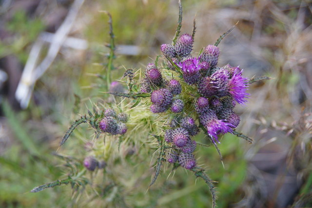
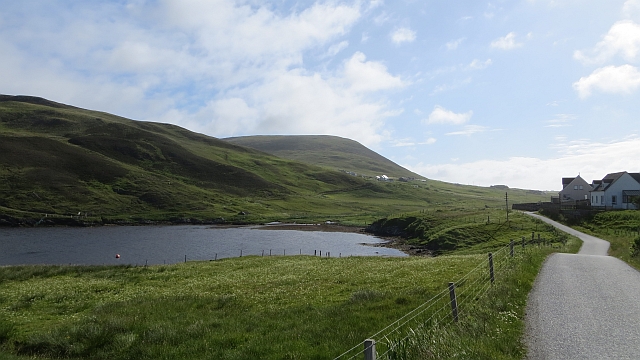
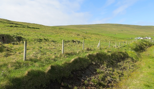
Situated in the central part of the Shetland Mainland, Sheens of Breitoe offers breathtaking panoramic views of the surrounding landscape. The hill is characterized by its gentle slopes covered in heather and grass, which provide a picturesque backdrop for visitors and hikers. The terrain is predominantly rocky, adding to the rugged charm of the area.

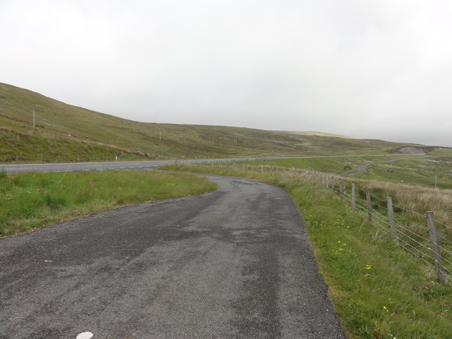
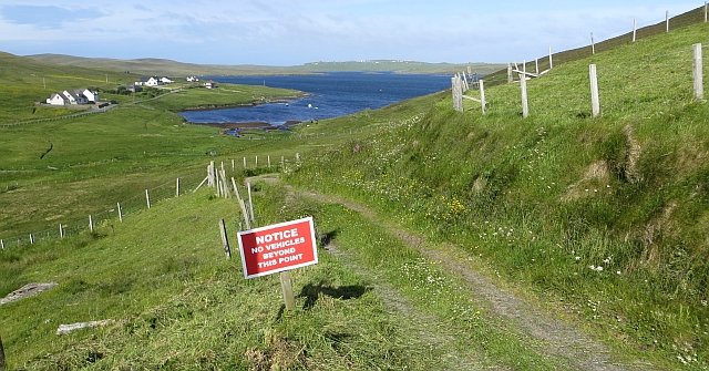
The hill is a popular destination for outdoor enthusiasts, including hikers and walkers, who are drawn to its natural beauty and the opportunity to explore the Shetland countryside. There are several well-marked trails leading to the summit, offering varying levels of difficulty for different abilities.

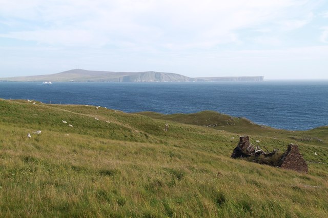
The summit of Sheens of Breitoe provides an impressive vantage point, allowing visitors to behold the vast expanse of the surrounding landscape. On clear days, one can see the nearby valleys, lochs, and even the distant North Sea. The hill's location also makes it an ideal spot for birdwatching, with many species of birds native to the Shetland Islands being spotted in the area.

Overall, Sheens of Breitoe is a captivating hill in the Shetland Islands, offering visitors a chance to immerse themselves in the natural beauty and tranquility of the Scottish countryside.

If you have any feedback on the listing, please let us know in the comments section below.

Sheens of Breitoe Images

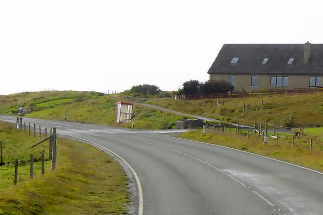
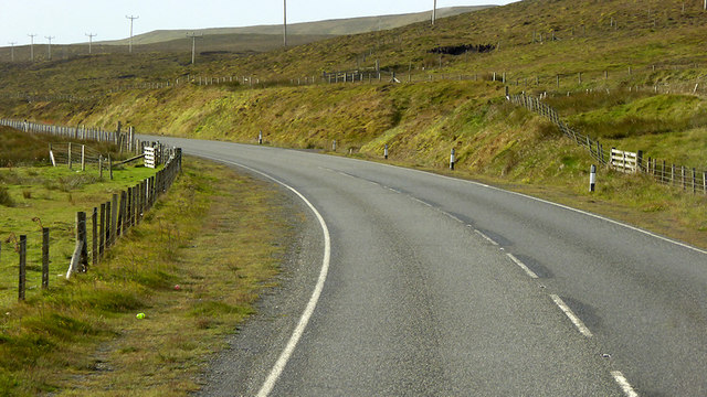
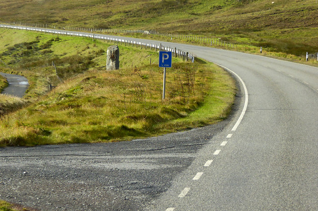
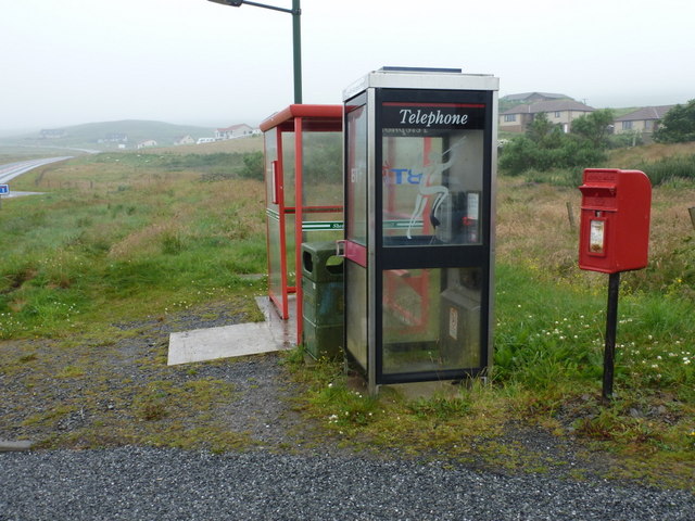
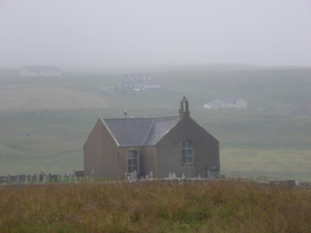
Images are sourced within 2km of 60.086028/-1.2476355 or Grid Reference HU4133. Thanks to Geograph Open Source API. All images are credited.

Quarff Leog between Quarff and Fladdabister
Marsh Thistle (Cirsium palustre), Quarff The densely packed flowerheads, and tallness, help distinguish this from other thistles.
Marsh Thistle (Cirsium palustre), Quarff
The densely packed flowerheads, and tallness, help distinguish this from other thistles.
A970 Road A970 road with a lay-by formed out of the old single lane road.
A970 Road
A970 road with a lay-by formed out of the old single lane road.
A970, Easter Quarff The A970 runs for 71 miles across most of the length of the "Mainland" in the Shetland Islands. It is a good-quality single-carriageway road for most of its route. Travelling from south to north, the road begins at Grutness near Sumburgh Airport and winds around the many hills and inlets passing close to a number of small villages without going through any large ones before Lerwick. After looping around Lerwick, a short spur runs to Scalloway whilst the main route continues northwards towards Brae where it crosses the narrow isthmus of Mavis Grind. At Sandy Lochs the road splits and a four-mile spur goes through Urafirth to Hillswick. The main route continuing to the right towards its northern terminus at Isbister. This last part of the route tends to be narrower with passing places.

<span class="nowrap"><a title="https://www.sabre-roads.org.uk/wiki/index.php?title=A970" rel="nofollow ugc noopener" href="https://www.sabre-roads.org.uk/wiki/index.php?title=A970">Link</a><img style="margin-left:2px;" alt="External link" title="External link - shift click to open in new window" src="https://s1.geograph.org.uk/img/external.png" width="10" height="10"/></span>  SABRE
A970, Easter Quarff
The A970 runs for 71 miles across most of the length of the "Mainland" in the Shetland Islands. It is a good-quality single-carriageway road for most of its route. Travelling from south to north, the road begins at Grutness near Sumburgh Airport and winds around the many hills and inlets passing close to a number of small villages without going through any large ones before Lerwick. After looping around Lerwick, a short spur runs to Scalloway whilst the main route continues northwards towards Brae where it crosses the narrow isthmus of Mavis Grind. At Sandy Lochs the road splits and a four-mile spur goes through Urafirth to Hillswick. The main route continuing to the right towards its northern terminus at Isbister. This last part of the route tends to be narrower with passing places. LinkExternal link SABRE
Bus Stop on A970 near Easter Quarff The A970 runs for 71 miles across most of the length of the "Mainland" in the Shetland Islands. It is a good-quality single-carriageway road for most of its route. Travelling from south to north, the road begins at Grutness near Sumburgh Airport and winds around the many hills and inlets passing close to a number of small villages without going through any large ones before Lerwick. After looping around Lerwick, a short spur runs to Scalloway whilst the main route continues northwards towards Brae where it crosses the narrow isthmus of Mavis Grind. At Sandy Lochs the road splits and a four-mile spur goes through Urafirth to Hillswick. The main route continuing to the right towards its northern terminus at Isbister. This last part of the route tends to be narrower with passing places.

<span class="nowrap"><a title="https://www.sabre-roads.org.uk/wiki/index.php?title=A970" rel="nofollow ugc noopener" href="https://www.sabre-roads.org.uk/wiki/index.php?title=A970">Link</a><img style="margin-left:2px;" alt="External link" title="External link - shift click to open in new window" src="https://s1.geograph.org.uk/img/external.png" width="10" height="10"/></span>  SABRE
Bus Stop on A970 near Easter Quarff
The A970 runs for 71 miles across most of the length of the "Mainland" in the Shetland Islands. It is a good-quality single-carriageway road for most of its route. Travelling from south to north, the road begins at Grutness near Sumburgh Airport and winds around the many hills and inlets passing close to a number of small villages without going through any large ones before Lerwick. After looping around Lerwick, a short spur runs to Scalloway whilst the main route continues northwards towards Brae where it crosses the narrow isthmus of Mavis Grind. At Sandy Lochs the road splits and a four-mile spur goes through Urafirth to Hillswick. The main route continuing to the right towards its northern terminus at Isbister. This last part of the route tends to be narrower with passing places. LinkExternal link SABRE
A970 between Quarff and Fladdabister The A970 runs for 71 miles across most of the length of the "Mainland" in the Shetland Islands. It is a good-quality single-carriageway road for most of its route. Travelling from south to north, the road begins at Grutness near Sumburgh Airport and winds around the many hills and inlets passing close to a number of small villages without going through any large ones before Lerwick. After looping around Lerwick, a short spur runs to Scalloway whilst the main route continues northwards towards Brae where it crosses the narrow isthmus of Mavis Grind. At Sandy Lochs the road splits and a four-mile spur goes through Urafirth to Hillswick. The main route continuing to the right towards its northern terminus at Isbister. This last part of the route tends to be narrower with passing places.

<span class="nowrap"><a title="https://www.sabre-roads.org.uk/wiki/index.php?title=A970" rel="nofollow ugc noopener" href="https://www.sabre-roads.org.uk/wiki/index.php?title=A970">Link</a><img style="margin-left:2px;" alt="External link" title="External link - shift click to open in new window" src="https://s1.geograph.org.uk/img/external.png" width="10" height="10"/></span>  SABRE
A970 between Quarff and Fladdabister
The A970 runs for 71 miles across most of the length of the "Mainland" in the Shetland Islands. It is a good-quality single-carriageway road for most of its route. Travelling from south to north, the road begins at Grutness near Sumburgh Airport and winds around the many hills and inlets passing close to a number of small villages without going through any large ones before Lerwick. After looping around Lerwick, a short spur runs to Scalloway whilst the main route continues northwards towards Brae where it crosses the narrow isthmus of Mavis Grind. At Sandy Lochs the road splits and a four-mile spur goes through Urafirth to Hillswick. The main route continuing to the right towards its northern terminus at Isbister. This last part of the route tends to be narrower with passing places. LinkExternal link SABRE
A970 near to Fladdabister The A970 runs for 71 miles across most of the length of the "Mainland" in the Shetland Islands. It is a good-quality single-carriageway road for most of its route. Travelling from south to north, the road begins at Grutness near Sumburgh Airport and winds around the many hills and inlets passing close to a number of small villages without going through any large ones before Lerwick. After looping around Lerwick, a short spur runs to Scalloway whilst the main route continues northwards towards Brae where it crosses the narrow isthmus of Mavis Grind. At Sandy Lochs the road splits and a four-mile spur goes through Urafirth to Hillswick. The main route continuing to the right towards its northern terminus at Isbister. This last part of the route tends to be narrower with passing places.

<span class="nowrap"><a title="https://www.sabre-roads.org.uk/wiki/index.php?title=A970" rel="nofollow ugc noopener" href="https://www.sabre-roads.org.uk/wiki/index.php?title=A970">Link</a><img style="margin-left:2px;" alt="External link" title="External link - shift click to open in new window" src="https://s1.geograph.org.uk/img/external.png" width="10" height="10"/></span>  SABRE
A970 near to Fladdabister
The A970 runs for 71 miles across most of the length of the "Mainland" in the Shetland Islands. It is a good-quality single-carriageway road for most of its route. Travelling from south to north, the road begins at Grutness near Sumburgh Airport and winds around the many hills and inlets passing close to a number of small villages without going through any large ones before Lerwick. After looping around Lerwick, a short spur runs to Scalloway whilst the main route continues northwards towards Brae where it crosses the narrow isthmus of Mavis Grind. At Sandy Lochs the road splits and a four-mile spur goes through Urafirth to Hillswick. The main route continuing to the right towards its northern terminus at Isbister. This last part of the route tends to be narrower with passing places. LinkExternal link SABRE
Fladdabister: not much of a view today Looking from a lay-by on the main road across the old road, towards a field of grazing sheep. Without today's thick fog, you would see the southern end of Bressay a few miles distant - but not today.
Fladdabister: not much of a view today
Looking from a lay-by on the main road across the old road, towards a field of grazing sheep. Without today's thick fog, you would see the southern end of Bressay a few miles distant - but not today.
Fladdabister: postbox № ZE2 13 The postbox serving Fladdabister is outside the actual village, and up on the main road by the junction. It is emptied at 9 o'clock each morning except Sunday.
Fladdabister: postbox № ZE2 13
The postbox serving Fladdabister is outside the actual village, and up on the main road by the junction. It is emptied at 9 o'clock each morning except Sunday.
Quarff: postbox № ZE2 64 and phone This postbox was probably moved here ten years or so ago when the post office (wherever it was) closed. It stands next to a modern phone box and a bus shelter on the main road, by the chief turning to the village. The postbox is emptied at 9am each weekday and Saturday.
Quarff: postbox № ZE2 64 and phone
This postbox was probably moved here ten years or so ago when the post office (wherever it was) closed. It stands next to a modern phone box and a bus shelter on the main road, by the chief turning to the village. The postbox is emptied at 9am each weekday and Saturday.
Quarff: the church A view from the main road in a drizzle!
Quarff: the church
A view from the main road in a drizzle!
Beside West Voe of Quarff West Voe of Quarff is an inlet of Clift Sound. This view is looking inland towards the settlement of Wester Quarff with the southern end of the Clift Hills behind.
Beside West Voe of Quarff
West Voe of Quarff is an inlet of Clift Sound. This view is looking inland towards the settlement of Wester Quarff with the southern end of the Clift Hills behind.
Ruined Croft Small Ruined Croft
Ruined Croft
Small Ruined Croft
The Quarff Gap A valley at right angles to the normal north-south grain of the land on Mainland. It has been suggested that this is a fossil river valley.
The Quarff Gap
A valley at right angles to the normal north-south grain of the land on Mainland. It has been suggested that this is a fossil river valley.
Wester Quarff The west end of the Quarff Gap south of Wester Quarff Voe.  There is a view of Scrae Field.
Wester Quarff
The west end of the Quarff Gap south of Wester Quarff Voe. There is a view of Scrae Field.
Farmland, Wester Quarff
Road end, Wester Quarff The west end of the Quarff Gap.
Road end, Wester Quarff
The west end of the Quarff Gap.
Muskna Field First TuMP of a 12 TuMP day with Tricky Speirs bagged in variable mist.
Name: Muskna Field
Hill number: 7078
Height: 262m / 860ft
Area: 22: Shetland Islands
Class: sHu
Grid ref: HU404327 (est)
Drop: 98m
Col: 164m  HU398313
Muskna Field
First TuMP of a 12 TuMP day with Tricky Speirs bagged in variable mist. Name: Muskna Field Hill number: 7078 Height: 262m / 860ft Area: 22: Shetland Islands Class: sHu Grid ref: HU404327 (est) Drop: 98m Col: 164m HU398313
Show me another place!

Sheens of Breitoe is located at Grid Ref: HU4133 (Lat: 60.086028, Lng: -1.2476355)

Unitary Authority: Shetland Islands

Police Authority: Highlands and Islands

What 3 Words

///rejected.rolled.dressing. Near Scalloway, Shetland Islands

Related Wikis

Quarff

Quarff is a small village on Mainland in the Shetland Islands in Scotland. It is located on the main A970 road, 5 miles (8.0 km) south of Shetland's only...

South Mainland

The South Mainland of the Shetland Islands is the southern peninsula of Mainland island. It lies south of Hellister (60° 14′N). The greater southern part...

East Burra

East Burra (Scots: East Burra; Old Norse: "Barrey") is one of the Scalloway Islands, a subgroup of the Shetland Islands in Scotland. It is connected by...

Brindister, South Mainland

Brindister is a village on South Mainland in Shetland, Scotland. Brindister is within the parish of Lerwick, and adjacent to the A970 south of Gulberwick...

Nearby Amenities

Located within 500m of 60.086028,-1.2476355
Sheens of Breitoe
Corbett: no
Ele: 224
Graham: no
Marilyn: no
Munro: no
Natural: peak
Lat/Long: 60.0853105/-1.2478026
The data included in this document is from www.openstreetmap.org. The data is made available under ODbL.

Have you been to Sheens of Breitoe?

Leave your review of Sheens of Breitoe below (or comments, questions and feedback).