Rushy Bottom

Valley in Oxfordshire West Oxfordshire

England

Rushy Bottom

Bridleway junction This is a bridleway crossroads.  We are looking towards Ditchley Park, the leg used by Shakespeare's Way, having come in from the left.
Bridleway junction Credit: Graham Horn

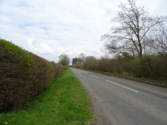
Rushy Bottom is a picturesque valley located in the county of Oxfordshire, England. Nestled amidst the rolling countryside, this idyllic landscape is renowned for its natural beauty and tranquility. The valley is situated near the village of Bampton, just a short distance from the bustling city of Oxford.

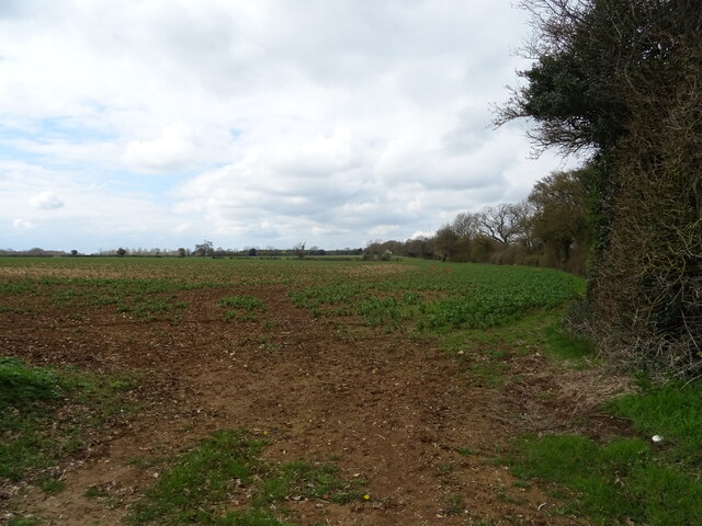
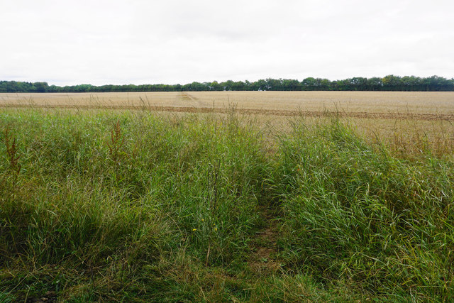
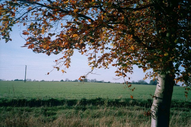
The defining feature of Rushy Bottom is its lush green meadows, which are dotted with vibrant wildflowers during the summer months. The meandering River Windrush flows gently through the valley, adding to its charm and providing a habitat for various species of fish and waterfowl.

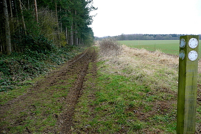
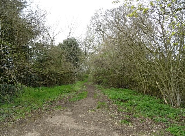
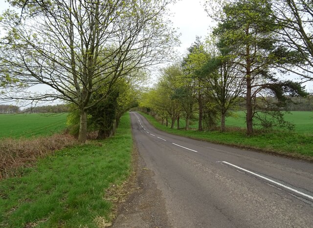
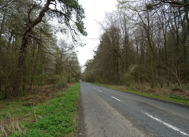
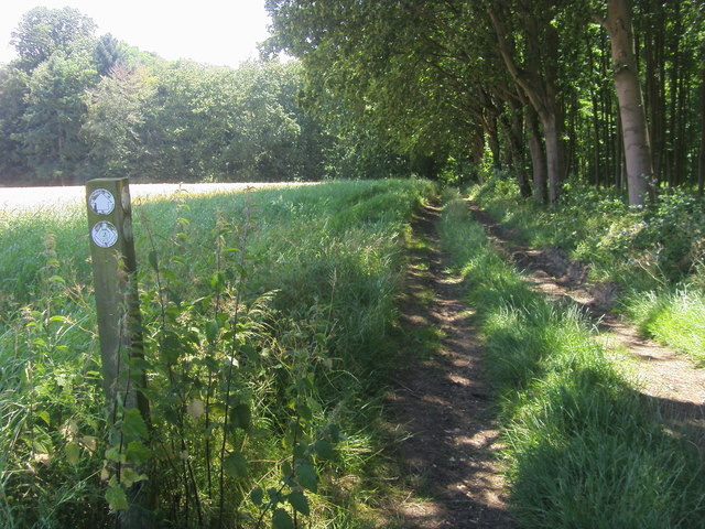
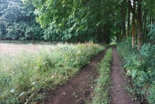
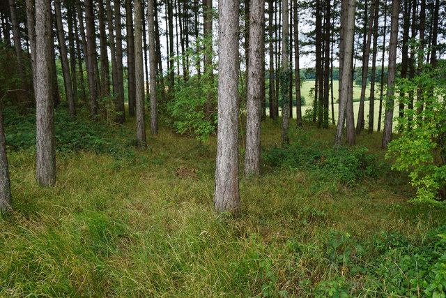
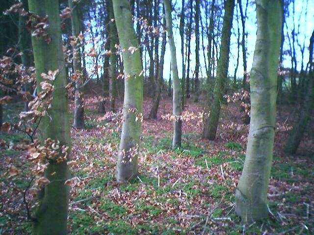
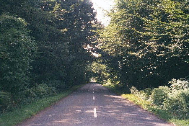
The valley is surrounded by wooded hillsides, creating a peaceful and secluded atmosphere. Walking trails wind their way through the valley, offering visitors the opportunity to explore its captivating scenery and enjoy the sights and sounds of nature. The area is also a haven for wildlife, with numerous species of birds, mammals, and insects calling Rushy Bottom their home.

Rushy Bottom is steeped in history, with evidence of human activity dating back to ancient times. Archaeological finds, such as Roman coins and pottery fragments, have been discovered in the area, providing insights into its past.

Due to its natural beauty and cultural significance, Rushy Bottom has become a popular destination for nature lovers, hikers, and history enthusiasts alike. Whether it's a leisurely stroll along the riverbank or a more adventurous hike up the hills, Rushy Bottom offers a serene and captivating experience for all who visit.

If you have any feedback on the listing, please let us know in the comments section below.
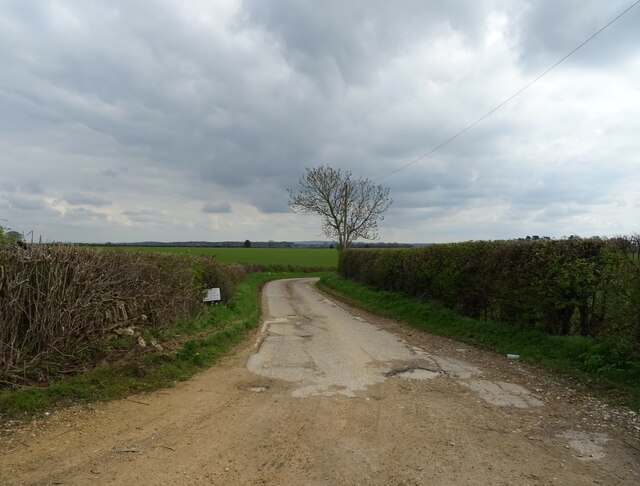
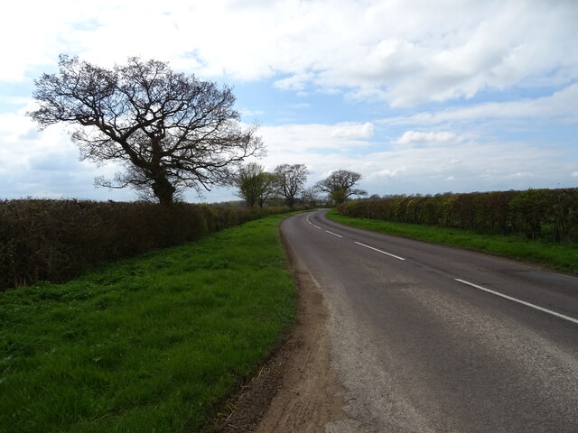
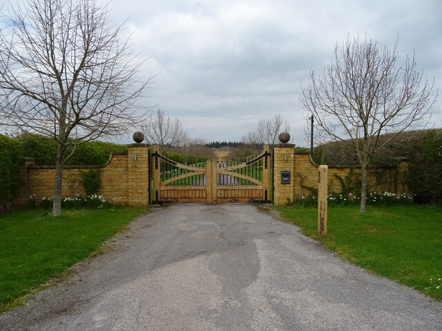
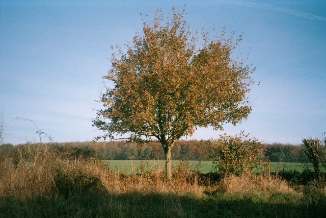
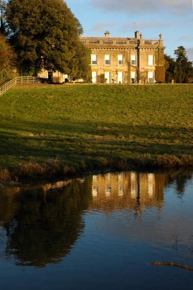
Rushy Bottom Images

Images are sourced within 2km of 51.880998/-1.4298586 or Grid Reference SP3920. Thanks to Geograph Open Source API. All images are credited.

Bridleway junction This is a bridleway crossroads.  We are looking towards Ditchley Park, the leg used by Shakespeare's Way, having come in from the left.
Bridleway junction
This is a bridleway crossroads. We are looking towards Ditchley Park, the leg used by Shakespeare's Way, having come in from the left.
Track (footpath) to Hill Barn Farm
B4437 towards Charlbury
Crop field off the B4437
The Wychwood Way footpath
B4437 heading east
B4437 heading east
Woodland beside the B4437
B4437 beside Sheer's Copse woodland
Gated road to Kingswood Farm
B4437 heading east towards the A44
Shakespeare's Way Shakespeare's Way cuts off to the right to Kingswood Bottom
Shakespeare's Way
Shakespeare's Way cuts off to the right to Kingswood Bottom
Track by a woodland corner The track heads on into the woods in Kingswood Bottom.
Track by a woodland corner
The track heads on into the woods in Kingswood Bottom.
Path across a harvested field Heading towards Over Kiddington, and its line has been preserved quite clearly over the field.
Path across a harvested field
Heading towards Over Kiddington, and its line has been preserved quite clearly over the field.
Band of woodland above Kingswood Bottom The woodland lines the south side of Shakespeare's Way.
Band of woodland above Kingswood Bottom
The woodland lines the south side of Shakespeare's Way.
Pintle Stripe near Charlbury Pintle Stripe is a thin lengthy copse on the Hundley Way track near Charlbury in Oxfordshire.
Pintle Stripe near Charlbury
Pintle Stripe is a thin lengthy copse on the Hundley Way track near Charlbury in Oxfordshire.
B4437 through Sheer's Copse A rare straight stretch on this road, through a thick patch of woodland. <a href="https://www.geograph.org.uk/photo/43800">SP3118 : B4437 near Ascott-under-Wychwood</a> is the same road, five miles to the west.
B4437 through Sheer's Copse
A rare straight stretch on this road, through a thick patch of woodland. SP3118 : B4437 near Ascott-under-Wychwood is the same road, five miles to the west.
Tree, track and field This image is taken facing west from the side of a track that runs from the B4022 <a href="https://www.geograph.org.uk/photo/85424">SP3621 : Unsuitable for motors</a>, south-east to <a href="https://www.geograph.org.uk/photo/85427">SP3721 : Track near Norman's Grove</a>, then past an entrance to Ditchley Park, which is a few hundred yards north of this point. It then continues towards Stonesfield. The next image, just south of Dustfield Farm, is <a href="https://www.geograph.org.uk/photo/85436">SP3819 : Tree and Ash Copse</a>.
Tree, track and field
This image is taken facing west from the side of a track that runs from the B4022 SP3621 : Unsuitable for motors, south-east to SP3721 : Track near Norman's Grove, then past an entrance to Ditchley Park, which is a few hundred yards north of this point. It then continues towards Stonesfield. The next image, just south of Dustfield Farm, is SP3819 : Tree and Ash Copse.
Tree and Ash Copse This image is taken facing north-east from a track that runs south-east from the B4022 <a href="https://www.geograph.org.uk/photo/85424">SP3621 : Unsuitable for motors</a> to near Stonesfield: an image a few hundred yards north of this one is at <a href="https://www.geograph.org.uk/photo/85434">SP3820 : Tree, track and field</a>. At this stage, the track runs through large open fields, but is lined with hedgerow and trees such as this one. Ash Copse, which is also within this grid-square, is visible in the background.
Tree and Ash Copse
This image is taken facing north-east from a track that runs south-east from the B4022 SP3621 : Unsuitable for motors to near Stonesfield: an image a few hundred yards north of this one is at SP3820 : Tree, track and field. At this stage, the track runs through large open fields, but is lined with hedgerow and trees such as this one. Ash Copse, which is also within this grid-square, is visible in the background.
Show me another place!

Rushy Bottom is located at Grid Ref: SP3920 (Lat: 51.880998, Lng: -1.4298586)

Administrative County: Oxfordshire

District: West Oxfordshire

Police Authority: Thames Valley

What 3 Words

///penned.printout.invest. Near Stonesfield, Oxfordshire

Related Wikis

Pheleley Priory

Pheleley Priory was a small 12th-century Benedictine monastic community located in a detached part of Bloxham, near Charlbury, in the English county of...

Ditchley Park

Ditchley Park is a country house near Charlbury in Oxfordshire, England. The estate was once the site of a Roman villa. Later it became a royal hunting...

Salt Way, Ditchley

Salt Way, Ditchley is a 2-hectare (4.9-acre) biological Site of Special Scientific Interest (SSSI) east of Charlbury in Oxfordshire. It is also a Local...

Out Wood

Out Wood is a 19.2-hectare (47-acre) biological Site of Special Scientific Interest east of Charlbury in Oxfordshire.This semi-natural wood is a surviving...

Asterleigh

Asterleigh, sometimes in the past called Esterley, is a farm and deserted medieval village about 3 miles (4.8 km) northeast of Charlbury in Oxfordshire...

Over Kiddington

Over Kiddington is a hamlet in the civil parish of Kiddington with Asterleigh in Oxfordshire, England, about 7 miles (11 km) southeast of Chipping Norton...

Kiddington Hall

Kiddington Hall is a large Grade II listed manor house located in Kiddington, near Woodstock, Oxfordshire, England. == History == Kiddington Hall was built...

Fulwell, Oxfordshire

Fulwell is a hamlet in the civil parish of Enstone in Oxfordshire, England. It lies about 4.5 miles (7 km) southeast of Chipping Norton. Fulwell's toponym...

Related Videos

Daisy & Olivers Oxfordshire Marquee Wedding

Highlights slideshow from Daisy & Olivers Oxfordshire Marquee Wedding in rural village of Stonesfield by Neil Hanson ...

Nearby Amenities

Located within 500m of 51.880998,-1.4298586
Barrier: stile
Lat/Long: 51.8815748/-1.4244933
The data included in this document is from www.openstreetmap.org. The data is made available under ODbL.

Have you been to Rushy Bottom?

Leave your review of Rushy Bottom below (or comments, questions and feedback).