South Briga Dale

Valley in Shetland

Scotland

South Briga Dale

Slyde, East Burrafirth House at the end of the road, above Aith Voe.
Slyde, East Burrafirth Credit: Mike Pennington

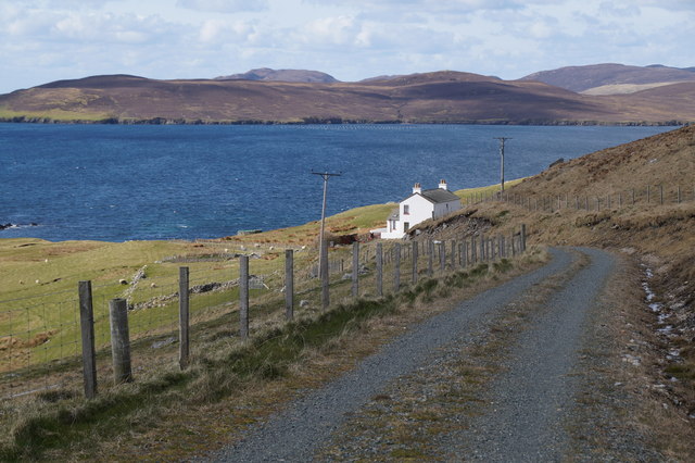
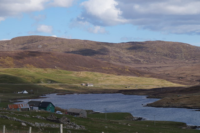
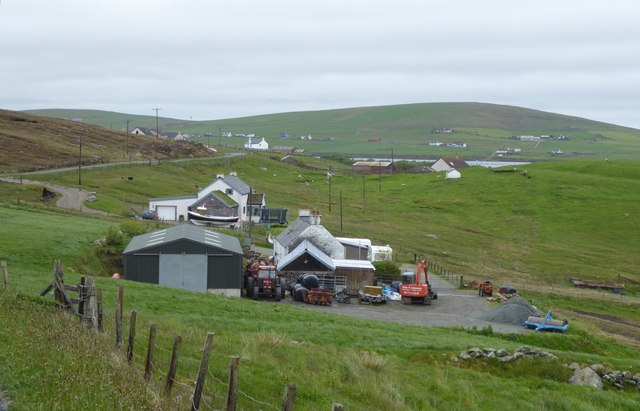
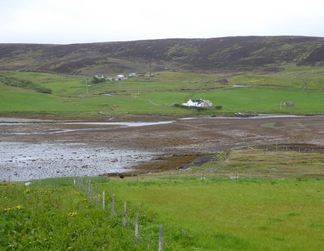
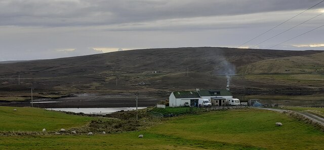
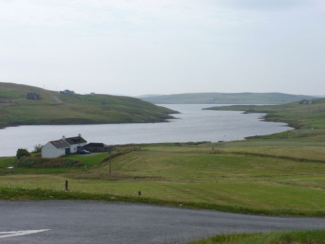
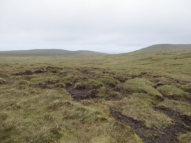
South Briga Dale is a picturesque valley located in the Shetland Islands, off the northeast coast of Scotland. Nestled between rolling hills and rugged coastline, this valley offers a stunning natural landscape that attracts visitors from near and far.

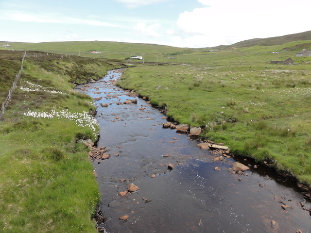
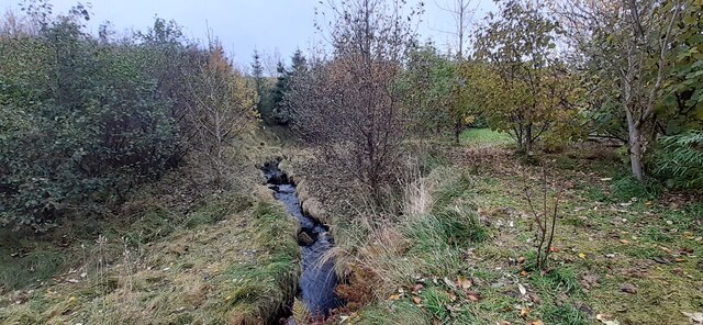
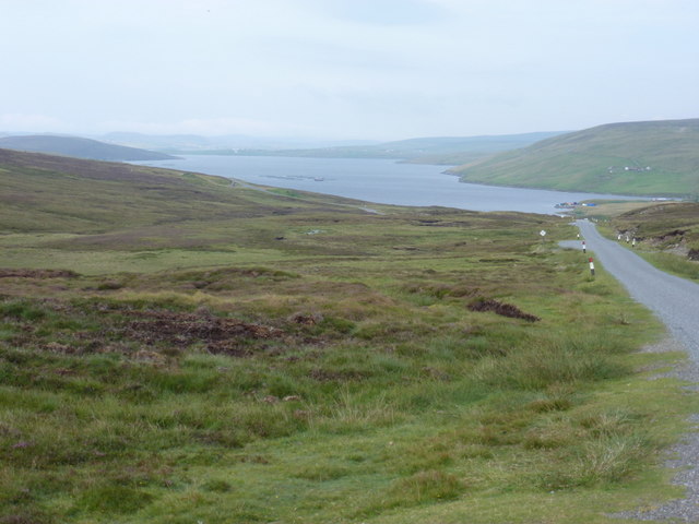
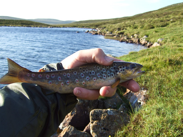
The valley itself is characterized by its lush greenery, dotted with wildflowers and diverse vegetation. It is home to a variety of wildlife, including birds, otters, and seals, making it a haven for nature enthusiasts and birdwatchers. The surrounding hills provide a dramatic backdrop, offering breathtaking views of the valley and the North Sea beyond.

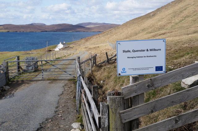
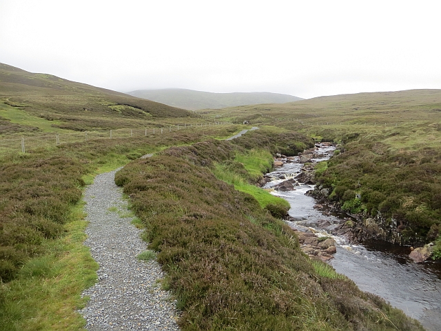
South Briga Dale is known for its tranquil atmosphere, making it an ideal spot for those seeking peace and quiet. The valley is crisscrossed by a network of walking trails, allowing visitors to explore its beauty at their own pace. One of the most popular routes is the coastal path, which offers panoramic vistas of the surrounding cliffs and sea stacks.

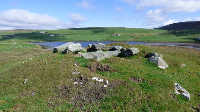
In addition to its natural splendor, South Briga Dale has a rich history. Ruins of ancient settlements can be found scattered throughout the valley, providing a glimpse into the lives of past inhabitants. The area has also been a site of archaeological excavation, unearthing artifacts that shed light on Shetland's ancient past.

Overall, South Briga Dale is a hidden gem in the Shetland Islands, offering a harmonious blend of stunning landscapes, biodiversity, and historical significance. Whether it's for a leisurely walk, birdwatching, or a peaceful escape, this valley is sure to captivate all who visit.

If you have any feedback on the listing, please let us know in the comments section below.

South Briga Dale Images

Images are sourced within 2km of 60.309798/-1.3391951 or Grid Reference HU3658. Thanks to Geograph Open Source API. All images are credited.

Slyde, East Burrafirth House at the end of the road, above Aith Voe.
Slyde, East Burrafirth
House at the end of the road, above Aith Voe.
Sign at East Burrafirth Managing habitats for biodiversity, the sign proclaims.
Sign at East Burrafirth
Managing habitats for biodiversity, the sign proclaims.
The head of East Burra Firth
East Burrafirth Burn of Burrafirth
East Burrafirth
Burn of Burrafirth
Crofts overlooking East Burra Firth With Aith Voe just visible in the distance.
Crofts overlooking East Burra Firth
With Aith Voe just visible in the distance.
Voehead Croft situated where the Burn of Burrafirth enters East Burra Firth.
Voehead
Croft situated where the Burn of Burrafirth enters East Burra Firth.
Cafe at East Burrafirth Tourist infrastructure is limited on Shetland.
We went miles to find this newly opened cafe.
Cafe at East Burrafirth
Tourist infrastructure is limited on Shetland. We went miles to find this newly opened cafe.
Plantation along the Burn of South Brigadale, East Burrafirth
Burn of South Brigadale, East Burrafirth
Voehead, East Burrafirth
East Burrafirth Chambered Cairn Well preserved small chambered cairn. <span class="nowrap"><a title="https://canmore.org.uk/site/722/east-burrafirth" rel="nofollow ugc noopener" href="https://canmore.org.uk/site/722/east-burrafirth">Link</a><img style="margin-left:2px;" alt="External link" title="External link - shift click to open in new window" src="https://s1.geograph.org.uk/img/external.png" width="10" height="10"/></span>
East Burrafirth Chambered Cairn
Well preserved small chambered cairn. LinkExternal link
Gonfirth: approach from the south Looking along the B9071 from Bixter towards Voe, as we approach the scattered hamlet of Gonfirth on the shore of Gon Firth, the inlet which we see projecting towards us in the background.
Gonfirth: approach from the south
Looking along the B9071 from Bixter towards Voe, as we approach the scattered hamlet of Gonfirth on the shore of Gon Firth, the inlet which we see projecting towards us in the background.
East Burrafirth: view along the firth Looking along East Burra Firth, the inlet giving the hamlet its name, from the junction of the road that leads to the scattered dwellings along the north side of the firth. The house in the foreground, Voehead, is in the next square south, as is the majority of the water.
East Burrafirth: view along the firth
Looking along East Burra Firth, the inlet giving the hamlet its name, from the junction of the road that leads to the scattered dwellings along the north side of the firth. The house in the foreground, Voehead, is in the next square south, as is the majority of the water.
Loch of Lunklet brown trout A typical small trout from the Loch of Lunklet, perhaps more commonly known locally as the Scallafield Loch.
Loch of Lunklet brown trout
A typical small trout from the Loch of Lunklet, perhaps more commonly known locally as the Scallafield Loch.
East Hill of Burrafirth Bagged with Tricky Speirs on a misty morning.

Name: East Hill of Burrafirth
Hill number: 103843
Height: 143m / 469ft
Area: 22: Shetland Islands
Class: 1
Grid ref: HU369592 (est)
Drop: 49m
Col: 94m
East Hill of Burrafirth
Bagged with Tricky Speirs on a misty morning. Name: East Hill of Burrafirth Hill number: 103843 Height: 143m / 469ft Area: 22: Shetland Islands Class: 1 Grid ref: HU369592 (est) Drop: 49m Col: 94m
Burn of Lunklet There is a good path up as far as the waterfall.
Burn of Lunklet
There is a good path up as far as the waterfall.
Descent of Scalla Field Three walkers descend Scalla Field. It is probable that they are: Sandy Peterson, Allison Duncan and Richard Gatehouse who were traversing the six highest Mainland hills on this day. They started from Ronas Hill at about 04.00. Either it was this team, or that Scalla Field was getting a rather busy day.
Descent of Scalla Field
Three walkers descend Scalla Field. It is probable that they are: Sandy Peterson, Allison Duncan and Richard Gatehouse who were traversing the six highest Mainland hills on this day. They started from Ronas Hill at about 04.00. Either it was this team, or that Scalla Field was getting a rather busy day.
Bogs of Burrafirth Peatland of central Mainland, visited on the way up Scalla Field.
Bogs of Burrafirth
Peatland of central Mainland, visited on the way up Scalla Field.
Show me another place!

South Briga Dale is located at Grid Ref: HU3658 (Lat: 60.309798, Lng: -1.3391951)

Unitary Authority: Shetland Islands

Police Authority: Highlands and Islands

What 3 Words

///pickup.reprints.whizzed. Near Aith, Shetland Islands

Related Wikis

Mainland, Shetland

The Mainland is the main island of Shetland, Scotland. The island contains Shetland's only burgh, Lerwick, and is the centre of Shetland's ferry and air...

Shetland

Shetland, also called the Shetland Islands, is an archipelago in Scotland lying between Orkney, the Faroe Islands, and Norway. It is the northernmost region...

Braewick, Sandsting

Braewick is a settlement on the west Mainland of Shetland, Scotland. Braewick is on the western shore of Aith Voe and 1.2 mi (2 km) north of Aith itself...

Aith Lifeboat Station

Aith Lifeboat Station is located at Aith, on the island of Shetland, and is the most northerly of the 238 Royal National Lifeboat Institution Lifeboat...

Nearby Amenities

Located within 500m of 60.309798,-1.3391951
Barrier: cattle_grid
Lat/Long: 60.3118285/-1.3401615
Power: pole
Lat/Long: 60.3053637/-1.3396681
Power: pole
Lat/Long: 60.3060205/-1.3392656
Power: pole
Lat/Long: 60.3065826/-1.3389403
Power: pole
Lat/Long: 60.3072124/-1.3387857
Power: pole
Lat/Long: 60.3078162/-1.3386538
Power: pole
Lat/Long: 60.308438/-1.3385242
Power: pole
Lat/Long: 60.3090564/-1.3383786
Power: pole
Lat/Long: 60.3096771/-1.3382422
Power: pole
Lat/Long: 60.3102955/-1.338108
Power: pole
Lat/Long: 60.3109286/-1.3379556
Power: pole
Lat/Long: 60.3115447/-1.3378305
Power: pole
Lat/Long: 60.312162/-1.3376918
Power: pole
Lat/Long: 60.3127668/-1.3375599
Power: pole
Lat/Long: 60.3133976/-1.3374257
Power: pole
Lat/Long: 60.3139416/-1.3372961
Power: pole
Lat/Long: 60.3054403/-1.3403344
Power: pole
Lat/Long: 60.3055664/-1.3415603
Power: pole
Lat/Long: 60.3056408/-1.3423585
The data included in this document is from www.openstreetmap.org. The data is made available under ODbL.

Have you been to South Briga Dale?

Leave your review of South Briga Dale below (or comments, questions and feedback).