Bonsall Dale
Valley in Derbyshire Derbyshire Dales
England
Bonsall Dale

Bonsall Dale, located in the heart of Derbyshire, England, is a picturesque valley that exudes natural beauty and tranquility. Nestled between the bustling towns of Matlock and Cromford, this idyllic dale stretches for approximately four miles and is known for its stunning landscapes and rich history.
The valley is renowned for its lush green fields, meandering rivers, and wooded hillsides, creating a haven for nature enthusiasts and outdoor adventurers. Bonsall Dale is home to a diverse range of flora and fauna, with rare wildflowers and bird species thriving in its protected environment. The region's geology is also fascinating, with limestone formations and rocky outcrops adding to its scenic appeal.
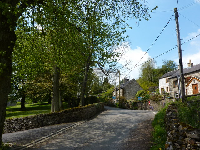
Bonsall Dale boasts a rich industrial heritage, particularly in the mining and lead industries. The remains of old mine shafts and the remnants of smelting mills can still be seen throughout the area, serving as a testament to the valley's past. The nearby village of Bonsall also showcases charming stone cottages and historic buildings, further immersing visitors in the region's history.
The dale is a popular destination for hikers, cyclists, and horse riders, with a network of well-maintained trails and paths that offer breathtaking views of the surrounding countryside. Additionally, Bonsall Dale is a haven for wildlife enthusiasts, providing opportunities for birdwatching, nature photography, and exploring the diverse ecosystem.
Whether it's the tranquility of the countryside, the allure of its industrial past, or the chance to immerse oneself in nature, Bonsall Dale offers a truly captivating experience for visitors seeking to connect with Derbyshire's natural and historical heritage.
If you have any feedback on the listing, please let us know in the comments section below.
Bonsall Dale Images
Images are sourced within 2km of 53.118683/-1.5940308 or Grid Reference SK2758. Thanks to Geograph Open Source API. All images are credited.


Bonsall Dale is located at Grid Ref: SK2758 (Lat: 53.118683, Lng: -1.5940308)
Administrative County: Derbyshire
District: Derbyshire Dales
Police Authority: Derbyshire
What 3 Words
///goodness.operating.tiptoes. Near Cromford, Derbyshire
Nearby Locations
Related Wikis
Slaley, Derbyshire
Slaley is a hamlet in the civil parish of Bonsall, in the Derbyshire Dales district, in the county of Derbyshire, England. The hamlet is located to the...
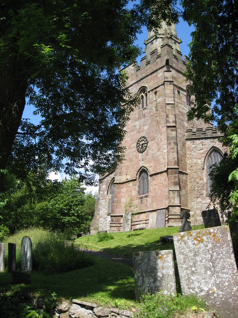
St James the Apostle's Church, Bonsall
St James the Apostle's Church, Bonsall is a Grade II* listed parish church in the Church of England: 101 in Bonsall, Derbyshire. == History == The church...

Bonsall, Derbyshire
Bonsall is a village and civil parish in the Derbyshire Dales on the edge of the Peak District. The civil parish population, including Brightgate and Horse...
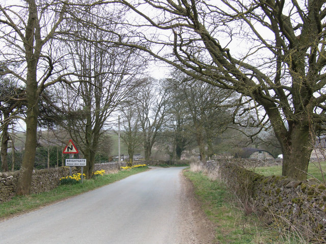
Brightgate
Brightgate is a village in Derbyshire, England. The population is recorded in the civil parish of Bonsall, Derbyshire. == References ==
Nearby Amenities
Located within 500m of 53.118683,-1.5940308Have you been to Bonsall Dale?
Leave your review of Bonsall Dale below (or comments, questions and feedback).