Coombs Dale

Valley in Derbyshire Derbyshire Dales

England

Coombs Dale

Woodland behind the Eyre Arms This woodland on this hill behind the Eyre Arms is just to the south-west of the centre of SK27.
Woodland behind the Eyre Arms Credit: Roger Temple

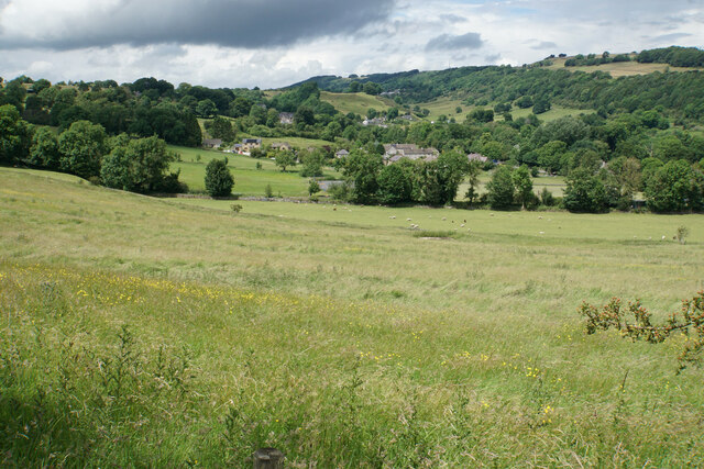
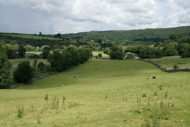
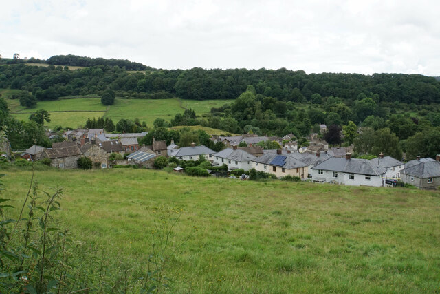
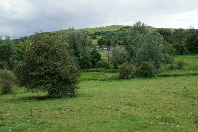
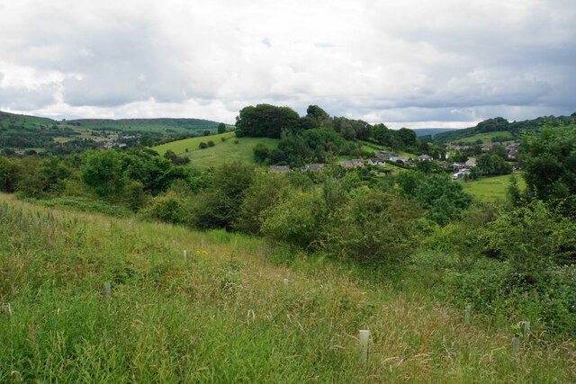
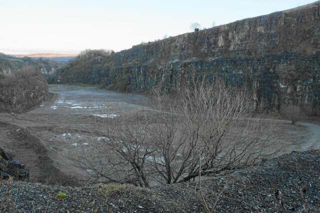
Coombs Dale is a picturesque valley located in the county of Derbyshire, England. Situated within the Peak District National Park, it is renowned for its stunning natural beauty, rolling hills, and tranquil atmosphere. The dale stretches for approximately 2 miles, offering visitors a peaceful escape from the hustle and bustle of city life.

The valley is characterized by its lush green meadows, dotted with wildflowers during the spring and summer months. The landscape is further enhanced by the presence of babbling brooks and small cascades, creating a soothing soundtrack for those exploring the area. Coombs Dale is also home to an abundance of wildlife, making it a popular spot for nature enthusiasts and birdwatchers.

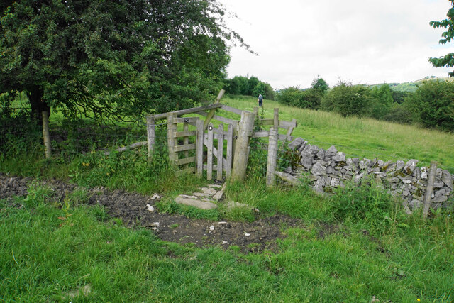
The dale is crisscrossed by a network of footpaths and trails, allowing visitors to fully immerse themselves in the surrounding natural beauty. Hikers and ramblers can enjoy the scenic views as they traverse the undulating terrain, with opportunities to spot local fauna such as deer and rabbits. The area is also a haven for wildflowers, including bluebells and orchids, which add a burst of color to the landscape.

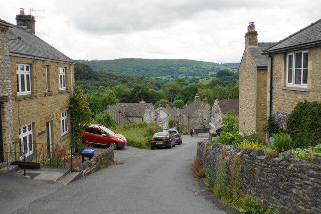
Coombs Dale is easily accessible from the nearby town of Bakewell, with parking facilities available for those arriving by car. It is a perfect destination for a leisurely stroll, a family picnic, or a peaceful retreat into nature. Whether visitors are seeking tranquility, wildlife sightings, or simply a break from the modern world, Coombs Dale offers a serene and idyllic escape.

If you have any feedback on the listing, please let us know in the comments section below.
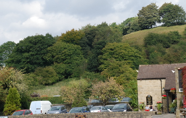
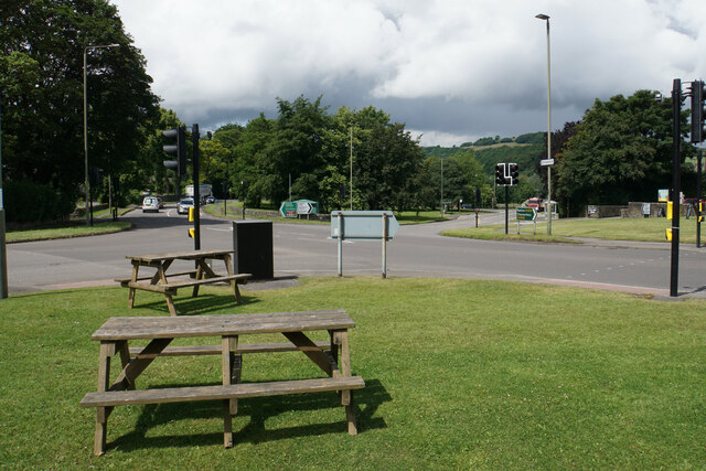
Coombs Dale Images

Images are sourced within 2km of 53.268789/-1.6631719 or Grid Reference SK2274. Thanks to Geograph Open Source API. All images are credited.

Woodland behind the Eyre Arms This woodland on this hill behind the Eyre Arms is just to the south-west of the centre of SK27.
Woodland behind the Eyre Arms
This woodland on this hill behind the Eyre Arms is just to the south-west of the centre of SK27.
Crossroads in Calver A lot of people will only know Calver from these crossroads, as the A623 passes through, and the A625 turns off. There is a village green here, with more on the opposite side, but the village has quieter and more attractive bits.
Crossroads in Calver
A lot of people will only know Calver from these crossroads, as the A623 passes through, and the A625 turns off. There is a village green here, with more on the opposite side, but the village has quieter and more attractive bits.
Hillside below Calver Low Looking down towards Stoney Middleton. Eyam is just visible further up the far hill.
Hillside below Calver Low
Looking down towards Stoney Middleton. Eyam is just visible further up the far hill.
Field at the bottom of Coombs Dale The A623 runs at the other end of the field. The Derwent valley is in the background with Froggatt Edge on the far side.
Field at the bottom of Coombs Dale
The A623 runs at the other end of the field. The Derwent valley is in the background with Froggatt Edge on the far side.
Footpath and gate above Stoney Middleton The wooden structures around the gate show some evolutionary randomness.
Footpath and gate above Stoney Middleton
The wooden structures around the gate show some evolutionary randomness.
Hillside below Eaton Fold A chance to look down on the rooftops of Stoney Middleton.
Hillside below Eaton Fold
A chance to look down on the rooftops of Stoney Middleton.
Middleton Lane A steeply descending road through Stoney Middleton. The Derwent valley is in the distance.
Middleton Lane
A steeply descending road through Stoney Middleton. The Derwent valley is in the distance.
Green fields at the bottom of Middleton Dale Calver Peak is opposite.
Green fields at the bottom of Middleton Dale
Calver Peak is opposite.
Hillside above Stoke Brook The course of Stoke Brook below is obscured by shrubbery. Opposite is Hare Knoll and Calver.
Hillside above Stoke Brook
The course of Stoke Brook below is obscured by shrubbery. Opposite is Hare Knoll and Calver.
Fields by Knouchley Farm Looking down the Derwent Valley, with Curbar and Baslow Edges up on the left.
Fields by Knouchley Farm
Looking down the Derwent Valley, with Curbar and Baslow Edges up on the left.
Hilly farmland near Knouchley Farm Part of the western side of the Derwent valley opposite Froggatt.
Hilly farmland near Knouchley Farm
Part of the western side of the Derwent valley opposite Froggatt.
Path down to the Derwent Froggatt Edge is at the top of the other side.
Path down to the Derwent
Froggatt Edge is at the top of the other side.
River Derwent by New Bridge On the opposite side is the Shuttle House, for which the local authority conservation records are here: <span class="nowrap"><a title="https://her.derbyshire.gov.uk/Monument/MDR3974" rel="nofollow ugc noopener" href="https://her.derbyshire.gov.uk/Monument/MDR3974">Link</a><img style="margin-left:2px;" alt="External link" title="External link - shift click to open in new window" src="https://s1.geograph.org.uk/img/external.png" width="10" height="10"/></span>.
River Derwent by New Bridge
On the opposite side is the Shuttle House, for which the local authority conservation records are here: LinkExternal link.
Calver Methodist Church The inscription states that this was Jubilee Primitive Methodist Chapel dating from 1860.
Calver Methodist Church
The inscription states that this was Jubilee Primitive Methodist Chapel dating from 1860.
Lamp standard and mounting block in Calver The lamp and its base are Grade II listed, with its listing details here: <span class="nowrap"><a title="https://historicengland.org.uk/listing/the-list/list-entry/1088211" rel="nofollow ugc noopener" href="https://historicengland.org.uk/listing/the-list/list-entry/1088211">Link</a><img style="margin-left:2px;" alt="External link" title="External link - shift click to open in new window" src="https://s1.geograph.org.uk/img/external.png" width="10" height="10"/></span>.
The cottage behind the hair salon is also Grade II listed.
Lamp standard and mounting block in Calver
The lamp and its base are Grade II listed, with its listing details here: LinkExternal link. The cottage behind the hair salon is also Grade II listed.
Guide Post Stone guide post located at entrance to Knouchley Farm.
I wonder if it has been relocated from the roadside
Guide Post
Stone guide post located at entrance to Knouchley Farm. I wonder if it has been relocated from the roadside
Black Harry Lane A steep climb out of Middleton Dale.
Black Harry Lane
A steep climb out of Middleton Dale.
Darlton Quarry One of several disused quarries in Middleton Dale. The quarry is shaded from the low winter sun but White Edge above Froggatt Edge is glowing in the distance.
Darlton Quarry
One of several disused quarries in Middleton Dale. The quarry is shaded from the low winter sun but White Edge above Froggatt Edge is glowing in the distance.
Show me another place!

Coombs Dale is located at Grid Ref: SK2274 (Lat: 53.268789, Lng: -1.6631719)

Administrative County: Derbyshire

District: Derbyshire Dales

Police Authority: Derbyshire

What 3 Words

///games.jobs.arranges. Near Baslow, Derbyshire

Nearby Locations

Coombs Dale Calver Peak

Related Wikis

Coombs Dale

Coombs Dale is a steep-sided, dry carboniferous limestone valley in the Derbyshire Peak District of England. The village of Calver lies about 1 km to the...

Dale Brook

Dale Brook is a stream in Stoney Middleton in the Derbyshire Peak District. The stream originates in Middleton Dale, where the Jumber Brook south of Eyam...
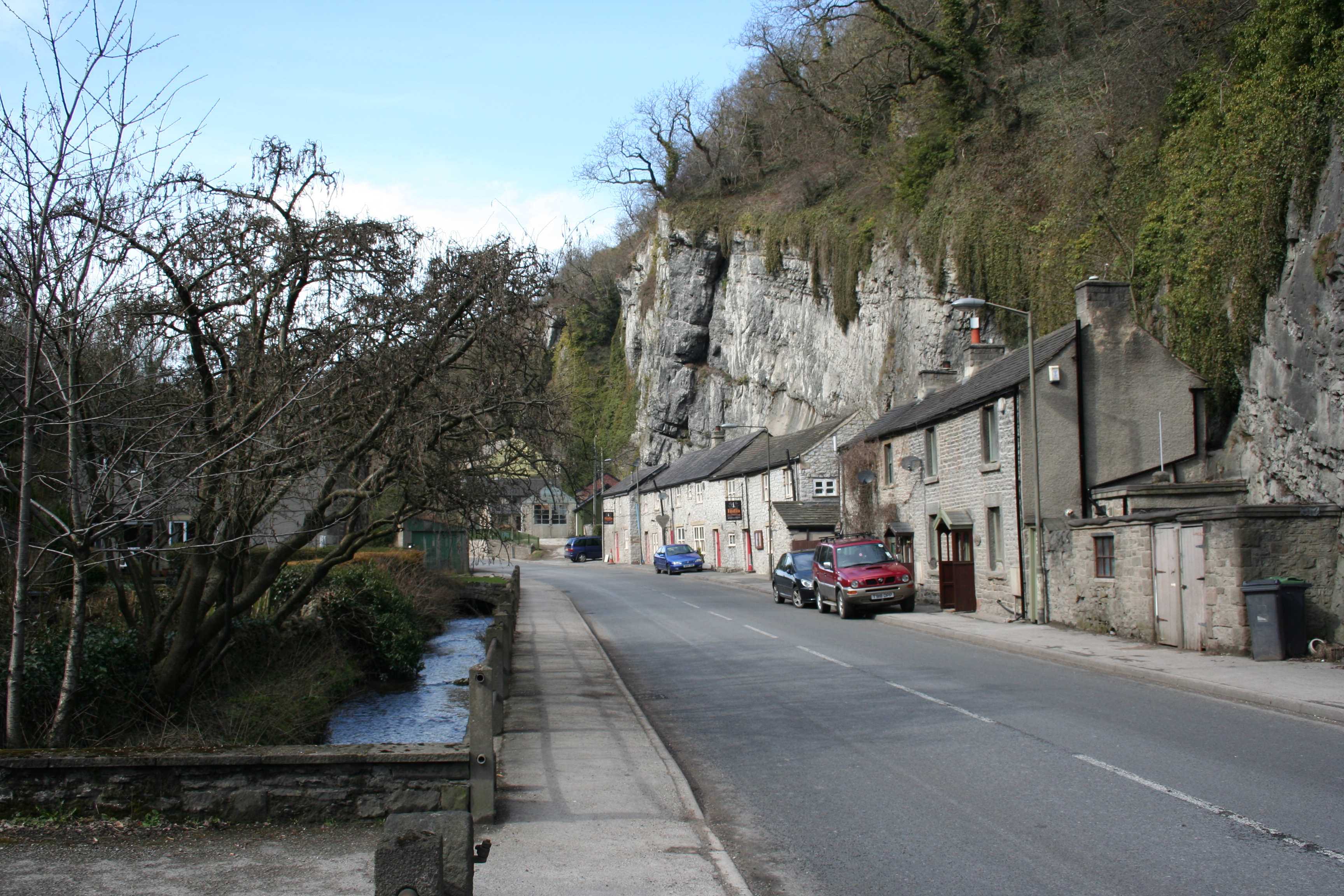
Stoney Middleton

Stoney Middleton is a village and civil parish in the Derbyshire Dales district of Derbyshire, England. It is in the White Peak area of the Peak District...

St Martin's Church, Stoney Middleton

St Martin's Church is a Grade II* listed parish church in the Church of England in Stoney Middleton, Derbyshire. == History == The church dates from the...

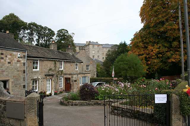
Middleton Hall, Stoney Middleton

Middleton Hall is a restored 17th-century country house at Stoney Middleton, Derbyshire. It is a Grade II listed building.The house was built in the mid...
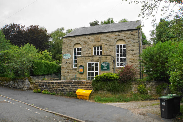
Calver

Calver (Old English Calf Slope) is a village and civil parish in Derbyshire, England. The population of the civil parish at the 2011 census was 710....

Riley Graveyard

Riley Graveyard is a 17th-century grade II listed cemetery in Eyam, Derbyshire. == History == The cemetery, on the outskirts of Eyam, contains the graves...
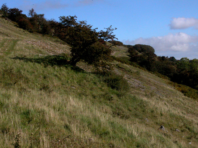
Longstone Edge

Longstone Edge is a limestone ridge in the Peak District National Park, in Derbyshire, England. Longstone Edge is immediately north of the village of Great...

Nearby Amenities

Located within 500m of 53.268789,-1.6631719
Barrier: stile
Stile: squeezer
Lat/Long: 53.2711901/-1.6627241
Barrier: stile
Material: wood
Source: survey;bing;gps
Stile: stepover
Lat/Long: 53.2656982/-1.6670787
Barrier: stile
Material: wood
Source: survey;gps
Step Count: 2
Stile: stepover
Lat/Long: 53.2685432/-1.6632964
Barrier: stile
Material: wood
Source: survey;gps
Step Count: 2
Stile: stepover
Lat/Long: 53.2689821/-1.662749
Barrier: stile
Material: wood
Source: survey;gps
Step Count: 1
Stile: stepover
Lat/Long: 53.2694544/-1.6592179
Barrier: entrance
Source: survey;gps
Lat/Long: 53.2695314/-1.6576059
Barrier: stile
Material: wood
Source: survey;gps
Stile: stepover
Lat/Long: 53.2677576/-1.6653278
Barrier: stile
Material: steel
Source: survey;gps
Stile: squeezer
Lat/Long: 53.2697125/-1.6640337
Barrier: stile
Material: steel
Source: survey;gps
Stile: squeezer
Lat/Long: 53.2705162/-1.6633212
Barrier: stile
Material: steel
Source: survey;gps
Stile: squeezer
Lat/Long: 53.272436/-1.6616222
Barrier: stile
Material: wood
Source: survey;gps
Stile: stepover
Lat/Long: 53.2699653/-1.6585148
Bench
Source: survey;gps
Lat/Long: 53.2694691/-1.6623543
Natural: spring
Lat/Long: 53.2695623/-1.6646182
Bench
Backrest: no
Lat/Long: 53.2699377/-1.6580369
Information: guidepost
Tourism: information
Lat/Long: 53.2684705/-1.6634456
Bench
Backrest: no
Lat/Long: 53.2659411/-1.6672812
The data included in this document is from www.openstreetmap.org. The data is made available under ODbL.

Have you been to Coombs Dale?

Leave your review of Coombs Dale below (or comments, questions and feedback).