Howden Clough

Valley in Yorkshire

England

Howden Clough

Dry stone wall below Ox Hey Looking uphill from the cycle route round Howden Reservoir.
Dry stone wall below Ox Hey Credit: Bill Boaden

Howden Clough is a picturesque valley located in the county of Yorkshire, England. Nestled amidst the rolling hills of the Pennines, this stunning natural landscape offers breathtaking views and a serene atmosphere. The valley is situated near the town of Batley, with easy accessibility from nearby cities like Leeds and Huddersfield.

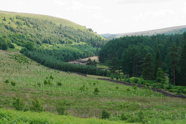
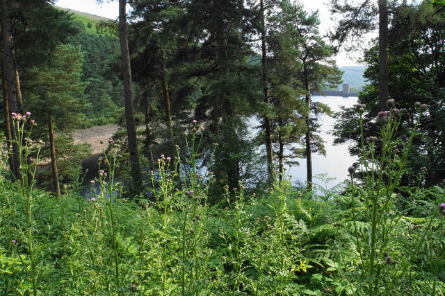
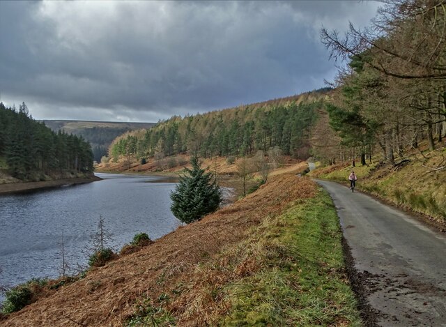
Stretching for approximately two miles, Howden Clough is renowned for its unspoiled beauty and diverse wildlife. The valley is characterized by its lush greenery, with a variety of plant species adorning the landscape. The babbling brook that runs through the valley adds a tranquil touch, creating a soothing ambiance for visitors.

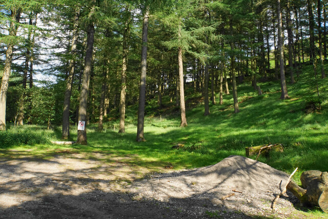
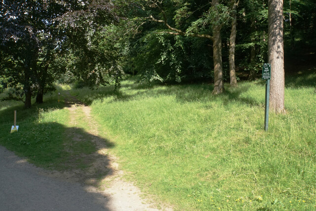
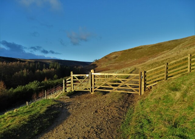
Howden Clough is a haven for nature enthusiasts and hikers alike. The valley boasts numerous well-maintained walking trails, allowing visitors to explore its scenic surroundings. One popular trail leads to the nearby Birstall Golf Club, offering golfers a chance to enjoy a game amidst stunning natural surroundings.

The valley is also home to an array of wildlife, including birds, rabbits, and squirrels. Nature lovers can spot various species of birds soaring in the sky or hear their melodic calls echoing through the valley. The peaceful setting of Howden Clough provides a perfect opportunity for birdwatching and wildlife photography.

In addition to its natural wonders, Howden Clough has historical significance as well. It is believed that the valley was once a site of prehistoric settlements, with archaeological evidence suggesting human occupation in the area dating back thousands of years.

Whether one seeks a peaceful retreat in nature or wishes to delve into the rich history of the region, Howden Clough in Yorkshire offers an idyllic destination that captivates visitors with its beauty and tranquility.

If you have any feedback on the listing, please let us know in the comments section below.

Howden Clough Images

Images are sourced within 2km of 53.438588/-1.7321764 or Grid Reference SK1793. Thanks to Geograph Open Source API. All images are credited.

Dry stone wall below Ox Hey Looking uphill from the cycle route round Howden Reservoir.
Dry stone wall below Ox Hey
Looking uphill from the cycle route round Howden Reservoir.
River Derwent at Slippery Stones Looking upstream from the stone bridge. This is a popular place to come for sunbathing and relaxation.
River Derwent at Slippery Stones
Looking upstream from the stone bridge. This is a popular place to come for sunbathing and relaxation.
Tree plantation at Cold Side The end of a ridge between Cold Side and Cranberry Clough. This view will be transformed when the trees grow up.
Tree plantation at Cold Side
The end of a ridge between Cold Side and Cranberry Clough. This view will be transformed when the trees grow up.
Diverging paths above Slippery Stones The Derwent Valley is left and Cranberry Clough to the right. The National Trust call the land ahead Howden Moor.
Diverging paths above Slippery Stones
The Derwent Valley is left and Cranberry Clough to the right. The National Trust call the land ahead Howden Moor.
Cycle track on Cold Side A well made path below Long Edge. Much of the hillside has been planted with trees, so the view will change in future.
Cycle track on Cold Side
A well made path below Long Edge. Much of the hillside has been planted with trees, so the view will change in future.
The head of Howden Reservoir Looking down from Cold Side. The water level is low, so only the dry banks can be seen. A lot of the hillside has been planted with trees, so this view will not last much longer.
The head of Howden Reservoir
Looking down from Cold Side. The water level is low, so only the dry banks can be seen. A lot of the hillside has been planted with trees, so this view will not last much longer.
Foliage above Howden Reservoir There are rare glimpses of the reservoir through the leaves from the main track, but this one gives a brief view of Howden Dam.
Foliage above Howden Reservoir
There are rare glimpses of the reservoir through the leaves from the main track, but this one gives a brief view of Howden Dam.
The bottom of Howden Clough Where the clough enters Howden Reservoir, it is full of flotsam.
The bottom of Howden Clough
Where the clough enters Howden Reservoir, it is full of flotsam.
Howden Reservoir The arm in the foreground is the former bottom of Howden Clough.
Howden Reservoir
The arm in the foreground is the former bottom of Howden Clough.
Howden Dam A view from the eastern side into bright afternoon sun.
Howden Dam
A view from the eastern side into bright afternoon sun.
Woodland in Abbey Clough The sign warns about forestry operations, but there is not much evidence of any.
Woodland in Abbey Clough
The sign warns about forestry operations, but there is not much evidence of any.
Path to Ewden via Broomhead Marked by Peak & Northern Footpaths Society sign no. 72.
Path to Ewden via Broomhead
Marked by Peak & Northern Footpaths Society sign no. 72.
Howden Reservoir The northern arm of the reservoir looking south from the end of the public road. The water level looks low though the reservoir was 50% full at the time.
Howden Reservoir
The northern arm of the reservoir looking south from the end of the public road. The water level looks low though the reservoir was 50% full at the time.
Howden Hydro-Power Scheme A 1.45GWh power station.
Howden Hydro-Power Scheme
A 1.45GWh power station.
Howden Dam Grade II listed. Listing number 1132874. Built 1901-12. Edward Sandeman, engineer, W. Flockhart, architectural adviser. Coursed, squared rock-faced gritstone, the core of large stone blocks set in concrete. 117 ft high, 178 ft thick at base, tapering to 10 ft at the top.
Howden Dam
Grade II listed. Listing number 1132874. Built 1901-12. Edward Sandeman, engineer, W. Flockhart, architectural adviser. Coursed, squared rock-faced gritstone, the core of large stone blocks set in concrete. 117 ft high, 178 ft thick at base, tapering to 10 ft at the top.
Gate on Cold Side Close to the top of The Derwent Reservoirs. The head of Howden Reservoir lies in the valley to the left.
Gate on Cold Side
Close to the top of The Derwent Reservoirs. The head of Howden Reservoir lies in the valley to the left.
Below Ridge Wood A side tongue of Howden Reservoir
Below Ridge Wood
A side tongue of Howden Reservoir
Cow Hey in The Derwent Valley It overlooks Howden Reservoir
Cow Hey in The Derwent Valley
It overlooks Howden Reservoir
Show me another place!

Howden Clough is located at Grid Ref: SK1793 (Lat: 53.438588, Lng: -1.7321764)

Division: West Riding

Unitary Authority: Sheffield

Police Authority: South Yorkshire

What 3 Words

///accent.occurs.sandpaper. Near Bradfield, South Yorkshire

Related Wikis

Howden Edge

Howden Edge (grid reference SK187943) is a peak in the north-east of the Upper Derwent Valley area of the Peak District National Park in England. At 545...

River Westend

The River Westend flows through the Dark Peak of the Derbyshire Peak District in England. Its source is at Bleaklow Stones on Bleaklow, from where it...

High Stones

High Stones, at 548 metres (1,798 ft), is the highest point within the boundaries of both the City of Sheffield and South Yorkshire, England.High Stones...
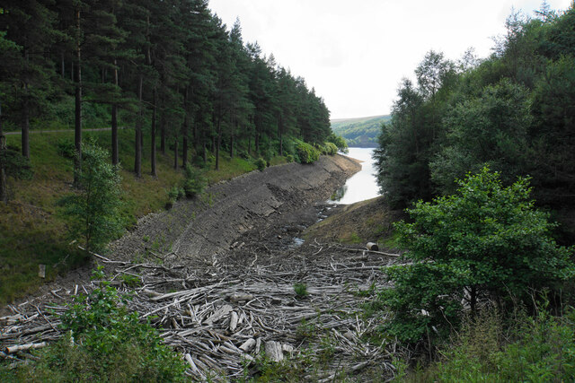
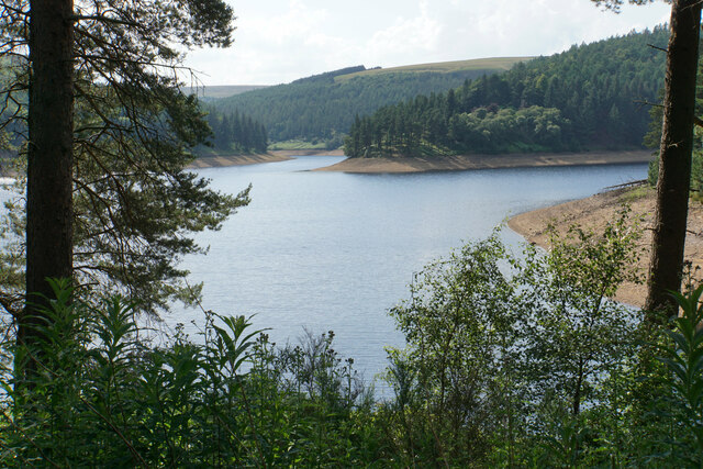
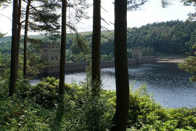
Howden Reservoir

The Howden Reservoir is a Y-shaped reservoir, the uppermost of the three in the Upper Derwent Valley, England. The western half of the reservoir lies in...

Margery Hill

Margery Hill is a 546-metre (1,791 ft) hill on the Howden Moors in South Yorkshire, England. It lies towards the northern boundary of the Peak District...

Lost Lad

Lost Lad is a hill, 518 metres (1,699 ft) high on the Derwent Edge in the Peak District in the county of Derbyshire in England. It is a subpeak of Back...

Derwent Reservoir (Derbyshire)

Derwent Reservoir is the middle of three reservoirs in the Upper Derwent Valley in the north of Derbyshire, England. It lies approximately 10 mi (16 km...

Alport Castles

The Alport Castles are a landslip feature in the Peak District National Park in Derbyshire. At over half a mile long, it is thought to be the largest landslide...

Nearby Amenities

Located within 500m of 53.438588,-1.7321764
Howden Clough
Place: locality
Lat/Long: 53.4388292/-1.7330246
Stony Bank Clough
Place: locality
Lat/Long: 53.4399464/-1.7354084
Natural: peak
Lat/Long: 53.435022/-1.7320459
Ford: yes
Lat/Long: 53.4387033/-1.7356847
The data included in this document is from www.openstreetmap.org. The data is made available under ODbL.

Have you been to Howden Clough?

Leave your review of Howden Clough below (or comments, questions and feedback).