Haycroft Bottom

Valley in Gloucestershire Cotswold

England

Haycroft Bottom

Stone Stile, Sherborne On the LHS of the entrance to Oranges Farm, on Gloucestershire footpath KSH13, looking SW.
Stone Stile, Sherborne Credit: Susan Lang

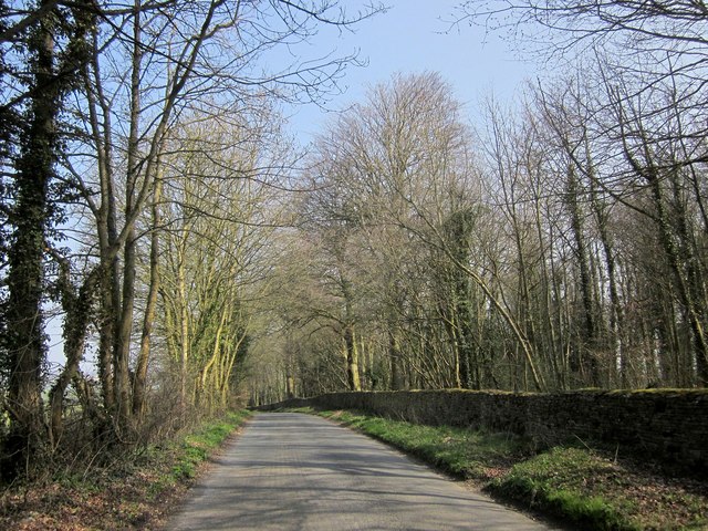
Haycroft Bottom is a picturesque valley located in the county of Gloucestershire in southwestern England. Situated within the Cotswold Area of Outstanding Natural Beauty, this idyllic valley is known for its stunning natural scenery and rich biodiversity.

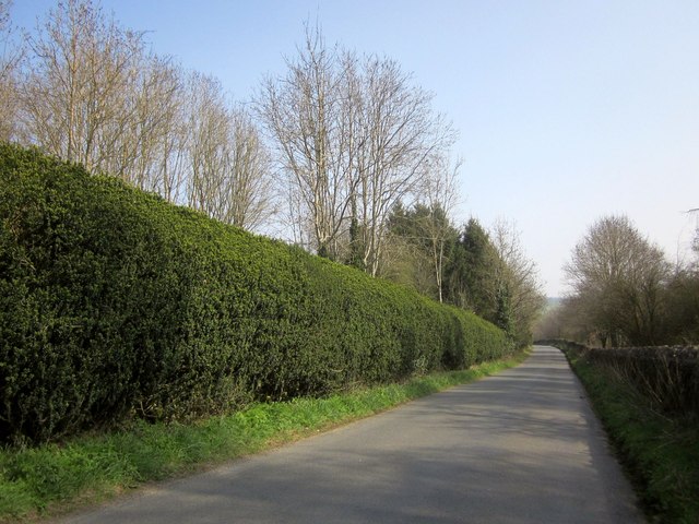
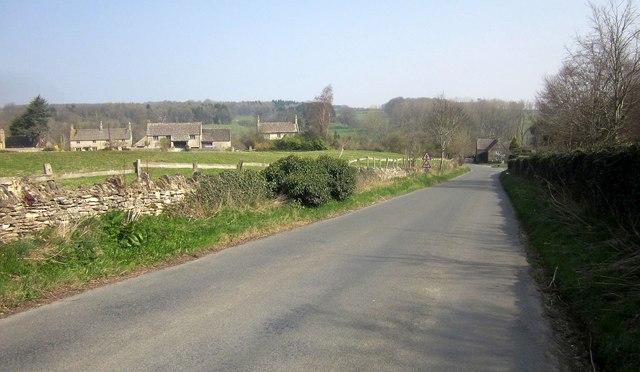
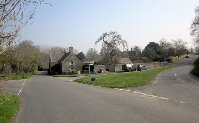
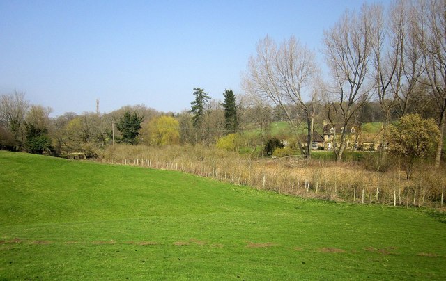
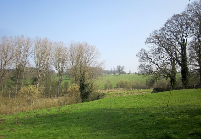
The valley is characterized by its undulating landscape, with rolling hills covered in lush greenery and dotted with charming villages. The area is famous for its traditional Cotswold stone buildings, which add to the timeless beauty of the valley. Haycroft Bottom is home to a variety of wildlife, including deer, foxes, and a multitude of bird species, making it a haven for nature enthusiasts and birdwatchers.

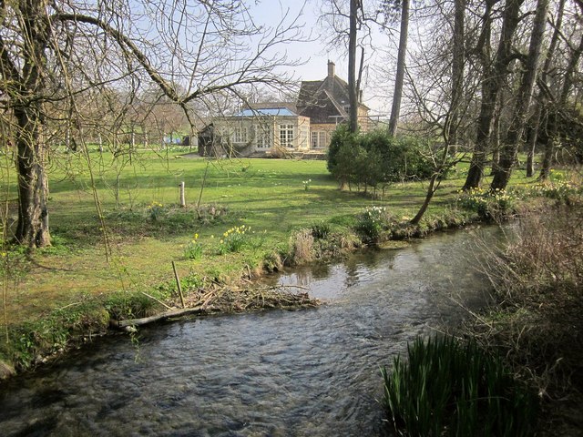
Tranquil streams and small rivers meander through the valley, providing a peaceful and serene atmosphere for visitors. The crystal-clear waters not only enhance the beauty of the landscape but also support a diverse range of aquatic plants and animals.

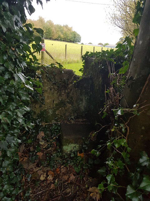
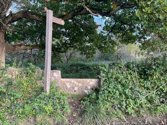
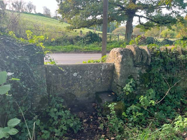
Haycroft Bottom offers numerous opportunities for outdoor activities such as hiking, cycling, and horseback riding. The valley is crisscrossed by a network of well-maintained footpaths and bridleways, allowing visitors to explore the area and enjoy its natural wonders.

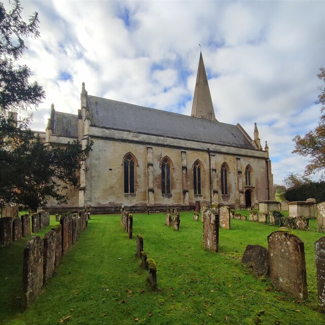
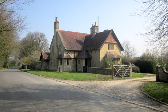
In addition to its natural beauty, Haycroft Bottom is also home to several historic sites and landmarks. The valley features a number of ancient churches, manor houses, and farmsteads, showcasing the rich heritage of the region.

Overall, Haycroft Bottom in Gloucestershire is a truly enchanting place, offering a perfect blend of natural beauty, wildlife, and cultural heritage. It is a must-visit destination for anyone seeking tranquility and a connection with nature.

If you have any feedback on the listing, please let us know in the comments section below.

Haycroft Bottom Images

Images are sourced within 2km of 51.842291/-1.7761439 or Grid Reference SP1515. Thanks to Geograph Open Source API. All images are credited.

Stone Stile, Sherborne On the LHS of the entrance to Oranges Farm, on Gloucestershire footpath KSH13, looking SW.
Stone Stile, Sherborne
On the LHS of the entrance to Oranges Farm, on Gloucestershire footpath KSH13, looking SW.
St Mary's Church, Sherborne
Stone Stile, Sherborne On  Gloucestershire footpath KSH14 heading back to the village.
The view West looking to the road is <a href="https://www.geograph.org.uk/photo/7640913">SP1615 : Stone Stile, Sherborne</a>.
Stone Stile, Sherborne
On Gloucestershire footpath KSH14 heading back to the village. The view West looking to the road is SP1615 : Stone Stile, Sherborne.
Stone Stile, Sherborne On  Gloucestershire footpath KSH14  looking to the road.
The view East  heading back to the village is <a href="https://www.geograph.org.uk/photo/7640906">SP1615 : Stone Stile, Sherborne</a>.
Stone Stile, Sherborne
On Gloucestershire footpath KSH14 looking to the road. The view East heading back to the village is SP1615 : Stone Stile, Sherborne.
Stone Stile, Sherborne At the entrance to Oranges Farm, on Gloucestershire footpath KSH13 looking from the road.
The view NE looking to the road is <a href="https://www.geograph.org.uk/photo/7640930">SP1514 : Stone Stile, Sherborne</a>.
Stone Stile, Sherborne
At the entrance to Oranges Farm, on Gloucestershire footpath KSH13 looking from the road. The view NE looking to the road is SP1514 : Stone Stile, Sherborne.
Stone Stile, Sherborne At the entrance to Oranges Farm, on Gloucestershire footpath KSH13 looking out to the road.
The view SW from the road is <a href="https://www.geograph.org.uk/photo/7640927">SP1514 : Stone Stile, Sherborne</a>.
Stone Stile, Sherborne
At the entrance to Oranges Farm, on Gloucestershire footpath KSH13 looking out to the road. The view SW from the road is SP1514 : Stone Stile, Sherborne.
Road to Sherborne With West Belt, a belt of trees about 60 metres across, alongside on the right. On the left is merely a line of trees.
Road to Sherborne
With West Belt, a belt of trees about 60 metres across, alongside on the right. On the left is merely a line of trees.
The Oranges Farm, Sherborne Farm buildings seen from the road shown in <a href="https://www.geograph.org.uk/photo/4668946">SP1514 : Road to Sherborne</a> through a gap between Teardrop Wood and Stoney Copse.
The Oranges Farm, Sherborne
Farm buildings seen from the road shown in SP1514 : Road to Sherborne through a gap between Teardrop Wood and Stoney Copse.
Road to Sherborne From the same spot as <a href="https://www.geograph.org.uk/photo/4668969">SP1514 : The Oranges Farm, Sherborne</a>, which looks to the left. As with <a href="https://www.geograph.org.uk/photo/4668946">SP1514 : Road to Sherborne</a>, the West Belt on the right continues but is about to narrow, and ends in 150 metres.
Road to Sherborne
From the same spot as SP1514 : The Oranges Farm, Sherborne, which looks to the left. As with SP1514 : Road to Sherborne, the West Belt on the right continues but is about to narrow, and ends in 150 metres.
West Lodge The west lodge to Sherborne Park and Sherborne House, on the road shown in <a href="https://www.geograph.org.uk/photo/4668976">SP1514 : Road to Sherborne</a>. It is described at <span class="nowrap"><a title="http://list.historicengland.org.uk/resultsingle.aspx?uid=1000780&searchtype=mapsearch" rel="nofollow ugc noopener" href="http://list.historicengland.org.uk/resultsingle.aspx?uid=1000780&searchtype=mapsearch">Link</a><img style="margin-left:2px;" alt="External link" title="External link - shift click to open in new window" src="https://s1.geograph.org.uk/img/external.png" width="10" height="10"/></span> as "a fairly substantial two-storey, stone, Arts and Crafts-influenced lodge of 1909".
West Lodge
The west lodge to Sherborne Park and Sherborne House, on the road shown in SP1514 : Road to Sherborne. It is described at LinkExternal link as "a fairly substantial two-storey, stone, Arts and Crafts-influenced lodge of 1909".
Road to Sherborne A tall hedge runs alongside the road from Radbutt's Corner; on the right is Ragged Copse.
Road to Sherborne
A tall hedge runs alongside the road from Radbutt's Corner; on the right is Ragged Copse.
Approaching Sherborne The road shown in <a href="https://www.geograph.org.uk/photo/4669027">SP1614 : Road to Sherborne</a> approaches the crossroads near the west end of the village.
Approaching Sherborne
The road shown in SP1614 : Road to Sherborne approaches the crossroads near the west end of the village.
Grass triangle, Sherborne The road from Radbutt's Corner into the Sherborne Brook valley crosses the winding lane through the village, which runs along the southern valley slopes.
Grass triangle, Sherborne
The road from Radbutt's Corner into the Sherborne Brook valley crosses the winding lane through the village, which runs along the southern valley slopes.
Sherborne Brook Looking upstream from the listed bridge on the road to Goms Hole. <a href="https://www.geograph.org.uk/photo/4669126">SP1615 : Sherborne Brook</a>] looks downstream.
Sherborne Brook
Looking upstream from the listed bridge on the road to Goms Hole. SP1615 : Sherborne Brook] looks downstream.
Sherborne Brook Looking downstream from the same bridge as <a href="https://www.geograph.org.uk/photo/4669105">SP1615 : Sherborne Brook</a>, with Sherbrooke House on the left.
Sherborne Brook
Looking downstream from the same bridge as SP1615 : Sherborne Brook, with Sherbrooke House on the left.
In the Sherborne Brook valley From footpath KSH 14/1, looking across the river towards Sherbrooke House.
In the Sherborne Brook valley
From footpath KSH 14/1, looking across the river towards Sherbrooke House.
In the Sherborne Brook valley From the same place on footpath KSH 14/1 as <a href="https://www.geograph.org.uk/photo/4669148">SP1615 : In the Sherborne Brook valley</a>, looking downstream to the right.
In the Sherborne Brook valley
From the same place on footpath KSH 14/1 as SP1615 : In the Sherborne Brook valley, looking downstream to the right.
Stile at Sherborne Footpath KSH 14/1 crosses this stile and heads between houses to meet the road through the village.
Stile at Sherborne
Footpath KSH 14/1 crosses this stile and heads between houses to meet the road through the village.
Show me another place!

Haycroft Bottom is located at Grid Ref: SP1515 (Lat: 51.842291, Lng: -1.7761439)

Administrative County: Gloucestershire

District: Cotswold

Police Authority: Gloucestershire

What 3 Words

///blogging.asterisk.shatters. Near Northleach, Gloucestershire

Nearby Locations

Mill Copse Haycroft Bottom

Related Wikis

Sherborne House, Gloucestershire

Sherborne House is a large house in the village of Sherborne, Gloucestershire, England. It is a former country house that has been converted into flats...

Church of St Peter, Farmington

The Anglican Church of St Peter at Farmington in the Cotswold District of Gloucestershire, England was built in the 12th century. It is a grade I listed...

Clapton, Gloucestershire

Clapton, also known as Clapton-on-the-Hill, is a small village and civil parish in the district of Cotswold, in the county of Gloucestershire, England...

Farmington, Gloucestershire

Farmington is a village located in the county of Gloucestershire, in England. As of 2011 the village had 112 residents. It is mentioned in the Domesday...

Sherborne, Gloucestershire

Sherborne is a village and civil parish almost 3.5 miles (5.6 km) east of Northleach in Gloucestershire. Sherborne is a linear village, extending more...

River Dikler

The River Dikler is a short river in the Cotswold District of Gloucestershire which flows for 12 kilometres (7.5 mi) through Upper Swell and to the west...

Lodge Park and Sherborne Estate

Lodge Park was built as a grandstand in the Sherborne Estate near the villages of Sherborne, Aldsworth and Northleach in Gloucestershire, England. The...

Northleach with Eastington

Northleach with Eastington is a civil parish in the English county of Gloucestershire that includes the town of Northleach and the hamlet of Eastington...

Have you been to Haycroft Bottom?

Leave your review of Haycroft Bottom below (or comments, questions and feedback).