Green Clough

Valley in Derbyshire High Peak

England

Green Clough

Remains of Birchinlee Viaduct The viaduct carried the railway used in the construction of the Derwent dams over Ouzelden Clough. The water level was low with capacity below 50% on the day of the visit. The low water level has exposed the stone foundations <a href="https://www.geograph.org.uk/photo/6943062">SK1691 : Foundations of Birchinlee Viaduct</a> but these fragments of wooden beams have survived over 100 years as they are usually above the water level.
Remains of Birchinlee Viaduct Credit: Graham Hogg

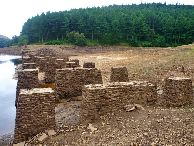
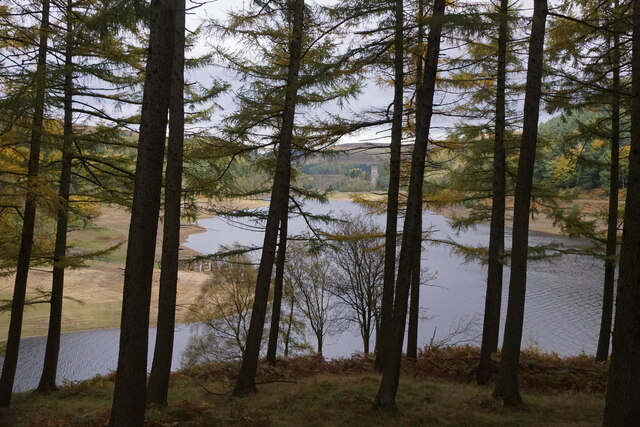
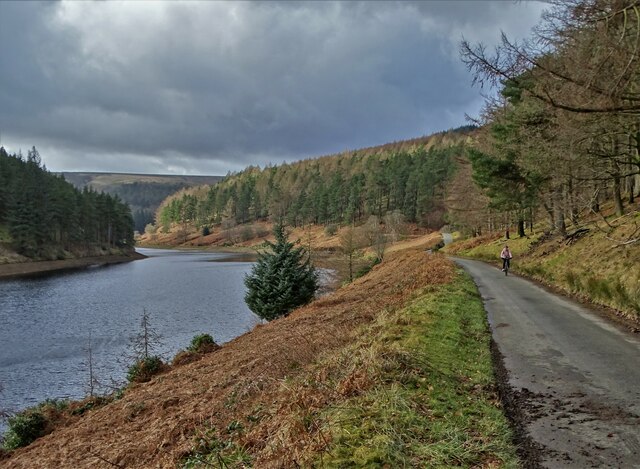
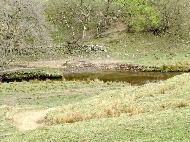
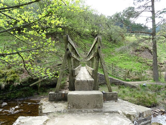
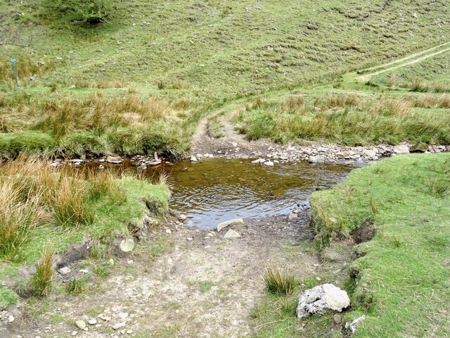
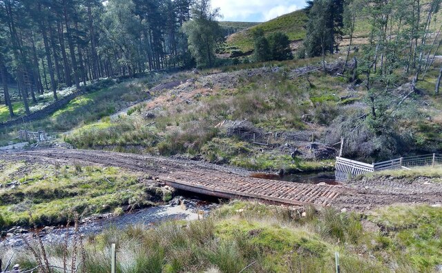
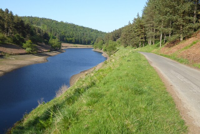
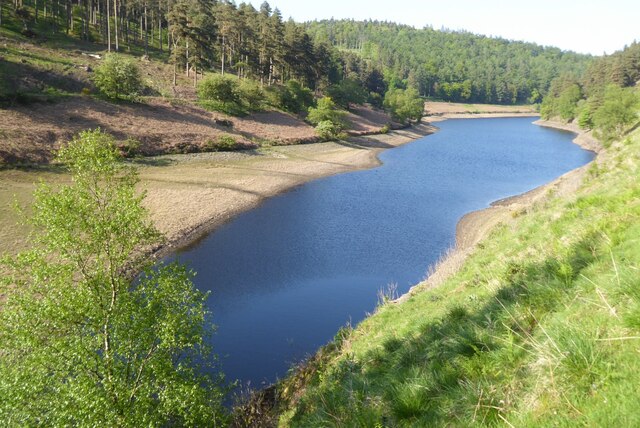
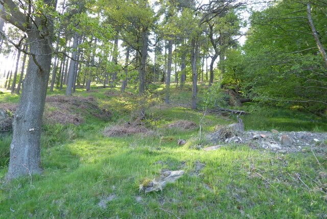
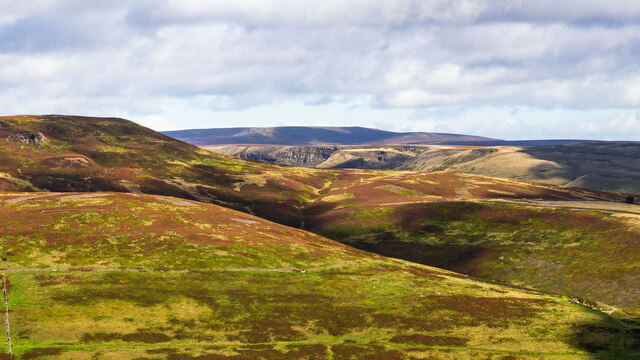
Green Clough is a picturesque valley located in Derbyshire, England. Situated in the heart of the Peak District National Park, it is renowned for its stunning natural beauty and tranquil atmosphere. The valley is surrounded by rolling hills, dense woodlands, and meandering streams, offering visitors a perfect escape from the hustle and bustle of city life.

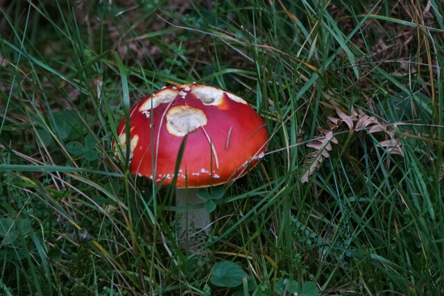
Green Clough is home to a diverse range of flora and fauna, making it a haven for nature enthusiasts and wildlife lovers. The valley is characterized by its lush green meadows, wildflowers, and ancient woodland, providing a habitat for various species of birds, mammals, and insects. It is not uncommon to spot deer, foxes, and rabbits roaming freely in this idyllic setting.

The valley is intersected by a babbling brook, which adds to its charm and serenity. The crystal-clear waters are teeming with fish, making it a popular spot for anglers seeking a peaceful day of fishing. Additionally, the brook provides a refreshing setting for leisurely walks, picnics, and even paddling during the warmer months.

For those seeking adventure, Green Clough offers numerous hiking trails and pathways that wind through the valley and surrounding countryside. These trails cater to all levels of fitness, from gentle strolls to more challenging hikes up the nearby hills. The breathtaking views from the hilltops are well worth the effort.

In conclusion, Green Clough is a hidden gem nestled within the Derbyshire countryside. Its natural beauty, abundant wildlife, and peaceful ambiance make it a must-visit destination for anyone seeking solace in nature.

If you have any feedback on the listing, please let us know in the comments section below.
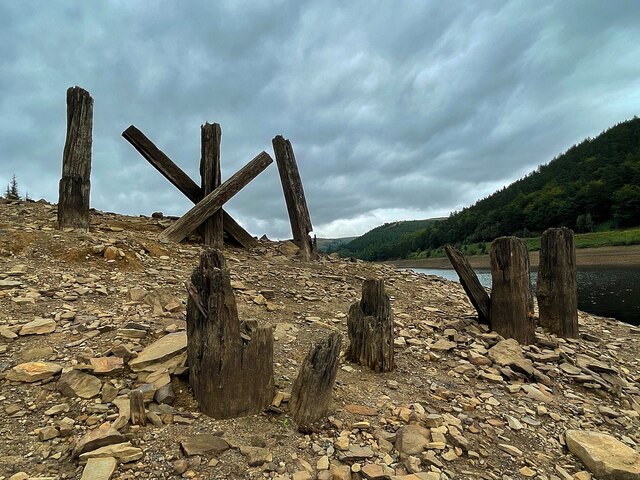
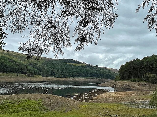
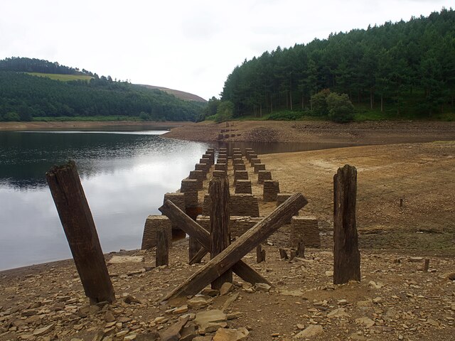
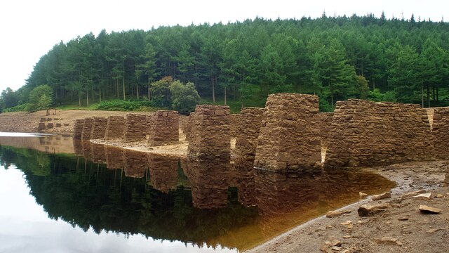
Green Clough Images

Images are sourced within 2km of 53.424657/-1.7762957 or Grid Reference SK1492. Thanks to Geograph Open Source API. All images are credited.

Remains of Birchinlee Viaduct The viaduct carried the railway used in the construction of the Derwent dams over Ouzelden Clough. The water level was low with capacity below 50% on the day of the visit. The low water level has exposed the stone foundations <a href="https://www.geograph.org.uk/photo/6943062">SK1691 : Foundations of Birchinlee Viaduct</a> but these fragments of wooden beams have survived over 100 years as they are usually above the water level.
Remains of Birchinlee Viaduct
The viaduct carried the railway used in the construction of the Derwent dams over Ouzelden Clough. The water level was low with capacity below 50% on the day of the visit. The low water level has exposed the stone foundations SK1691 : Foundations of Birchinlee Viaduct but these fragments of wooden beams have survived over 100 years as they are usually above the water level.
Upper Derwent Reservoir The stone foundations of the railway bridge over Ouzelden Clough can be seen in the foreground. The railway was built for the construction of the Derwent and Howden dams and the foundations have been exposed due to the low water level.
Upper Derwent Reservoir
The stone foundations of the railway bridge over Ouzelden Clough can be seen in the foreground. The railway was built for the construction of the Derwent and Howden dams and the foundations have been exposed due to the low water level.
Foundations of Birchinlee Viaduct The viaduct carried the railway used in the construction of the Derwent and Howden dams over Ouzelden Clough. The water level was low with capacity at 50% on the day of the visit.
Foundations of Birchinlee Viaduct
The viaduct carried the railway used in the construction of the Derwent and Howden dams over Ouzelden Clough. The water level was low with capacity at 50% on the day of the visit.
Derwent Reservoir, looking towards the Howden Dam
Fly Agaric (Amanita muscaria), Upper Derwent Valley
Below Ridge Wood A side tongue of Howden Reservoir
Below Ridge Wood
A side tongue of Howden Reservoir
The cellar of "The Derwent Canteen" "The Derwent Canteen" was a public house that served the residents of Tin Town - a temporary settlement built to house men who worked on the enormous civil engineering project that resulted in the three reservoirs at the head of The Derwent Valley. Some men also lived in Tin Town with their wives and children.
The cellar of "The Derwent Canteen"
"The Derwent Canteen" was a public house that served the residents of Tin Town - a temporary settlement built to house men who worked on the enormous civil engineering project that resulted in the three reservoirs at the head of The Derwent Valley. Some men also lived in Tin Town with their wives and children.
Ford crossing the River Alport
Footbridge over the River Alport
Ford crossing the River Alport
Temporary bridge made for logging vehicles An area of mature conifers was clear felled and this bridge was made for access by logging vehicles using some of the cut logs.
Temporary bridge made for logging vehicles
An area of mature conifers was clear felled and this bridge was made for access by logging vehicles using some of the cut logs.
View to Howden Dam View across Upper Derwent Reservoir to Howden Dam.
View to Howden Dam
View across Upper Derwent Reservoir to Howden Dam.
Road and Howden Reservoir Howden Reservoir and the road which is only open on weekdays running along side.
Road and Howden Reservoir
Howden Reservoir and the road which is only open on weekdays running along side.
The Howden Reservoir
Trees below Banktop Plantation Trees below Banktop Plantation above Howden Reservoir.
Trees below Banktop Plantation
Trees below Banktop Plantation above Howden Reservoir.
Alport Castles The distinctive rock outcrops at Alport Castles.  Nether Moor in the foreground and Crookstone Hill in the near middle distance (Crookstone Knoll prominent to the left).
Alport Castles
The distinctive rock outcrops at Alport Castles. Nether Moor in the foreground and Crookstone Hill in the near middle distance (Crookstone Knoll prominent to the left).
Show me another place!

Green Clough is located at Grid Ref: SK1492 (Lat: 53.424657, Lng: -1.7762957)

Administrative County: Derbyshire

District: High Peak

Police Authority: Derbyshire

What 3 Words

///sapping.grinders.stylist. Near High Peak, Derbyshire

Related Wikis

Alport Castles

The Alport Castles are a landslip feature in the Peak District National Park in Derbyshire. At over half a mile long, it is thought to be the largest landslide...

Howden Reservoir

The Howden Reservoir is a Y-shaped reservoir, the uppermost of the three in the Upper Derwent Valley, England. The western half of the reservoir lies in...

River Westend

The River Westend flows through the Dark Peak of the Derbyshire Peak District in England. Its source is at Bleaklow Stones on Bleaklow, from where it...

Derwent Reservoir (Derbyshire)

Derwent Reservoir is the middle of three reservoirs in the Upper Derwent Valley in the north of Derbyshire, England. It lies approximately 10 mi (16 km...

River Alport

The River Alport flows for 5.6 miles (9 km) in the Dark Peak of the Peak District in Derbyshire, England. Its source is on Bleaklow, 3 miles (4.8 km)...

Hope Woodlands

Hope Woodlands is an extensive civil parish in the High Peak district of Derbyshire in England. The parish covers the Woodlands Valley, the western Upper...

Dark Peak

The Dark Peak is the higher and wilder part of the Peak District in England, mostly forming the northern section but also extending south into its eastern...

Howden Edge

Howden Edge (grid reference SK187943) is a peak in the north-east of the Upper Derwent Valley area of the Peak District National Park in England. At 545...

Nearby Amenities

Located within 500m of 53.424657,-1.7762957
Birchinlee Pasture
Place: locality
Source: Bing
Lat/Long: 53.4223859/-1.7814906
Green Clough
Place: locality
Source: Bing
Lat/Long: 53.4243596/-1.7760738
Green Clough
Place: locality
Lat/Long: 53.4254417/-1.7707752
The data included in this document is from www.openstreetmap.org. The data is made available under ODbL.

Have you been to Green Clough?

Leave your review of Green Clough below (or comments, questions and feedback).