Biggin Dale

Valley in Derbyshire Derbyshire Dales

England

Biggin Dale

Early morning view northwest to Biggin from field path
Early morning view northwest to Biggin from field path Credit: Colin Park

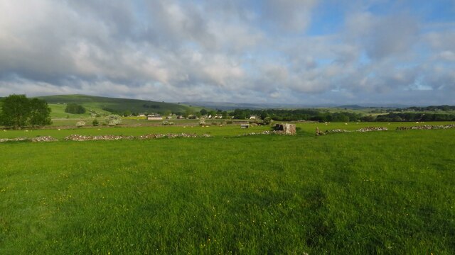
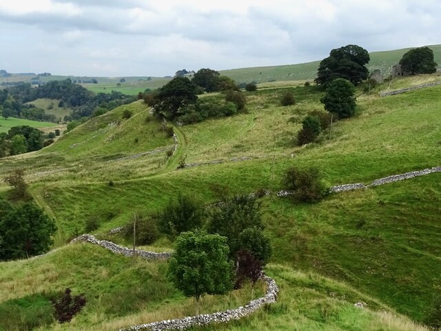
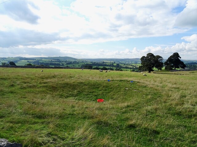
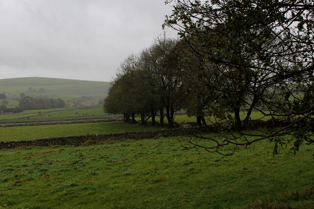
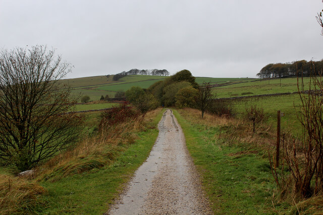
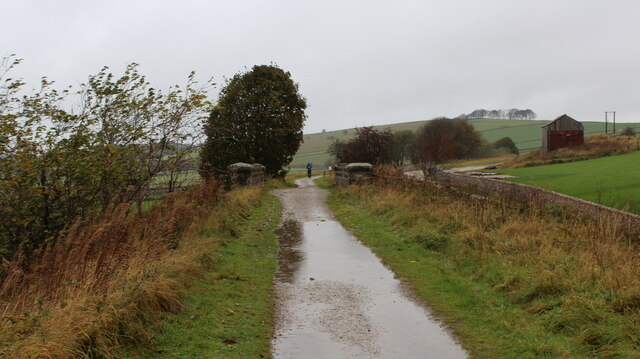
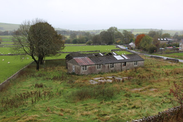
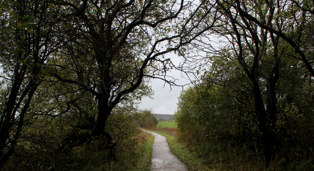
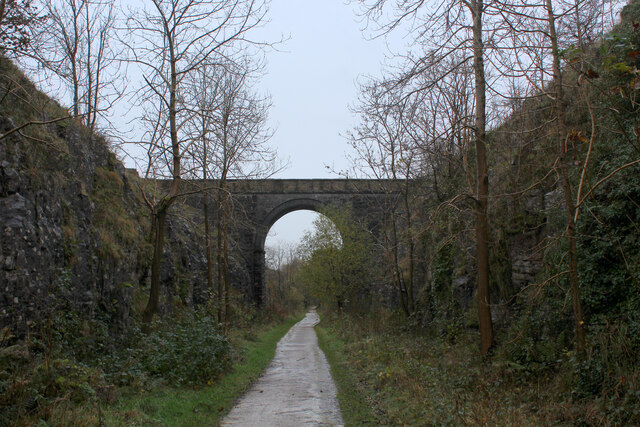
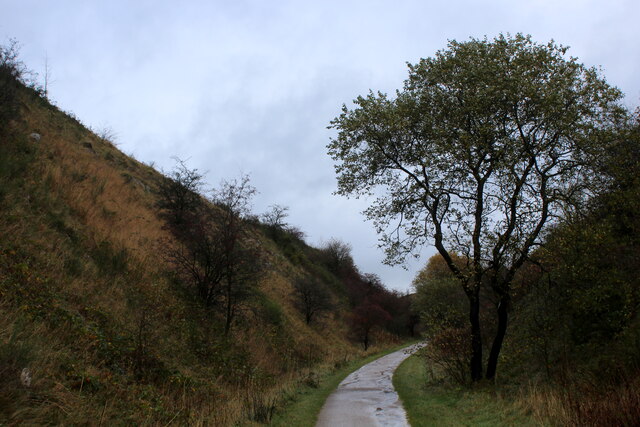
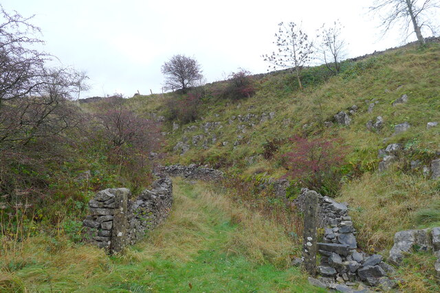
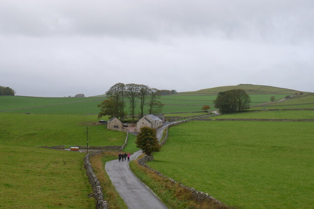
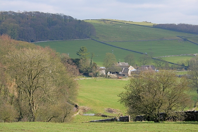
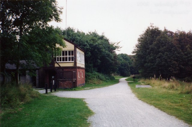
Biggin Dale is a picturesque valley located in the heart of Derbyshire, England. This stunning natural landscape is known for its rugged beauty and tranquil atmosphere. The dale stretches for approximately 2 miles and is renowned for its lush greenery, meandering river, and breathtaking limestone cliffs.

The valley is a popular destination for nature lovers and outdoor enthusiasts due to its abundance of wildlife and scenic walking trails. The dale is home to a variety of rare plant species, including orchids and ferns, making it a haven for botany enthusiasts. Birdwatchers also flock to Biggin Dale to catch a glimpse of the numerous avian species that call this place home.

The crystal-clear river that flows through Biggin Dale is a highlight for visitors. It provides a perfect spot for picnicking, paddling, and even wild swimming during the warmer months. The river is also a popular spot for fly fishing, attracting anglers from far and wide.

One of the most striking features of Biggin Dale is its imposing limestone cliffs, which tower above the valley floor. These dramatic cliffs provide a stunning backdrop and are a favorite among rock climbers and photographers alike.

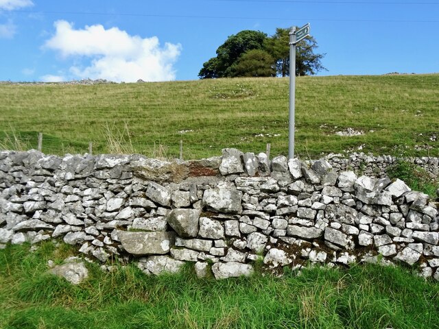
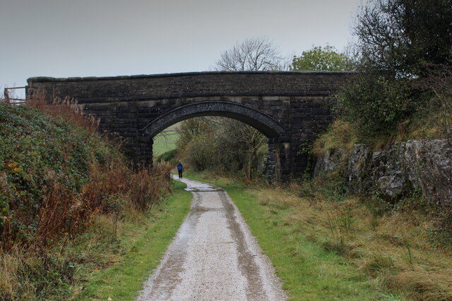
The dale is easily accessible, with a car park located nearby, and is a great starting point for exploring the wider Peak District National Park. Whether you're seeking a peaceful stroll through nature, an adrenaline-pumping adventure, or simply the opportunity to unwind in a truly breathtaking location, Biggin Dale is a must-visit destination in Derbyshire.

If you have any feedback on the listing, please let us know in the comments section below.
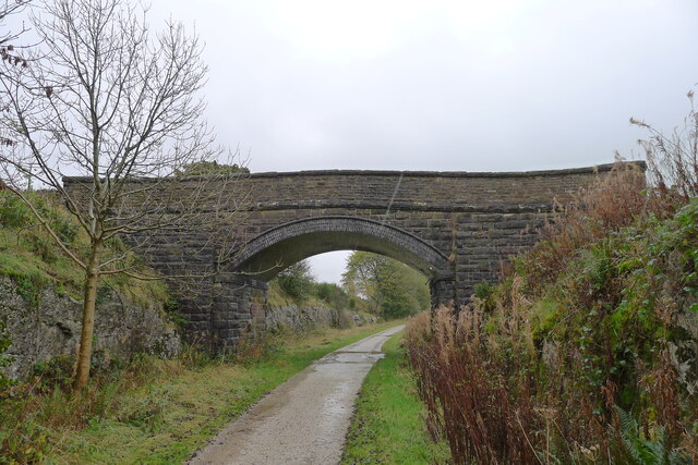
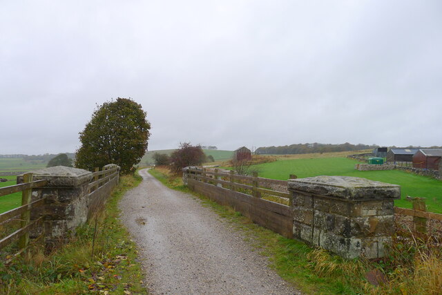
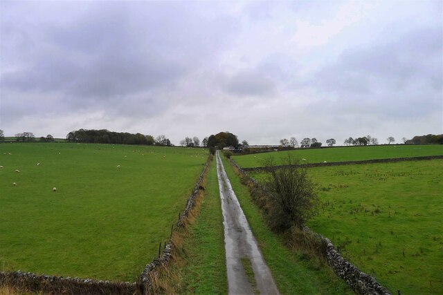
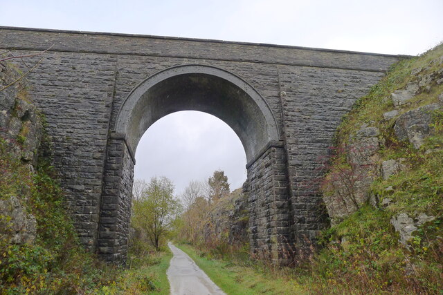
Biggin Dale Images

Images are sourced within 2km of 53.12227/-1.7835751 or Grid Reference SK1458. Thanks to Geograph Open Source API. All images are credited.

Early morning view northwest to Biggin from field path
Farm track climbing out of the dale A narrow track winds its way uphill to some farm buildings
Farm track climbing out of the dale
A narrow track winds its way uphill to some farm buildings
Dry dew pond On current OS maps, this pond is marked as being in-water, but it appears to be dry, now.
Dry dew pond
On current OS maps, this pond is marked as being in-water, but it appears to be dry, now.
Step stile on a shortcut A short length of footpath cuts the corner at the junction of a couple of old lanes.
Step stile on a shortcut
A short length of footpath cuts the corner at the junction of a couple of old lanes.
Pastures between Heathcote and Biggin Countryside as seen from the Tissington Trail
Pastures between Heathcote and Biggin
Countryside as seen from the Tissington Trail
Tissington Trail near Biggin Farm access track crosses over the trail on a substantial bridge
Tissington Trail near Biggin
Farm access track crosses over the trail on a substantial bridge
Along the Tissington Trail near Biggin Section that once formed part of a railway link between Buxton and Ashbourne - now a popular venue for cyclists, walkers and the horse fraternity.
Along the Tissington Trail near Biggin
Section that once formed part of a railway link between Buxton and Ashbourne - now a popular venue for cyclists, walkers and the horse fraternity.
Tissington Trail crossing the Road from Biggin The trail crosses the minor road between Biggin and the A515
Tissington Trail crossing the Road from Biggin
The trail crosses the minor road between Biggin and the A515
Remains of Former Prisoner of War Huts near Biggin Housed Italian Prisoners of War - as seen from the Tissington Trail
Remains of Former Prisoner of War Huts near Biggin
Housed Italian Prisoners of War - as seen from the Tissington Trail
On the Tissington Traill The trail just to the north of Back Lane
On the Tissington Traill
The trail just to the north of Back Lane
Single Arched Viaduct over the Tissington Trail A grand structure supporting a track that gives access between fields - spanning the Tissington Trail as it passes through a cutting.
Single Arched Viaduct over the Tissington Trail
A grand structure supporting a track that gives access between fields - spanning the Tissington Trail as it passes through a cutting.
Cutting on the Tissington Trail Section of the leisure trail, popular among cyclists, horse riders and the walking fraternity - once part of the railway link between Buxton and Ashbourne
Cutting on the Tissington Trail
Section of the leisure trail, popular among cyclists, horse riders and the walking fraternity - once part of the railway link between Buxton and Ashbourne
"Dream of Noise and Wheels and Coal and Steam" The title is from the plaque on the left pier.
"Dream of Noise and Wheels and Coal and Steam"
The title is from the plaque on the left pier.
The Tissington Trail The track bed of the former London and North Western Railway (Ashbourne to Buxton) crossing a minor road
The Tissington Trail
The track bed of the former London and North Western Railway (Ashbourne to Buxton) crossing a minor road
Back Lane leading to Bigginmoor Farm Viewed from the Tissington Trail
Back Lane leading to Bigginmoor Farm
Viewed from the Tissington Trail
Bridge over the former Ashbourne to Buxton railway Looking at old OS maps this bridge, built at the end of the 19th century, has never carried any substantial road or track. It seems to be a very expensive structure if its only purpose was to connect farmland on either side of the railway.
Bridge over the former Ashbourne to Buxton railway
Looking at old OS maps this bridge, built at the end of the 19th century, has never carried any substantial road or track. It seems to be a very expensive structure if its only purpose was to connect farmland on either side of the railway.
Entrance to old track leading off the former Ashbourne to Buxton railway line The track gave access to a quarry on the other side of the line
Entrance to old track leading off the former Ashbourne to Buxton railway line
The track gave access to a quarry on the other side of the line
Walkers on the road past Lees Barn The group was on its way to join the Tissington Trail
Walkers on the road past Lees Barn
The group was on its way to join the Tissington Trail
Show me another place!

Biggin Dale is located at Grid Ref: SK1458 (Lat: 53.12227, Lng: -1.7835751)

Administrative County: Derbyshire

District: Derbyshire Dales

Police Authority: Derbyshire

What 3 Words

///loopholes.actor.shields. Near Newhaven, Derbyshire

Nearby Locations

Biggin Dale

Related Wikis

Wolfscote Hill

Wolfscote Hill is a limestone hill near the village of Hartington in the Derbyshire Peak District. The summit is 388 metres (1,273 ft) above sea level...

Biggin (Dovedale and Parwich Ward)

Biggin is a village in the Derbyshire Dales district of Derbyshire, England. It is part of the Hartington Nether Quarter parish, and is in the Peak District...

Hartington Nether Quarter

Hartington Nether Quarter is a civil parish in the Derbyshire Dales district of Derbyshire, England. The parish was created from the subdivision of the...

Eaton and Alsop

Eaton and Alsop is a civil parish within the Derbyshire Dales district, in the county of Derbyshire, England. Largely rural, Along with the adjacent Newton...

Hartington Hall

Hartington Hall is a much altered and extended 17th-century manor house at Hartington, Derbyshire, now a youth hostel. The Hall was built by the Bateman...

Hartington, Derbyshire

Hartington is a village in the centre of the White Peak area of the Derbyshire Peak District, England, lying on the River Dove which is the Staffordshire...

Hartington railway station

Hartington railway station is a former railway station which operated from 1899 to 1963. It was built to serve the village of Hartington (grid reference...

Newhaven, Derbyshire

Newhaven is a hamlet in the county of Derbyshire, England, east of Hartington and west of Cromford. The principal employer in the area is DSF Refractories...

Related Videos

holiday vlog | Beresford Dale | holiday house tour in the UK | silent vlog in the UK | vlog ep.20

silentvlog #vlog #holidayvlog #peakdistrict #travel #walking #hiking #housetour ✨ Hello everyone! Welcome to Episode 20 of my ...

Aleck Low #peakdistrict #summit #derbyshire #summit

Aleck Low - a Peak District amble. #peakdistrict #summit.

Tranquility of Wolfscote Dale: Peak District | Solo Hiking

Solo Hiking - 5K Cinematic Short Film: The Tranquility of Wolfscote Dale - Derbyshire Dales - Peak District - UK | Solo Traveler ...

Nearby Amenities

Located within 500m of 53.12227,-1.7835751
Hiking: yes
Information: guidepost
Source: GPS survey
Tourism: information
Lat/Long: 53.1258763/-1.7842189
The data included in this document is from www.openstreetmap.org. The data is made available under ODbL.

Have you been to Biggin Dale?

Leave your review of Biggin Dale below (or comments, questions and feedback).