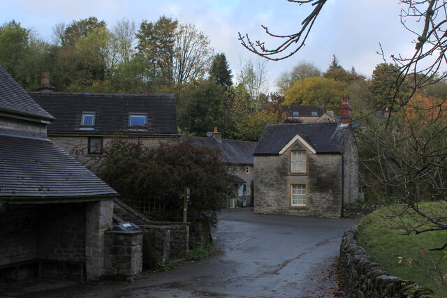
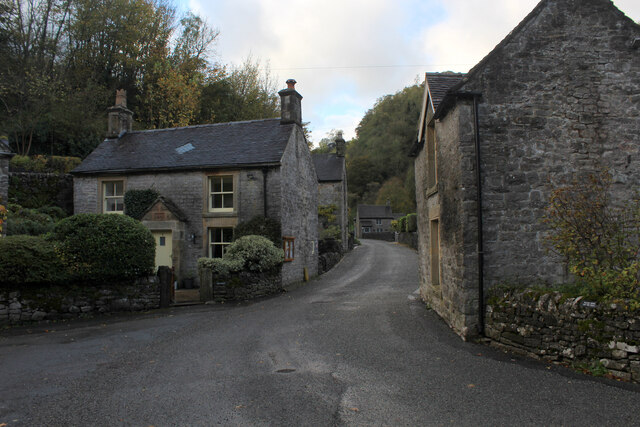
Mill Dale

Valley in Derbyshire Derbyshire Dales

England

Mill Dale

The start of a footpath to Alstonefield A narrow flight of steps leads off a narrow back lane at the start of a footpath, which climbs steeply out of Milldale towards Alstonefield.
The start of a footpath to Alstonefield Credit: Ian Calderwood

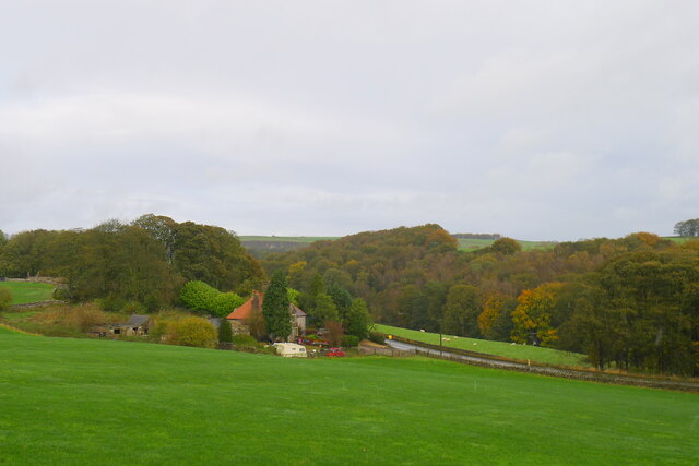
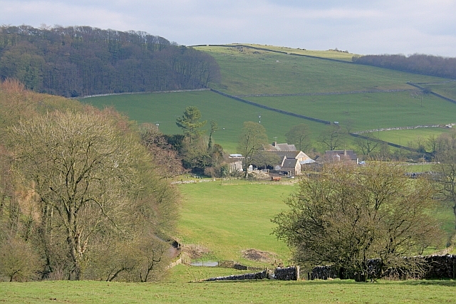
Mill Dale is a picturesque valley located in the Peak District National Park, in the county of Derbyshire, England. It is situated near the village of Alstonfield and is known for its natural beauty and tranquility.

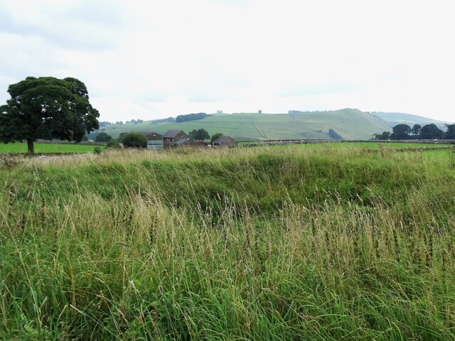
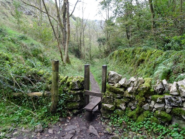
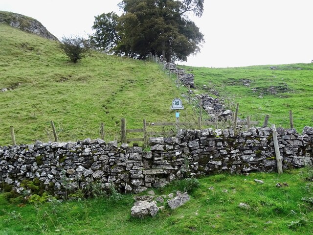
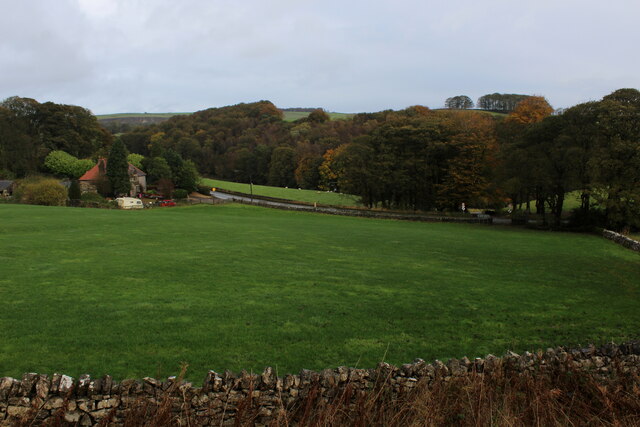
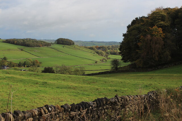
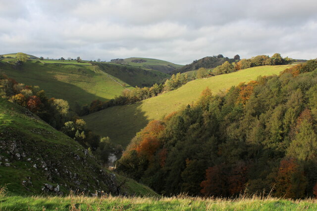
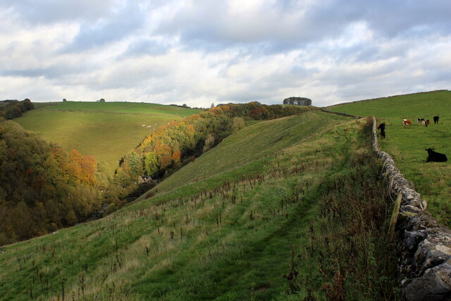
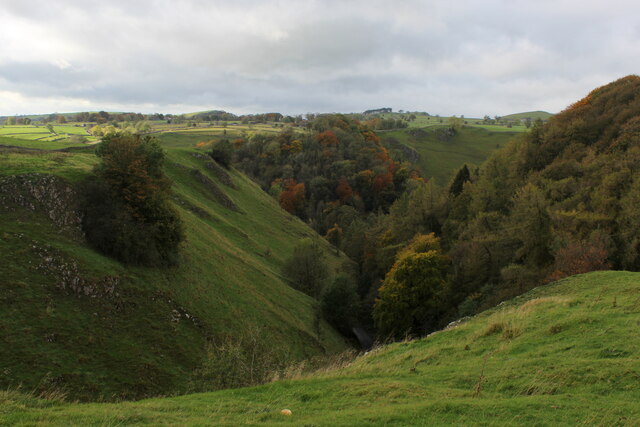
The valley is characterized by its lush green meadows, rolling hills, and crystal-clear streams. It is surrounded by limestone cliffs, which provide a stunning backdrop to the landscape. Many visitors are drawn to Mill Dale for its peaceful atmosphere and the opportunity to connect with nature.

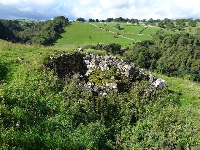
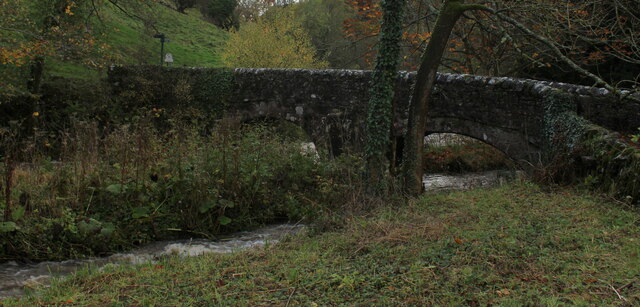
The name Mill Dale comes from the historic watermills that once operated in the area. These mills utilized the fast-flowing water from the river to grind corn and produce flour. While the mills are no longer in operation, remnants of their structures can still be seen along the riverbanks.

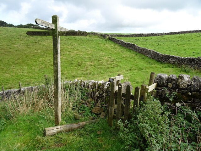
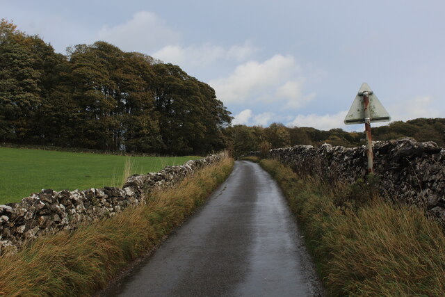
The valley is a popular destination for hikers and nature enthusiasts, as it offers a variety of walking trails through its scenic surroundings. One of the most well-known paths is the Dovedale Valley Walk, which follows the course of the River Dove and provides breathtaking views of the valley.

Wildlife is abundant in Mill Dale, with a wide range of bird species, including peregrine falcons and kingfishers, making their home in the area. The river is also home to a variety of fish, such as brown trout and grayling, making it a popular spot for fishing enthusiasts.

Overall, Mill Dale is a hidden gem in Derbyshire, offering visitors a chance to escape the hustle and bustle of city life and immerse themselves in the beauty of the natural world.

If you have any feedback on the listing, please let us know in the comments section below.
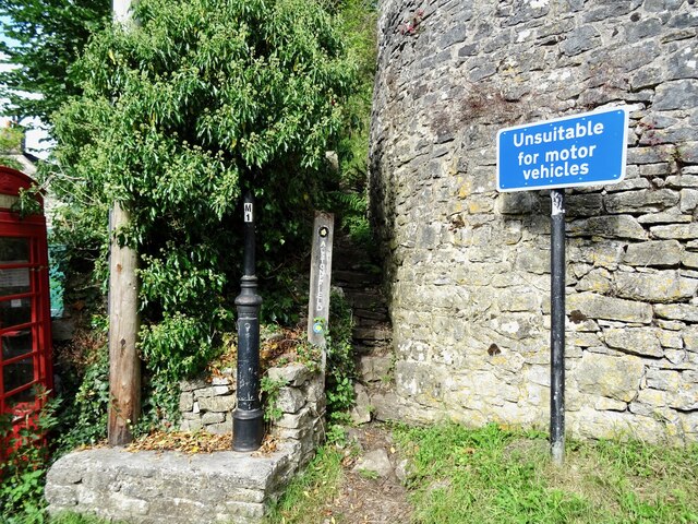
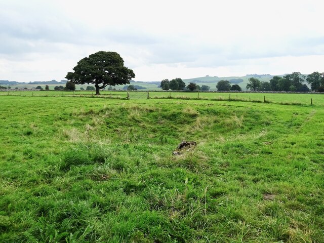
Mill Dale Images

Images are sourced within 2km of 53.091261/-1.7901661 or Grid Reference SK1454. Thanks to Geograph Open Source API. All images are credited.

The start of a footpath to Alstonefield A narrow flight of steps leads off a narrow back lane at the start of a footpath, which climbs steeply out of Milldale towards Alstonefield.
The start of a footpath to Alstonefield
A narrow flight of steps leads off a narrow back lane at the start of a footpath, which climbs steeply out of Milldale towards Alstonefield.
Old dew pond by Millway Lane A neglected dew pond sits dry, neglected and overgrown at the edge of Alstonefield.
Old dew pond by Millway Lane
A neglected dew pond sits dry, neglected and overgrown at the edge of Alstonefield.
Old dew pond by Gratton Lane An old dew pond sits dry and neglected in a field by Gratton Lane.
Old dew pond by Gratton Lane
An old dew pond sits dry and neglected in a field by Gratton Lane.
A ruin above Mill Dale The remains of some kind of small building, pen or fold, marked on old OS maps as a plain, unlabelled rectangle.
A ruin above Mill Dale
The remains of some kind of small building, pen or fold, marked on old OS maps as a plain, unlabelled rectangle.
Footpath crossroads According to the finger post, this is where the footpath from Milldale to Alsop Station crosses the footpath from Lode Mill to Tissington.
Footpath crossroads
According to the finger post, this is where the footpath from Milldale to Alsop Station crosses the footpath from Lode Mill to Tissington.
Stile in Hall Dale
Stile in Hall Dale
Step stile and sign at Allen's Bank in Hall Dale
Footpath to Pasture Lane The footpath from Hall Dale enters Stanshope via Pasture Lane.
Footpath to Pasture Lane
The footpath from Hall Dale enters Stanshope via Pasture Lane.
Looking towards Greenlowfield and the A515 As seen from the Tissington Trail, slightly to the north of the former Alsop station.
Looking towards Greenlowfield and the A515
As seen from the Tissington Trail, slightly to the north of the former Alsop station.
Countryside near Alsop en le Dale As seen from the Tissington Trail beside Stonepit Plantation
Countryside near Alsop en le Dale
As seen from the Tissington Trail beside Stonepit Plantation
Oxclose Lane Climbing out of the trench of Dovedale towards the A515
Oxclose Lane
Climbing out of the trench of Dovedale towards the A515
View from Above Shining Tor Overlooks the deep trench that is Dovedale
View from Above Shining Tor
Overlooks the deep trench that is Dovedale
Footpath High above Milldale The public footpath follows the wall, with ground falling away sharply to the left towards Milldale
Footpath High above Milldale
The public footpath follows the wall, with ground falling away sharply to the left towards Milldale
Looking over Mill Dale
Milldale (1) Small village comprising several stone buildings, squeezed deep in the narrow valley of Dovedale - so narrow that sunshine finds difficulty in reaching the community.
Milldale (1)
Small village comprising several stone buildings, squeezed deep in the narrow valley of Dovedale - so narrow that sunshine finds difficulty in reaching the community.
Milldale (2) Delightful small village squeezed tightly between the valley sides of Dovedale - so tightly, that sunshine is at a premium.
A popular walk stretches south from here, running beside the River Dove to the stepping stones near Thorpe.
Milldale (2)
Delightful small village squeezed tightly between the valley sides of Dovedale - so tightly, that sunshine is at a premium. A popular walk stretches south from here, running beside the River Dove to the stepping stones near Thorpe.
Viator's Bridge Ancient packhorse bridge, which has been in use since medieval times. Izaak Walton wrote about this bridge in "The Compleat Angler" - referring to himself as Viator (Latin for traveller), which accounts for the structure's name.
Viator's Bridge
Ancient packhorse bridge, which has been in use since medieval times. Izaak Walton wrote about this bridge in "The Compleat Angler" - referring to himself as Viator (Latin for traveller), which accounts for the structure's name.
Greenlowfield from the Tissington Trail Semi-detached cottages on the A515
Greenlowfield from the Tissington Trail
Semi-detached cottages on the A515
Show me another place!

Mill Dale is located at Grid Ref: SK1454 (Lat: 53.091261, Lng: -1.7901661)

Administrative County: Derbyshire

District: Derbyshire Dales

Police Authority: Derbyshire

What 3 Words

///enchanted.mingles.requiring. Near Newhaven, Derbyshire

Nearby Locations

Baley Hill Mill Dale

Related Wikis

St Peter's Church, Alstonefield

The Church of St Peter in Alstonefield, Staffordshire Moorlands, England is a grade I listed Anglican parish church. The oldest parts are 12th century...

Tissington Trail

The Tissington Trail is a bridleway, footpath and cycleway in Derbyshire, England, along part of the trackbed of the former railway line connecting Ashbourne...

Alstonefield

Alstonefield (alternative spelling: Alstonfield) is a village and civil parish in the Peak District National Park and the Staffordshire Moorlands district...

Alsop en le Dale railway station

Alsop en le Dale railway station was opened in 1899 near Alsop en le Dale and Alstonefield, villages in Derbyshire southeast of Buxton. It was on the...

St Michael and All Angels' Church, Alsop-en-le-Dale

St Michael and all Angels' Church, Alsop en le Dale is a Grade II listed parish church in the Church of England in Alsop en le Dale, Derbyshire. ��2�...

Alsop en le Dale

Alsop en le Dale is a village in Derbyshire, England about 5 miles (8.0 km) north of Ashbourne close to the Staffordshire border, and a mile from Dovedale...

Eaton and Alsop

Eaton and Alsop is a civil parish within the Derbyshire Dales district, in the county of Derbyshire, England. Largely rural, Along with the adjacent Newton...

Long Low, Wetton

Long Low is a Neolithic and Bronze Age site in the English county of Staffordshire. It is about 2 km SE of Wetton (grid reference SK122539).It consists...

Nearby Amenities

Located within 500m of 53.091261,-1.7901661
Waterway: weir
Lat/Long: 53.0874059/-1.793667
Milldale
Created By: Potlatch 0.10f
Is In: Derbyshire, England
Place: hamlet
Wikidata: Q79051296
Lat/Long: 53.0897095/-1.7940996
Telephone
Booth: K6
Covered: booth
Operator: BT
Operator Wikidata: Q593786
Payment Coins: no
Payment Credit Cards: yes
Payment Debit Cards: yes
Payment Notes: no
Phone: +44 1335 310226
Source: survey
Lat/Long: 53.0896078/-1.79373
Post Box
Brand: Royal Mail
Brand Wikidata: Q638098
Operator: Royal Mail
Operator Wikidata: Q638098
Post Box Type: lamp
Ref: DE6 876
Royal Cypher: EIIR
Royal Cypher Wikidata: Q33102113
Lat/Long: 53.0896069/-1.793743
Bus Stop
Millway Lane
Bus: yes
Naptan AtcoCode: 3800C816400
Naptan Bearing: SW
Naptan CommonName: Millway Lane
Naptan Indicator: Opp
Naptan Landmark: Millway Lane
Naptan Street: Sunny Bank
Naptan Verified: no
Public Transport: platform
Source: naptan_import
Lat/Long: 53.0894174/-1.7936813
Bus Stop
The Weir
Bus: yes
Naptan AtcoCode: 3800C816401
Naptan Bearing: SE
Naptan CommonName: The Weir
Naptan Indicator: Adj
Naptan Landmark: The Weir
Naptan Street: Sunny Bank
Naptan Verified: no
Public Transport: platform
Source: naptan_import
Lat/Long: 53.089543/-1.7941869
Bus Stop
Lode Mill
Bus: yes
Naptan AtcoCode: 3800C891100
Naptan Bearing: E
Naptan CommonName: Lode Mill
Naptan Indicator: Adj
Naptan Landmark: Lode Mill
Naptan Street: Lode Ln
Naptan Verified: no
Public Transport: platform
Source: naptan_import
Lat/Long: 53.0929141/-1.7843093
Barrier: stile
Foot: yes
Material: stone
Stile: squeezer
Lat/Long: 53.090052/-1.7902934
Milldale Information Barn
Information: office
Operator: National Trust
Source: survey
Tourism: information
Lat/Long: 53.0890581/-1.7940136
Barrier: stile
Material: stone
Source: survey;gps
Stile: squeezer
Lat/Long: 53.08815/-1.7866057
Barrier: stile
Material: stone
Source: survey;gps
Stile: squeezer
Lat/Long: 53.0892541/-1.7897856
Barrier: stile
Material: stone
Source: survey;gps
Stile: stepover
Lat/Long: 53.0945744/-1.7901002
Barrier: stile
Material: stone
Source: survey;gps
Stile: stepover
Lat/Long: 53.0951029/-1.7917331
Barrier: entrance
Source: survey;gps
Lat/Long: 53.0926966/-1.7833566
Barrier: stile
Material: stone
Source: survey;gps
Stile: squeezer
Lat/Long: 53.0947964/-1.7911564
Fast Food
Pollys Cottage
Note: Missing apostrophe is not a survey error, but reflects the actual sign outside the shop.
Shop: kiosk
Lat/Long: 53.089464/-1.7939291
Bench
Source: survey;gps
Lat/Long: 53.0892967/-1.7936633
Waterway: weir
Lat/Long: 53.0914044/-1.7925089
Waterway: weir
Lat/Long: 53.0916546/-1.7919146
Barrier: stile
Material: stone
Source: survey;gps
Stile: squeezer
Lat/Long: 53.0906327/-1.7954667
Bench
Lat/Long: 53.0893551/-1.7936173
Bench
Lat/Long: 53.0891672/-1.7939558
Defibrillator
Access: yes
Defibrillator Location: outside toilets in Milldale
Emergency: defibrillator
Indoor: no
Opening Hours: 24/7
Ref GB The Circuit: D62B915C-C12D-43C1-9042-F295BD63D6A4
Lat/Long: 53.0891592/-1.7939353
Waterway: weir
Lat/Long: 53.0876292/-1.7938238
Waterway: weir
Lat/Long: 53.090205/-1.7927952
Waterway: weir
Lat/Long: 53.0917505/-1.7903946
Waterway: weir
Lat/Long: 53.0915717/-1.7895927
Drinking Water
Bottle: yes
Cold Water: yes
Hot Water: no
Indoor: no
Man Made: water_tap
Lat/Long: 53.0891617/-1.7939344
The data included in this document is from www.openstreetmap.org. The data is made available under ODbL.

Have you been to Mill Dale?

Leave your review of Mill Dale below (or comments, questions and feedback).