Well Bottom

Valley in Wiltshire

England

Well Bottom

Wood's Butt, Wiltshire Looking north along a track running north/south to the eastern edge of Wood's Butt. This area is within the Westdown Artillery Range and is only accessible when the red danger flags are not flying.
Wood's Butt, Wiltshire Credit: Rebecca A Wills

Well Bottom is a small valley located in the county of Wiltshire, England. Situated in the picturesque countryside, it is nestled between rolling hills and surrounded by lush greenery, making it a haven for nature lovers and enthusiasts. The valley is named after the natural spring that flows at the bottom, providing a constant source of fresh water.

The landscape of Well Bottom is characterized by its undulating terrain and fertile soil, which has made it an ideal location for agricultural activities. Local farmers take advantage of the rich land to cultivate crops such as wheat, barley, and vegetables. The valley is also home to a few livestock farms, where sheep and cattle graze peacefully.

The area is known for its tranquility and idyllic setting, attracting visitors who seek solace and relaxation in nature. Hiking and walking trails crisscross the valley, providing opportunities for exploration and outdoor activities. Well Bottom also boasts a small, charming village that offers quaint cottages, a village pub, and a few local shops, providing basic amenities for residents and tourists.

The valley's proximity to other attractions in Wiltshire, including the famous Stonehenge and the historic city of Salisbury, makes it a popular choice for tourists looking to explore the region. With its stunning natural beauty and rural charm, Well Bottom offers a peaceful retreat away from the bustling cities, inviting visitors to experience the serenity of the English countryside.

If you have any feedback on the listing, please let us know in the comments section below.
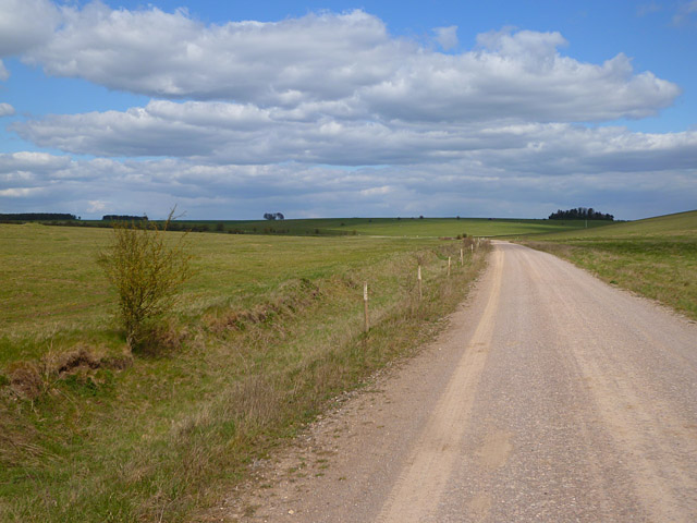
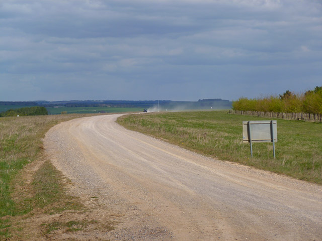
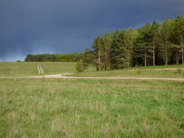
Well Bottom Images

Images are sourced within 2km of 51.233681/-1.8366555 or Grid Reference SU1148. Thanks to Geograph Open Source API. All images are credited.

Wood's Butt, Wiltshire Looking north along a track running north/south to the eastern edge of Wood's Butt. This area is within the Westdown Artillery Range and is only accessible when the red danger flags are not flying.
Wood's Butt, Wiltshire
Looking north along a track running north/south to the eastern edge of Wood's Butt. This area is within the Westdown Artillery Range and is only accessible when the red danger flags are not flying.
Netheravon Down, Wiltshire Looking north along a track on Netheravon Down. The day was foggy but Newfoundland Farm Wood can be seen in the distance. This area is within the Westdown Artillery Range and is only accessible when the red danger flags are not flying.
Netheravon Down, Wiltshire
Looking north along a track on Netheravon Down. The day was foggy but Newfoundland Farm Wood can be seen in the distance. This area is within the Westdown Artillery Range and is only accessible when the red danger flags are not flying.
Farmland, Enford Looking across a dry valley from just west of the trig point.
Farmland, Enford
Looking across a dry valley from just west of the trig point.
Downland and plantation, Enford The eastern side of Shrewton Folly (woodland).
Downland and plantation, Enford
The eastern side of Shrewton Folly (woodland).
Track, Larkhill Artillery Range Looking towards Old Farm Clump. There is also a glimpse of buildings at the Royal Aircraft Establishment.
Track, Larkhill Artillery Range
Looking towards Old Farm Clump. There is also a glimpse of buildings at the Royal Aircraft Establishment.
Track, Larkhill Artillery Range Approaching Blackball Firs from Shrewton Folly.
Track, Larkhill Artillery Range
Approaching Blackball Firs from Shrewton Folly.
Track and downland, Netheravon The junction of byways to the west of Wexland Farm.
Track and downland, Netheravon
The junction of byways to the west of Wexland Farm.
Track and downland, Netheravon A byway heading towards Netheravon from the Larkhill Ranges.
Track and downland, Netheravon
A byway heading towards Netheravon from the Larkhill Ranges.
Track and downland, Enford A track heading towards the Avon valley from near Lavington Folly. A vehicle is leaving a cloud of dust in its wake.
Track and downland, Enford
A track heading towards the Avon valley from near Lavington Folly. A vehicle is leaving a cloud of dust in its wake.
Old Milestone on Great Lynch, Netheravon parish Carved stone post by the bridleway, in parish of NETHERAVON (KENNET District), Great Lynch, on Easternmost (sunken) of 3 parallel tracks, 300m Northwest of junction, on East side of road. Erected by the Amesbury turnpike trust in the 19th century. 

Inscription once read:-
(Netheravon 1 Mile) 
Carved benchmark right middle.

Grade II listed.  
List Entry Number: 1033919 <span class="nowrap"><a title="https://historicengland.org.uk/listing/the-list/list-entry/1033919" rel="nofollow ugc noopener" href="https://historicengland.org.uk/listing/the-list/list-entry/1033919">Link</a><img style="margin-left:2px;" alt="External link" title="External link - shift click to open in new window" src="https://s1.geograph.org.uk/img/external.png" width="10" height="10"/></span>

Milestone Society National ID: WI_NEDZ01.
Old Milestone on Great Lynch, Netheravon parish
Carved stone post by the bridleway, in parish of NETHERAVON (KENNET District), Great Lynch, on Easternmost (sunken) of 3 parallel tracks, 300m Northwest of junction, on East side of road. Erected by the Amesbury turnpike trust in the 19th century. Inscription once read:- (Netheravon 1 Mile) Carved benchmark right middle. Grade II listed. List Entry Number: 1033919 LinkExternal link Milestone Society National ID: WI_NEDZ01.
Pasture, Enford Cattle grazing to the west of Fifield.
Pasture, Enford
Cattle grazing to the west of Fifield.
Track, grassland and plantations, Netheravon The byway above Wexland Farm with threatening skies.
Track, grassland and plantations, Netheravon
The byway above Wexland Farm with threatening skies.
Downland, tracks and plantations, Netheravon Round Covert is the more distant plantation.
Downland, tracks and plantations, Netheravon
Round Covert is the more distant plantation.
Track, downland and plantation, Netheravon Off the byway near the northern end of the Larkhill point-to-point course.
Track, downland and plantation, Netheravon
Off the byway near the northern end of the Larkhill point-to-point course.
Track and downland, Netheravon A crossroads of byways and the adjacent flagpole used to indicate when the danger area is out of bounds.
Track and downland, Netheravon
A crossroads of byways and the adjacent flagpole used to indicate when the danger area is out of bounds.
Track, downland and plantation, Netheravon The byway following a shallow dry valley above Wexland Farm.
Track, downland and plantation, Netheravon
The byway following a shallow dry valley above Wexland Farm.
Downland, Netheravon Sheep to the east of Well Bottom.
Downland, Netheravon
Sheep to the east of Well Bottom.
Downland, Netheravon Grassland to the west of Newfoundland Farm Wood.
Downland, Netheravon
Grassland to the west of Newfoundland Farm Wood.
Show me another place!

Well Bottom is located at Grid Ref: SU1148 (Lat: 51.233681, Lng: -1.8366555)

Unitary Authority: Wiltshire

Police Authority: Wiltshire

What 3 Words

///relations.unguarded.sketch. Near Netheravon, Wiltshire

Nearby Locations

Well Bottom

Related Wikis

Robin Hood's Ball

Robin Hood’s Ball is a Neolithic causewayed enclosure on Salisbury Plain in Wiltshire, England, approximately 5 miles (8 km) northwest of the town of Amesbury...

Netheravon

Netheravon is a village and civil parish on the River Avon and A345 road, about 4 miles (6.4 km) north of the town of Amesbury in Wiltshire, South West...

All Saints' Church, Netheravon

The Church of All Saints is the Church of England parish church for the village of Netheravon, Wiltshire, England. A church has stood on this site near...

Fittleton cum Haxton

Fittleton cum Haxton is a civil parish in Wiltshire, England, 12 miles (19 km) north of Salisbury. The parish contains the adjacent settlements of Fittleton...

Have you been to Well Bottom?

Leave your review of Well Bottom below (or comments, questions and feedback).