Honeycombe Chine

Valley in Hampshire

England

Honeycombe Chine

Bournemouth trolleybus 274 at Pokesdown Station – 1969 There were two trolleybus routes between Bournemouth and Christchurch, via Iford (20) or Southbourne (21), which split at this point.

Bournemouth Corporation 274 is a Sunbeam MF2B with Weymann bodywork, new in 1959. This was the last day of normal trolleybus operation in Bournemouth, so at only 10 years old it was far from life-expired.

This is one of a series of views featuring buses in the 60s, 70s, and 80s. <a title="https://www.geograph.org.uk/search.php?i=137652761" href="https://www.geograph.org.uk/search.php?i=137652761">Link</a>
Bournemouth trolleybus 274 at Pokesdown Station – 1969 Credit: Alan Murray-Rust

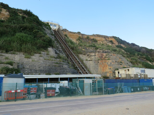
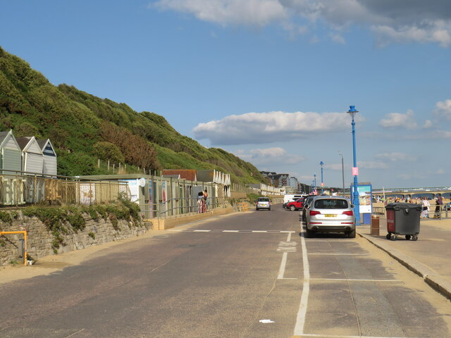
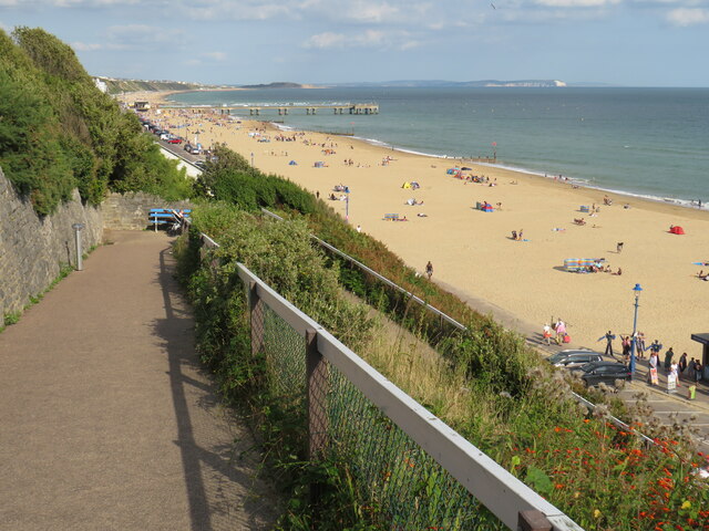
Honeycombe Chine is a picturesque valley located in Hampshire, England. Situated on the southern coast of the country, it is a popular destination for nature lovers and tourists seeking tranquility and natural beauty. The chine is nestled between towering cliffs and stretches from the village of Barton-on-Sea to the seaside town of Highcliffe.

The chine itself is a narrow, steep-sided ravine, carved by a stream over thousands of years. Lush vegetation adorns the slopes of the chine, with a variety of trees including oak, beech, and yew, creating a verdant and enchanting atmosphere. The stream that flows through the chine adds to its allure, glistening and babbling as it makes its way towards the sea.

The chine is also home to a diverse array of wildlife, making it a haven for nature enthusiasts. Birdwatchers can spot a variety of species, including woodpeckers, kingfishers, and warblers, while small mammals such as squirrels and rabbits can be seen darting through the undergrowth.

Visitors to Honeycombe Chine can enjoy scenic walks along well-maintained footpaths, taking in the breathtaking views of the surrounding cliffs and the sparkling sea beyond. There are also picnic areas where visitors can relax and soak in the serenity of their surroundings.

Overall, Honeycombe Chine offers a unique and idyllic natural experience, combining stunning landscapes, rich biodiversity, and a sense of tranquility that makes it a must-visit destination for nature lovers and those seeking a peaceful retreat.

If you have any feedback on the listing, please let us know in the comments section below.

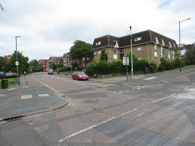
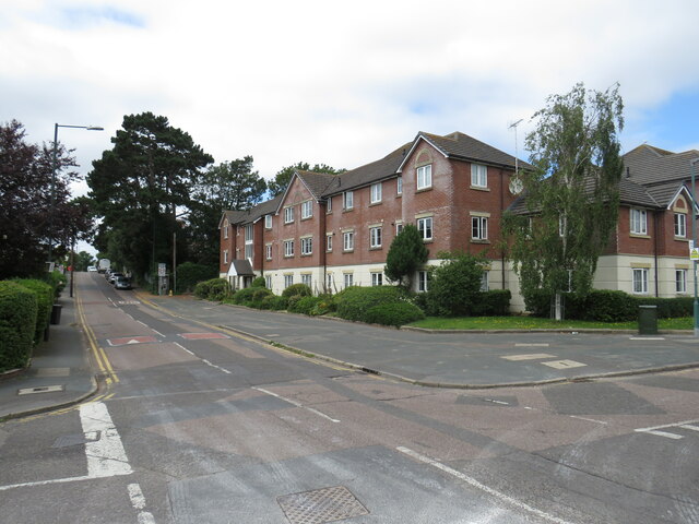
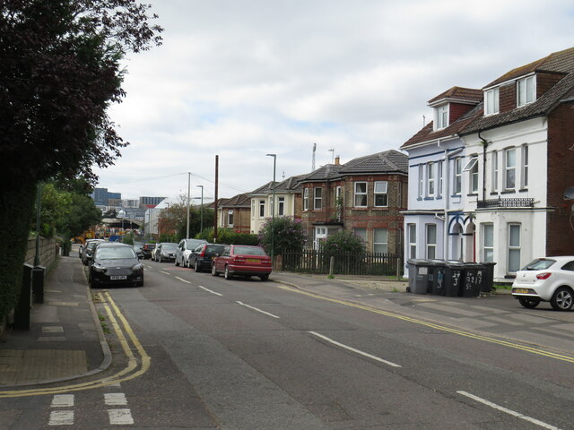
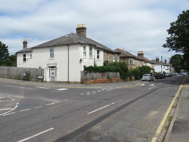
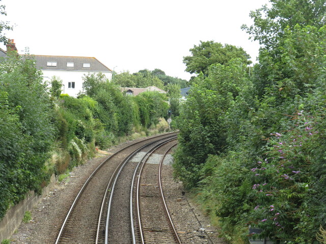
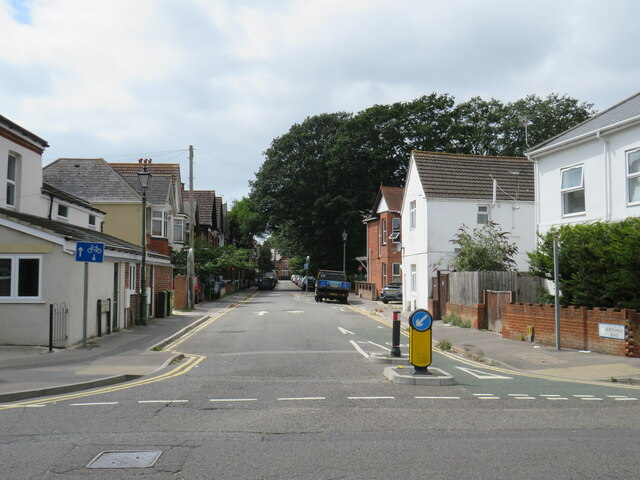
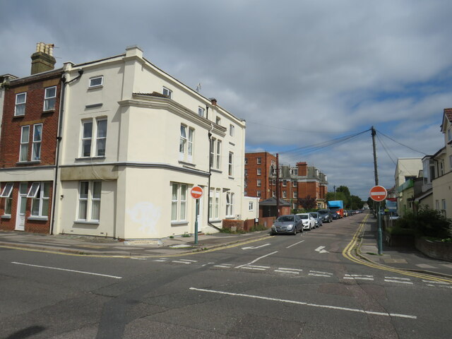
Honeycombe Chine Images

Images are sourced within 2km of 50.720828/-1.8393203 or Grid Reference SZ1191. Thanks to Geograph Open Source API. All images are credited.

Bournemouth trolleybus 274 at Pokesdown Station – 1969 There were two trolleybus routes between Bournemouth and Christchurch, via Iford (20) or Southbourne (21), which split at this point.

Bournemouth Corporation 274 is a Sunbeam MF2B with Weymann bodywork, new in 1959. This was the last day of normal trolleybus operation in Bournemouth, so at only 10 years old it was far from life-expired.

This is one of a series of views featuring buses in the 60s, 70s, and 80s. <a title="https://www.geograph.org.uk/search.php?i=137652761" href="https://www.geograph.org.uk/search.php?i=137652761">Link</a>
Bournemouth trolleybus 274 at Pokesdown Station – 1969
There were two trolleybus routes between Bournemouth and Christchurch, via Iford (20) or Southbourne (21), which split at this point. Bournemouth Corporation 274 is a Sunbeam MF2B with Weymann bodywork, new in 1959. This was the last day of normal trolleybus operation in Bournemouth, so at only 10 years old it was far from life-expired. This is one of a series of views featuring buses in the 60s, 70s, and 80s. Link
Bournemouth Corporation trolleybus 271 on Beresford Road – 1969 On service 23 from Tuckton Bridge via Cranleigh Road, taken on the last day of normal trolleybus operation in Bournemouth.

This is one of a series of views featuring buses in the 60s, 70s, and 80s. <a title="https://www.geograph.org.uk/search.php?i=137652761" href="https://www.geograph.org.uk/search.php?i=137652761">Link</a>
Bournemouth Corporation trolleybus 271 on Beresford Road – 1969
On service 23 from Tuckton Bridge via Cranleigh Road, taken on the last day of normal trolleybus operation in Bournemouth. This is one of a series of views featuring buses in the 60s, 70s, and 80s. Link
Cliff lift at East Cliff, Bournemouth In August 2021, the cliff lift at East Cliff was still closed following a landslip which had occurred in April 2016.  The landslip caused serious damage but, thankfully, nobody was injured.
Cliff lift at East Cliff, Bournemouth
In August 2021, the cliff lift at East Cliff was still closed following a landslip which had occurred in April 2016. The landslip caused serious damage but, thankfully, nobody was injured.
Undercliff Drive, near Boscombe Undercliff Drive forms part of a promenade which stretches for around 10 miles along the seafront at Bournemouth.  It forms part of the route of National Cycle Network route 2.  However, during the peak summer holiday months of July and August, cycling is prohibited on this section of route between 10:00 and 18:00.  Cyclists must use an alternative route on the cliff top.
Undercliff Drive, near Boscombe
Undercliff Drive forms part of a promenade which stretches for around 10 miles along the seafront at Bournemouth. It forms part of the route of National Cycle Network route 2. However, during the peak summer holiday months of July and August, cycling is prohibited on this section of route between 10:00 and 18:00. Cyclists must use an alternative route on the cliff top.
Path to the beach, East Cliff, Bournemouth Toft Zig-Zag is a path leading from the overcliff to the beach at East Cliff, between Bournemouth and Boscombe.  From the top of the path there are views along the coastline to Boscombe Pier (in the middle distance) and Hengistbury Head, and also to the chalk cliffs of The Needles on the Isle of Wight (towards the right of the image)
Path to the beach, East Cliff, Bournemouth
Toft Zig-Zag is a path leading from the overcliff to the beach at East Cliff, between Bournemouth and Boscombe. From the top of the path there are views along the coastline to Boscombe Pier (in the middle distance) and Hengistbury Head, and also to the chalk cliffs of The Needles on the Isle of Wight (towards the right of the image)
Vitality Stadium Vitality Stadium with Ted MacDougall stand
Vitality Stadium
Vitality Stadium with Ted MacDougall stand
Christchurch Road, Lansdowne – 1969 At the time this was still the main A35, running through the centre of the town. In the background is the entrance to the Odeon cinema, nestling between the apartment blocks on either side. The cinema is showing the film 'Candy', and the sign features Marlon Brando, Richard Burton and John Coburn as stars. The female lead, the relatively unknown Ewa Aulin, playing Candy, gets no mention! <span class="nowrap"><a title="https://en.wikipedia.org/wiki/Candy_(1968_film)" rel="nofollow ugc noopener" href="https://en.wikipedia.org/wiki/Candy_(1968_film)">Link</a><img style="margin-left:2px;" alt="External link" title="External link - shift click to open in new window" src="https://s1.geograph.org.uk/img/external.png" width="10" height="10"/></span> . Like many cinemas it became a Bingo hall in the 1970s, finally closing in 2021 due to the Covid 19 pandemic.

In the foreground Wilts & Dorset bus 823 is on its way into Bournemouth on route 38 from Salisbury. It is a Bristol RE with ECW bodywork, new that same year.

This is one of a series of views featuring buses in the 60s, 70s, and 80s. <a title="https://www.geograph.org.uk/search.php?i=137652761" href="https://www.geograph.org.uk/search.php?i=137652761">Link</a>
Christchurch Road, Lansdowne – 1969
At the time this was still the main A35, running through the centre of the town. In the background is the entrance to the Odeon cinema, nestling between the apartment blocks on either side. The cinema is showing the film 'Candy', and the sign features Marlon Brando, Richard Burton and John Coburn as stars. The female lead, the relatively unknown Ewa Aulin, playing Candy, gets no mention! LinkExternal link . Like many cinemas it became a Bingo hall in the 1970s, finally closing in 2021 due to the Covid 19 pandemic. In the foreground Wilts & Dorset bus 823 is on its way into Bournemouth on route 38 from Salisbury. It is a Bristol RE with ECW bodywork, new that same year. This is one of a series of views featuring buses in the 60s, 70s, and 80s. Link
Southcote Road, Bournemouth Southcote Road is a minor road in the suburbs of Bournemouth.
Southcote Road, Bournemouth
Southcote Road is a minor road in the suburbs of Bournemouth.
Vale Road, Bournemouth Vale Road is a residential road in the suburbs of Bournemouth.
Vale Road, Bournemouth
Vale Road is a residential road in the suburbs of Bournemouth.
Southcote Road, Bournemouth Southcote Road is a residential road in the suburbs of Bournemouth.
Southcote Road, Bournemouth
Southcote Road is a residential road in the suburbs of Bournemouth.
St. Clement's Road, Bournemouth St. Clement's Road is a residential road in the suburbs of Bournemouth.
St. Clement's Road, Bournemouth
St. Clement's Road is a residential road in the suburbs of Bournemouth.
St. Clement's Road, Bournemouth St. Clement's Road is a residential road in the suburbs of Bournemouth.
St. Clement's Road, Bournemouth
St. Clement's Road is a residential road in the suburbs of Bournemouth.
Railway near Boscombe A double-track railway passing through Boscombe, near Bournemouth.  This railway is the main line from London and Southampton to Bournemouth and Weymouth.  The tracks are electrified using the third rail system.
Railway near Boscombe
A double-track railway passing through Boscombe, near Bournemouth. This railway is the main line from London and Southampton to Bournemouth and Weymouth. The tracks are electrified using the third rail system.
Salvation Army church, Boscombe A Salvation Army church in Boscombe, near Bournemouth.
Salvation Army church, Boscombe
A Salvation Army church in Boscombe, near Bournemouth.
Borthwick Road, Boscombe Borthwick Road is a residential road in Boscombe, near Bournemouth.  The road is one-way for motor vehicles, but there is a contraflow lane for cyclists.
Borthwick Road, Boscombe
Borthwick Road is a residential road in Boscombe, near Bournemouth. The road is one-way for motor vehicles, but there is a contraflow lane for cyclists.
Shelley Road, Boscombe Shelley Road in Boscombe, near Bournemouth.  "No entry" signs indicate that this is a one-way street.
Shelley Road, Boscombe
Shelley Road in Boscombe, near Bournemouth. "No entry" signs indicate that this is a one-way street.
Boscombe Baptist Church The Baptist Church in Boscombe, near Bournemouth
Boscombe Baptist Church
The Baptist Church in Boscombe, near Bournemouth
Royal Arcade, Boscombe The Royal Arcade shopping arcade in Boscombe, near Bournemouth.  It dates from the 1890s and is Grade II listed.  More information can be found on the British Listed Buildings website: <span class="nowrap"><a title="https://britishlistedbuildings.co.uk/101152825-royal-arcade-ward" rel="nofollow ugc noopener" href="https://britishlistedbuildings.co.uk/101152825-royal-arcade-ward">Link</a><img style="margin-left:2px;" alt="External link" title="External link - shift click to open in new window" src="https://s1.geograph.org.uk/img/external.png" width="10" height="10"/></span>
Royal Arcade, Boscombe
The Royal Arcade shopping arcade in Boscombe, near Bournemouth. It dates from the 1890s and is Grade II listed. More information can be found on the British Listed Buildings website: LinkExternal link
Show me another place!

Honeycombe Chine is located at Grid Ref: SZ1191 (Lat: 50.720828, Lng: -1.8393203)

Unitary Authority: Bournemouth, Christchurch and Poole

Police Authority: Dorset

What 3 Words

///beans.result.broker. Near Bournemouth, Dorset

Nearby Locations

Boscombe Honeycombe Chine

Related Wikis

Boscombe Surf Reef

Boscombe Surf Reef was an artificial reef built to enhance surfing conditions at Boscombe in Dorset, England. The project cost £3.2 million and is considered...

Boscombe

Boscombe is a suburb of Bournemouth, England. Historically in Hampshire, but today in Dorset, it is located to the east of Bournemouth town centre and...

O2 Academy Bournemouth

O2 Academy Bournemouth is a live entertainment venue in Bournemouth, Dorset, England. It is a grade-II listed building. The building at 568–578 Christchurch...

Corpus Christi Church, Boscombe

Corpus Christi Church is a Roman Catholic church in Boscombe, on the outskirts of Bournemouth in Dorset. It was founded by Baroness Pauline von Hugel and...

Nearby Amenities

Located within 500m of 50.720828,-1.8393203
Traffic Signals
Traffic Signals: signal
Lat/Long: 50.7230914/-1.840626
Traffic Signals
Lat/Long: 50.7227569/-1.8441281
Chine Hotel
Addr Housenumber: 21-25
Addr Postcode: BH5 1AX
Addr Street: Boscombe Spa Road
Fhrs Id: 342472
Source Addr: FHRS Open Data
Tourism: hotel
Lat/Long: 50.721383/-1.8456578
Crossing
Crossing: unmarked
Crossing Island: yes
Crossing Markings: no
Tactile Paving: yes
Lat/Long: 50.7215729/-1.8336172
Crossing
Crossing: unmarked
Crossing Island: yes
Crossing Markings: no
Tactile Paving: yes
Lat/Long: 50.7216647/-1.8341603
Crossing
Check Date Crossing: 2021-10-21
Crossing: uncontrolled
Tactile Paving: no
Lat/Long: 50.7203758/-1.841478
Bicycle Parking
Bicycle Parking: stands
Capacity: 16
Covered: no
Lat/Long: 50.7199551/-1.8427265
Post Box
Brand: Royal Mail
Brand Wikidata: Q638098
Brand Wikipedia: en:Royal Mail
Collection Times: Mo-Fr 09:00, Sa 07:00
Operator: Royal Mail
Operator Wikidata: Q638098
Post Box Type: pillar
Ref: BH5 53
Ref GB Uprn: 10015386728
Royal Cypher: GVIR
Royal Cypher Wikidata: Q33102169
Lat/Long: 50.7239999/-1.8399286
Post Box
Collection Times: Mo-Fr 09:00, Sa 07:00
Operator: Royal Mail
Operator Wikidata: Q638098
Post Box Type: pillar
Ref: BH5 119
Ref GB Uprn: 10015363293
Royal Cypher: EVIIR
Royal Cypher Wikidata: Q33102324
Lat/Long: 50.722891/-1.8368031
Post Box
Collection Times: Mo-Fr 09:00, Sa 07:00
Operator: Royal Mail
Operator Wikidata: Q638098
Post Box Type: pillar
Ref: BH5 115
Ref GB Uprn: 10015419710
Royal Cypher: EIIR
Royal Cypher Wikidata: Q33102113
Lat/Long: 50.7206353/-1.8431725
Seamark Light Category: vertical
Seamark Light Character: F
Seamark Light Colour: red
Seamark Light Height: 7
Seamark Light Multiple: 2
Seamark Light Range: 1
Seamark Light Reference: A 0522
Seamark Type: light_minor
Source: US NGA Pub. 114. 2011-05-26.
Lat/Long: 50.7180093/-1.8428387
The Edwardian Hotel
Tourism: guest_house
Lat/Long: 50.724944/-1.8387913
Carlton Lodge
Tourism: guest_house
Lat/Long: 50.7252326/-1.8392017
Telephone
Booth: KX100
Check Date: 2022-03-21
Covered: booth
Lat/Long: 50.7238289/-1.8441703
Sorted Surf Shop
Addr City: Boscombe
Addr Postcode: BH5 1BN
Addr Street: Undercliff Drive
Opening Hours: Mo-Fr 09:30-17:00; Sa,Su 09:00-17:00
Shop: sports
Lat/Long: 50.720153/-1.8407003
Toilets
Check Date: 2021-10-21
Fee: no
Wheelchair: yes
Lat/Long: 50.7202101/-1.8404503
Restaurant
Flamingo
Addr Housenumber: 42c
Addr Postcode: BH5 1BQ
Addr Street: Sea Road
Opening Hours: Su-Th 08:00-22:00; Fr,Sa 08:00-23:00
Source: Bing; survey
Source Addr: FHRS Open Data
Lat/Long: 50.7214411/-1.8421493
Restaurant
Urban Reef
Addr Postcode: BH5 1BN
Addr Street: Undercliff Drive
Cuisine: regional
Fhrs Id: 342198
Level: 0;1
Outdoor Seating: yes
Source Addr: FHRS Open Data
Lat/Long: 50.7201079/-1.8409893
Fast Food
Reefside Takeaway
Addr Postcode: BH5 1BN
Addr Street: Sea Road
Fhrs Id: 342378
Source Addr: FHRS Open Data
Lat/Long: 50.7197947/-1.8432846
Entrance: yes
Lat/Long: 50.7200424/-1.8428832
Bus Stop
Boscombe Pier
Bench: yes
Bin: yes
Bus: yes
Lit: yes
Naptan AtcoCode: 1290BOB20266
Naptan Bearing: S
Naptan CommonName: Boscombe Pier
Naptan Indicator: S-bound
Naptan NaptanCode: boudwmj
Naptan PlusbusZoneRef: BOMO
Naptan Street: Sea Road
Naptan Verified: no
Public Transport: platform
Shelter: yes
Tactile Paving: no
Lat/Long: 50.7202029/-1.8431259
Bicycle Parking
Bicycle Parking: stands
Capacity: 16
Covered: no
Lat/Long: 50.7201598/-1.8430884
Bench
Backrest: yes
Check Date: 2023-08-29
Lat/Long: 50.720009/-1.844125
Bench
Backrest: yes
Check Date: 2023-08-29
Lat/Long: 50.7200417/-1.8441214
Bench
Backrest: yes
Check Date: 2023-08-29
Lat/Long: 50.7200709/-1.8441195
Bench
Backrest: yes
Check Date: 2023-08-29
Lat/Long: 50.7201013/-1.8441103
Bench
Backrest: yes
Check Date: 2023-08-29
Lat/Long: 50.7201316/-1.8440863
Bench
Backrest: yes
Check Date: 2023-08-29
Lat/Long: 50.7201492/-1.8440476
Bench
Backrest: yes
Check Date: 2023-08-29
Lat/Long: 50.719988/-1.8440549
Bench
Backrest: yes
Check Date: 2023-08-29
Lat/Long: 50.7200183/-1.8440513
Bench
Backrest: yes
Check Date: 2023-08-29
Lat/Long: 50.720051/-1.8440383
Bench
Backrest: yes
Check Date: 2023-08-29
Lat/Long: 50.7200826/-1.8440236
Bench
Backrest: yes
Check Date: 2023-08-29
Lat/Long: 50.7201106/-1.8439941
Bench
Backrest: yes
Check Date: 2023-08-29
Lat/Long: 50.720127/-1.8439609
Bench
Backrest: yes
Check Date: 2023-08-29
Lat/Long: 50.7200172/-1.8439867
Bench
Backrest: yes
Check Date: 2023-08-29
Lat/Long: 50.7200557/-1.8439553
Bench
Backrest: yes
Check Date: 2023-08-29
Lat/Long: 50.7200966/-1.8439203
Bicycle Rental
Boscombe Pier
Bicycle Rental: dropoff_point
Capacity: 7
Email: support@beryl.cc
Fee: yes
Name Signed: no
Network: Beryl - Bournemouth Poole Christchurch
Official Name: Boscombe Pier
Operator: Beryl
Operator Wikidata: Q106575369
Payment App: yes
Payment App Android: cc.beryl.basis
Payment App Ios: 1386768364
Payment Cash: no
Payment Credit Cards: no
Payment Cryptocurrencies: no
Payment Debit Cards: no
Payment Electronic Purses: no
Phone: +44 20 3003 5044
Ref Gbfs: beryl_bcp:130
Rental: city_bike
Website: https://beryl.cc/scheme/bournemouth-christchurch-and-poole
Lat/Long: 50.7198944/-1.842598
Bicycle Rental
Boscombe Pier & Sea Road
Bicycle Rental: dropoff_point
Capacity: 7
Email: support@beryl.cc
Fee: yes
Name Signed: no
Network: Beryl - Bournemouth Poole Christchurch
Official Name: Boscombe Pier & Sea Road
Operator: Beryl
Operator Wikidata: Q106575369
Payment App: yes
Payment App Android: cc.beryl.basis
Payment App Ios: 1386768364
Payment Cash: no
Payment Credit Cards: no
Payment Cryptocurrencies: no
Payment Debit Cards: no
Payment Electronic Purses: no
Phone: +44 20 3003 5044
Ref Gbfs: beryl_bcp:195
Rental: city_bike
Website: https://beryl.cc/scheme/bournemouth-christchurch-and-poole
Lat/Long: 50.7201538/-1.843067
Bus Stop
Boscombe Spa Road
Bench: no
Bin: no
Bus: yes
Lit: no
Naptan AtcoCode: 1290BOA90846
Naptan Bearing: SE
Naptan BusStopType: CUS
Naptan CommonName: Boscombe Spa Road
Naptan Indicator: SE-bound
Naptan NaptanCode: bougwat
Naptan PlusbusZoneRef: BOMO
Naptan Street: St John's Road
Naptan Verified: no
Public Transport: platform
Shelter: no
Tactile Paving: no
Lat/Long: 50.7221801/-1.8436271
Bus Stop
Boscombe Spa Road
Bench: no
Bin: no
Bus: yes
Lit: no
Naptan AtcoCode: 1290BOA90814
Naptan Bearing: NW
Naptan CommonName: Boscombe Spa Road
Naptan Indicator: NW-bound
Naptan NaptanCode: bougtjd
Naptan PlusbusZoneRef: BOMO
Naptan Street: St Johns Road
Naptan Verified: no
Public Transport: platform
Shelter: no
Tactile Paving: no
Lat/Long: 50.7221189/-1.8436968
Bus Stop
Wollstonecraft Road
Bench: no
Bin: no
Bus: yes
Lit: no
Naptan AtcoCode: 1290BOB20262
Naptan Bearing: E
Naptan CommonName: Wollstonecraft Road
Naptan Indicator: E-bound
Naptan NaptanCode: bougama
Naptan PlusbusZoneRef: BOMO
Naptan Street: Boscombe Cliff Road
Naptan Verified: no
Public Transport: platform
Shelter: no
Tactile Paving: no
Lat/Long: 50.7219423/-1.8360136
Bus Stop
Wollstonecraft Road
Bench: no
Bin: no
Bus: yes
Lit: no
Naptan AtcoCode: 1290BOB20263
Naptan Bearing: W
Naptan CommonName: Wollstonecraft Road
Naptan Indicator: W-bound
Naptan NaptanCode: bougajp
Naptan PlusbusZoneRef: BOMO
Naptan Street: Boscombe Cliff Road
Naptan Verified: no
Public Transport: platform
Shelter: no
Tactile Paving: no
Lat/Long: 50.7217853/-1.8364669
Bus Stop
Michelgrove Road
Bench: yes
Bin: no
Bus: yes
Lit: no
Naptan AtcoCode: 1290BOB20264
Naptan Bearing: E
Naptan CommonName: Michelgrove Road
Naptan Indicator: E-bound
Naptan NaptanCode: bougadj
Naptan PlusbusZoneRef: BOMO
Naptan Street: Boscombe Cliff Road
Naptan Verified: no
Public Transport: platform
Shelter: no
Tactile Paving: no
Lat/Long: 50.7221936/-1.8390834
Bench
Backrest: yes
Material: wood
Lat/Long: 50.7213152/-1.8390382
Bench
Backrest: yes
Material: wood
Lat/Long: 50.7212328/-1.8344603
Bench
Backrest: yes
Material: wood
Lat/Long: 50.7211793/-1.8343945
Bench
Backrest: yes
Material: wood
Lat/Long: 50.721134/-1.83462
Bench
Backrest: yes
Material: wood
Lat/Long: 50.7212519/-1.8338118
Bench
Backrest: yes
Material: wood
Lat/Long: 50.7213887/-1.8325045
Bench
Backrest: yes
Material: wood
Lat/Long: 50.7213506/-1.8323325
Bench
Backrest: yes
Material: wood
Lat/Long: 50.7205145/-1.8436295
Bench
Backrest: yes
Material: wood
Lat/Long: 50.7204978/-1.8434868
Shelter
Bench: yes
Bin: no
Shelter Type: weather_shelter
Lat/Long: 50.7202995/-1.8436591
Bench
Backrest: yes
Material: wood
Lat/Long: 50.720137/-1.8443681
Sorted Surf Shop
Opening Hours: Mo-Su 09:00-17:00
Shop: sports
Sport: surfing
Lat/Long: 50.7215/-1.8420584
Bench
Backrest: yes
Material: wood
Lat/Long: 50.7208699/-1.8350133
Bench
Backrest: yes
Material: wood
Lat/Long: 50.7208654/-1.8343916
Bench
Backrest: yes
Material: wood
Lat/Long: 50.7208594/-1.8337593
Bench
Backrest: yes
Material: wood
Lat/Long: 50.7208805/-1.8333412
Chemical Wedding
Artist Name: Andy Kirkby
Artwork Type: sculpture
Description: 'Chemical Wedding' on the plaque in the pavement; this piece is called 'Sun Fish' by the sculptor. Part of the Boscombe Art Trail.
Material: metal
Tourism: artwork
Lat/Long: 50.7208823/-1.8429811
Optic
Artist Name: Andy Kirkby
Artwork Type: sculpture
Description: 'Optic' on the plaque in the pavement; this piece is untitled by the sculptor. Part of the Boscombe Art Trail.
Material: metal
Tourism: artwork
Lat/Long: 50.7217688/-1.8422239
From Dawn Until Dusk
Artist Name: Simon Hitchens
Artwork Type: sculpture
Material: granite
Tourism: artwork
Website: https://www.simonhitchens.com/public-commissions/from-dawn-until-dusk/
Lat/Long: 50.7200713/-1.843629
Murano
Artist Name: Andy Kirkby
Artwork Type: sculpture
Description: 'Murano' on the plaque in the pavement; this piece is called 'Dome' by the sculptor. Part of the Boscombe Art Trail.
Material: metal
Tourism: artwork
Lat/Long: 50.7204649/-1.8433942
Verne
Artist Name: Andy Kirkby
Artwork Type: sculpture
Description: 'Verne' on the plaque in the pavement; this piece is called 'Diver' by the sculptor. Part of the Boscombe Art Trail.
Material: metal
Tourism: artwork
Lat/Long: 50.7240363/-1.8406605
Vessel
Artist Name: Andy Kirkby
Artwork Type: sculpture
Description: 'Vessel' on the plaque in the pavement; this piece is called 'Boat' by the sculptor. Part of the Boscombe Art Trail.
Material: metal
Tourism: artwork
Lat/Long: 50.7252572/-1.8405044
Tableau
Artist Name: Andy Kirkby
Artwork Type: sculpture
Description: 'Tableau' on the plaque in the pavement; this piece is called 'Shelley's Feather' (in recognition of Mary Shelley) by the sculptor. Part of the Boscombe Art Trail.
Material: metal
Tourism: artwork
Lat/Long: 50.7231697/-1.8407748
Bbq
Access: yes
Capacity: 10
Covered: no
Fuel: electric
Opening Hours: Easter-Oct: Mo-Su 10:00-22:00
Website: https://www.bcpcouncil.gov.uk/Leisure-culture-and-local-heritage/Beaches-and-quays/Electric-beach-barbecues.aspx
Lat/Long: 50.719887/-1.8421375
Boscombe Beach Office
Addr City: Boscombe
Addr Postcode: BH5 1BN
Addr Street: Undercliff Drive
Government: public_service
Office: government
Website: https://www.bcpcouncil.gov.uk/Leisure-culture-and-local-heritage/Beaches-and-quays/Beaches-and-quays.aspx
Lat/Long: 50.7200612/-1.8417526
Restaurant
The Wood Oven
Addr City: Boscombe
Addr Postcode: BH5 1BN
Addr Street: Undercliff Drive
Cuisine: pizza
Fhrs Id: 873855
Level: 0
Source Addr: FHRS Open Data
Takeaway: yes
Lat/Long: 50.7201213/-1.8411227
Bus Stop
Boscombe Michelgrove Road
Bench: no
Bin: no
Bus: yes
Lit: no
Naptan AtcoCode: 1290BOB20269
Naptan Bearing: SW
Naptan CommonName: Michelgrove Road
Naptan Indicator: SW-bound
Naptan NaptanCode: boudwpw
Naptan PlusbusZoneRef: BOMO
Naptan Street: Sea Road
Naptan Verified: no
Public Transport: platform
Shelter: no
Tactile Paving: no
Lat/Long: 50.7223902/-1.8409433
Bus Stop
Boscombe Percy Road
Bench: no
Bin: no
Bus: yes
Lit: no
Naptan AtcoCode: 1290BOB20272
Naptan Bearing: S
Naptan CommonName: Boscombe Spa Road
Naptan Indicator: S-bound
Naptan NaptanCode: boudwtg
Naptan PlusbusZoneRef: BOMO
Naptan Street: Percy Road
Naptan Verified: no
Public Transport: platform
Shelter: no
Tactile Paving: no
Lat/Long: 50.7234392/-1.8405568
Bus Stop
Boscombe opp. San Remo Towers
Bench: no
Bin: no
Bus: yes
Lit: no
Naptan AtcoCode: 1290BOB20265
Naptan Bearing: S
Naptan CommonName: San Remo Towers
Naptan Indicator: opp
Naptan NaptanCode: boudwtm
Naptan PlusbusZoneRef: BOMO
Naptan Street: Michelgrove Road
Naptan Verified: no
Public Transport: platform
Shelter: no
Tactile Paving: no
Lat/Long: 50.7219492/-1.8397533
Playground: musical_instrument
Lat/Long: 50.7189406/-1.8429853
Playground: musical_instrument
Lat/Long: 50.7193476/-1.8431146
Playground: musical_instrument
Lat/Long: 50.7182607/-1.8428007
Playground: musical_instrument
Lat/Long: 50.7196982/-1.8431437
Playground: musical_instrument
Lat/Long: 50.7182508/-1.8429179
Waste Basket
Waste: trash
Lat/Long: 50.7250313/-1.8403355
Waste Basket
Waste: trash
Lat/Long: 50.7229936/-1.8406929
Bench
Backrest: yes
Material: wood
Lat/Long: 50.7231897/-1.8407055
Bench
Backrest: yes
Material: wood
Lat/Long: 50.7230426/-1.8407412
Bench
Backrest: yes
Material: wood
Lat/Long: 50.7230256/-1.840532
Bench
Backrest: yes
Material: wood
Lat/Long: 50.7217337/-1.8422279
Bench
Backrest: yes
Material: wood
Lat/Long: 50.7216732/-1.8427348
Bench
Backrest: yes
Material: wood
Lat/Long: 50.7202682/-1.843208
Bench
Backrest: yes
Material: wood
Lat/Long: 50.7217228/-1.8420561
Crossing
Crossing: unmarked
Crossing Island: yes
Crossing Markings: no
Kerb: lowered
Tactile Paving: yes
Lat/Long: 50.7205711/-1.8430909
Waste Basket
Waste: trash
Lat/Long: 50.7205382/-1.8429461
Waste Basket
Waste: trash
Lat/Long: 50.7213434/-1.8399687
Waste Basket
Waste: dog_excrement
Lat/Long: 50.7213061/-1.8399911
Bench
Backrest: yes
Material: wood
Lat/Long: 50.7205486/-1.8430421
Waste Basket
Waste: dog_excrement
Lat/Long: 50.7235843/-1.8338782
Waste Basket
Material: metal
Waste: trash
Lat/Long: 50.7235996/-1.8338793
Bench
Backrest: yes
Material: wood
Lat/Long: 50.7231244/-1.8334115
Waste Basket
Material: metal
Waste: trash
Lat/Long: 50.7228217/-1.8334195
Waste Basket
Material: metal
Waste: trash
Lat/Long: 50.7223822/-1.8328667
Bench
Backrest: yes
Material: wood
Lat/Long: 50.7213218/-1.839446
Bench
Backrest: yes
Material: wood
Lat/Long: 50.7213179/-1.8393366
Bench
Backrest: yes
Material: wood
Lat/Long: 50.7213218/-1.8392549
Bench
Backrest: yes
Material: wood
Lat/Long: 50.7215693/-1.83913
Bench
Backrest: yes
Material: wood
Lat/Long: 50.7214442/-1.8398549
Bench
Backrest: yes
Material: wood
Lat/Long: 50.7212982/-1.8389572
Bench
Backrest: yes
Material: wood
Lat/Long: 50.7212787/-1.8388971
Bench
Backrest: yes
Material: wood
Lat/Long: 50.7212592/-1.8388016
Bench
Backrest: yes
Material: wood
Lat/Long: 50.7212387/-1.83874
Bench
Backrest: yes
Material: wood
Lat/Long: 50.7212231/-1.8386753
Bench
Backrest: yes
Material: wood
Lat/Long: 50.7210333/-1.8381581
Bench
Backrest: yes
Material: wood
Lat/Long: 50.7210101/-1.8381263
Bench
Backrest: yes
Material: wood
Lat/Long: 50.7209775/-1.8380767
Waste Basket
Waste: trash
Lat/Long: 50.7212762/-1.8388851
Bench
Backrest: yes
Material: wood
Lat/Long: 50.7214204/-1.8385601
Barrier: bollard
Bicycle: no
Bollard: fixed
Material: metal
Lat/Long: 50.7209441/-1.8379728
Barrier: bollard
Bicycle: no
Bollard: removable
Material: metal
Motor Vehicle: no
Lat/Long: 50.7214606/-1.8400222
Historic: memorial
Inscription: TO COMMEMORATE THE 50TH ANNIVERSARY OF 'D' DAY tHIS PINE (P. Pinea) WAS PLANTED BY HIS WORSHIP THE MAYOR OF BOURNEMOUTH COUNCILLOR DR. JOHN MILLWARD 6TH JUNE 1994
Material: metal
Memorial: plaque
Lat/Long: 50.7213943/-1.8400015
Bench
Backrest: yes
Material: wood
Lat/Long: 50.7211912/-1.8375294
Bench
Backrest: yes
Material: wood
Lat/Long: 50.7211955/-1.8373873
Bench
Backrest: yes
Material: wood
Lat/Long: 50.7212002/-1.8371351
Bench
Backrest: yes
Material: wood
Lat/Long: 50.7211964/-1.8370436
Bench
Backrest: yes
Material: wood
Lat/Long: 50.7211976/-1.8367662
Bench
Backrest: yes
Material: wood
Lat/Long: 50.7212011/-1.8366349
Bench
Backrest: yes
Material: wood
Lat/Long: 50.7211537/-1.8369589
Bench
Backrest: yes
Material: wood
Lat/Long: 50.7210347/-1.836969
Bench
Backrest: yes
Material: wood
Lat/Long: 50.7210321/-1.8372231
Bench
Backrest: yes
Material: wood
Lat/Long: 50.7209915/-1.8375199
Bench
Backrest: yes
Material: wood
Lat/Long: 50.7209935/-1.8373826
Bench
Backrest: yes
Material: wood
Lat/Long: 50.7209922/-1.837151
Bench
Backrest: yes
Material: wood
Lat/Long: 50.7209954/-1.8370351
Bench
Backrest: yes
Material: wood
Lat/Long: 50.7209968/-1.8367447
Bench
Backrest: yes
Material: wood
Lat/Long: 50.7209941/-1.8366304
Bench
Backrest: yes
Material: wood
Lat/Long: 50.7212211/-1.8345888
Bench
Backrest: yes
Material: wood
Lat/Long: 50.7212976/-1.8343184
Bench
Backrest: yes
Material: wood
Lat/Long: 50.7213211/-1.8340158
Waste Basket
Waste: trash
Lat/Long: 50.7212999/-1.8341004
Waste Basket
Waste: dog_excrement
Lat/Long: 50.721305/-1.8340801
Waste Basket
Waste: trash
Lat/Long: 50.7213089/-1.8340548
Bench
Backrest: yes
Material: wood
Lat/Long: 50.7211123/-1.8340157
Information: guidepost
Tourism: information
Lat/Long: 50.7203212/-1.8438288
The data included in this document is from www.openstreetmap.org. The data is made available under ODbL.

Have you been to Honeycombe Chine?

Leave your review of Honeycombe Chine below (or comments, questions and feedback).