Upper Seal Clough

Valley in Derbyshire High Peak

England

Upper Seal Clough

River Ashop Footbridge crossing the River Ashop in Woodlands Valley.
River Ashop Credit: Peter McDermott

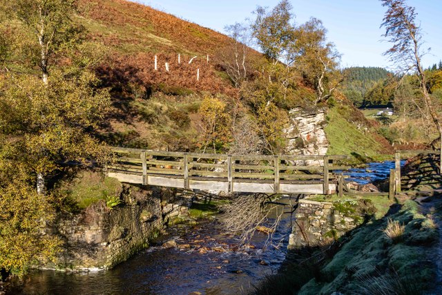
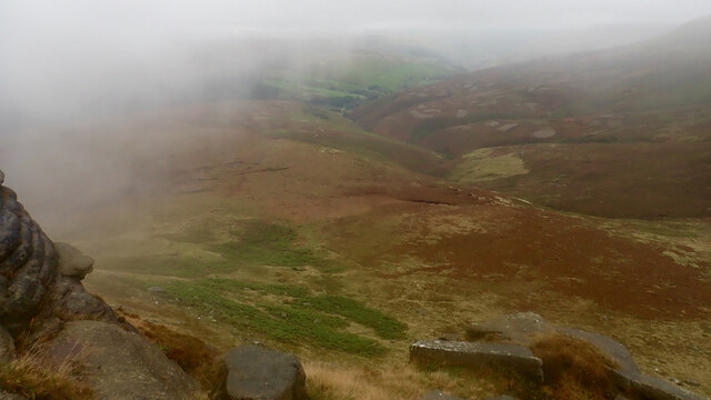
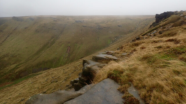
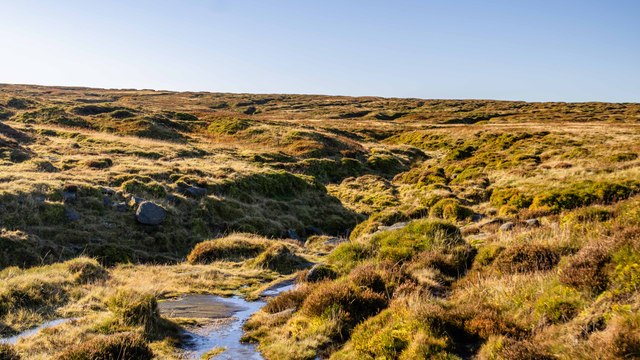
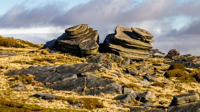
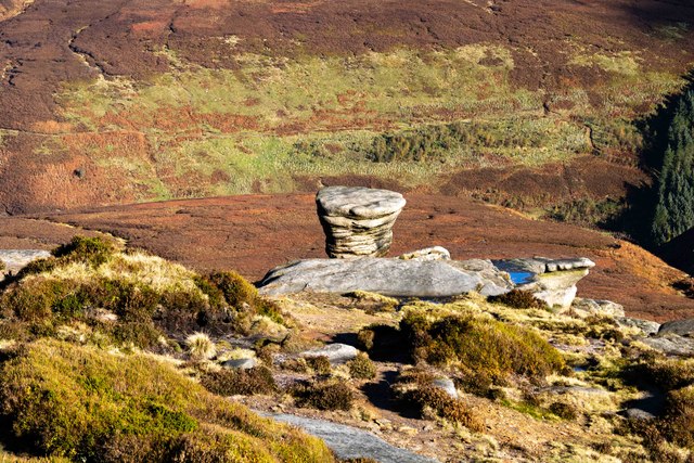
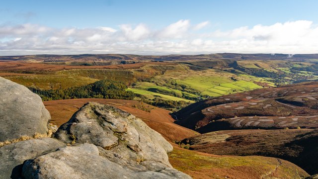
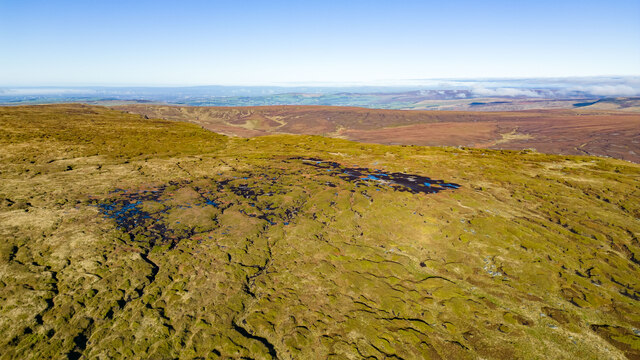
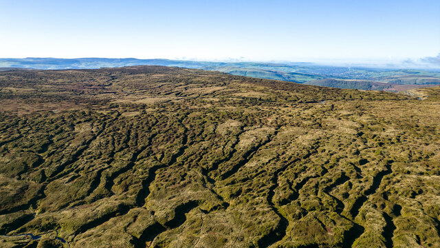
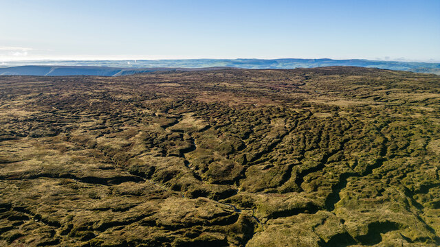
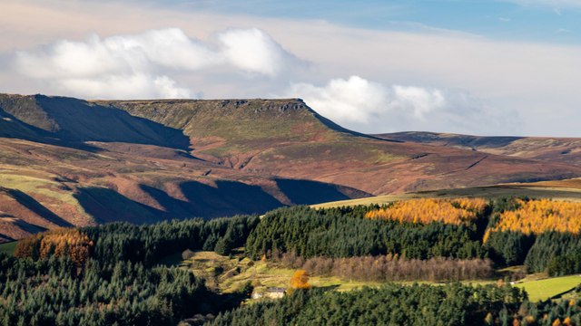
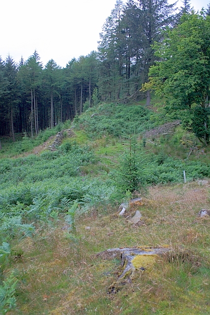
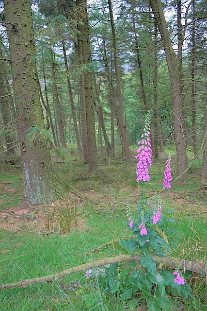
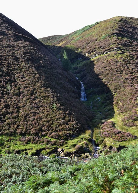
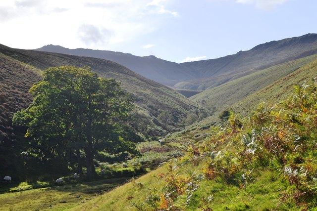
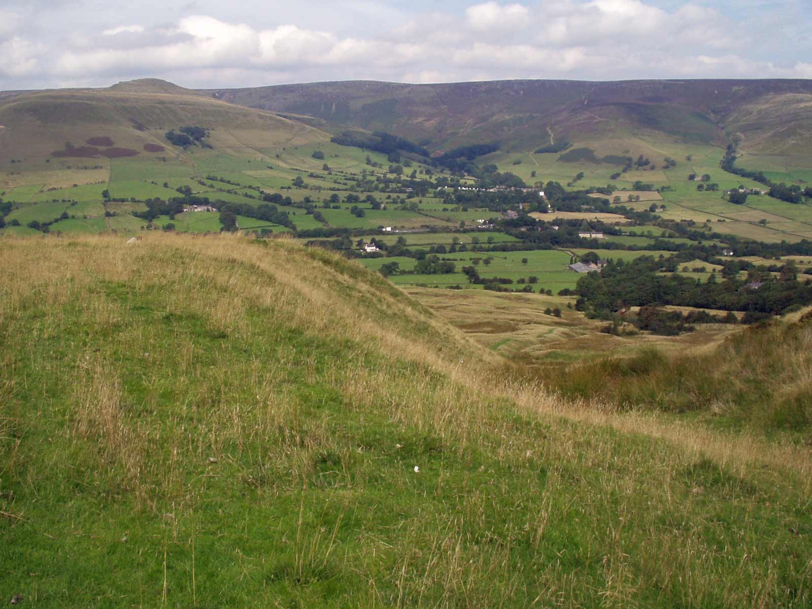
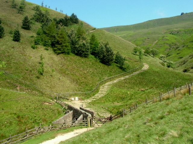
Upper Seal Clough is a picturesque valley located in the Derbyshire Peak District, England. Nestled amidst rolling hills and dense woodlands, it is a popular destination for nature lovers and outdoor enthusiasts. The valley stretches for approximately 2 miles and is characterized by its rugged beauty and tranquil atmosphere.

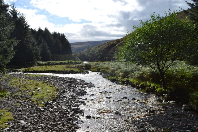
The landscape of Upper Seal Clough is dominated by a meandering river that flows through the valley, adding to its scenic charm. The river is surrounded by lush green meadows, dotted with wildflowers during the warmer months. The valley is also home to a variety of wildlife, including deer, rabbits, and numerous bird species, making it an ideal spot for birdwatching and wildlife spotting.

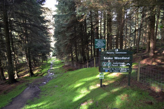
Visitors to Upper Seal Clough can explore the valley's network of footpaths and walking trails, which provide stunning views of the surrounding countryside. The area is particularly renowned for its hiking opportunities, with trails ranging from easy strolls to more challenging hikes for experienced walkers. This makes it a perfect destination for both casual walkers and seasoned adventurers.

Upper Seal Clough is also a popular spot for picnicking and relaxation, with several designated picnic areas scattered throughout the valley. These spots offer visitors the chance to unwind and enjoy the peaceful ambiance while surrounded by the beauty of nature.

Overall, Upper Seal Clough is a must-visit destination for those seeking a tranquil retreat in the heart of Derbyshire's stunning countryside. Its natural beauty, diverse wildlife, and extensive walking trails make it a beloved location for outdoor enthusiasts and nature lovers alike.

If you have any feedback on the listing, please let us know in the comments section below.

Upper Seal Clough Images

Images are sourced within 2km of 53.401771/-1.843195 or Grid Reference SK1089. Thanks to Geograph Open Source API. All images are credited.

River Ashop Footbridge crossing the River Ashop in Woodlands Valley.
River Ashop
Footbridge crossing the River Ashop in Woodlands Valley.
Ashop Clough from Fairbrook Naze
Fair Brook from Fairbrook Naze
Fair Brook The catchment of Fair Brook on the Kinder Scout Plateau.
Fair Brook
The catchment of Fair Brook on the Kinder Scout Plateau.
Fairbrook Naze Rock outcrops on Fairbrook Naze.
Fairbrook Naze
Rock outcrops on Fairbrook Naze.
Fairbrook Naze Rock outcrops on Fairbrook Naze.
Fairbrook Naze
Rock outcrops on Fairbrook Naze.
View from Fairbrook Naze View looking down the valley of Fair Brook to the Ashop Valley.
View from Fairbrook Naze
View looking down the valley of Fair Brook to the Ashop Valley.
Kinder Scout Plateau Aerial view across Kinder Scout Plateau towards Nether Red Brook on 'The Edge'.  The pronounced area of exposed peat in the foreground is clearly visible from satellite imagery.

See also <a href="https://www.geograph.org.uk/photo/7635005">SK0988 : Kinder Scout Plateau</a> and <a href="https://www.geograph.org.uk/photo/7635004">SK0888 : Kinder Scout Plateau</a>.
Kinder Scout Plateau
Aerial view across Kinder Scout Plateau towards Nether Red Brook on 'The Edge'. The pronounced area of exposed peat in the foreground is clearly visible from satellite imagery. See also SK0988 : Kinder Scout Plateau and SK0888 : Kinder Scout Plateau.
Kinder Scout Plateau Aerial view of the River Kinder crossing  Kinder Scout Plateau with the top of the Kinder Downfall just visible on the right of the picture.

See also <a href="https://www.geograph.org.uk/photo/7635005">SK0988 : Kinder Scout Plateau</a> and <a href="https://www.geograph.org.uk/photo/7635003">SK0889 : Kinder Scout Plateau</a>.
Kinder Scout Plateau
Aerial view of the River Kinder crossing Kinder Scout Plateau with the top of the Kinder Downfall just visible on the right of the picture. See also SK0988 : Kinder Scout Plateau and SK0889 : Kinder Scout Plateau.
Kinder Scout Plateau Aerial view of Kinder Scout Plateau looking towards the watershed between the River Kinder and Fair Brook (in the foreground).

See also <a href="https://www.geograph.org.uk/photo/7635004">SK0888 : Kinder Scout Plateau</a> and <a href="https://www.geograph.org.uk/photo/7635003">SK0889 : Kinder Scout Plateau</a>.
Kinder Scout Plateau
Aerial view of Kinder Scout Plateau looking towards the watershed between the River Kinder and Fair Brook (in the foreground). See also SK0888 : Kinder Scout Plateau and SK0889 : Kinder Scout Plateau.
Fairbrook Naze View looking across the Upper Derwent Valley (near distance) and the Ashop Valley (over the first horizon) towards the prominent outline of Fairbrook Naze.
Fairbrook Naze
View looking across the Upper Derwent Valley (near distance) and the Ashop Valley (over the first horizon) towards the prominent outline of Fairbrook Naze.
Clearing, Woods behind Snake Inn A Public Footpath and the course of a Roman Road.
Clearing, Woods behind Snake Inn
A Public Footpath and the course of a Roman Road.
Foxgloves in the Forest
"The Snake Pass Inn" February 2012
Snake Woodland and the start of the Snake Path
View from Lady Clough footbridge to the Woodlands Valley
Urchin Clough from the Snake Path
Looking back along Fair Brook to Kinder Scout
Show me another place!

Upper Seal Clough is located at Grid Ref: SK1089 (Lat: 53.401771, Lng: -1.843195)

Administrative County: Derbyshire

District: High Peak

Police Authority: Derbyshire

What 3 Words

///pegged.thinnest.punchy. Near High Peak, Derbyshire

Related Wikis

Kinder Scout

Kinder Scout is a moorland plateau and national nature reserve in the Dark Peak of the Derbyshire Peak District in England. Part of the moor, at 636 metres...

Grindslow Knoll

Grindslow Knoll is a hill in the Dark Peak area of the Peak District National Park in Derbyshire, England. It is joined to Kinder Scout by a high col though...

Dark Peak

The Dark Peak is the higher and wilder part of the Peak District in England, mostly forming the northern section but also extending south into its eastern...

Featherbed Top

Featherbed Top is an open, flat-topped hill, 544 metres (1,785 ft) high, in the Peak District in the county of Derbyshire in England. == Description... ==

Mermaid's Pool (Peak District)

Mermaid's Pool is a small pool on Kinder Scout in Derbyshire, England, which, according to legend, is inhabited by a beautiful mermaid who can be seen...

Hope Woodlands

Hope Woodlands is an extensive civil parish in the High Peak district of Derbyshire in England. The parish covers the Woodlands Valley, the western Upper...

River Alport

The River Alport flows for 5.6 miles (9 km) in the Dark Peak of the Peak District in Derbyshire, England. Its source is on Bleaklow, 3 miles (4.8 km)...

Jacob's Ladder, Derbyshire

Jacob's Ladder is a bridleway between Kinder Scout plateau and the hamlet of Upper Booth in the Vale of Edale, in the Derbyshire Peak District of England...

Nearby Amenities

Located within 500m of 53.401771,-1.843195
Black Ashop Moor
Place: locality
Source: Bing
Lat/Long: 53.4058265/-1.8418074
The data included in this document is from www.openstreetmap.org. The data is made available under ODbL.

Have you been to Upper Seal Clough?

Leave your review of Upper Seal Clough below (or comments, questions and feedback).