Glutton Dale
Valley in Derbyshire Derbyshire Dales
England
Glutton Dale
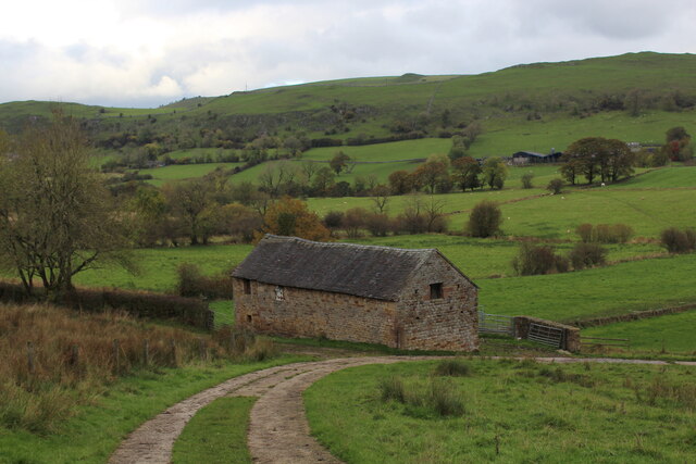
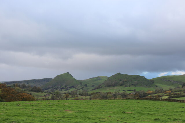
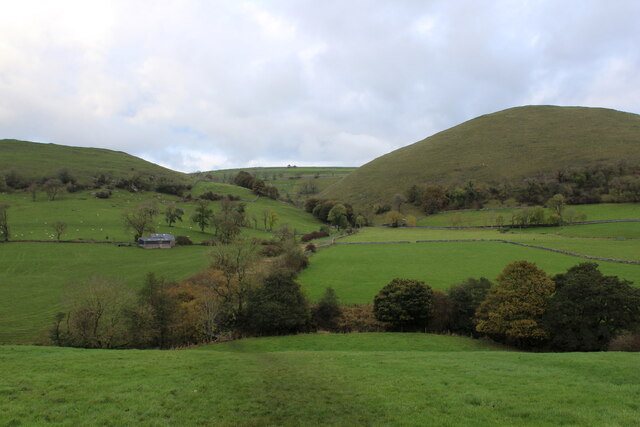
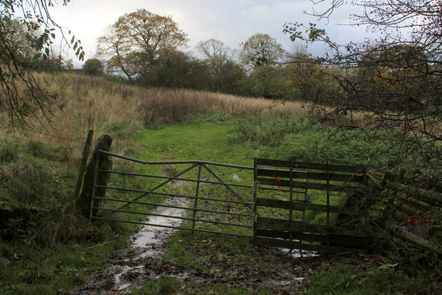
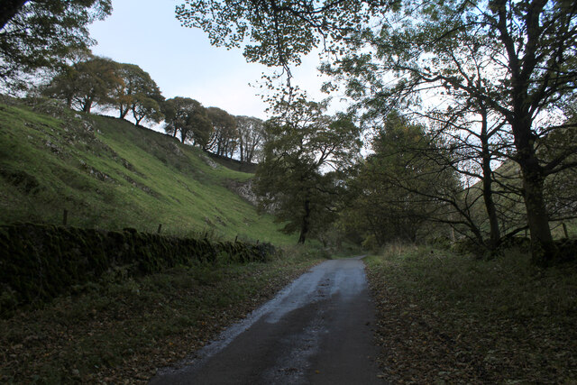
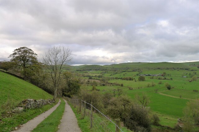
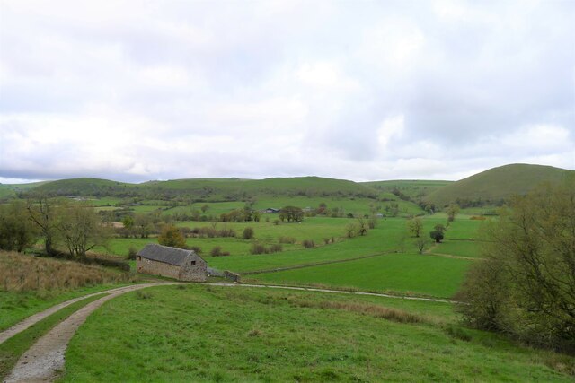
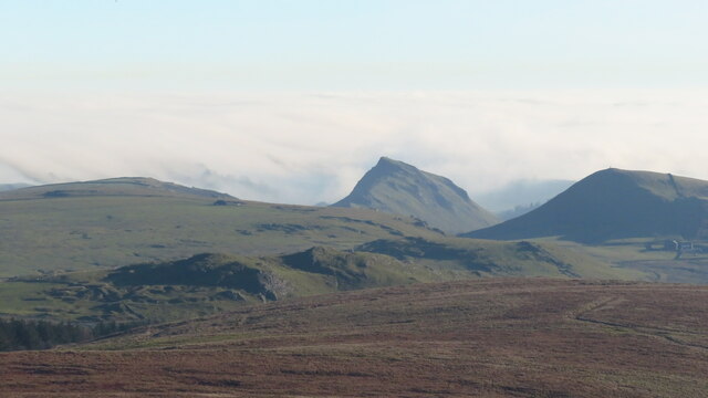
Glutton Dale is a picturesque valley located in the county of Derbyshire, England. Situated in the heart of the Peak District National Park, it is renowned for its natural beauty and stunning landscape. The valley is nestled between rolling hills and surrounded by dense woodland, creating a tranquil and idyllic setting.
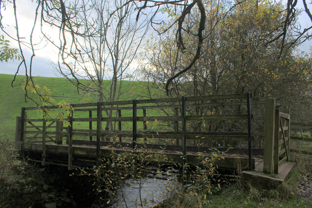
Glutton Dale is characterized by its steep cliffs and deep gorges, carved out by the Glutton River over thousands of years. The river meanders through the valley, adding to its charm and providing a habitat for a variety of wildlife. The area is particularly popular with hikers and nature enthusiasts, who are drawn to its extensive network of walking trails and panoramic viewpoints.
The valley is also home to several caves and caverns, which have attracted explorers and adventurers for centuries. One of the most famous is Glutton Hole, a vast underground system that offers a fascinating glimpse into the region's geological history. Guided tours of the cave are available for visitors to experience its unique features and formations.
In addition to its natural attractions, Glutton Dale boasts a rich cultural heritage. The nearby village of Glutton is a quaint and traditional English village, with charming stone cottages and a historic church. The village is a popular starting point for exploring the valley and offers a range of amenities, including cozy pubs and local shops.
Overall, Glutton Dale is a haven for those seeking natural beauty and outdoor adventure. Its stunning scenery, diverse wildlife, and rich history make it a must-visit destination for nature lovers and explorers alike.
If you have any feedback on the listing, please let us know in the comments section below.
Glutton Dale Images
Images are sourced within 2km of 53.201511/-1.8731175 or Grid Reference SK0867. Thanks to Geograph Open Source API. All images are credited.


Glutton Dale is located at Grid Ref: SK0867 (Lat: 53.201511, Lng: -1.8731175)
Administrative County: Derbyshire
District: Derbyshire Dales
Police Authority: Derbyshire
What 3 Words
///overcomes.etchings.physical. Near Buxton, Derbyshire
Nearby Locations
Related Wikis

Earl Sterndale
Earl Sterndale is a village in the Upper Dove Valley in the Peak District, Derbyshire, England, situated near the River Dove, 5 miles south of Buxton,...

Parkhouse Hill
Parkhouse Hill is a small but distinctive hill in the Peak District National Park of the Hartington Middle Quarter civil parish, in the English county...

Chrome Hill
Chrome Hill is a limestone reef knoll in Derbyshire, England, in the upper Dove valley beside the border with Staffordshire, within the civil parish...

Dowlow Works
Dowlow Works is a quarry in High Peak, Derbyshire near the village of Earl Sterndale. The quarry has been in operation since 1899, and has extracting permissions...

Dowlow Halt railway station
Dowlow Halt was opened in 1920 between Dowlow (hill now largely quarried away) and Greatlow to the south east of Buxton, Derbyshire on the London and North...

High Wheeldon
High Wheeldon is a distinctive dome-shaped hill near the Staffordshire border in Hartington Middle Quarter civil parish, Derbyshire, in the Peak District...

Hollinsclough
Hollinsclough is a small rural village in the county of Staffordshire in the English Midlands. It is within the Peak District National Park. == Location... ==

Hindlow railway station
Hindlow railway station was opened for goods in 1833 near to Hindlow near King Sterndale to the south east of Buxton, Derbyshire on the Cromford and High...
Nearby Amenities
Located within 500m of 53.201511,-1.8731175Have you been to Glutton Dale?
Leave your review of Glutton Dale below (or comments, questions and feedback).