Barrwood

Settlement in Stirlingshire

Scotland

Barrwood

Rowancraig Spring Made into a shrine. With the offering of an empty can of coke.
Rowancraig Spring Credit: Mick Garratt

Barrwood is a small village located in the Stirling council area of central Scotland. Situated approximately 10 miles northwest of Falkirk and 5 miles east of Stirling, it is nestled within the picturesque countryside of Stirlingshire.

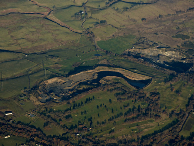
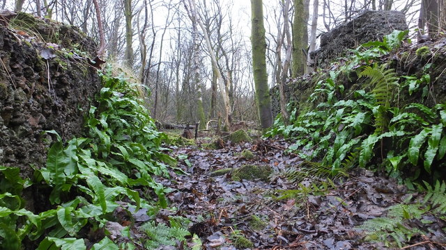
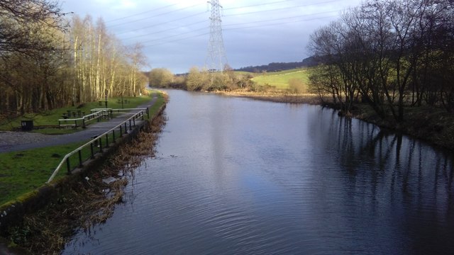
The village is known for its tranquil atmosphere and natural beauty, with lush green fields, rolling hills, and dense woodlands surrounding the area. It is an ideal location for those seeking a peaceful retreat away from the bustle of city life.

Despite its small size, Barrwood offers a range of amenities to its residents. The village has a local primary school, providing education for the younger population. For outdoor enthusiasts, there are several walking and cycling trails that wind through the surrounding countryside, allowing residents to explore the stunning landscapes and enjoy the fresh air.

The nearby town of Stirling provides additional amenities and services, including shopping centers, restaurants, and leisure facilities. Stirling Castle, a historic fortress dating back to the 12th century, is a popular tourist attraction and a must-visit landmark for history enthusiasts.

Transport links in Barrwood are convenient, with easy access to major roads connecting to nearby towns and cities. The village is well-connected to public transportation, with regular bus services operating in the area.

Overall, Barrwood offers a peaceful and idyllic setting for those seeking a retreat in the heart of the Scottish countryside, while still providing easy access to nearby amenities and attractions.

If you have any feedback on the listing, please let us know in the comments section below.
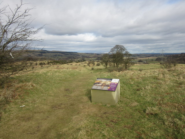
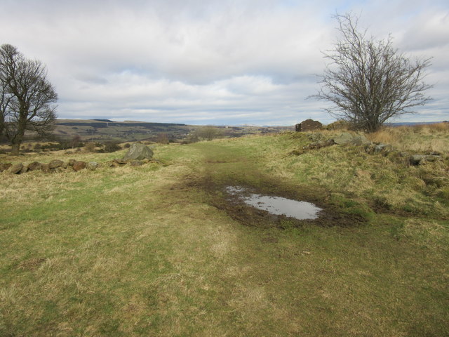
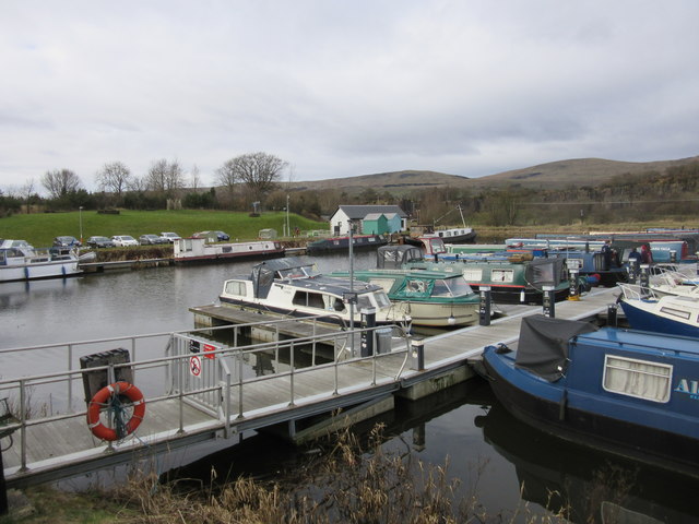
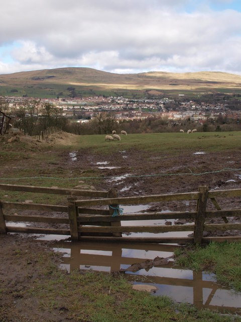
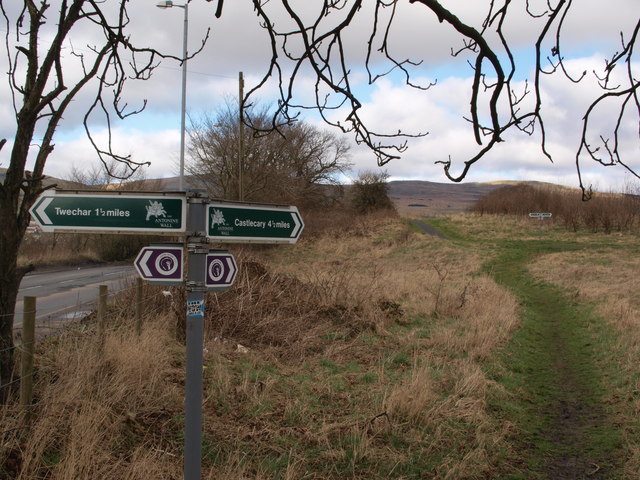
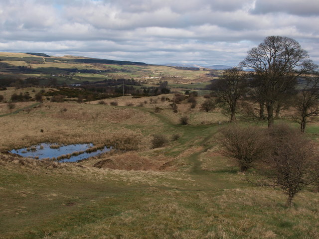
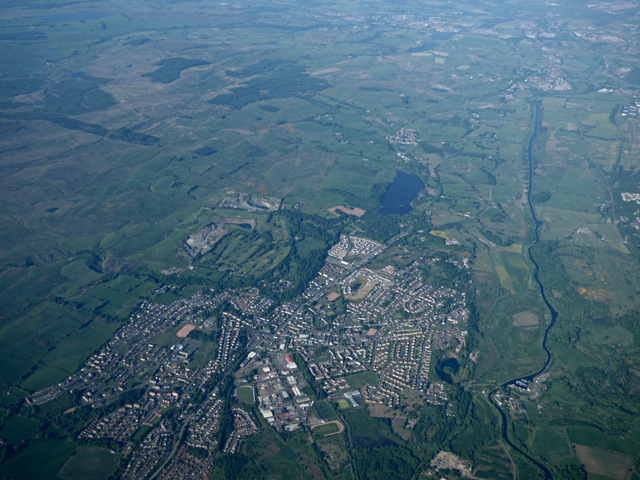
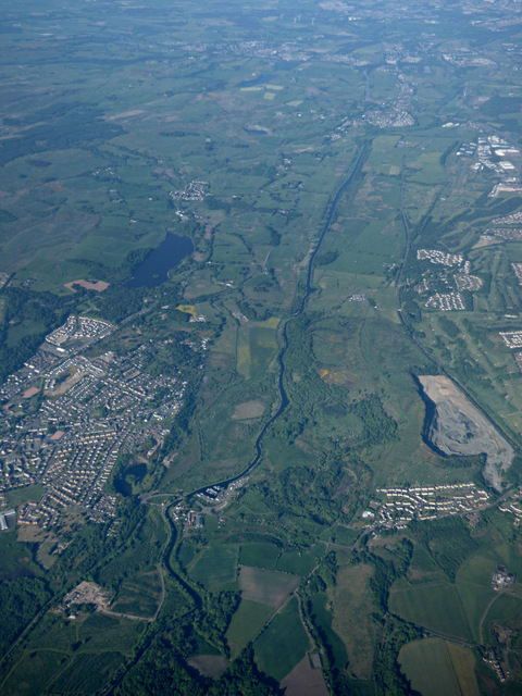
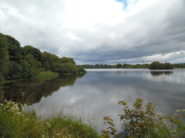
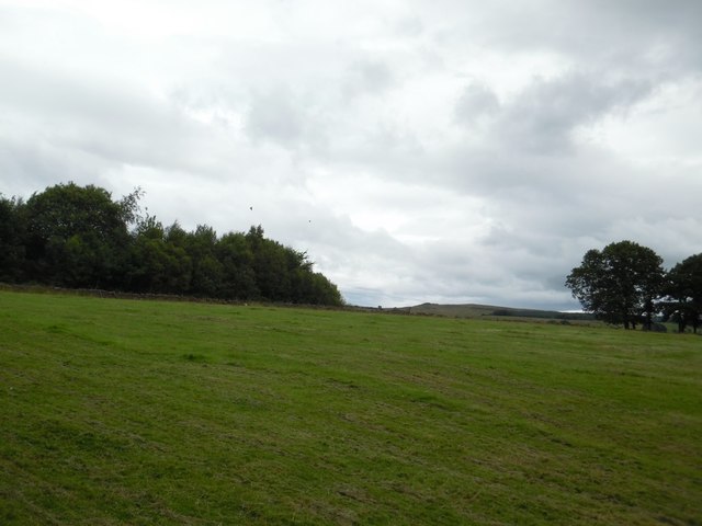
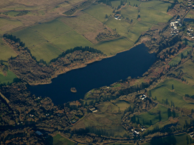
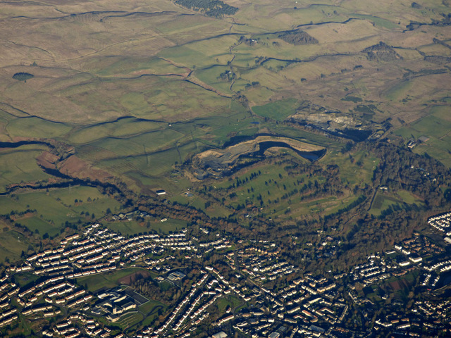
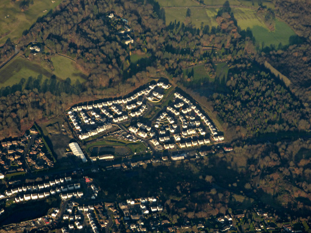
Barrwood Images

Images are sourced within 2km of 55.973763/-4.048273 or Grid Reference NS7277. Thanks to Geograph Open Source API. All images are credited.

Rowancraig Spring Made into a shrine. With the offering of an empty can of coke.
Rowancraig Spring
Made into a shrine. With the offering of an empty can of coke.
The Antonine Wall, Croy Hill Construction of the Antonine Wall began sometime after 140AD, running from Old Kilpatrick in the west to Bridgeness in the east.  The section of the wall that once stood here was built by the Sixth Legion, and excavations have revealed that a fortlet once occupied the area in the picture.
The Antonine Wall, Croy Hill
Construction of the Antonine Wall began sometime after 140AD, running from Old Kilpatrick in the west to Bridgeness in the east. The section of the wall that once stood here was built by the Sixth Legion, and excavations have revealed that a fortlet once occupied the area in the picture.
The Antonine Wall, Croy Hill On this section of the Antonine Wall was sited a fort which housed a Roman garrison of approximately 200 men.
The Antonine Wall, Croy Hill
On this section of the Antonine Wall was sited a fort which housed a Roman garrison of approximately 200 men.
Auchinstarry Marina, Kilsyth
Field beside the "Military Way" The picture was taken from the Military Way, as described in <a href="https://www.geograph.org.uk/photo/2781998">NS7176 : The Military Way</a>. The muddy field with the grazing sheep lies immediately north of the track.
Field beside the "Military Way"
The picture was taken from the Military Way, as described in NS7176 : The Military Way. The muddy field with the grazing sheep lies immediately north of the track.
Croy Signs for walkers These signs help walkers to negotiate the network of paths that takes in Croy Hill, the Forth and Clyde Canal, Bar Hill and Twechar, and of course other destinations further afield.
Croy Signs for walkers
These signs help walkers to negotiate the network of paths that takes in Croy Hill, the Forth and Clyde Canal, Bar Hill and Twechar, and of course other destinations further afield.
East side of Croy Hill The line of the Antonine Wall runs left to right across the bottom of this picture and a small Roman fort lay to the right. The paths in the centre of the picture give access to or from the Forth and Clyde Canal.
East side of Croy Hill
The line of the Antonine Wall runs left to right across the bottom of this picture and a small Roman fort lay to the right. The paths in the centre of the picture give access to or from the Forth and Clyde Canal.
Kilsyth from the air With the Forth & Clyde Canal running the length of the photo on the right.
Kilsyth from the air
With the Forth & Clyde Canal running the length of the photo on the right.
Kilsyth and the Forth & Clyde Canal from the air The disused Rowancraig Quarry is on the right.
Kilsyth and the Forth & Clyde Canal from the air
The disused Rowancraig Quarry is on the right.
Banton Loch from the west
Fields east of Riskend Quarry
Banton Loch from the air Formerly known as Townhead reservoir. Built in 1772 to provide water to the nearby Forth & Clyde Canal . Speirs Island can be seen within the loch.

On the site of the Battle of Kilsyth (1645).
Banton Loch from the air
Formerly known as Townhead reservoir. Built in 1772 to provide water to the nearby Forth & Clyde Canal . Speirs Island can be seen within the loch. On the site of the Battle of Kilsyth (1645).
Kilsyth from the air Kilsyth Lennox Golf Club and the Beltmoss quarries can also be seen.
Kilsyth from the air
Kilsyth Lennox Golf Club and the Beltmoss quarries can also be seen.
Beltmoss quarries from the air Kilsyth Lennox Golf Club is in the foreground.
Beltmoss quarries from the air
Kilsyth Lennox Golf Club is in the foreground.
Kilsyth from the air Looking over new houses at Cavalry Park Road towards Colzium House.
Kilsyth from the air
Looking over new houses at Cavalry Park Road towards Colzium House.
Natural fernery Ferns adorning some old buildings
Natural fernery
Ferns adorning some old buildings
Forth and Clyde Canal, Wester Dullatur
Houses on Laird's Hill Place, Kilsyth
Show me another place!

Barrwood is located at Grid Ref: NS7277 (Lat: 55.973763, Lng: -4.048273)

Unitary Authority: North Lanarkshire

Police Authority: Lanarkshire

What 3 Words

///unit.jolt.patio. Near Kilsyth, North Lanarkshire

Related Wikis

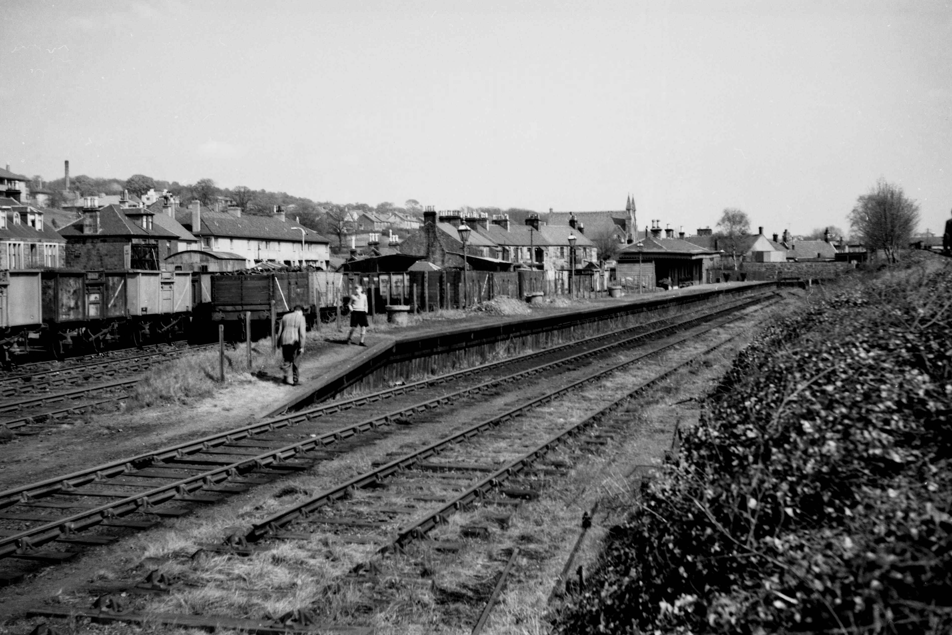
Kilsyth New railway station

Kilsyth New station served the town of Kilsyth in Scotland. The station was on the Kilsyth and Bonnybridge Railway. == History == The station opened on...

Kilsyth railway station

Kilsyth Old station served the town of Kilsyth in Scotland. It was the original terminus of the Kelvin Valley Railway. == History == The station opened...

Kilsyth

Kilsyth (; Scottish Gaelic Cill Saidhe) is a town and civil parish in North Lanarkshire, roughly halfway between Glasgow and Stirling in Scotland. The...

Kilsyth Rangers F.C.

Kilsyth Rangers Football Club are a Scottish football club based in the town of Kilsyth, North Lanarkshire. Nicknamed The Wee Gers, they were formed in...

Nearby Amenities

Located within 500m of 55.973763,-4.048273
Turning Circle
Lat/Long: 55.9734817/-4.0529848
South Barrwood
Place: suburb
Lat/Long: 55.9709793/-4.0433799
Post Box
Source: survey
Lat/Long: 55.9716359/-4.0531205
Telephone
Booth: KX300
Covered: booth
Source: survey
Lat/Long: 55.9725702/-4.0560254
Barrwood Colliery No1
Historic: mine
Lat/Long: 55.9719176/-4.0448682
Barrwood Colliery No2 Pit
Historic: mine
Lat/Long: 55.9740909/-4.0507369
Charging Station
Lat/Long: 55.9780254/-4.0502373
Charging Station
Lat/Long: 55.9780009/-4.0502003
Historic: memorial
Memorial: war_memorial
Lat/Long: 55.9766885/-4.0541629
Generator Method: photovoltaic
Generator Output Electricity: yes
Generator Source: solar
Generator Type: solar_photovoltaic_panel
Power: generator
Lat/Long: 55.9768038/-4.0461212
Generator Method: photovoltaic
Generator Output Electricity: yes
Generator Source: solar
Generator Type: solar_photovoltaic_panel
Power: generator
Lat/Long: 55.9770073/-4.0481747
Generator Method: photovoltaic
Generator Output Electricity: yes
Generator Source: solar
Generator Type: solar_photovoltaic_panel
Power: generator
Lat/Long: 55.977003/-4.0480807
Generator Method: photovoltaic
Generator Output Electricity: yes
Generator Source: solar
Generator Type: solar_photovoltaic_panel
Power: generator
Lat/Long: 55.9770116/-4.0479159
Generator Method: photovoltaic
Generator Output Electricity: yes
Generator Source: solar
Generator Type: solar_photovoltaic_panel
Power: generator
Lat/Long: 55.9770271/-4.0478142
Generator Method: photovoltaic
Generator Output Electricity: yes
Generator Source: solar
Generator Type: solar_photovoltaic_panel
Power: generator
Lat/Long: 55.97704/-4.0476694
Generator Method: photovoltaic
Generator Output Electricity: yes
Generator Source: solar
Generator Type: solar_photovoltaic_panel
Power: generator
Lat/Long: 55.9770478/-4.0475816
Generator Method: photovoltaic
Generator Output Electricity: yes
Generator Source: solar
Generator Type: solar_photovoltaic_panel
Power: generator
Lat/Long: 55.9770702/-4.0474183
Generator Method: photovoltaic
Generator Output Electricity: yes
Generator Source: solar
Generator Type: solar_photovoltaic_panel
Power: generator
Lat/Long: 55.9770814/-4.0473244
Generator Method: photovoltaic
Generator Output Electricity: yes
Generator Source: solar
Generator Type: solar_photovoltaic_panel
Power: generator
Lat/Long: 55.9773572/-4.0478574
Generator Method: photovoltaic
Generator Output Electricity: yes
Generator Source: solar
Generator Type: solar_photovoltaic_panel
Power: generator
Lat/Long: 55.9773581/-4.0477819
Generator Method: photovoltaic
Generator Output Electricity: yes
Generator Source: solar
Generator Type: solar_photovoltaic_panel
Power: generator
Lat/Long: 55.9773072/-4.0480207
Generator Method: photovoltaic
Generator Output Electricity: yes
Generator Source: solar
Generator Type: solar_photovoltaic_panel
Power: generator
Lat/Long: 55.9772952/-4.04813
Generator Method: photovoltaic
Generator Output Electricity: yes
Generator Source: solar
Generator Type: solar_photovoltaic_panel
Power: generator
Lat/Long: 55.977028/-4.0488772
Generator Method: photovoltaic
Generator Output Electricity: yes
Generator Source: solar
Generator Type: solar_photovoltaic_panel
Power: generator
Lat/Long: 55.9770288/-4.0487971
Power: pole
Lat/Long: 55.9711774/-4.0464029
Power: pole
Lat/Long: 55.9711876/-4.0462179
Power: pole
Lat/Long: 55.9701478/-4.0466014
Power: pole
Lat/Long: 55.9706724/-4.0462618
Power: pole
Lat/Long: 55.971225/-4.0459035
Power: pole
Lat/Long: 55.971492/-4.0453556
Power: pole
Lat/Long: 55.9715631/-4.0441245
Power: pole
Lat/Long: 55.9717018/-4.04306
Power: pole
Lat/Long: 55.9719827/-4.0413413
Power: pole
Lat/Long: 55.9726542/-4.0417205
Power: pole
Lat/Long: 55.9713824/-4.0452046
Power: pole
Lat/Long: 55.9712932/-4.0443036
Power: pole
Lat/Long: 55.9711719/-4.0432162
Power: pole
Lat/Long: 55.9712512/-4.0420996
Power: pole
Lat/Long: 55.971348/-4.0453931
Power: pole
Lat/Long: 55.9707698/-4.0442765
Power: pole
Lat/Long: 55.9705821/-4.042937
Bus Stop
Kilsyth, Howe Road after Fisher Avenue
Bus: yes
Departures Board: timetable
Naptan AtcoCode: 61601400
Naptan NaptanCode: 65232526
Public Transport: platform
Shelter: no
Lat/Long: 55.9740736/-4.0562219
Bus Stop
Kilsyth, Howe Road before Prinie Place
Bus: yes
Departures Board: timetable
Naptan AtcoCode: 61601401
Naptan NaptanCode: 65236598
Public Transport: platform
Shelter: no
Lat/Long: 55.9747325/-4.0554639
Bus Stop
Kilsyth, Manse Road opp Barlandfauld Street
Bus: yes
Departures Board: timetable
Naptan AtcoCode: 61601615
Naptan NaptanCode: 65236873
Public Transport: platform
Shelter: no
Lat/Long: 55.9720243/-4.0511931
Bus Stop
Kilsyth, Manse Road before Barlandfauld Street
Bus: yes
Departures Board: no
Naptan AtcoCode: 61601395
Naptan NaptanCode: 65235984
Public Transport: platform
Shelter: no
Lat/Long: 55.9720998/-4.0512291
Bus Stop
Kilsyth, Manse Road before South Barrwood
Bus: yes
Departures Board: timetable
Naptan AtcoCode: 61601393
Naptan NaptanCode: 65234968
Public Transport: platform
Shelter: no
Lat/Long: 55.9725987/-4.0480807
Bus Stop
Kilsyth, Manse Road opp South Barrwood
Bus: yes
Departures Board: timetable
Naptan AtcoCode: 61601394
Naptan NaptanCode: 65234858
Public Transport: platform
Shelter: no
Lat/Long: 55.9726718/-4.0481913
Bus Stop
Kilsyth, St Mirrens Road opp Courthill Crescent
Bus: yes
Departures Board: timetable
Naptan AtcoCode: 61601392
Naptan NaptanCode: 65232378
Public Transport: platform
Shelter: no
Lat/Long: 55.9739321/-4.044777
Bus Stop
Kilsyth, Haughton Avenue before Watson Crescent
Bus: yes
Departures Board: timetable
Naptan AtcoCode: 61601678
Naptan NaptanCode: 65279679
Public Transport: platform
Shelter: no
Lat/Long: 55.9752584/-4.0457885
Bus Stop
Kilsyth, Haughton Avenue after Watson Crescent
Bus: yes
Departures Board: timetable
Naptan AtcoCode: 61601677
Naptan NaptanCode: 65279678
Public Transport: platform
Shelter: no
Lat/Long: 55.9751176/-4.0483982
Bus Stop
Kilsyth, Low Craigends before U P Road
Bus: yes
Departures Board: timetable
Naptan AtcoCode: 61601747
Naptan NaptanCode: 65237859
Public Transport: platform
Shelter: no
Lat/Long: 55.9758622/-4.0529038
Bus Stop
Kilsyth, Low Craigends opp St Patricks Church
Bus: yes
Departures Board: timetable
Naptan AtcoCode: 61601748
Naptan NaptanCode: 65237892
Public Transport: platform
Shelter: no
Lat/Long: 55.9758756/-4.0527299
The data included in this document is from www.openstreetmap.org. The data is made available under ODbL.

Have you been to Barrwood?

Leave your review of Barrwood below (or comments, questions and feedback).