Barrow's Green
Settlement in Lancashire
England
Barrow's Green
Barrow's Green is a small village located in the county of Lancashire, England. Situated in the district of Chorley, it is positioned approximately 8 miles northeast of the town of Chorley itself. Nestled amidst the picturesque countryside, the village offers a tranquil and idyllic setting for its residents.
The village of Barrow's Green is characterized by its charming rural atmosphere and close-knit community. It is primarily a residential area, consisting of a cluster of traditional stone-built houses and cottages. The architecture reflects the village's rich history, with some buildings dating back several centuries.
The village is surrounded by lush green fields and rolling hills, providing ample opportunities for outdoor activities such as walking, hiking, and cycling. The nearby Leeds and Liverpool Canal also offers a scenic route for boating enthusiasts. Additionally, Barrow's Green is in close proximity to the stunning countryside of the West Pennine Moors, offering further options for exploring nature.
Despite its small size, the village boasts a range of amenities for residents. These include a local pub, shops, and a primary school, ensuring that the basic needs of the community are met. For additional services and facilities, the larger towns of Chorley and Preston are easily accessible by road.
Overall, Barrow's Green presents an attractive option for those seeking a peaceful and picturesque village lifestyle, with the added convenience of nearby towns for amenities and services. Its charming architecture, scenic surroundings, and welcoming community make it a desirable place to call home.
If you have any feedback on the listing, please let us know in the comments section below.
Barrow's Green Images
Images are sourced within 2km of 53.38045/-2.701435 or Grid Reference SJ5387. Thanks to Geograph Open Source API. All images are credited.


Barrow's Green is located at Grid Ref: SJ5387 (Lat: 53.38045, Lng: -2.701435)
Unitary Authority: Halton
Police Authority: Cheshire
What 3 Words
///ranch.twinkling.views. Near Widnes, Cheshire
Nearby Locations
Related Wikis
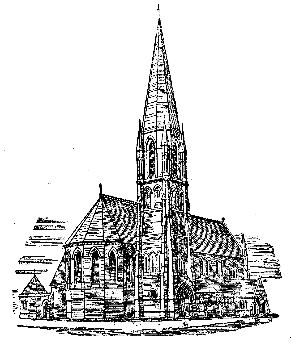
St Ambrose Church, Widnes
St Ambrose Church, in Widnes, England, was built in 1882 to a design by James Francis Doyle of Liverpool (c. 1840–1913). == The first building == Widnes...

Farnworth & Bold railway station
Farnworth & Bold railway station served the Farnworth area of Widnes, England. The station was on the southern section of the St Helens and Runcorn Gap...
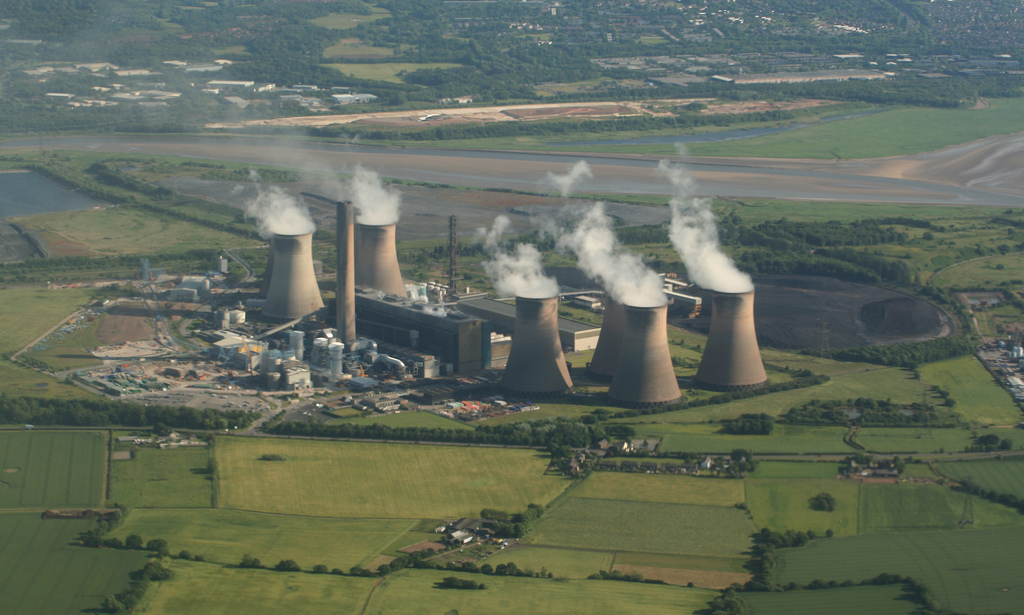
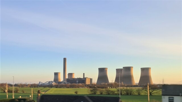
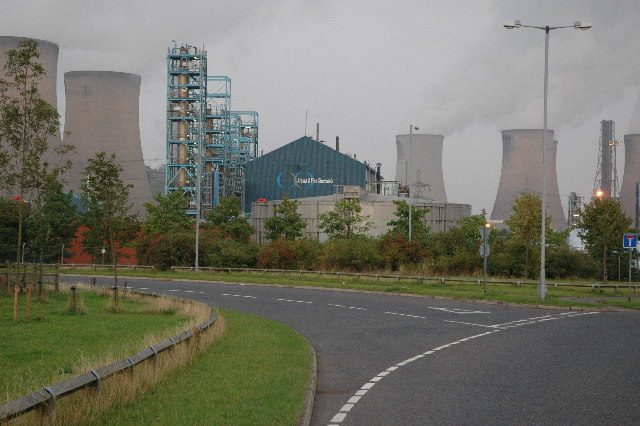
Fiddlers Ferry power station
Fiddlers Ferry power station is a decommissioned coal fired power station located in Warrington, Cheshire, England. Opened in 1971, the station had a generating...
Cuerdley
Cuerdley is a civil parish in the Borough of Warrington, Cheshire, England. It has a population of 107 (2001 census) and much of its area is farmland....
Nearby Amenities
Located within 500m of 53.38045,-2.701435Have you been to Barrow's Green?
Leave your review of Barrow's Green below (or comments, questions and feedback).