Auchinstarry Loch

Lake, Pool, Pond, Freshwater Marsh in Stirlingshire

Scotland

Auchinstarry Loch

Rowancraig Spring Made into a shrine. With the offering of an empty can of coke.
Rowancraig Spring Credit: Mick Garratt

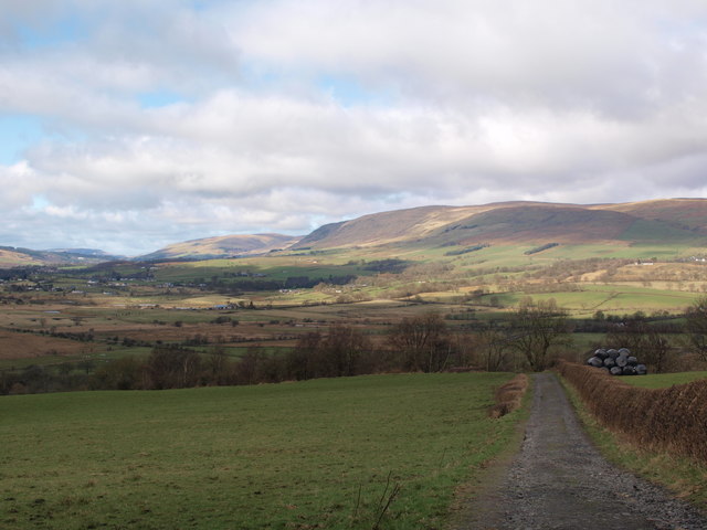
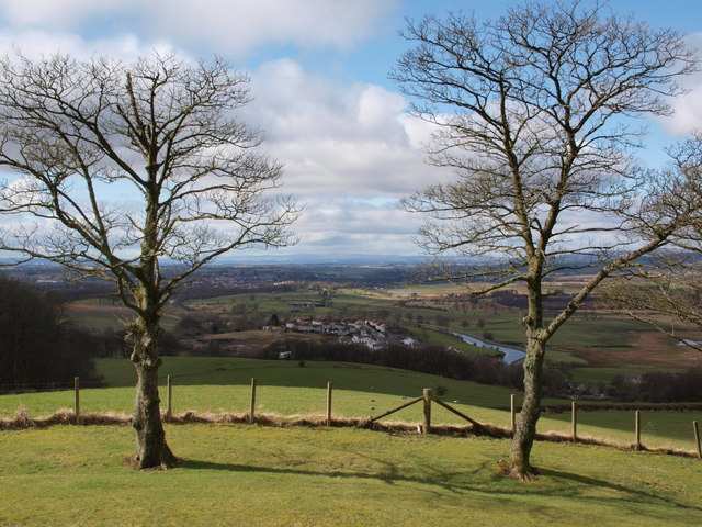
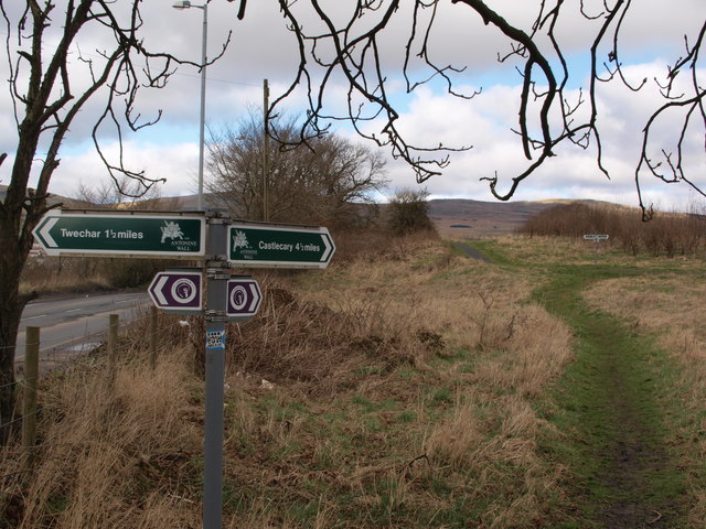
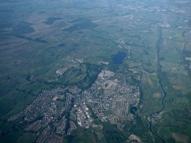
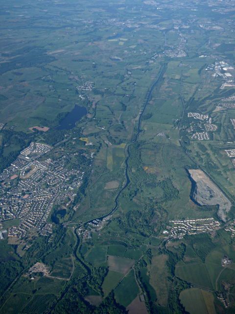
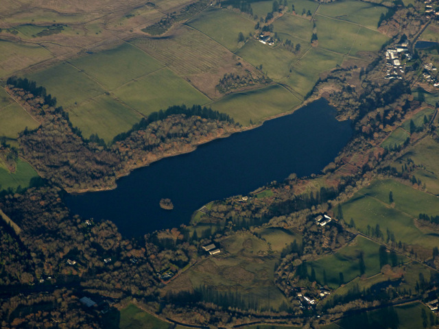
Auchinstarry Loch is a picturesque freshwater loch located in Stirlingshire, Scotland. Nestled amidst the scenic landscapes of the Central Belt, it covers an area of approximately 11 hectares (27 acres). The loch is situated near the village of Kilsyth and is easily accessible by road, making it a popular destination for both locals and tourists alike.

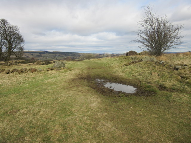
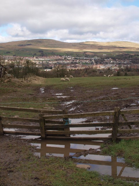
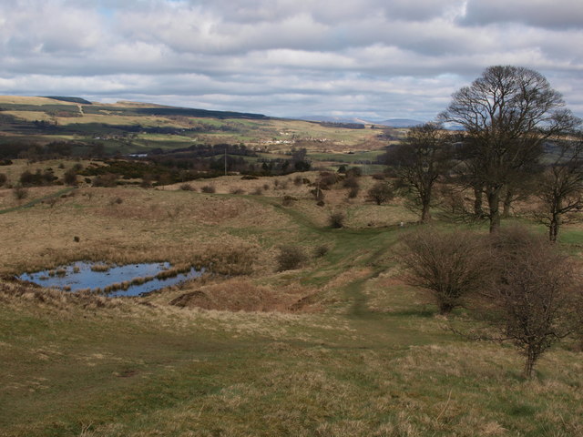
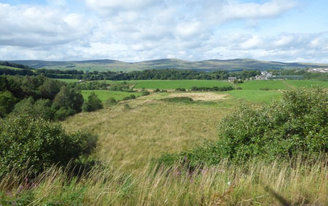
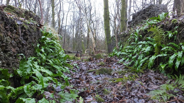
Surrounded by lush greenery and rolling hills, Auchinstarry Loch offers a tranquil and serene setting. Its calm waters reflect the beauty of the surrounding landscape, creating a perfect backdrop for nature enthusiasts and photographers. The loch is home to a diverse range of flora and fauna, attracting a variety of bird species, including swans, ducks, and herons. The surrounding woodlands provide a habitat for numerous small mammals and woodland birds.

Auchinstarry Loch also serves as a recreational spot for outdoor activities. Fishing is a popular pastime here, with the loch being well-stocked with fish such as brown trout. Anglers can enjoy a peaceful day on the water, surrounded by nature. Additionally, the loch is a great spot for leisurely walks and picnics, with well-maintained paths and designated picnic areas.

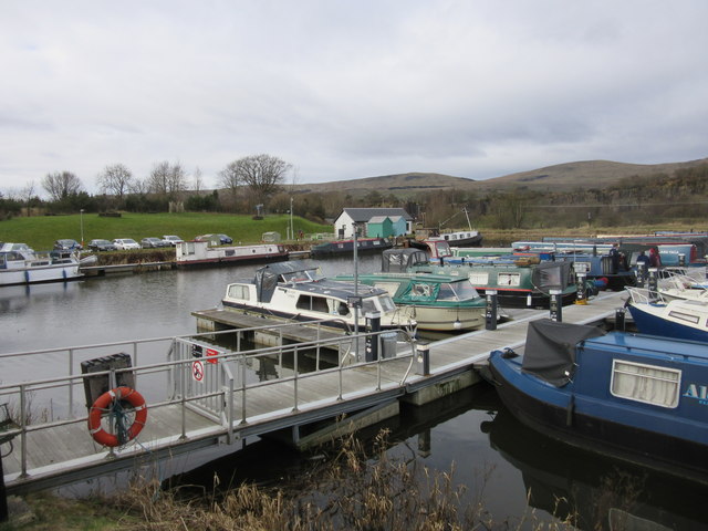
The loch is part of the larger Auchinstarry Marina complex, which offers amenities such as a café, boat hire, and a caravan park. Visitors can rent a boat or canoe to explore the calm waters, or simply relax and soak in the natural beauty of the surroundings. Auchinstarry Loch truly offers a peaceful retreat in the heart of Stirlingshire, providing a haven for nature lovers and outdoor enthusiasts.

If you have any feedback on the listing, please let us know in the comments section below.

Auchinstarry Loch Images

Images are sourced within 2km of 55.970289/-4.0522237 or Grid Reference NS7277. Thanks to Geograph Open Source API. All images are credited.

Rowancraig Spring Made into a shrine. With the offering of an empty can of coke.
Rowancraig Spring
Made into a shrine. With the offering of an empty can of coke.
The Antonine Wall, Croy Hill Construction of the Antonine Wall began sometime after 140AD, running from Old Kilpatrick in the west to Bridgeness in the east.  The section of the wall that once stood here was built by the Sixth Legion, and excavations have revealed that a fortlet once occupied the area in the picture.
The Antonine Wall, Croy Hill
Construction of the Antonine Wall began sometime after 140AD, running from Old Kilpatrick in the west to Bridgeness in the east. The section of the wall that once stood here was built by the Sixth Legion, and excavations have revealed that a fortlet once occupied the area in the picture.
The Antonine Wall, Croy Hill On this section of the Antonine Wall was sited a fort which housed a Roman garrison of approximately 200 men.
The Antonine Wall, Croy Hill
On this section of the Antonine Wall was sited a fort which housed a Roman garrison of approximately 200 men.
Auchinstarry Marina, Kilsyth
Track to Bar Hill Roman fort A good farm road leads walkers from Twechar to the Roman fort on Bar Hill. This picture looks back along this road from a point close to the fort.
Track to Bar Hill Roman fort
A good farm road leads walkers from Twechar to the Roman fort on Bar Hill. This picture looks back along this road from a point close to the fort.
Trees on Bar Hill As seen in e.g. <a href="https://www.geograph.org.uk/photo/128421">NS7075 : Barr Hill Roman Baths</a>, the top of Bar Hill is sparsely wooded. These two trees stand on the western edge of the Roman fort area, and the picture looks west. Part of Twechar can be seen between them, as well as the Forth and Clyde Canal.
Trees on Bar Hill
As seen in e.g. NS7075 : Barr Hill Roman Baths, the top of Bar Hill is sparsely wooded. These two trees stand on the western edge of the Roman fort area, and the picture looks west. Part of Twechar can be seen between them, as well as the Forth and Clyde Canal.
Field beside the "Military Way" The picture was taken from the Military Way, as described in <a href="https://www.geograph.org.uk/photo/2781998">NS7176 : The Military Way</a>. The muddy field with the grazing sheep lies immediately north of the track.
Field beside the "Military Way"
The picture was taken from the Military Way, as described in NS7176 : The Military Way. The muddy field with the grazing sheep lies immediately north of the track.
Croy Signs for walkers These signs help walkers to negotiate the network of paths that takes in Croy Hill, the Forth and Clyde Canal, Bar Hill and Twechar, and of course other destinations further afield.
Croy Signs for walkers
These signs help walkers to negotiate the network of paths that takes in Croy Hill, the Forth and Clyde Canal, Bar Hill and Twechar, and of course other destinations further afield.
East side of Croy Hill The line of the Antonine Wall runs left to right across the bottom of this picture and a small Roman fort lay to the right. The paths in the centre of the picture give access to or from the Forth and Clyde Canal.
East side of Croy Hill
The line of the Antonine Wall runs left to right across the bottom of this picture and a small Roman fort lay to the right. The paths in the centre of the picture give access to or from the Forth and Clyde Canal.
Kilsyth from the air With the Forth & Clyde Canal running the length of the photo on the right.
Kilsyth from the air
With the Forth & Clyde Canal running the length of the photo on the right.
Kilsyth and the Forth & Clyde Canal from the air The disused Rowancraig Quarry is on the right.
Kilsyth and the Forth & Clyde Canal from the air
The disused Rowancraig Quarry is on the right.
Croy railway station, Lanarkshire, 2016 Opened in 1842 by the Edinburgh & Glasgow Railway. 
View south west towards Lenzie and Glasgow. A lot has happened in the 3 years since <a href="https://www.geograph.org.uk/photo/3373232">NS7275 : Croy railway station, Lanarkshire, 2013</a> was taken. Electric wires have been erected through the station, the platforms have been extended and a new housing estate has appeared in the distance. 
More was to follow, in the shape of a new footbridge with lifts. See <a href="https://www.geograph.org.uk/photo/7560295">NS7275 : Croy railway station, Lanarkshire</a> for a 2023 view from a similar camera position.
Croy railway station, Lanarkshire, 2016
Opened in 1842 by the Edinburgh & Glasgow Railway. View south west towards Lenzie and Glasgow. A lot has happened in the 3 years since NS7275 : Croy railway station, Lanarkshire, 2013 was taken. Electric wires have been erected through the station, the platforms have been extended and a new housing estate has appeared in the distance. More was to follow, in the shape of a new footbridge with lifts. See NS7275 : Croy railway station, Lanarkshire for a 2023 view from a similar camera position.
Drumglass Viewed from a Glasgow bound train leaving Croy station.
Drumglass
Viewed from a Glasgow bound train leaving Croy station.
Banton Loch from the air Formerly known as Townhead reservoir. Built in 1772 to provide water to the nearby Forth & Clyde Canal . Speirs Island can be seen within the loch.

On the site of the Battle of Kilsyth (1645).
Banton Loch from the air
Formerly known as Townhead reservoir. Built in 1772 to provide water to the nearby Forth & Clyde Canal . Speirs Island can be seen within the loch. On the site of the Battle of Kilsyth (1645).
Kilsyth from the air Kilsyth Lennox Golf Club and the Beltmoss quarries can also be seen.
Kilsyth from the air
Kilsyth Lennox Golf Club and the Beltmoss quarries can also be seen.
Beltmoss quarries from the air Kilsyth Lennox Golf Club is in the foreground.
Beltmoss quarries from the air
Kilsyth Lennox Golf Club is in the foreground.
Kilsyth from the air Looking over new houses at Cavalry Park Road towards Colzium House.
Kilsyth from the air
Looking over new houses at Cavalry Park Road towards Colzium House.
Natural fernery Ferns adorning some old buildings
Natural fernery
Ferns adorning some old buildings
Show me another place!

Auchinstarry Loch is located at Grid Ref: NS7277 (Lat: 55.970289, Lng: -4.0522237)

Unitary Authority: North Lanarkshire

Police Authority: Lanarkshire

What 3 Words

///hairpin.farmer.drags. Near Kilsyth, North Lanarkshire

Related Wikis

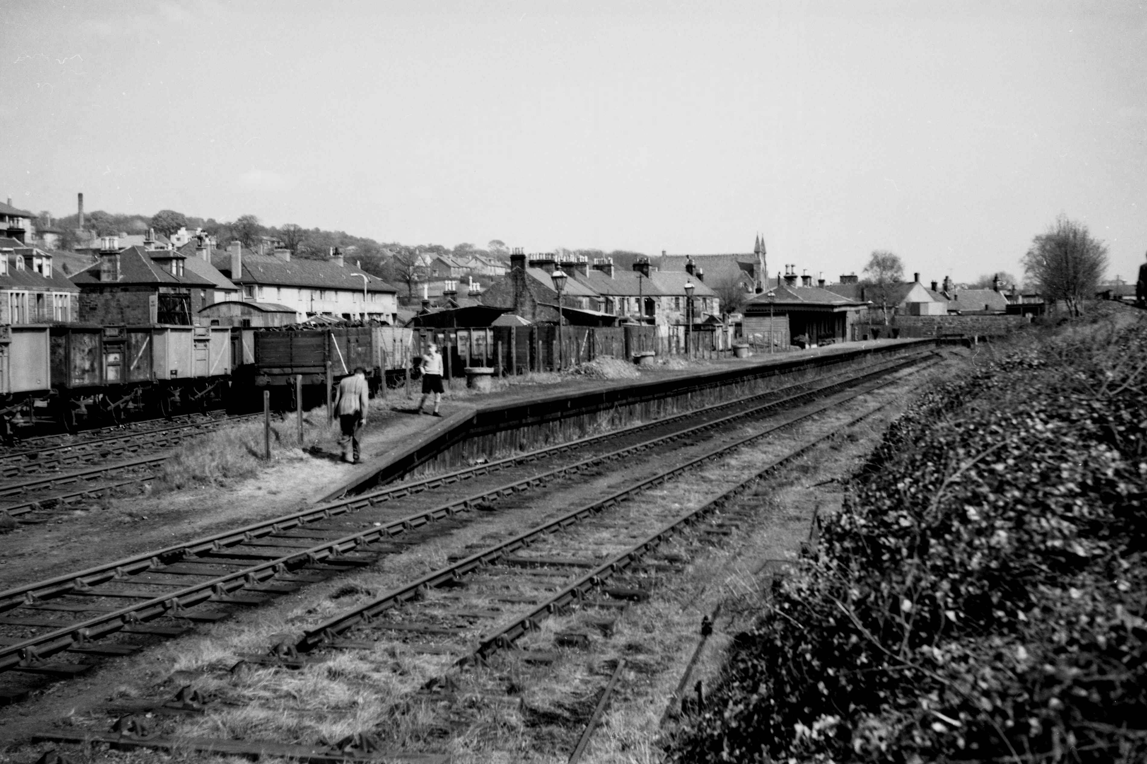
Kilsyth New railway station

Kilsyth New station served the town of Kilsyth in Scotland. The station was on the Kilsyth and Bonnybridge Railway. == History == The station opened on...
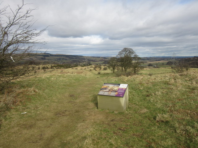
Antonine Wall

The Antonine Wall, known to the Romans as Vallum Antonini, was a turf fortification on stone foundations, built by the Romans across what is now the Central...

Kilsyth Rangers F.C.

Kilsyth Rangers Football Club are a Scottish football club based in the town of Kilsyth, North Lanarkshire. Nicknamed The Wee Gers, they were formed in...

Kilsyth railway station

Kilsyth Old station served the town of Kilsyth in Scotland. It was the original terminus of the Kelvin Valley Railway. == History == The station opened...

Nearby Amenities

Located within 500m of 55.970289,-4.0522237
Crossing
Crossing: unmarked
Crossing Island: no
Kerb: flush
Tactile Paving: yes
Lat/Long: 55.9682755/-4.0516626
Barrier: cycle_barrier
Bicycle: yes
Foot: yes
Motor Vehicle: no
Lat/Long: 55.9679871/-4.0534769
Auchinstarry
Is In: North Lanarkshire, Scotland, UK
Place: village
Lat/Long: 55.9674186/-4.0530177
Barrier: cycle_barrier
Lat/Long: 55.9682591/-4.0517953
Turning Circle
Lat/Long: 55.9734817/-4.0529848
Turning Circle
Lat/Long: 55.970979/-4.0587979
Turning Circle
Lat/Long: 55.9667195/-4.0493528
Parking
Wheelchair: yes
Lat/Long: 55.9666939/-4.0504685
Barrier: cycle_barrier
Bicycle: yes
Cycle Barrier: single
Foot: yes
Motor Vehicle: no
Lat/Long: 55.9681716/-4.0524861
Post Box
Source: survey
Lat/Long: 55.9716359/-4.0531205
Telephone
Booth: KX300
Covered: booth
Source: survey
Lat/Long: 55.9725702/-4.0560254
Crossing
Crossing: uncontrolled
Crossing Ref: zebra
Supervised: no
Lat/Long: 55.9728094/-4.0564688
Barrwood Colliery No1
Historic: mine
Lat/Long: 55.9719176/-4.0448682
Barrwood Colliery No2 Pit
Historic: mine
Lat/Long: 55.9740909/-4.0507369
Noexit: yes
Lat/Long: 55.9722288/-4.0582536
Post Box
Lat/Long: 55.972477/-4.0578045
Crossing
Crossing: unmarked
Lat/Long: 55.9718946/-4.0591856
Power: pole
Lat/Long: 55.9711774/-4.0464029
Power: pole
Lat/Long: 55.9711876/-4.0462179
Power: pole
Lat/Long: 55.9681332/-4.0587922
Power: pole
Lat/Long: 55.9680761/-4.0574965
Power: pole
Lat/Long: 55.9682766/-4.055957
Power: pole
Lat/Long: 55.9685285/-4.0547488
Power: pole
Lat/Long: 55.9685588/-4.0534155
Power: pole
Lat/Long: 55.9685798/-4.0525656
Power: pole
Lat/Long: 55.9686217/-4.0505886
Power: pole
Lat/Long: 55.9686066/-4.0495679
Power: pole
Lat/Long: 55.9685879/-4.048495
Power: pole
Lat/Long: 55.9685844/-4.0475659
Power: pole
Lat/Long: 55.9692186/-4.0471763
Power: pole
Lat/Long: 55.9701478/-4.0466014
Power: pole
Lat/Long: 55.9706724/-4.0462618
Power: pole
Lat/Long: 55.971225/-4.0459035
Power: pole
Lat/Long: 55.9686579/-4.0528447
Power: pole
Lat/Long: 55.971492/-4.0453556
Power: pole
Lat/Long: 55.9713824/-4.0452046
Power: pole
Lat/Long: 55.971348/-4.0453931
Power: pole
Lat/Long: 55.9707698/-4.0442765
Bus Stop
Auchenstarry, B802 southbound
Bus: yes
Departures Board: timetable
Naptan AtcoCode: 61602143
Naptan NaptanCode: 65278762
Public Transport: platform
Shelter: no
Lat/Long: 55.9672435/-4.0513302
Bus Stop
Auchenstarry, B802 at Auchinstarry Farm
Bus: yes
Departures Board: timetable
Naptan AtcoCode: 61601500
Naptan NaptanCode: 65237289
Public Transport: platform
Shelter: no
Lat/Long: 55.9675176/-4.0514764
Bus Stop
Kilsyth, Howe Road after Manse Road
Bus: yes
Departures Board: timetable
Naptan AtcoCode: 61601397
Naptan NaptanCode: 65235624
Public Transport: platform
Shelter: yes
Lat/Long: 55.970326/-4.0563064
Bus Stop
Kilsyth, Howe Road opp Manse Road
Bus: yes
Departures Board: timetable
Naptan AtcoCode: 61601398
Naptan NaptanCode: 65235969
Public Transport: platform
Shelter: no
Lat/Long: 55.9713526/-4.056754
Bus Stop
Kilsyth, Howe Road after Fisher Avenue
Bus: yes
Departures Board: timetable
Naptan AtcoCode: 61601400
Naptan NaptanCode: 65232526
Public Transport: platform
Shelter: no
Lat/Long: 55.9740736/-4.0562219
Bus Stop
Kilsyth, Howe Road after Murray Avenue
Bus: yes
Departures Board: timetable
Naptan AtcoCode: 61601399
Naptan NaptanCode: 65236943
Public Transport: platform
Shelter: no
Lat/Long: 55.9730241/-4.0563479
Bus Stop
Kilsyth, Manse Road after Howe Road
Bus: yes
Departures Board: timetable
Naptan AtcoCode: 61601396
Naptan NaptanCode: 65232854
Public Transport: platform
Shelter: no
Lat/Long: 55.9708292/-4.0560254
Bus Stop
Kilsyth, Manse Road before Howe Road
Bus: yes
Departures Board: timetable
Naptan AtcoCode: 61602096
Naptan NaptanCode: 65262525
Public Transport: platform
Shelter: no
Lat/Long: 55.9708189/-4.0557347
Bus Stop
Kilsyth, Manse Road opp Barlandfauld Street
Bus: yes
Departures Board: timetable
Naptan AtcoCode: 61601615
Naptan NaptanCode: 65236873
Public Transport: platform
Shelter: no
Lat/Long: 55.9720243/-4.0511931
Bus Stop
Kilsyth, Manse Road before Barlandfauld Street
Bus: yes
Departures Board: no
Naptan AtcoCode: 61601395
Naptan NaptanCode: 65235984
Public Transport: platform
Shelter: no
Lat/Long: 55.9720998/-4.0512291
Bus Stop
Kilsyth, Manse Road before South Barrwood
Bus: yes
Departures Board: timetable
Naptan AtcoCode: 61601393
Naptan NaptanCode: 65234968
Public Transport: platform
Shelter: no
Lat/Long: 55.9725987/-4.0480807
Bus Stop
Kilsyth, Manse Road opp South Barrwood
Bus: yes
Departures Board: timetable
Naptan AtcoCode: 61601394
Naptan NaptanCode: 65234858
Public Transport: platform
Shelter: no
Lat/Long: 55.9726718/-4.0481913
Sport: climbing
Lat/Long: 55.9694127/-4.0535895
The data included in this document is from www.openstreetmap.org. The data is made available under ODbL.

Have you been to Auchinstarry Loch?

Leave your review of Auchinstarry Loch below (or comments, questions and feedback).