Hole Bottom

Valley in Yorkshire Richmondshire

England

Hole Bottom

Old Moor Gate A little used bridleway.
Old Moor Gate Credit: Mick Garratt

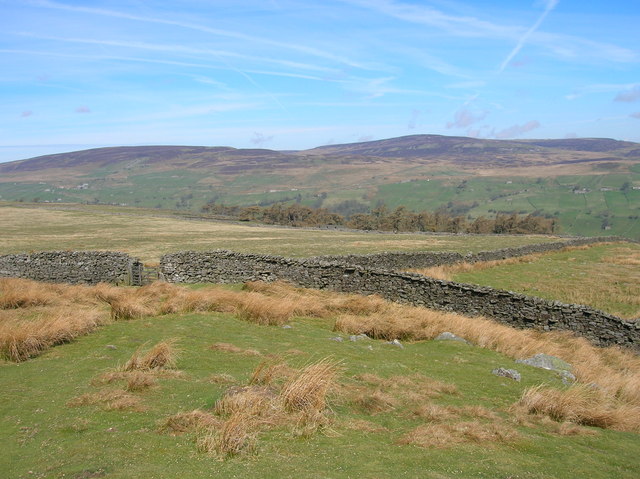
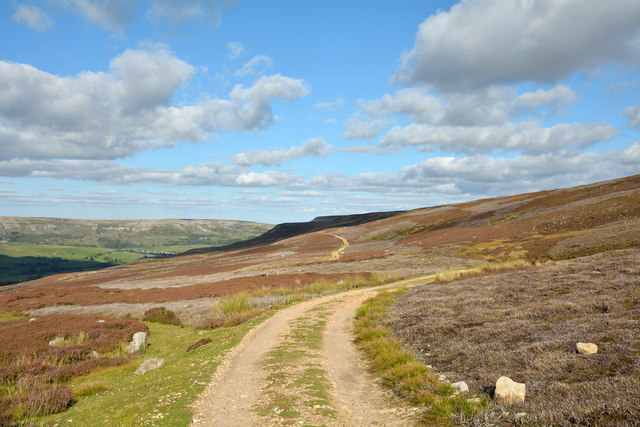
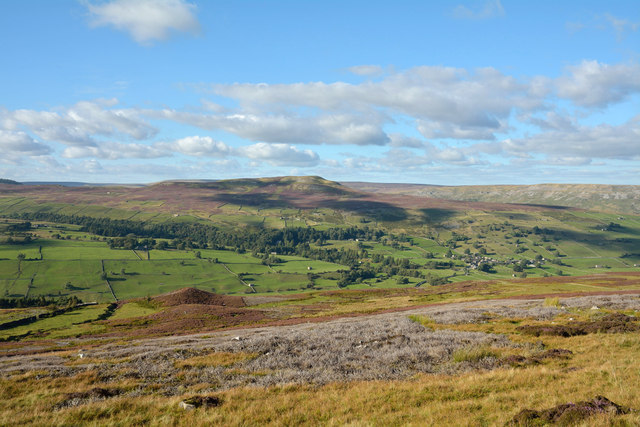
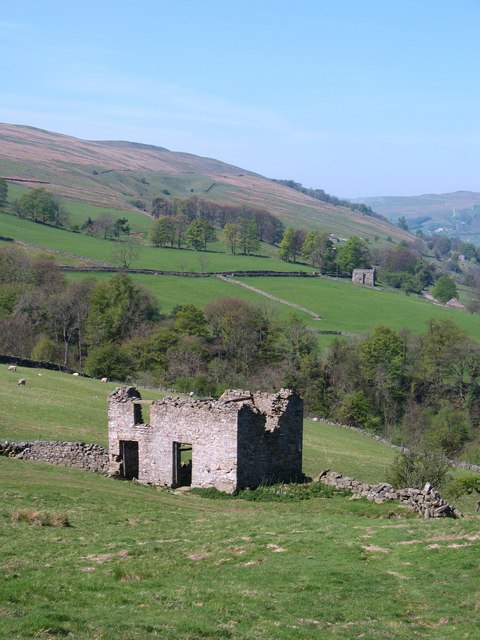
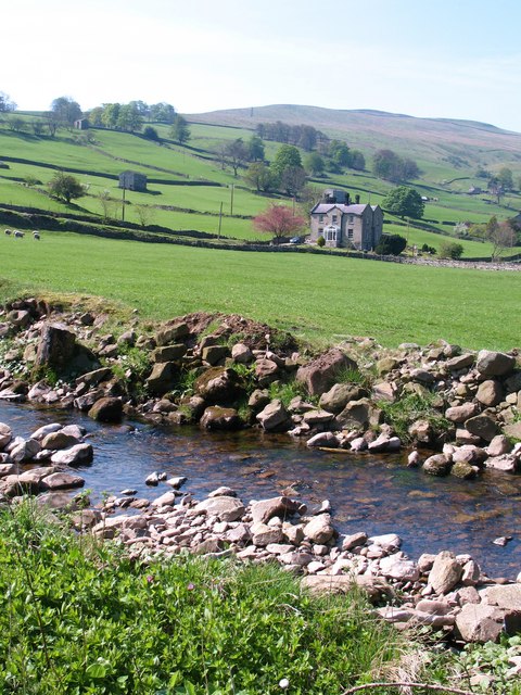
Hole Bottom is a picturesque valley located in Yorkshire, England. Nestled amidst the rolling hills of the Yorkshire Dales, this idyllic valley offers breathtaking natural beauty and a tranquil escape from the bustling city life.

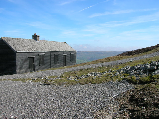
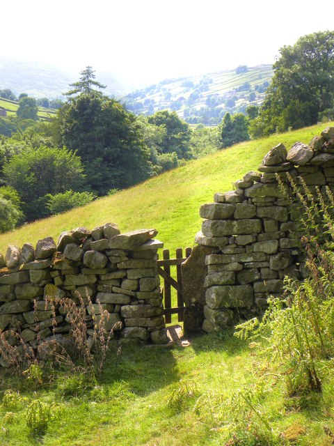
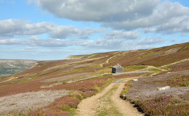
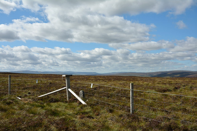
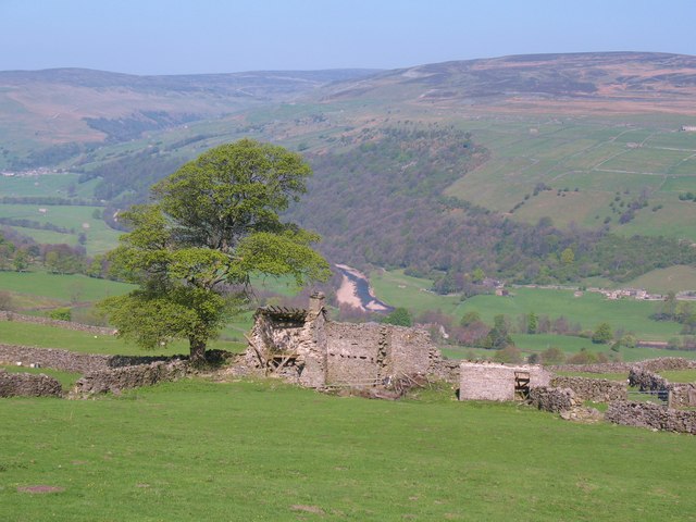
The valley is characterized by its lush green meadows, meandering streams, and charming stone cottages. The surrounding hills provide a stunning backdrop, with their rugged terrain and heather-clad slopes. Visitors to Hole Bottom can enjoy leisurely walks or hikes along the numerous footpaths that crisscross the valley, allowing them to fully immerse themselves in the serene countryside.

The valley is home to a diverse range of wildlife, including various species of birds, mammals, and insects. On a lucky day, visitors may spot elusive creatures such as red deer, hares, or even the occasional otter along the streams. The valley also boasts a rich array of plant life, with wildflowers carpeting the meadows during the spring and summer months.

For those seeking a taste of local culture, the nearby villages offer traditional pubs, charming tea rooms, and quaint shops that sell locally produced goods. The friendly locals are always happy to share stories and recommendations, ensuring a warm welcome for visitors.

Hole Bottom truly offers a peaceful retreat, allowing visitors to reconnect with nature and experience the timeless beauty of the Yorkshire countryside. Its unspoiled landscapes and charming atmosphere make it a must-visit destination for nature lovers and those seeking a respite from the hectic pace of modern life.

If you have any feedback on the listing, please let us know in the comments section below.
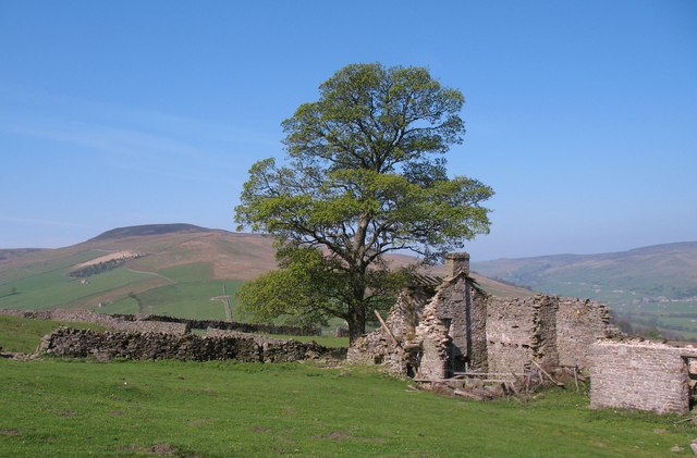
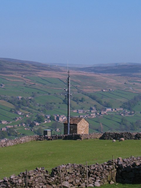
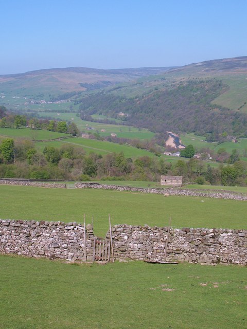
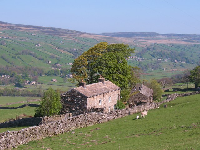
Hole Bottom Images

Images are sourced within 2km of 54.369331/-2.0092936 or Grid Reference SD9997. Thanks to Geograph Open Source API. All images are credited.

Old Moor Gate A little used bridleway.
Old Moor Gate
A little used bridleway.
Shooting Hut at Blue Hill
Swaledale footpath Part of what is an ancient route between Feetham and Healaugh contouring the hillside above the present B6270 which drops to the flood prone meadows by the Swale. At its eastern end this path heads for Barney Beck High Bridge, which also has medieval origins.
Swaledale footpath
Part of what is an ancient route between Feetham and Healaugh contouring the hillside above the present B6270 which drops to the flood prone meadows by the Swale. At its eastern end this path heads for Barney Beck High Bridge, which also has medieval origins.
Estate road below Beldow Hill Beldow Hill is a fairly vague location on the northern slope of High Carl and Gibbon Hill, which are themselves two minor features of the southern side of Swaledale. The road is heading eastwards towards a shooting hut where, on earlier visits the photographer has found a stuffed ram in one of the unlocked rooms! It was absent on this occasion.
Estate road below Beldow Hill
Beldow Hill is a fairly vague location on the northern slope of High Carl and Gibbon Hill, which are themselves two minor features of the southern side of Swaledale. The road is heading eastwards towards a shooting hut where, on earlier visits the photographer has found a stuffed ram in one of the unlocked rooms! It was absent on this occasion.
Estate road north of High Carl The road is on the southern slope of Swaledale; it follows a route which is also that of a bridleway.
Estate road north of High Carl
The road is on the southern slope of Swaledale; it follows a route which is also that of a bridleway.
Summit area of High Carl High Carl is a moorland hill top near to Apedale Head. The fence crosses close to the hill's highest point which may well be just beyond the fence line - OS mapping gives a spot height in that direction, west of the fence angle, at 555m. The low boundary stone is cut with a 'B' on the south side which is in view; there's the letter 'F' on the other side.
Summit area of High Carl
High Carl is a moorland hill top near to Apedale Head. The fence crosses close to the hill's highest point which may well be just beyond the fence line - OS mapping gives a spot height in that direction, west of the fence angle, at 555m. The low boundary stone is cut with a 'B' on the south side which is in view; there's the letter 'F' on the other side.
Slope descending near Browna Gill The slope is on the south side of Swaledale. Calver Hill is on the far side of the valley at the centre of the image with Fremington Edge to the right of it and more distant.
Slope descending near Browna Gill
The slope is on the south side of Swaledale. Calver Hill is on the far side of the valley at the centre of the image with Fremington Edge to the right of it and more distant.
Pond, Apedale Head A former pit shaft I think.
Pond, Apedale Head
A former pit shaft I think.
Ruins of Plaintree House Once a farmhouse on High Whitaside, this ruin would appear to have been abandoned over 50 years ago.
Ruins of Plaintree House
Once a farmhouse on High Whitaside, this ruin would appear to have been abandoned over 50 years ago.
Plaintree House ruins Situated above the 1000ft contour on High Whitaside, life here would have always been hard. One of several ruined farmhouses in the area. The hill of Blea Barf in the distance.
Plaintree House ruins
Situated above the 1000ft contour on High Whitaside, life here would have always been hard. One of several ruined farmhouses in the area. The hill of Blea Barf in the distance.
Technology comes to Swaledale New communications mast at High Whitaside.
Technology comes to Swaledale
New communications mast at High Whitaside.
Footpath at High Whitaside Heading downhill on Grinton parish footpath number 46. The Swale can be seen in the distance with large areas of pebble showing due to the dry spring weather.
Footpath at High Whitaside
Heading downhill on Grinton parish footpath number 46. The Swale can be seen in the distance with large areas of pebble showing due to the dry spring weather.
Lane House One of several farmhouses, some of which have been converted for holiday use, that are scattered along the hillside at High Whitaside.  Most settlement in Swaledale is on the north side to catch the sun and take advantage of better ground, but here the steep southern slopes of the dale relent to provide an area of relatively sunny ground with reasonable soils.
Lane House
One of several farmhouses, some of which have been converted for holiday use, that are scattered along the hillside at High Whitaside. Most settlement in Swaledale is on the north side to catch the sun and take advantage of better ground, but here the steep southern slopes of the dale relent to provide an area of relatively sunny ground with reasonable soils.
Ruined barn , High Whitaside There are many Dales barns in this sort of state, and others which are in danger of going the same way unless money is spent on them.  When a barn has no particular use, what do you do with it?
Ruined barn , High Whitaside
There are many Dales barns in this sort of state, and others which are in danger of going the same way unless money is spent on them. When a barn has no particular use, what do you do with it?
Twin bridges over Haverdale Beck The public footpath crosses the concrete beam bridge on the left. This looks like one of the typical North Riding bridges of the 1960's, whilst to the right is a farmers sleeper bridge giving acees to the fields.
Twin bridges over Haverdale Beck
The public footpath crosses the concrete beam bridge on the left. This looks like one of the typical North Riding bridges of the 1960's, whilst to the right is a farmers sleeper bridge giving acees to the fields.
Waterfall on Haverdale Beck [1] Haverdale Beck splashes its way down over limestone outcrops below Crackpot hamlet.
Waterfall on Haverdale Beck [1]
Haverdale Beck splashes its way down over limestone outcrops below Crackpot hamlet.
Waterfall on Haverdale Beck [2] A few metres below the first fall is this larger one which is between 2 and 3 metres high. The rock lip is carboniferous limestone in the Yoredale series.
Waterfall on Haverdale Beck [2]
A few metres below the first fall is this larger one which is between 2 and 3 metres high. The rock lip is carboniferous limestone in the Yoredale series.
Haverdale beck and 'The Gables' Looking across the final section of Haverdale Beck towards The Gables Guest House, which was originally the vicarage for Melbecks parish. This seems a trifle odd as the house is within Grinton parish.
Haverdale beck and 'The Gables'
Looking across the final section of Haverdale Beck towards The Gables Guest House, which was originally the vicarage for Melbecks parish. This seems a trifle odd as the house is within Grinton parish.
Show me another place!

Hole Bottom is located at Grid Ref: SD9997 (Lat: 54.369331, Lng: -2.0092936)

Division: North Riding

Administrative County: North Yorkshire

District: Richmondshire

Police Authority: North Yorkshire

What 3 Words

///bookcases.ringers.brothers. Near Leyburn, North Yorkshire

Related Wikis

Feetham

Feetham is a hamlet opposite Low Row in the Yorkshire Dales, North Yorkshire, England. The origin of the place-name is from Old Norse and means place at...

Low Row

Low Row is a village in Swaledale, in the Yorkshire Dales, North Yorkshire, England. It lies about 3 miles west of Reeth and is between Healaugh and Gunnerside...

Kearton

Kearton is a hamlet in the Yorkshire Dales, North Yorkshire, England. Kearton is situated near Low Row and Reeth. == References == == External links... ==

Crackpot, North Yorkshire

Crackpot is a village in Swaledale, North Yorkshire, England. Its name derives from the Old English kraka (crow) and the Viking word pot (usually a pit...

Maiden Castle, North Yorkshire

Maiden Castle is a settlement in Grinton, North Yorkshire (grid reference SE02189808) which probably dates from the Iron Age. It is listed as a Scheduled...

Healaugh, Richmondshire

Healaugh (pronounced "hee-law") is a small village in the civil parish of Reeth, Fremington and Healaugh, in Swaledale in the Yorkshire Dales. It is in...

Calver Hill

Calver Hill is a fell in the Yorkshire Dales National Park in North Yorkshire, England. It is composed of limestone and is situated at grid reference NZ012003...

Richmondshire

Richmondshire was a local government district of North Yorkshire, England, from 1974 to 2023. It covered a large northern area of the Yorkshire Dales including...

Nearby Amenities

Located within 500m of 54.369331,-2.0092936
Green Hills Mine
Historic: mine
Source: gps survey
Lat/Long: 54.3677388/-2.0031206
Barrier: entrance
Lat/Long: 54.3706962/-2.0151781
Barrier: entrance
Lat/Long: 54.3710223/-2.0138055
Barrier: entrance
Lat/Long: 54.3715358/-2.0119415
Barrier: entrance
Lat/Long: 54.3718796/-2.0092388
Barrier: entrance
Lat/Long: 54.3719606/-2.0071634
The data included in this document is from www.openstreetmap.org. The data is made available under ODbL.

Have you been to Hole Bottom?

Leave your review of Hole Bottom below (or comments, questions and feedback).