Birks Plantation

Wood, Forest in Yorkshire Richmondshire

England

Birks Plantation

Morley Gate
Morley Gate Credit: Mick Garratt

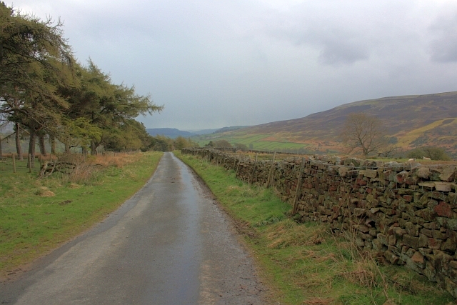
Birks Plantation, located in Yorkshire, is a picturesque woodland area encompassing approximately 100 acres. Situated near the village of Wood, it forms an integral part of the local landscape and is a popular destination for nature enthusiasts and hikers.

The forest is predominantly composed of native tree species such as oak, beech, and birch, creating a diverse and vibrant habitat for a wide range of flora and fauna. The woodland floor is adorned with an array of wildflowers, creating a colorful carpet during the spring and summer months.

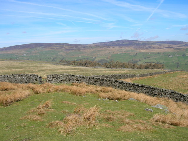
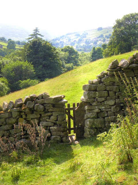
Birks Plantation is crisscrossed by numerous walking trails, allowing visitors to explore its beauty at their own pace. These well-maintained paths offer scenic views of the surrounding countryside, including rolling hills and meandering streams. One of the highlights of the forest is a tranquil pond, providing a serene spot for relaxation and wildlife observation.

The plantation is also home to a variety of wildlife, including deer, foxes, and numerous bird species. Birdwatchers will delight in the opportunity to spot native and migratory birds, such as woodpeckers, owls, and warblers.

Managed by the Yorkshire Wildlife Trust, Birks Plantation plays a vital role in conservation efforts and biodiversity preservation. The trust actively promotes sustainable practices and organizes educational events to raise awareness about the importance of protecting natural habitats.

Overall, Birks Plantation in Yorkshire offers visitors a tranquil escape into nature, with its stunning woodlands, diverse wildlife, and well-maintained trails. Whether one seeks solitude, exercise, or an opportunity to learn about the local environment, this forest is a must-visit destination.

If you have any feedback on the listing, please let us know in the comments section below.

Birks Plantation Images

Images are sourced within 2km of 54.374858/-2.0100337 or Grid Reference SD9997. Thanks to Geograph Open Source API. All images are credited.
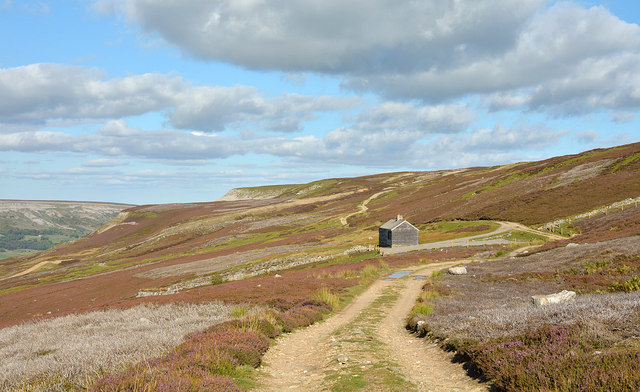
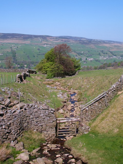
Morley Gate
Morley Gate
Old Moor Gate A little used bridleway.
Old Moor Gate
A little used bridleway.
Shooting Hut at Blue Hill
Swaledale footpath Part of what is an ancient route between Feetham and Healaugh contouring the hillside above the present B6270 which drops to the flood prone meadows by the Swale. At its eastern end this path heads for Barney Beck High Bridge, which also has medieval origins.
Swaledale footpath
Part of what is an ancient route between Feetham and Healaugh contouring the hillside above the present B6270 which drops to the flood prone meadows by the Swale. At its eastern end this path heads for Barney Beck High Bridge, which also has medieval origins.
Birk Park from near Nova Scotia The name 'Birk' often appears in Yorkshire [Birk Crag at Harrogate, Birkenshaw etc] and refers to birch trees, usually the first coloniser of rough moorland. The view is SW across Swaledale towards Blea Barf, the fell on the far side of the valley.
Birk Park from near Nova Scotia
The name 'Birk' often appears in Yorkshire [Birk Crag at Harrogate, Birkenshaw etc] and refers to birch trees, usually the first coloniser of rough moorland. The view is SW across Swaledale towards Blea Barf, the fell on the far side of the valley.
Estate road below Beldow Hill Beldow Hill is a fairly vague location on the northern slope of High Carl and Gibbon Hill, which are themselves two minor features of the southern side of Swaledale. The road is heading eastwards towards a shooting hut where, on earlier visits the photographer has found a stuffed ram in one of the unlocked rooms! It was absent on this occasion.
Estate road below Beldow Hill
Beldow Hill is a fairly vague location on the northern slope of High Carl and Gibbon Hill, which are themselves two minor features of the southern side of Swaledale. The road is heading eastwards towards a shooting hut where, on earlier visits the photographer has found a stuffed ram in one of the unlocked rooms! It was absent on this occasion.
Estate road north of High Carl The road is on the southern slope of Swaledale; it follows a route which is also that of a bridleway.
Estate road north of High Carl
The road is on the southern slope of Swaledale; it follows a route which is also that of a bridleway.
Slope descending near Browna Gill The slope is on the south side of Swaledale. Calver Hill is on the far side of the valley at the centre of the image with Fremington Edge to the right of it and more distant.
Slope descending near Browna Gill
The slope is on the south side of Swaledale. Calver Hill is on the far side of the valley at the centre of the image with Fremington Edge to the right of it and more distant.
Hillside barn near Healaugh Field barn set above the level flood prone land beside the Swale.
Hillside barn near Healaugh
Field barn set above the level flood prone land beside the Swale.
Technology comes to Swaledale New communications mast at High Whitaside.
Technology comes to Swaledale
New communications mast at High Whitaside.
Lane House One of several farmhouses, some of which have been converted for holiday use, that are scattered along the hillside at High Whitaside.  Most settlement in Swaledale is on the north side to catch the sun and take advantage of better ground, but here the steep southern slopes of the dale relent to provide an area of relatively sunny ground with reasonable soils.
Lane House
One of several farmhouses, some of which have been converted for holiday use, that are scattered along the hillside at High Whitaside. Most settlement in Swaledale is on the north side to catch the sun and take advantage of better ground, but here the steep southern slopes of the dale relent to provide an area of relatively sunny ground with reasonable soils.
Ruined barn , High Whitaside There are many Dales barns in this sort of state, and others which are in danger of going the same way unless money is spent on them.  When a barn has no particular use, what do you do with it?
Ruined barn , High Whitaside
There are many Dales barns in this sort of state, and others which are in danger of going the same way unless money is spent on them. When a barn has no particular use, what do you do with it?
Haverdale beck and 'The Gables' Looking across the final section of Haverdale Beck towards The Gables Guest House, which was originally the vicarage for Melbecks parish. This seems a trifle odd as the house is within Grinton parish.
Haverdale beck and 'The Gables'
Looking across the final section of Haverdale Beck towards The Gables Guest House, which was originally the vicarage for Melbecks parish. This seems a trifle odd as the house is within Grinton parish.
Footbridge over Mirk Gill Old stone footbridge over Mirk Gill, close to Hops House.
Footbridge over Mirk Gill
Old stone footbridge over Mirk Gill, close to Hops House.
Hops House One of several old farmhouses scattered along the hillside at High Whitaside. Access by foot, horse, or possibly bicycle.
Hops House
One of several old farmhouses scattered along the hillside at High Whitaside. Access by foot, horse, or possibly bicycle.
Birks Gill Birks Gill should mean 'gill of the birches', but the only tree in evidence here appears to be an ash. The beck is almost completely dry following weeks with very little rainfall.
Birks Gill
Birks Gill should mean 'gill of the birches', but the only tree in evidence here appears to be an ash. The beck is almost completely dry following weeks with very little rainfall.
Ruins at Birks End There are ruins either side of the gill at Birks End and it is difficult to work out if either was once a house. This building is unusual in that it has steeply angled gables, which would suggest that it once had a ling thatched roof. The Birks End farmhouse on the modern map is a few metres further up the hillside.
Ruins at Birks End
There are ruins either side of the gill at Birks End and it is difficult to work out if either was once a house. This building is unusual in that it has steeply angled gables, which would suggest that it once had a ling thatched roof. The Birks End farmhouse on the modern map is a few metres further up the hillside.
Mirk Gill Unlike its neighbour Birk Gill, this gill actually has water running down it. Swaledale gets plenty of rain, but the first few months of 2011 have been unusually dry.
Mirk Gill
Unlike its neighbour Birk Gill, this gill actually has water running down it. Swaledale gets plenty of rain, but the first few months of 2011 have been unusually dry.
Show me another place!

Birks Plantation is located at Grid Ref: SD9997 (Lat: 54.374858, Lng: -2.0100337)

Division: North Riding

Administrative County: North Yorkshire

District: Richmondshire

Police Authority: North Yorkshire

What 3 Words

///eclipses.encourage.reap. Near Leyburn, North Yorkshire

Related Wikis

Feetham

Feetham is a hamlet opposite Low Row in the Yorkshire Dales, North Yorkshire, England. The origin of the place-name is from Old Norse and means place at...

Kearton

Kearton is a hamlet in the Yorkshire Dales, North Yorkshire, England. Kearton is situated near Low Row and Reeth. == References == == External links... ==

Low Row

Low Row is a village in Swaledale, in the Yorkshire Dales, North Yorkshire, England. It lies about 3 miles west of Reeth and is between Healaugh and Gunnerside...

Crackpot, North Yorkshire

Crackpot is a village in Swaledale, North Yorkshire, England. Its name derives from the Old English kraka (crow) and the Viking word pot (usually a pit...

Healaugh, Richmondshire

Healaugh (pronounced "hee-law") is a small village in the civil parish of Reeth, Fremington and Healaugh, in Swaledale in the Yorkshire Dales. It is in...

Maiden Castle, North Yorkshire

Maiden Castle is a settlement in Grinton, North Yorkshire (grid reference SE02189808) which probably dates from the Iron Age. It is listed as a Scheduled...

Calver Hill

Calver Hill is a fell in the Yorkshire Dales National Park in North Yorkshire, England. It is composed of limestone and is situated at grid reference NZ012003...

Gunnerside

Gunnerside is a village in North Yorkshire, England. It is situated in Swaledale, on the B6270 road, 3 miles (5 km) east of Muker and 6 miles (10 km) west...

Nearby Amenities

Located within 500m of 54.374858,-2.0100337
Barrier: entrance
Lat/Long: 54.3710223/-2.0138055
Barrier: entrance
Lat/Long: 54.3715358/-2.0119415
Barrier: entrance
Lat/Long: 54.3718796/-2.0092388
Barrier: entrance
Lat/Long: 54.3719606/-2.0071634
Barrier: entrance
Lat/Long: 54.3775178/-2.0061975
Barrier: stile
Lat/Long: 54.3761668/-2.0161064
Barrier: stile
Lat/Long: 54.3762422/-2.0158491
Barrier: stile
Stile: stepover
Lat/Long: 54.3782218/-2.0060362
Power: pole
Lat/Long: 54.3779173/-2.0047112
Power: pole
Lat/Long: 54.3778673/-2.0060349
Power: pole
Lat/Long: 54.3777923/-2.0075932
Power: pole
Lat/Long: 54.3777392/-2.0088941
Power: pole
Lat/Long: 54.3776549/-2.01014
Power: pole
Lat/Long: 54.3775721/-2.0114395
Power: pole
Lat/Long: 54.3775182/-2.0122173
Power: pole
Lat/Long: 54.3772479/-2.0134686
Power: pole
Lat/Long: 54.3770128/-2.0145884
Power: pole
Lat/Long: 54.3768222/-2.0154561
Power: pole
Lat/Long: 54.3764136/-2.016238
Power: pole
Lat/Long: 54.376498/-2.0091207
Power: pole
Lat/Long: 54.3770464/-2.0103465
Barrier: stile
Lat/Long: 54.3777908/-2.0106617
Feetham Holme
Place: isolated_dwelling
Lat/Long: 54.3769965/-2.0138178
Usha Top Farm
Place: farm
Lat/Long: 54.3763565/-2.0126208
The data included in this document is from www.openstreetmap.org. The data is made available under ODbL.

Have you been to Birks Plantation?

Leave your review of Birks Plantation below (or comments, questions and feedback).