Derwentdale

Valley in Durham

England

Derwentdale

Lead Mining Trail on Edmondbyers Common This ancient bridleway runs along the crest of Edmondbyers Common and has been signed by Durham County Council as the Lead Mining Trail between Edmondbyers and Cowshill in Weardale
Lead Mining Trail on Edmondbyers Common Credit: Oliver Dixon

Derwentdale is a picturesque valley located in County Durham, England. Situated along the River Derwent, this scenic area is renowned for its natural beauty and rich history. The valley stretches approximately 20 miles from its source in the North Pennines to its confluence with the River Tyne.

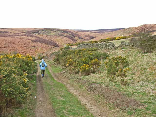
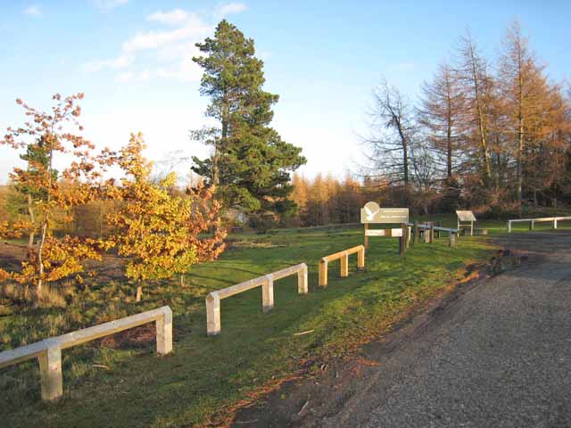
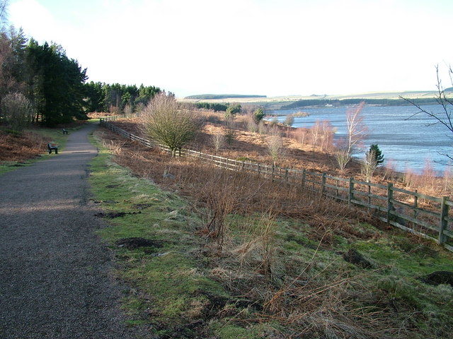
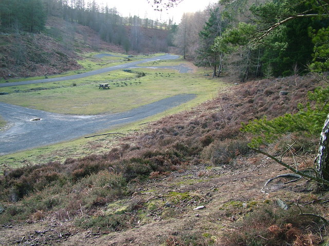
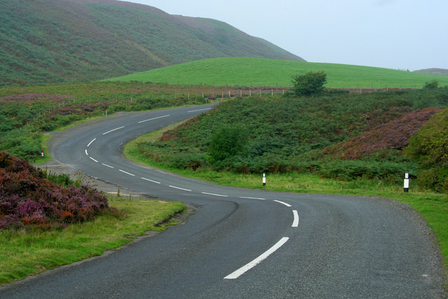
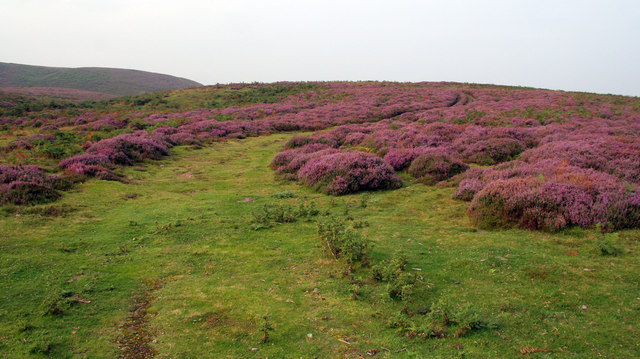
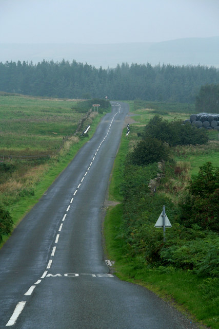
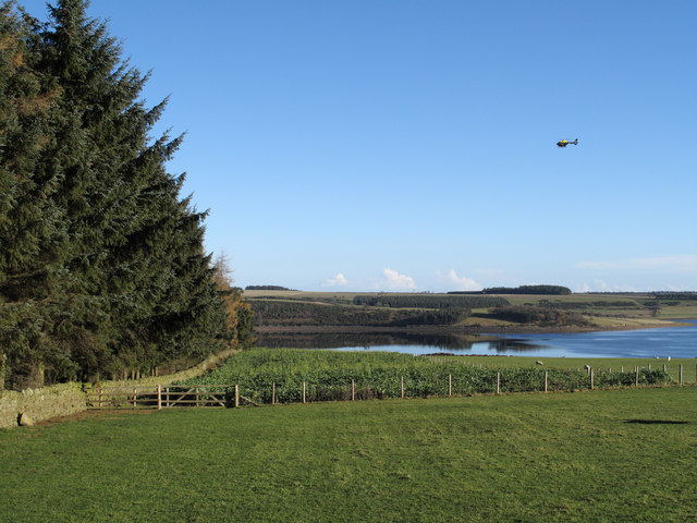
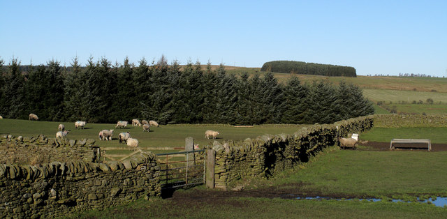
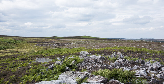
Derwentdale is known for its rolling hills, lush green fields, and charming villages that dot the landscape. The valley is surrounded by stunning countryside, making it a popular destination for outdoor enthusiasts. Hiking and walking trails, such as the Derwent Walk, provide visitors with the opportunity to explore the area's stunning scenery and enjoy panoramic views.

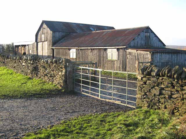
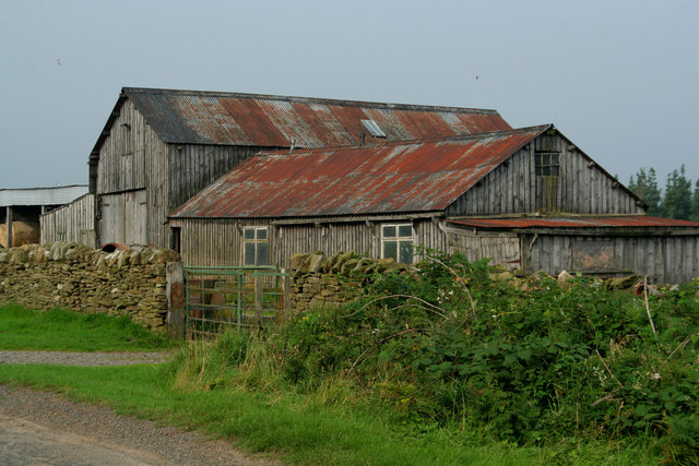
In addition to its natural beauty, Derwentdale boasts a fascinating history. The valley is home to several historic sites, including the medieval Blanchland Abbey, which was founded in the 12th century. The area also played a significant role in the industrial revolution, with coal mining and lead mining being major industries in the past. Remnants of this industrial heritage can still be seen in the form of old mining buildings and ruins.

The villages in Derwentdale, such as Blanchland, Shotley Bridge, and Blackhall Mill, offer a glimpse into the region's past, with their charming stone houses and traditional architecture. Visitors can explore local shops, pubs, and cafes, immersing themselves in the area's unique character.

Overall, Derwentdale is a captivating destination that seamlessly combines natural beauty with a rich cultural heritage. Its stunning landscapes, historic sites, and welcoming villages make it an ideal place to visit for those seeking tranquility and a taste of rural England.

If you have any feedback on the listing, please let us know in the comments section below.
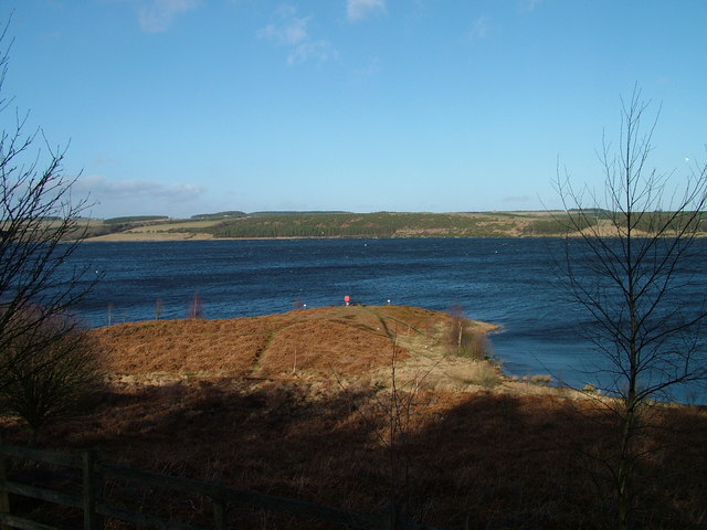
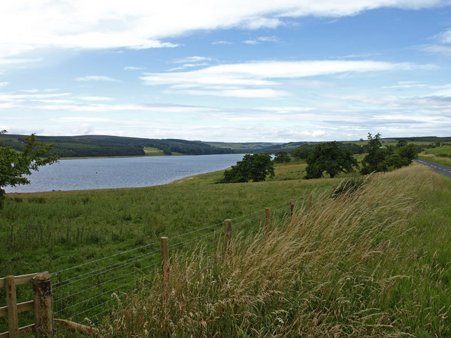
Derwentdale Images

Images are sourced within 2km of 54.859629/-2.0127584 or Grid Reference NY9951. Thanks to Geograph Open Source API. All images are credited.

Lead Mining Trail on Edmondbyers Common This ancient bridleway runs along the crest of Edmondbyers Common and has been signed by Durham County Council as the Lead Mining Trail between Edmondbyers and Cowshill in Weardale
Lead Mining Trail on Edmondbyers Common
This ancient bridleway runs along the crest of Edmondbyers Common and has been signed by Durham County Council as the Lead Mining Trail between Edmondbyers and Cowshill in Weardale
Pow Hill Country Park <span class="nowrap"><a title="http://www.durham.gov.uk/durhamcc/usp.nsf/pws/Parks+and+Picnic+Areas+-+Pow+Hill" rel="nofollow ugc noopener" href="http://www.durham.gov.uk/durhamcc/usp.nsf/pws/Parks+and+Picnic+Areas+-+Pow+Hill">Link</a><img style="margin-left:2px;" alt="External link" title="External link - shift click to open in new window" src="https://s1.geograph.org.uk/img/external.png" width="10" height="10"/></span> Upper picnic site, next to the road.
Pow Hill Country Park
LinkExternal link Upper picnic site, next to the road.
Haybales near Ruffside Hall
Barn near Ruffside Hall
Derwent Reservoir from Pow Hill Country Park
Pow Hill Country Park
Berry Bank The B6306 crossing Skinny Burn at Berry Bank.
Berry Bank
The B6306 crossing Skinny Burn at Berry Bank.
Berry Bank Track leading up through the heather on Berry Bank.
Berry Bank
Track leading up through the heather on Berry Bank.
Ruffside Wooden barns near Ruffside.
Ruffside
Wooden barns near Ruffside.
B6306 The B6306 beneath Berry Bank.
B6306
The B6306 beneath Berry Bank.
Govan Gill View looking up Goven Gill at Black Hole.
Govan Gill
View looking up Goven Gill at Black Hole.
Derwent reservoir View from the road on the northern side of the reservoir.
Derwent reservoir
View from the road on the northern side of the reservoir.
Fields descending towards Derwent Reservoir The view downhill towards the reservoir is from the B6306. Hunter House Plantation lies to the left in this image and a helicopter flies through.
Fields descending towards Derwent Reservoir
The view downhill towards the reservoir is from the B6306. Hunter House Plantation lies to the left in this image and a helicopter flies through.
Low Hospital Plantation Low Hospital Plantation is seen here over walls and fields from the B6306. The plantation on the skyline is on the north side of Derwent Reservoir on Pithouse Fell.
Low Hospital Plantation
Low Hospital Plantation is seen here over walls and fields from the B6306. The plantation on the skyline is on the north side of Derwent Reservoir on Pithouse Fell.
Corrugated metal barn The corrugated metal barn stands to the north of the B6306 and has a corrugated roof too - by appearance it's probably of asbestos. In front of the barn sits a pile of the now almost ubiquitous, plastic-shrouded bales of silage.
Corrugated metal barn
The corrugated metal barn stands to the north of the B6306 and has a corrugated roof too - by appearance it's probably of asbestos. In front of the barn sits a pile of the now almost ubiquitous, plastic-shrouded bales of silage.
Rocks along sparsely vegetated rib of ground Close to the village of Edmundbyers, low heather is growing along a minor ridge of ground with scattered angular rocks. The shallow-angled moorland cones in the distance are not named on OS maps but are where Matt's Sheepfold is located.
Rocks along sparsely vegetated rib of ground
Close to the village of Edmundbyers, low heather is growing along a minor ridge of ground with scattered angular rocks. The shallow-angled moorland cones in the distance are not named on OS maps but are where Matt's Sheepfold is located.
Barn, Black Hole
Barn, Black Hole
Show me another place!

Derwentdale is located at Grid Ref: NY9951 (Lat: 54.859629, Lng: -2.0127584)

Unitary Authority: County Durham

Police Authority: Durham

What 3 Words

///grid.walls.diverts. Near Muggleswick, Co. Durham

Related Wikis

Pow Hill Bog

Pow Hill Bog is a Site of Special Scientific Interest in the Wear Valley district of County Durham, England. It lies alongside Derwent Reservoir, approximately...

Derwent Reservoir (North East England)

The Derwent Reservoir is a reservoir on the River Derwent, on the border between County Durham and Northumberland, in England. It is west of Consett. It...

Edmundbyers

Edmundbyers is a village in County Durham, in England. It is situated a few miles to the west of Consett, near Derwent Reservoir. In 2001 it had a population...

Blanchland Abbey

Blanchland Abbey at Blanchland, in the English county of Northumberland, was founded as a premonstratensian priory in 1165 by Walter de Bolbec II, and...

Nearby Amenities

Located within 500m of 54.859629,-2.0127584
Ruffside
Place: locality
Lat/Long: 54.8581144/-2.0143233
Bus Stop
Ruffside
Naptan AtcoCode: 13001076B
Naptan Bearing: NE
Naptan CommonName: Ruffside
Naptan Indicator: north east bound
Naptan Landmark: Landmark not known
Naptan NaptanCode: duradadp
Naptan Notes: South of 5 Fell Farm.
Naptan Street: B6306
Naptan Verified: no
Source: naptan_import
Lat/Long: 54.8582154/-2.0152974
Bus Stop
Ruffside
Naptan AtcoCode: 13001076F
Naptan Bearing: SW
Naptan CommonName: Ruffside
Naptan Indicator: south west bound
Naptan Landmark: Landmark not known
Naptan NaptanCode: duradadt
Naptan Notes: Opposite the south side of 5 Fell Farm.
Naptan Street: B6306
Naptan Verified: no
Source: naptan_import
Lat/Long: 54.8581525/-2.0152506
Bus Stop
Ruffside Hall
Naptan AtcoCode: 13001077B
Naptan Bearing: NE
Naptan CommonName: Ruffside Hall
Naptan Indicator: north east bound
Naptan Landmark: Landmark not known
Naptan NaptanCode: duradadw
Naptan Notes: Eastern entrance to Ruffside Hall.
Naptan Street: B6306
Naptan Verified: no
Source: naptan_import
Lat/Long: 54.8605436/-2.0087085
Bus Stop
Ruffside Hall
Naptan AtcoCode: 13001077F
Naptan Bearing: SW
Naptan CommonName: Ruffside Hall
Naptan Indicator: south west bound
Naptan Landmark: Landmark not known
Naptan NaptanCode: duradaga
Naptan Notes: Eastern entrance to Ruffside Hall.
Naptan Street: B6306
Naptan Verified: no
Source: naptan_import
Lat/Long: 54.8604627/-2.0086306
Turning Loop
Lat/Long: 54.8610926/-2.0126108
Fell Farm
Place: farm
Source Name: OS OpenData StreetView
Lat/Long: 54.8589581/-2.0150471
Barrier: yes
Lat/Long: 54.860654/-2.008537
The data included in this document is from www.openstreetmap.org. The data is made available under ODbL.

Have you been to Derwentdale?

Leave your review of Derwentdale below (or comments, questions and feedback).