Bridge Plantation

Wood, Forest in Durham

England

Bridge Plantation

Pow Hill Country Park <span class="nowrap"><a title="http://www.durham.gov.uk/durhamcc/usp.nsf/pws/Parks+and+Picnic+Areas+-+Pow+Hill" rel="nofollow ugc noopener" href="http://www.durham.gov.uk/durhamcc/usp.nsf/pws/Parks+and+Picnic+Areas+-+Pow+Hill">Link</a><img style="margin-left:2px;" alt="External link" title="External link - shift click to open in new window" src="https://s1.geograph.org.uk/img/external.png" width="10" height="10"/></span> Upper picnic site, next to the road.
Pow Hill Country Park Credit: Oliver Dixon

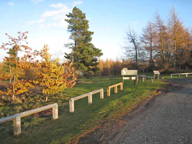
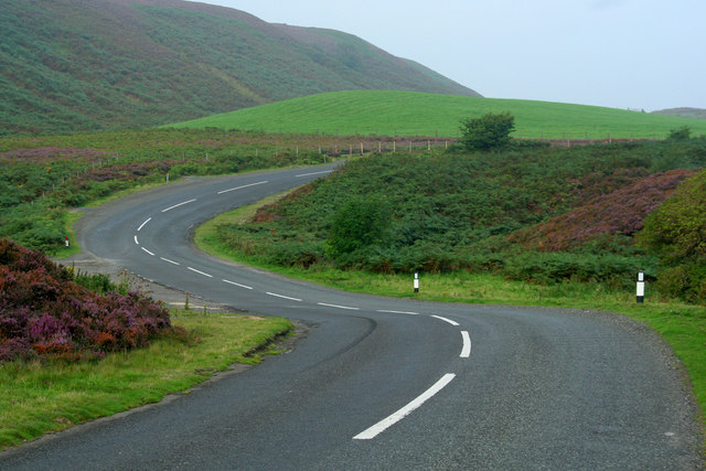
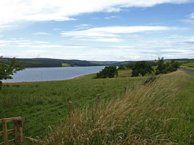
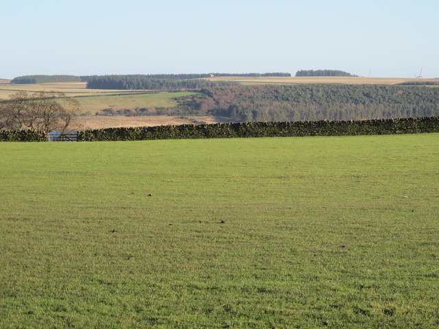
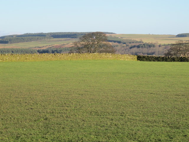
Bridge Plantation is a picturesque woodland located in Durham, England. It is nestled in the heart of the county, offering visitors a serene and tranquil escape from the bustling city life. The plantation is situated on the outskirts of the village of Bridge, surrounded by lush greenery and a diverse range of flora and fauna.

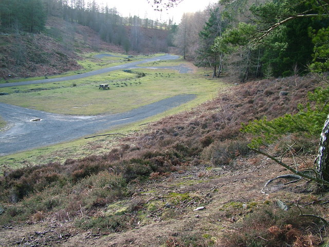
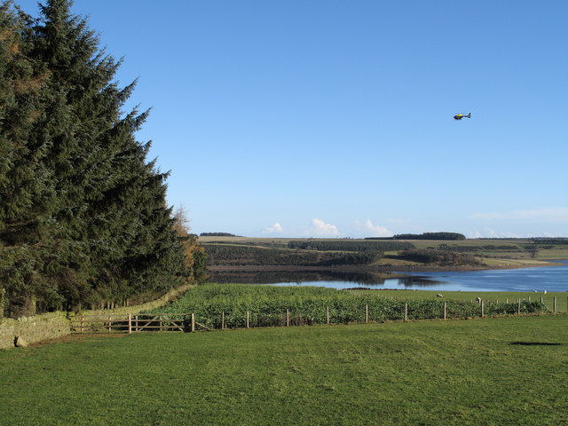
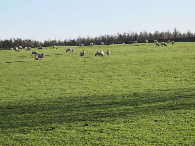
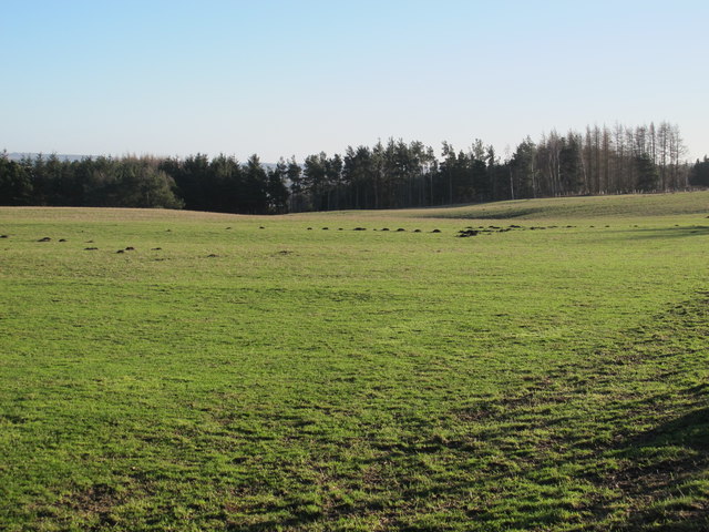
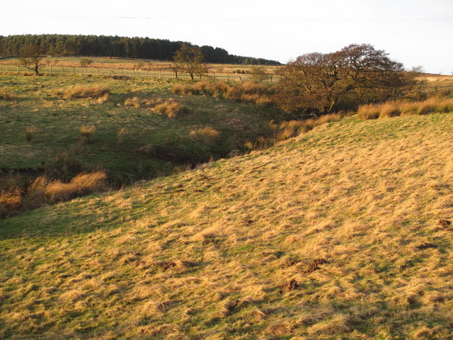
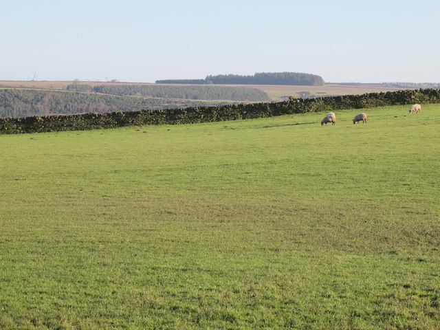
Covering an expansive area, Bridge Plantation boasts a rich and diverse ecosystem. The woodland is predominantly composed of tall, majestic trees, such as oak, beech, and ash, which create a dense canopy overhead. These trees provide a haven for various species of birds, including woodpeckers, owls, and songbirds, making it a paradise for birdwatchers.

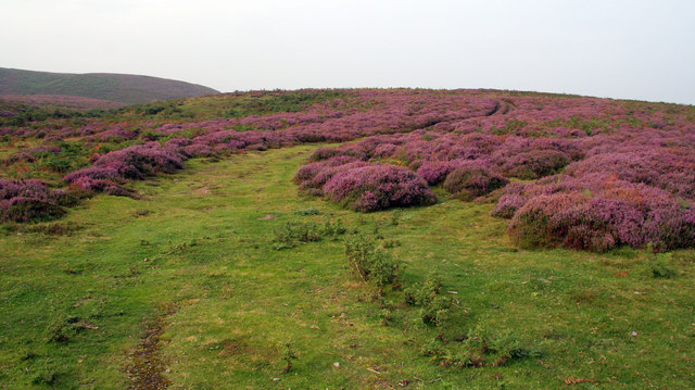
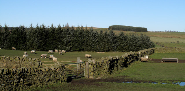
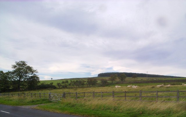
The forest floor is carpeted with a vibrant array of wildflowers, creating a stunning display of colors during the spring and summer months. Visitors can also spot various species of woodland animals, such as deer, foxes, and squirrels, as they roam freely in their natural habitat.

Bridge Plantation offers a range of amenities to enhance visitors' experience. Well-maintained walking trails weave through the woodland, allowing nature enthusiasts to explore the plantation at their own pace. Picnic areas are scattered throughout the area, providing a perfect spot for families and friends to relax and enjoy a meal amidst the serene surroundings.

Nature conservation is of paramount importance at Bridge Plantation. The woodland is managed by local authorities, who work tirelessly to protect and preserve its natural beauty. Educational programs and guided tours are also organized to raise awareness about the importance of ecological sustainability and the diverse wildlife that calls the plantation home.

In summary, Bridge Plantation in Durham is a captivating woodland that offers a peaceful retreat for nature lovers. With its majestic trees, colorful wildflowers, and abundant wildlife, it provides a perfect setting to reconnect with nature and escape the stresses of everyday life.

If you have any feedback on the listing, please let us know in the comments section below.

Bridge Plantation Images

Images are sourced within 2km of 54.861111/-2.0150021 or Grid Reference NY9951. Thanks to Geograph Open Source API. All images are credited.

Pow Hill Country Park <span class="nowrap"><a title="http://www.durham.gov.uk/durhamcc/usp.nsf/pws/Parks+and+Picnic+Areas+-+Pow+Hill" rel="nofollow ugc noopener" href="http://www.durham.gov.uk/durhamcc/usp.nsf/pws/Parks+and+Picnic+Areas+-+Pow+Hill">Link</a><img style="margin-left:2px;" alt="External link" title="External link - shift click to open in new window" src="https://s1.geograph.org.uk/img/external.png" width="10" height="10"/></span> Upper picnic site, next to the road.
Pow Hill Country Park
LinkExternal link Upper picnic site, next to the road.
Haybales near Ruffside Hall
Barn near Ruffside Hall
Pow Hill Country Park
Berry Bank The B6306 crossing Skinny Burn at Berry Bank.
Berry Bank
The B6306 crossing Skinny Burn at Berry Bank.
Berry Bank Track leading up through the heather on Berry Bank.
Berry Bank
Track leading up through the heather on Berry Bank.
Ruffside Wooden barns near Ruffside.
Ruffside
Wooden barns near Ruffside.
Derwent reservoir View from the road on the northern side of the reservoir.
Derwent reservoir
View from the road on the northern side of the reservoir.
Fields descending towards Derwent Reservoir The view downhill towards the reservoir is from the B6306. Hunter House Plantation lies to the left in this image and a helicopter flies through.
Fields descending towards Derwent Reservoir
The view downhill towards the reservoir is from the B6306. Hunter House Plantation lies to the left in this image and a helicopter flies through.
Low Hospital Plantation Low Hospital Plantation is seen here over walls and fields from the B6306. The plantation on the skyline is on the north side of Derwent Reservoir on Pithouse Fell.
Low Hospital Plantation
Low Hospital Plantation is seen here over walls and fields from the B6306. The plantation on the skyline is on the north side of Derwent Reservoir on Pithouse Fell.
Looking towards Espershields Plantation View North from the road beside Derwent Reservoir.
Looking towards Espershields Plantation
View North from the road beside Derwent Reservoir.
Pastures east of Hunter House Plantation
Farmland west of Pow Hill Country Park
Rough pastures west of Bale Hill
Pastures southwest of Hunter House
Pastures southwest of Hunter House (2)
Pastures southwest of Hunter House (3)
Show me another place!

Bridge Plantation is located at Grid Ref: NY9951 (Lat: 54.861111, Lng: -2.0150021)

Unitary Authority: County Durham

Police Authority: Durham

What 3 Words

///urge.only.overheard. Near Slaley, Northumberland

Related Wikis

Pow Hill Bog

Pow Hill Bog is a Site of Special Scientific Interest in the Wear Valley district of County Durham, England. It lies alongside Derwent Reservoir, approximately...

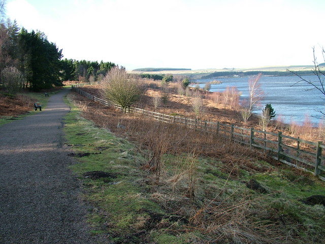
Derwent Reservoir (North East England)

The Derwent Reservoir is a reservoir on the River Derwent, on the border between County Durham and Northumberland, in England. It is west of Consett. It...

Blanchland Abbey

Blanchland Abbey at Blanchland, in the English county of Northumberland, was founded as a premonstratensian priory in 1165 by Walter de Bolbec II, and...

Blanchland

Blanchland is a village in Northumberland, England, on the County Durham boundary. The population of the civil parish at the 2011 census was 135.Set beside...

Edmundbyers

Edmundbyers is a village in County Durham, in England. It is situated a few miles to the west of Consett, near Derwent Reservoir. In 2001 it had a population...

Colpitts Grange

Colpitts Grange is a hamlet in Northumberland, England. It is about 7 miles (11 km) to the south-east of Hexham. == Governance == Colpitts Grange is in...

Slaley Hall

Slaley Hall is a country house golf resort in Northumberland in North East England, built by local developers Seamus O'Carroll and John Rourke which hosted...

Baybridge, Northumberland

Baybridge is a small village in Northumberland, England, just to the west of Blanchland and on the border with County Durham. It is situated to the west...

Nearby Amenities

Located within 500m of 54.861111,-2.0150021
Ruffside
Place: locality
Lat/Long: 54.8581144/-2.0143233
Bus Stop
Ruffside
Naptan AtcoCode: 13001076B
Naptan Bearing: NE
Naptan CommonName: Ruffside
Naptan Indicator: north east bound
Naptan Landmark: Landmark not known
Naptan NaptanCode: duradadp
Naptan Notes: South of 5 Fell Farm.
Naptan Street: B6306
Naptan Verified: no
Source: naptan_import
Lat/Long: 54.8582154/-2.0152974
Bus Stop
Ruffside
Naptan AtcoCode: 13001076F
Naptan Bearing: SW
Naptan CommonName: Ruffside
Naptan Indicator: south west bound
Naptan Landmark: Landmark not known
Naptan NaptanCode: duradadt
Naptan Notes: Opposite the south side of 5 Fell Farm.
Naptan Street: B6306
Naptan Verified: no
Source: naptan_import
Lat/Long: 54.8581525/-2.0152506
Bus Stop
Ruffside Hall
Naptan AtcoCode: 13001077B
Naptan Bearing: NE
Naptan CommonName: Ruffside Hall
Naptan Indicator: north east bound
Naptan Landmark: Landmark not known
Naptan NaptanCode: duradadw
Naptan Notes: Eastern entrance to Ruffside Hall.
Naptan Street: B6306
Naptan Verified: no
Source: naptan_import
Lat/Long: 54.8605436/-2.0087085
Bus Stop
Ruffside Hall
Naptan AtcoCode: 13001077F
Naptan Bearing: SW
Naptan CommonName: Ruffside Hall
Naptan Indicator: south west bound
Naptan Landmark: Landmark not known
Naptan NaptanCode: duradaga
Naptan Notes: Eastern entrance to Ruffside Hall.
Naptan Street: B6306
Naptan Verified: no
Source: naptan_import
Lat/Long: 54.8604627/-2.0086306
Turning Loop
Lat/Long: 54.8610926/-2.0126108
Fell Farm
Place: farm
Source Name: OS OpenData StreetView
Lat/Long: 54.8589581/-2.0150471
Barrier: yes
Lat/Long: 54.860654/-2.008537
The data included in this document is from www.openstreetmap.org. The data is made available under ODbL.

Have you been to Bridge Plantation?

Leave your review of Bridge Plantation below (or comments, questions and feedback).