Leinthall Earls

Settlement in Herefordshire

England

Leinthall Earls

Bench beneath the pines on Croft Ambrey One of the very best sited benches that I am aware of, with one of the best views available locally encompassing the Black Mountains around Hay, the distant Brecon Beacons on a clear day, and the beautiful valley of the River Lugg below with the rolling hills of Radnorshire stretching out west into Wales. The wind sighs through the pines, the sun is warm, what more can man want.
Bench beneath the pines on Croft Ambrey Credit: Jeremy Bolwell

Leinthall Earls is a small village located in the county of Herefordshire, England. Situated in the Marches region, on the border of Wales, it is nestled in a picturesque rural setting surrounded by rolling hills and lush green fields. The village is part of the civil parish of Aymestrey and falls within the Leominster district.

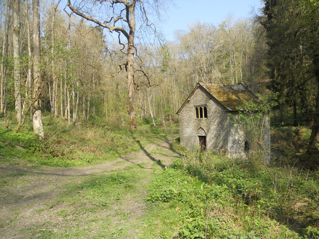
With a population of just over 200 residents, Leinthall Earls is a close-knit community that exudes a charming and tranquil atmosphere. The village is known for its historic buildings, including the Grade II listed Leinthall Earls Church, which dates back to the 12th century and features stunning architectural details. The church is a focal point of the village and holds regular services for locals and visitors alike.

Leinthall Earls offers a range of amenities to cater to the needs of its residents. These include a community hall, where various events and gatherings take place throughout the year, and a local pub that serves as a meeting point for locals and visitors, offering a warm and friendly atmosphere.

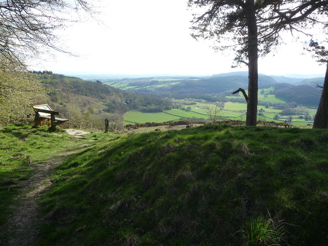
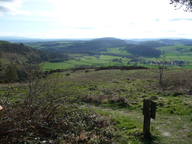
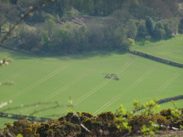
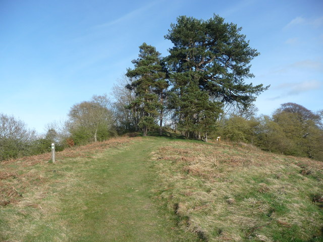
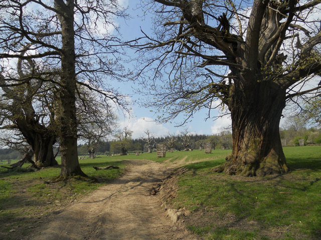
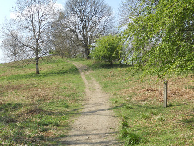
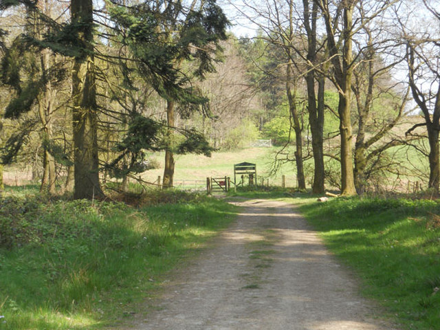
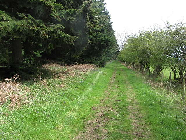
The village's countryside location makes it an ideal destination for outdoor enthusiasts. There are numerous walking and cycling routes in the surrounding area, providing opportunities to explore the beautiful countryside and enjoy the scenic views. The nearby Mortimer Trail, a long-distance footpath that stretches from Ludlow to Kington, passes through Leinthall Earls, making it a popular stop for hikers and nature lovers.

Overall, Leinthall Earls is a peaceful and idyllic village that offers a rich heritage, natural beauty, and a strong sense of community. It is a perfect destination for those seeking a tranquil escape in the heart of the English countryside.

If you have any feedback on the listing, please let us know in the comments section below.

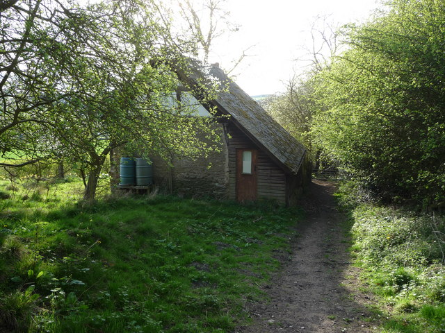
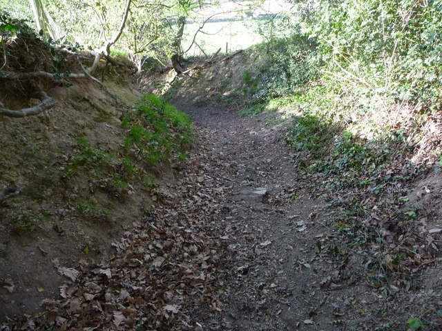
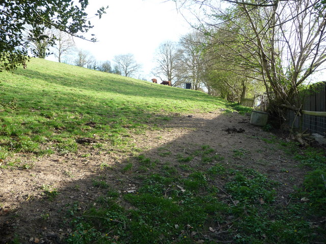
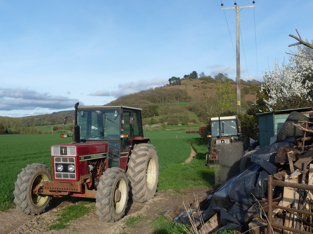
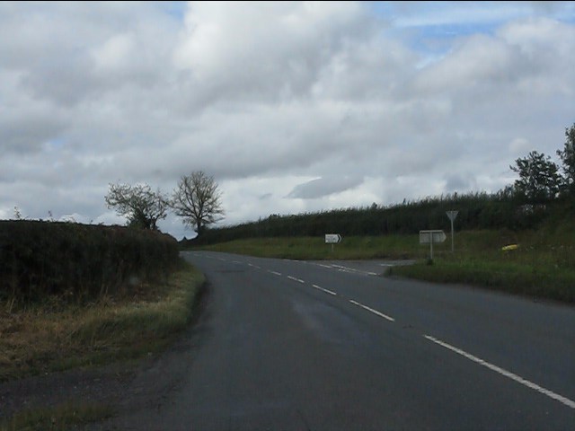
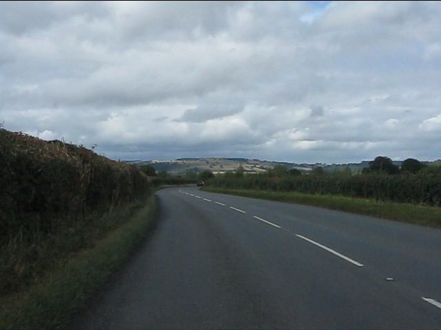
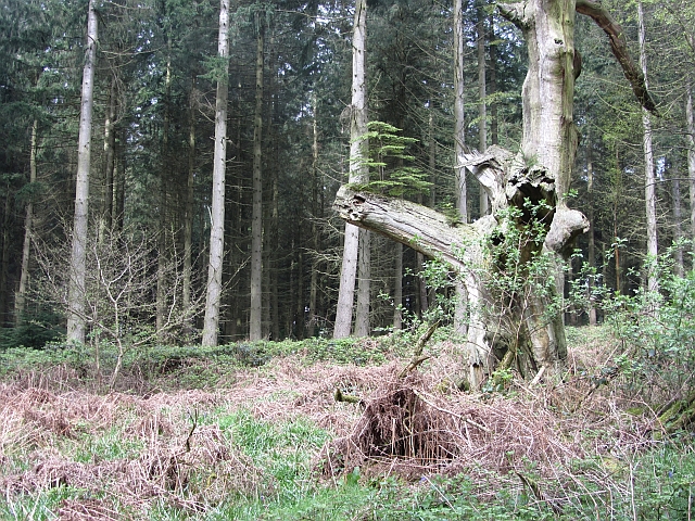
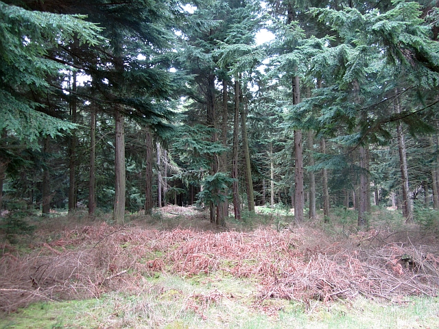
Leinthall Earls Images

Images are sourced within 2km of 52.305331/-2.818726 or Grid Reference SO4467. Thanks to Geograph Open Source API. All images are credited.

Bench beneath the pines on Croft Ambrey One of the very best sited benches that I am aware of, with one of the best views available locally encompassing the Black Mountains around Hay, the distant Brecon Beacons on a clear day, and the beautiful valley of the River Lugg below with the rolling hills of Radnorshire stretching out west into Wales. The wind sighs through the pines, the sun is warm, what more can man want.
Bench beneath the pines on Croft Ambrey
One of the very best sited benches that I am aware of, with one of the best views available locally encompassing the Black Mountains around Hay, the distant Brecon Beacons on a clear day, and the beautiful valley of the River Lugg below with the rolling hills of Radnorshire stretching out west into Wales. The wind sighs through the pines, the sun is warm, what more can man want.
View from the bench beneath the pines on Croft Ambrey The little smudge in one of the green fields below is a herd of deer, moving slowly and grazing the new crops.
View from the bench beneath the pines on Croft Ambrey
The little smudge in one of the green fields below is a herd of deer, moving slowly and grazing the new crops.
A herd of Deer below Croft Ambrey A fairly common sight in the woodlands around this area, but rarely stationary out in the open fields. This herd comprising some 30 individuals grazed for ten minutes and moved slowly into shade. Later a Land Rover Discovery passed on a track and disturbed them and they vanished without trace.
A herd of Deer below Croft Ambrey
A fairly common sight in the woodlands around this area, but rarely stationary out in the open fields. This herd comprising some 30 individuals grazed for ten minutes and moved slowly into shade. Later a Land Rover Discovery passed on a track and disturbed them and they vanished without trace.
Pines on the top of Yatton Bank There are two stands of pines on this steep hillside, one halfway up and this one on the crown of the hill.
Pines on the top of Yatton Bank
There are two stands of pines on this steep hillside, one halfway up and this one on the crown of the hill.
Tiny cottage at the foot of Yatton Bank A small isolated cottage that looks very appealing in Spring sunshine but can only be accessed via a sunken path between high banks and hedges a few hundred metres from the village.
Tiny cottage at the foot of Yatton Bank
A small isolated cottage that looks very appealing in Spring sunshine but can only be accessed via a sunken path between high banks and hedges a few hundred metres from the village.
Sunken path to Yatton Often used by walkers and horse riders it seems these days.
Sunken path to Yatton
Often used by walkers and horse riders it seems these days.
Long horned cattle near Yatton At first I thought these two were Highland but they seem too red in colour, so possibly are some other rare breed.
Long horned cattle near Yatton
At first I thought these two were Highland but they seem too red in colour, so possibly are some other rare breed.
Long horned cattle near Yatton Happily grazing this steep pasture above Yatton.
Long horned cattle near Yatton
Happily grazing this steep pasture above Yatton.
Old tractors in the field near Yatton An old Case International 585 - 1980's vintage and still going strong by the looks of it.
Old tractors in the field near Yatton
An old Case International 585 - 1980's vintage and still going strong by the looks of it.
In the park at Croft Castle
Footpath across Croft Ambrey Fort
Derelict pump house in Fishpool Valley
Mortimer Trail at Bircher Common
A4110 at the turning for Yatton The main road curves left leaving the course of a Roman road which, unsurprisingly, continues straight on.
A4110 at the turning for Yatton
The main road curves left leaving the course of a Roman road which, unsurprisingly, continues straight on.
Curving along the A4110
Croft Wood This conifer plantation has survived long past its fell by date and is developing into a convincing pastiche of a North American forest. View from the path up to Croft Ambrey either from Fishpools Valley (free) or Croft Castle (hefty admission charge to the two fields not on the public footpath).
Croft Wood
This conifer plantation has survived long past its fell by date and is developing into a convincing pastiche of a North American forest. View from the path up to Croft Ambrey either from Fishpools Valley (free) or Croft Castle (hefty admission charge to the two fields not on the public footpath).
Ladyacre Plantation Conifer wood above the Yatton Hill scarp. 
The inexplicable CRoW mapping strikes again - most of the Forestry Commission's Bringewood holdings are a funny colour on the 1:25k maps, but not this block. I have never heard of any problems here though, short of idiotic no cycling signs on a metalled logging road, though.  This may also explain why the trees have yet to be felled.
Ladyacre Plantation
Conifer wood above the Yatton Hill scarp. The inexplicable CRoW mapping strikes again - most of the Forestry Commission's Bringewood holdings are a funny colour on the 1:25k maps, but not this block. I have never heard of any problems here though, short of idiotic no cycling signs on a metalled logging road, though. This may also explain why the trees have yet to be felled.
Path, Croft Wood A path, not too muddy today, passes along the edge of the wood above the Croft parklands.
Path, Croft Wood
A path, not too muddy today, passes along the edge of the wood above the Croft parklands.
Show me another place!

Leinthall Earls is located at Grid Ref: SO4467 (Lat: 52.305331, Lng: -2.818726)

Unitary Authority: County of Herefordshire

Police Authority: West Mercia

What 3 Words

///fearfully.blackmail.reminder. Near Wigmore, Herefordshire

Related Wikis

Leinthall Earls

Leinthall Earls or Leinthall Earles is a village in Aymestrey civil parish, Herefordshire, England. == Parish church == The earliest parts of the Church...
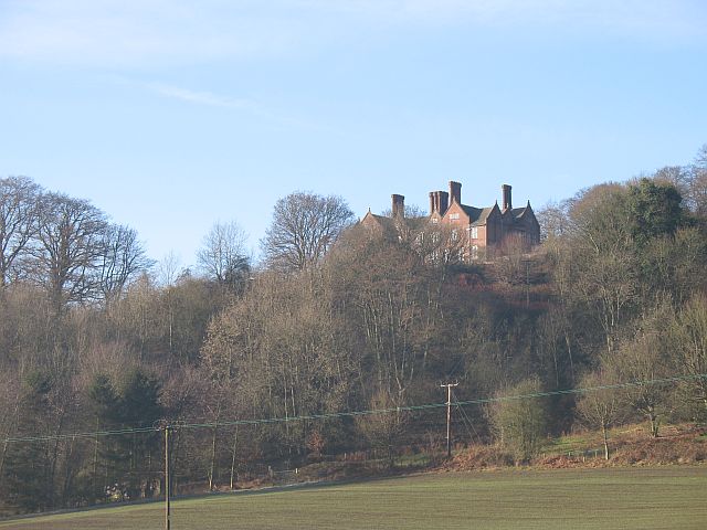
Gatley Park

Gatley Park is an English 17th-century park and country house lying near Leinthall Earls, Herefordshire. Both the park and the house are separately listed...

Yatton, Aymestrey

Yatton is a hamlet in the civil parish of Aymestrey in north-western Herefordshire, England. In 1870–72 the township had a population of 214.The hamlet...

Croft Ambrey

Croft Ambrey is an Iron Age hill fort in Herefordshire, England. == Location == Croft Ambrey, on Yatton Hill, is in the civil parish of Aymestrey, 6 miles...

Aymestrey burial

The Aymestrey burial was a beaker cist at Aymestrey, Herefordshire, England. The remains and objects are now in a recreated cist, at Leominster Museum...

Leinthall Starkes

Leinthall Starkes is a small village and civil parish in north-western Herefordshire, England. It is about 7 miles south-west of Ludlow, and near the larger...

Croft Castle

Croft Castle is a country house in the village of Croft, Herefordshire, England. Owned by the Croft family since 1085, the castle and estate passed out...

Croft, Herefordshire

Croft is a village and former civil parish, now in the parish of Croft and Yarpole, in north Herefordshire, England. In 1961 the parish had a population...

Nearby Amenities

Located within 500m of 52.305331,-2.818726
Leinthall Earls
Alt Name: Leinthall Earles
Place: hamlet
Wikidata: Q18160530
Lat/Long: 52.3054197/-2.8187294
Telephone
Booth: K6
Colour: gold
Covered: booth
Man Made: telephone_box
Lat/Long: 52.3050227/-2.8186838
Post Box
Post Box Mounting: wooden_post
Post Box Type: lamp
Lat/Long: 52.304918/-2.8187211
The data included in this document is from www.openstreetmap.org. The data is made available under ODbL.

Have you been to Leinthall Earls?

Leave your review of Leinthall Earls below (or comments, questions and feedback).