Leinthall Starkes

Settlement in Herefordshire

England

Leinthall Starkes

A4110 approaching the junction for Leinthall Earls
A4110 approaching the junction for Leinthall Earls Credit: Peter Whatley

Leinthall Starkes is a small village located in Herefordshire, England. Situated in the picturesque countryside, it is surrounded by rolling hills, lush green fields, and charming rural landscapes. The village is nestled within the Leinthall Starkes civil parish, which encompasses the neighboring hamlet of Leinthall Earls.

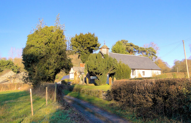
With a population of around 100 residents, Leinthall Starkes exudes a tranquil and close-knit community feel. The architecture of the village predominantly consists of traditional stone-built cottages, giving it a quaint and timeless ambiance. The village is known for its well-preserved historic buildings, including the 12th-century St. Andrew's Church, which stands as a testament to the village's rich history.

While Leinthall Starkes is predominantly a residential area, it also offers recreational opportunities for both locals and visitors. The village is surrounded by a network of footpaths and bridleways that attract hikers, cyclists, and nature enthusiasts. The countryside vistas and serene atmosphere provide an ideal setting for leisurely walks and exploring the natural beauty of Herefordshire.

Despite its small size, Leinthall Starkes is conveniently located near the town of Ludlow, which is just a short drive away. Ludlow offers a wider range of amenities, including shops, restaurants, and cultural attractions, making it easily accessible for the villagers to meet their daily needs.

In conclusion, Leinthall Starkes presents a charming and peaceful village setting, offering residents and visitors an idyllic countryside experience. With its rich history and natural beauty, this small Herefordshire village is a hidden gem for those seeking a tranquil escape from the bustling city life.

If you have any feedback on the listing, please let us know in the comments section below.

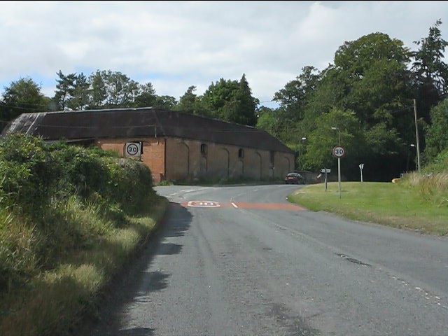
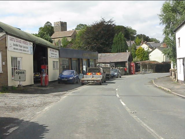
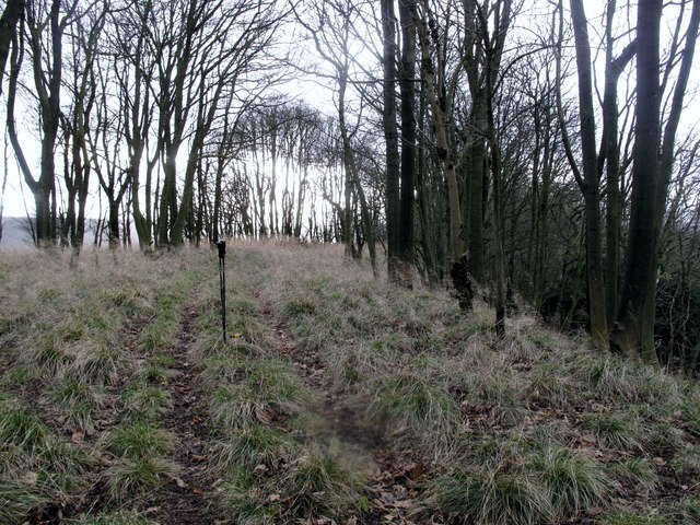
Leinthall Starkes Images

Images are sourced within 2km of 52.320717/-2.8350461 or Grid Reference SO4369. Thanks to Geograph Open Source API. All images are credited.

A4110 approaching the junction for Leinthall Earls
A4110 south of Wigmore
A4110 enters Wigmore from the south
Castle Garage, Wigmore
St James' church Wigmore View of the back of St James' church in Wigmore, Herefordshire.
St James' church Wigmore
View of the back of St James' church in Wigmore, Herefordshire.
Oakley House, Wigmore Grade II House on Broad Street. Built circa 1600 with mid-C19 alterations. Timber-framed with painted brick and rendered infill on rubble base and slate roofs.
Oakley House, Wigmore
Grade II House on Broad Street. Built circa 1600 with mid-C19 alterations. Timber-framed with painted brick and rendered infill on rubble base and slate roofs.
Gatley Hill Parked at entrance to forest to SW and followed over grown tracks to gain summit ridge early so gentle ridge walk from there. Dry and occasionally windy.
Name: Gatley Hill
Hill number: 5363
Height: 338m / 1109ft
Area: 38B: West Gloucestershire, Hereford & Worcester
Class: Hu
Grid ref: SO446693 (est)
Drop: 110m
Col: 228m  SO462698
Gatley Hill
Parked at entrance to forest to SW and followed over grown tracks to gain summit ridge early so gentle ridge walk from there. Dry and occasionally windy. Name: Gatley Hill Hill number: 5363 Height: 338m / 1109ft Area: 38B: West Gloucestershire, Hereford & Worcester Class: Hu Grid ref: SO446693 (est) Drop: 110m Col: 228m SO462698
Part of Wigmore village centre Just a few of the many 'black and white' buildings to be found in Wigmore, and this area of North Herefordshire, and comprising just a part of the Black and white Trail through the villages of this 'rural backwater', as it is sometimes described.

There is so much to see and discover in this locality - for my money the best corner of the county and well worth a visit by car and on foot. History, geology, ecology and plenty of other 'ologies' vie for the attention of the curious mind and there is a wealth of architectural heritage, great pubs and eateries, superb walking and the locals are a friendly bunch, unfailingly entertaining and engaging and keen to point tourists in the direction of their stated interests.
Part of Wigmore village centre
Just a few of the many 'black and white' buildings to be found in Wigmore, and this area of North Herefordshire, and comprising just a part of the Black and white Trail through the villages of this 'rural backwater', as it is sometimes described. There is so much to see and discover in this locality - for my money the best corner of the county and well worth a visit by car and on foot. History, geology, ecology and plenty of other 'ologies' vie for the attention of the curious mind and there is a wealth of architectural heritage, great pubs and eateries, superb walking and the locals are a friendly bunch, unfailingly entertaining and engaging and keen to point tourists in the direction of their stated interests.
ROC Monitoring Post, Leinthall Starkes ROC Monitoring Post, in the corner of a field on the Western side of Leinthall Starkes, near Wigmore, Herefordshire.
<span class="nowrap"><a title="http://www.subbrit.org.uk/category/nuclear-monitoring-posts" rel="nofollow ugc noopener" href="http://www.subbrit.org.uk/category/nuclear-monitoring-posts">Link</a><img style="margin-left:2px;" alt="External link" title="External link - shift click to open in new window" src="https://s1.geograph.org.uk/img/external.png" width="10" height="10"/></span>
<span class="nowrap"><a title="http://en.wikipedia.org/wiki/Royal_Observer_Corps_Monitoring_Post" rel="nofollow ugc noopener" href="http://en.wikipedia.org/wiki/Royal_Observer_Corps_Monitoring_Post">Link</a><img style="margin-left:2px;" alt="External link" title="External link - shift click to open in new window" src="https://s1.geograph.org.uk/img/external.png" width="10" height="10"/></span>
ROC Monitoring Post, Leinthall Starkes
ROC Monitoring Post, in the corner of a field on the Western side of Leinthall Starkes, near Wigmore, Herefordshire. LinkExternal link LinkExternal link
ROC Monitoring Post, Leinthall Starkes The ROC Monitoring Post in a field on the Western side of Leinthall Starkes.

<span class="nowrap"><a title="http://en.wikipedia.org/wiki/Royal_Observer_Corps_Monitoring_Post" rel="nofollow ugc noopener" href="http://en.wikipedia.org/wiki/Royal_Observer_Corps_Monitoring_Post">Link</a><img style="margin-left:2px;" alt="External link" title="External link - shift click to open in new window" src="https://s1.geograph.org.uk/img/external.png" width="10" height="10"/></span>
<span class="nowrap"><a title="http://www.subbrit.org.uk/category/nuclear-monitoring-posts" rel="nofollow ugc noopener" href="http://www.subbrit.org.uk/category/nuclear-monitoring-posts">Link</a><img style="margin-left:2px;" alt="External link" title="External link - shift click to open in new window" src="https://s1.geograph.org.uk/img/external.png" width="10" height="10"/></span>
ROC Monitoring Post, Leinthall Starkes
The ROC Monitoring Post in a field on the Western side of Leinthall Starkes. LinkExternal link LinkExternal link
St. James' church, Wigmore A large and cool building to visit on a hot day.
St. James' church, Wigmore
A large and cool building to visit on a hot day.
Un-named lane south of Lowerhouse Farm
A4110 in Wigmore
A4110 in Wigmore
Ford Street passes the Castle Inn The pub was previously called The Compasses.
Ford Street passes the Castle Inn
The pub was previously called The Compasses.
Un-named lane junction in Leinthall Starkes
Un-named lane southwest of Allcock's Bridge
St Andrew, Leinthall Earls  'A humble chapel' says Pevsner, which hardly does this lovely little building justice. Some churches are just magical and in my view this is one.
St Andrew, Leinthall Earls
'A humble chapel' says Pevsner, which hardly does this lovely little building justice. Some churches are just magical and in my view this is one.
St Andrew, Leinthall Earls A simple but utterly charming country chapel at the gate to Gatley Park.
St Andrew, Leinthall Earls
A simple but utterly charming country chapel at the gate to Gatley Park.
Show me another place!

Leinthall Starkes is located at Grid Ref: SO4369 (Lat: 52.320717, Lng: -2.8350461)

Unitary Authority: County of Herefordshire

Police Authority: West Mercia

What 3 Words

///momentous.candles.defaults. Near Wigmore, Herefordshire

Related Wikis

Leinthall Starkes

Leinthall Starkes is a small village and civil parish in north-western Herefordshire, England. It is about 7 miles south-west of Ludlow, and near the larger...

Wigmore High School

Wigmore High School is a mixed secondary school in Wigmore, in the county of Herefordshire, England.Previously a foundation school, in 2007 Wigmore High...

Wigmore Hall, Herefordshire

Wigmore Hall is a Grade II listed building in the village of Wigmore in Herefordshire, England. == History == Wigmore Hall dates from the 16th century...

Wigmore, Herefordshire

Wigmore is a village and civil parish in the northwest part of the county of Herefordshire, England. It is located on the A4110 road, about 8 miles (13...

Nearby Amenities

Located within 500m of 52.320717,-2.8350461
Bus Stop
Burrington Turn
Bus: yes
Naptan AtcoCode: 2090A141100
Naptan Bearing: SW
Naptan BusStopType: CUS
Naptan CommonName: Burrington Turn
Naptan Indicator: opp
Naptan Landmark: Lime Brook Cottages
Naptan NaptanCode: heragdmg
Naptan Street: N/K
Naptan Verified: no
Public Transport: platform
Source: naptan_import
Lat/Long: 52.3227309/-2.8284907
Leinthall Starkes
Place: village
Lat/Long: 52.3222298/-2.8317936
Generator Method: photovoltaic
Generator Output Electricity: yes
Generator Source: solar
Generator Type: solar_photovoltaic_panel
Location: roof
Power: generator
Lat/Long: 52.3166988/-2.8379837
Power: pole
Source: bing
Lat/Long: 52.3211502/-2.8406873
Power: pole
Source: bing
Lat/Long: 52.3208879/-2.8417495
Power: pole
Source: bing
Lat/Long: 52.3202632/-2.8408778
Power: pole
Source: bing
Lat/Long: 52.3198222/-2.8402904
Telephone
Booth: K6
Covered: booth
Man Made: telephone_box
Lat/Long: 52.3221/-2.8311166
Post Box
Post Box Type: lamp
Lat/Long: 52.3221127/-2.8310823
The data included in this document is from www.openstreetmap.org. The data is made available under ODbL.

Have you been to Leinthall Starkes?

Leave your review of Leinthall Starkes below (or comments, questions and feedback).