Slatequarry Cleugh

Valley in Northumberland

England

Slatequarry Cleugh

Trig point at Warlaw Pike The trig point at Warlaw Pike at 402 m.; it lies to the north of the local high point on Bulbeck Common at 413 m.
The view beyond is to the west, across the valley of Devil's Water.
Trig point at Warlaw Pike Credit: Trevor Littlewood

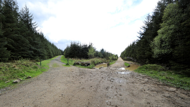
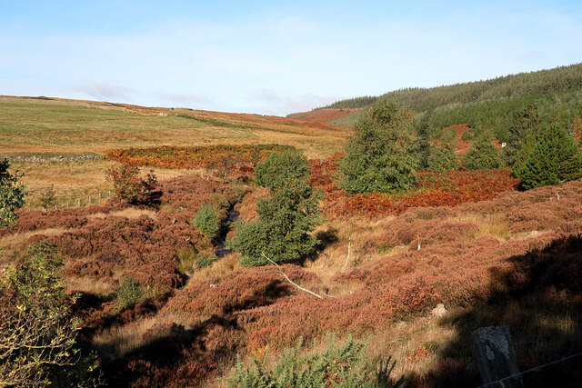
Slatequarry Cleugh is a picturesque valley located in Northumberland, England. Nestled within the North Pennines Area of Outstanding Natural Beauty, this enchanting landscape offers visitors a glimpse into the region's rich industrial history and stunning natural beauty.

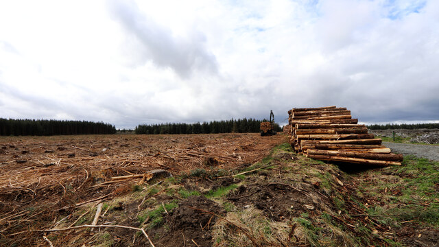
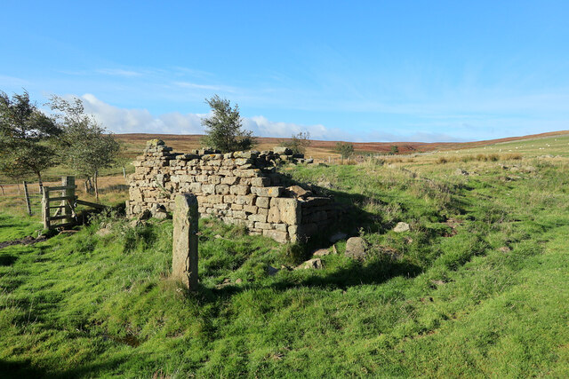
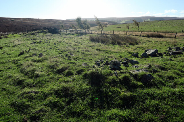
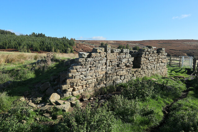
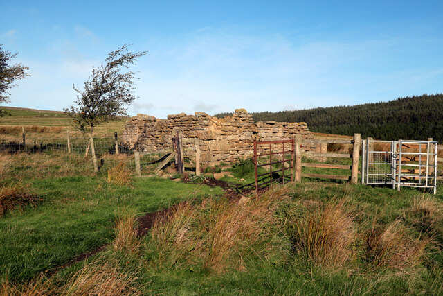
The cleugh, or valley, gets its name from the slate quarry that was once the heart of the local economy. In the 19th century, slate mining was a significant industry in Northumberland, and Slatequarry Cleugh was one of the primary extraction sites. The remnants of the quarry can still be seen today, with old mining buildings and machinery scattered across the valley.

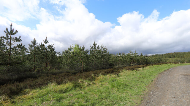
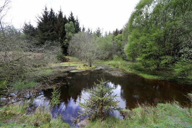
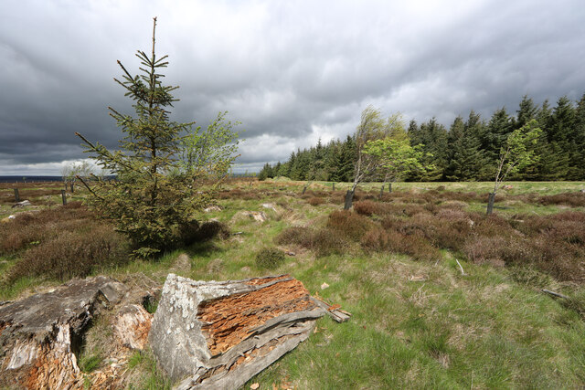
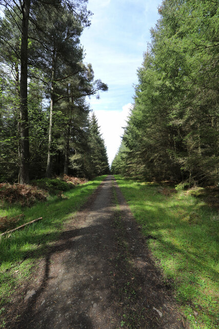
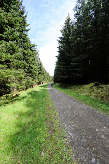
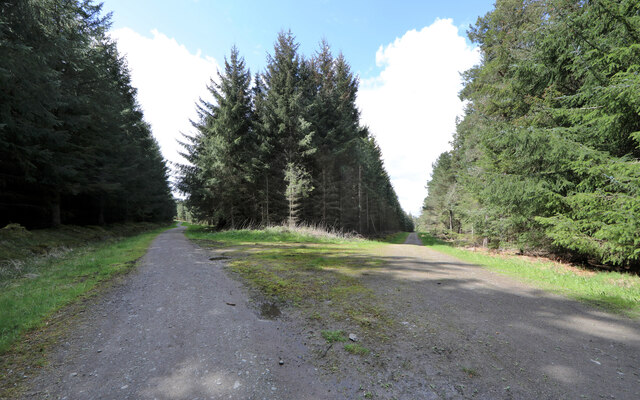
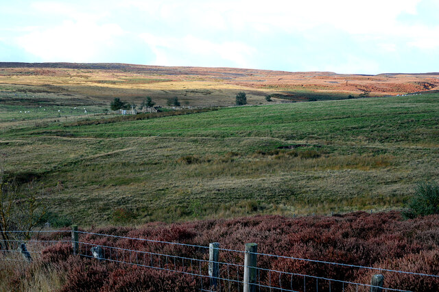
Nature enthusiasts will find themselves captivated by the breathtaking scenery of Slatequarry Cleugh. The valley is adorned with lush greenery, vibrant wildflowers, and the soothing sound of a nearby stream meandering through the landscape. This idyllic setting provides the perfect backdrop for hiking, birdwatching, or simply taking a leisurely stroll along the well-maintained footpaths.

For history buffs, Slatequarry Cleugh offers a fascinating insight into the area's industrial past. Interpretive signage throughout the valley provides information about the quarry's operations and the lives of the workers who toiled here. Visitors can explore the old mining buildings, marvel at the remnants of the machinery, and imagine the bustling activity that once filled these hills.

Slatequarry Cleugh is truly a hidden gem in Northumberland, offering a harmonious blend of history and natural beauty. Whether seeking adventure, tranquility, or a glimpse into the past, this valley is a must-visit destination for anyone exploring the region.

If you have any feedback on the listing, please let us know in the comments section below.

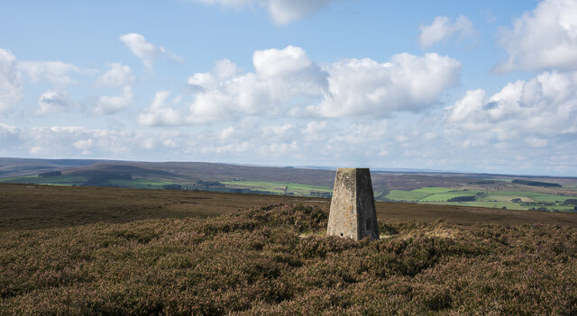
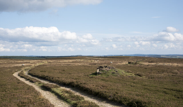
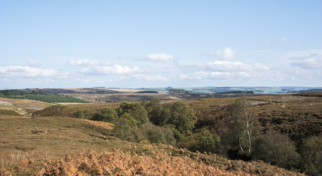
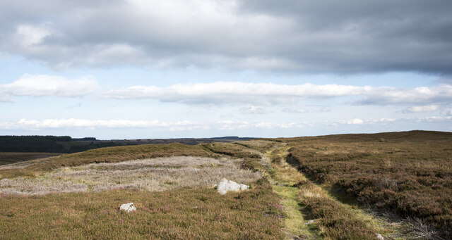
Slatequarry Cleugh Images

Images are sourced within 2km of 54.883914/-2.0602917 or Grid Reference NY9654. Thanks to Geograph Open Source API. All images are credited.

Trig point at Warlaw Pike The trig point at Warlaw Pike at 402 m.; it lies to the north of the local high point on Bulbeck Common at 413 m.
The view beyond is to the west, across the valley of Devil's Water.
Trig point at Warlaw Pike
The trig point at Warlaw Pike at 402 m.; it lies to the north of the local high point on Bulbeck Common at 413 m. The view beyond is to the west, across the valley of Devil's Water.
Line of grouse butts on Blanchland Moor An estate road alongside the grouse butt line heading east over the flat heather moor.
Line of grouse butts on Blanchland Moor
An estate road alongside the grouse butt line heading east over the flat heather moor.
Tree tops showing in valley of Potter Burn Potter Burn is a stream of little note draining Blanchland Moor, but the short stretch in view where Ravens Crags are located is quite incised with the sides broken by rock exposures.
Tree tops showing in valley of Potter Burn
Potter Burn is a stream of little note draining Blanchland Moor, but the short stretch in view where Ravens Crags are located is quite incised with the sides broken by rock exposures.
Track crossing heather moor on Dean Rigg Dean Rigg is a minor ridge of ground on Cowbyers Moor to the south of Potter Burn; the estate road or track follows the ridge before moving to the north side of Acton Dean.
Track crossing heather moor on Dean Rigg
Dean Rigg is a minor ridge of ground on Cowbyers Moor to the south of Potter Burn; the estate road or track follows the ridge before moving to the north side of Acton Dean.
Harvesting a section of Slaley Forest Signs at the entrance to the eastern end of Slaley Forest warn of a number of closed tracks as a diamond-shaped section of the plantation was being actively clear-cut. The noise of chainsaws filled the air, which a tractor dragged cut logs on a trailer, using a crane to lift these into stacks. A big road-legal timber truck was the other side of the logpile using its own crane to take them off again and away to become glamourous new products like fenceposts or newsprint.
Harvesting a section of Slaley Forest
Signs at the entrance to the eastern end of Slaley Forest warn of a number of closed tracks as a diamond-shaped section of the plantation was being actively clear-cut. The noise of chainsaws filled the air, which a tractor dragged cut logs on a trailer, using a crane to lift these into stacks. A big road-legal timber truck was the other side of the logpile using its own crane to take them off again and away to become glamourous new products like fenceposts or newsprint.
Regenerating Slaley Forest Areas of the forest have been harvested on a cycle, and this patch seems to have been cut some years ago. Whilst much of the mature plantation is Sitka Spruce, this area has been repopulated with pine. Forestry does not feel obliged to stick with native species, and the trees aren't big enough yet that I could identify whether they are Scots Pine (which are native), Austrian/Corsican Pine (which have been widely used for shelter in the UK) or an American species like Lodgepole Pine (the coast range subspecies of which, Shore Pine, is used in forestry). They certainly aren't that widely planted and very fast-growing species much used for timber or woodpulp in somewhat warmer climes, Pinus radiata (Monterrey Pine).
Regenerating Slaley Forest
Areas of the forest have been harvested on a cycle, and this patch seems to have been cut some years ago. Whilst much of the mature plantation is Sitka Spruce, this area has been repopulated with pine. Forestry does not feel obliged to stick with native species, and the trees aren't big enough yet that I could identify whether they are Scots Pine (which are native), Austrian/Corsican Pine (which have been widely used for shelter in the UK) or an American species like Lodgepole Pine (the coast range subspecies of which, Shore Pine, is used in forestry). They certainly aren't that widely planted and very fast-growing species much used for timber or woodpulp in somewhat warmer climes, Pinus radiata (Monterrey Pine).
Slaley Forest pond A pool in a clearing surrounded by a greater diversity of tree species than found elsewhere in the forest, with a small island which no doubt provides a safer nesting spot for someone. However, this view is strictly time-limited as the diminutive conifer directly in front of the photographer is a volunteer seedling Sitka Spruce which, given considerably more light than the ones planted so densely in the plantation, will rapidly grow to occupy the foreground.
Slaley Forest pond
A pool in a clearing surrounded by a greater diversity of tree species than found elsewhere in the forest, with a small island which no doubt provides a safer nesting spot for someone. However, this view is strictly time-limited as the diminutive conifer directly in front of the photographer is a volunteer seedling Sitka Spruce which, given considerably more light than the ones planted so densely in the plantation, will rapidly grow to occupy the foreground.
Rogue spruce, Slaley Forest This area on the edge of Slaley Forest has been clear cut and not replanted, so the remaining stumps are rotting away nicely, providing habitat for numerous invertebrates and the birds which feed on them. The proximity of serried ranks of alien Sitka Spruce provides a much bigger input of seeds than do sparser and more distant natives, so this Sitka Spruce has taken advantage of the ungrazed space and daylight to establish itself.
Rogue spruce, Slaley Forest
This area on the edge of Slaley Forest has been clear cut and not replanted, so the remaining stumps are rotting away nicely, providing habitat for numerous invertebrates and the birds which feed on them. The proximity of serried ranks of alien Sitka Spruce provides a much bigger input of seeds than do sparser and more distant natives, so this Sitka Spruce has taken advantage of the ungrazed space and daylight to establish itself.
Forest track branches off byway, Slaley Forest The forest track to the left is guarded by a closed barrier to deter those who use the byway from straying where they are not permitted. Whilst signage implies a significant overuse of the byways by motor traffic, some of them shown on the map seem to have been erased entirely on the ground. The ones that still exist seem sufficiently straight that there can be little scope for noisy rally driving, but no doubt provide sport for mindless boy racers who think it fun to go very fast in a straight line. Signs advise calling Northumbria Police if you see bad behaviour taking place, but don't bother to mention where one might find a phone box to do so.
Forest track branches off byway, Slaley Forest
The forest track to the left is guarded by a closed barrier to deter those who use the byway from straying where they are not permitted. Whilst signage implies a significant overuse of the byways by motor traffic, some of them shown on the map seem to have been erased entirely on the ground. The ones that still exist seem sufficiently straight that there can be little scope for noisy rally driving, but no doubt provide sport for mindless boy racers who think it fun to go very fast in a straight line. Signs advise calling Northumbria Police if you see bad behaviour taking place, but don't bother to mention where one might find a phone box to do so.
Forest track in Slaley Forest A byway is shown on maps running roughly east-west for a kilometre and a half in this area of Slaley Forest, but on the ground, the line it supposedly takes is just densely planted forest. Instead, one is obliged to take a longer route via a number of SW-NE and SE-NW forest tracks such as this one, which are not rights of way of any description (though the bulk of the forest is CROW Access Land).
Forest track in Slaley Forest
A byway is shown on maps running roughly east-west for a kilometre and a half in this area of Slaley Forest, but on the ground, the line it supposedly takes is just densely planted forest. Instead, one is obliged to take a longer route via a number of SW-NE and SE-NW forest tracks such as this one, which are not rights of way of any description (though the bulk of the forest is CROW Access Land).
Forest track branches off byway, Slaley Forest The route to the right is supposedly a byway, though the line of that right of way some way ahead seems to have been wholly effaced by the forest leaving only rather longer routes on the forest tracks (with signage making clear that these are not for vehicles). The route to the left is one of these tracks, and the one we have just taken to reach this point (in the absence of any trace of the byway we'd intended to use starting about two kilometres away).
Forest track branches off byway, Slaley Forest
The route to the right is supposedly a byway, though the line of that right of way some way ahead seems to have been wholly effaced by the forest leaving only rather longer routes on the forest tracks (with signage making clear that these are not for vehicles). The route to the left is one of these tracks, and the one we have just taken to reach this point (in the absence of any trace of the byway we'd intended to use starting about two kilometres away).
Acton Burn
Acton Burn
Ruin near site of Acton High Mill The ruin is named as Acton Mill on the first edition OS map (1865).

The OS Name Book (c.1860) describes "A cottage and garden so called from the Smelting Mill which formerly stood near here" <span class="nowrap"><a title="http://namebooks.org.uk/browse/main/?OSref=411&Page=35.0" rel="nofollow ugc noopener" href="http://namebooks.org.uk/browse/main/?OSref=411&Page=35.0">Link</a><img style="margin-left:2px;" alt="External link" title="External link - shift click to open in new window" src="https://s1.geograph.org.uk/img/external.png" width="10" height="10"/></span> <span class="nowrap"><a title="https://web.archive.org/web/20221009161928/http://namebooks.org.uk/browse/main/?OSref=411&Page=35.0" rel="nofollow ugc noopener" href="https://web.archive.org/web/20221009161928/http://namebooks.org.uk/browse/main/?OSref=411&Page=35.0">Archive Link</a><img style="margin-left:2px;" alt="External link" title="External link - shift click to open in new window" src="https://s1.geograph.org.uk/img/external.png" width="10" height="10"/></span>

A property shown as High Actonmill, about 250m to the north-east, is described in the Name Books as "A small cottage with garden attached occupying a very bleak situation. It derives its name from a Smelting Mill which formerly stood South East of this cottage". <span class="nowrap"><a title="http://namebooks.org.uk/browse/main/?OSref=411&Page=17.0" rel="nofollow ugc noopener" href="http://namebooks.org.uk/browse/main/?OSref=411&Page=17.0">Link</a><img style="margin-left:2px;" alt="External link" title="External link - shift click to open in new window" src="https://s1.geograph.org.uk/img/external.png" width="10" height="10"/></span> <span class="nowrap"><a title="https://web.archive.org/web/20221009162706/http://namebooks.org.uk/browse/main/?OSref=411&Page=17.0" rel="nofollow ugc noopener" href="https://web.archive.org/web/20221009162706/http://namebooks.org.uk/browse/main/?OSref=411&Page=17.0">Archive Link</a><img style="margin-left:2px;" alt="External link" title="External link - shift click to open in new window" src="https://s1.geograph.org.uk/img/external.png" width="10" height="10"/></span>
Ruin near site of Acton High Mill
The ruin is named as Acton Mill on the first edition OS map (1865). The OS Name Book (c.1860) describes "A cottage and garden so called from the Smelting Mill which formerly stood near here" LinkExternal link Archive LinkExternal link A property shown as High Actonmill, about 250m to the north-east, is described in the Name Books as "A small cottage with garden attached occupying a very bleak situation. It derives its name from a Smelting Mill which formerly stood South East of this cottage". LinkExternal link Archive LinkExternal link
Ruin near site of Acton High Mill The ruin is named as Acton Mill on the first edition OS map (1865).

The OS Name Book (c.1860) describes "A cottage and garden so called from the Smelting Mill which formerly stood near here" <span class="nowrap"><a title="http://namebooks.org.uk/browse/main/?OSref=411&Page=35.0" rel="nofollow ugc noopener" href="http://namebooks.org.uk/browse/main/?OSref=411&Page=35.0">Link</a><img style="margin-left:2px;" alt="External link" title="External link - shift click to open in new window" src="https://s1.geograph.org.uk/img/external.png" width="10" height="10"/></span> <span class="nowrap"><a title="https://web.archive.org/web/20221009161928/http://namebooks.org.uk/browse/main/?OSref=411&Page=35.0" rel="nofollow ugc noopener" href="https://web.archive.org/web/20221009161928/http://namebooks.org.uk/browse/main/?OSref=411&Page=35.0">Archive Link</a><img style="margin-left:2px;" alt="External link" title="External link - shift click to open in new window" src="https://s1.geograph.org.uk/img/external.png" width="10" height="10"/></span>

A property shown as High Actonmill, about 250m to the north-east, is described in the Name Books as "A small cottage with garden attached occupying a very bleak situation. It derives its name from a Smelting Mill which formerly stood South East of this cottage". <span class="nowrap"><a title="http://namebooks.org.uk/browse/main/?OSref=411&Page=17.0" rel="nofollow ugc noopener" href="http://namebooks.org.uk/browse/main/?OSref=411&Page=17.0">Link</a><img style="margin-left:2px;" alt="External link" title="External link - shift click to open in new window" src="https://s1.geograph.org.uk/img/external.png" width="10" height="10"/></span> <span class="nowrap"><a title="https://web.archive.org/web/20221009162706/http://namebooks.org.uk/browse/main/?OSref=411&Page=17.0" rel="nofollow ugc noopener" href="https://web.archive.org/web/20221009162706/http://namebooks.org.uk/browse/main/?OSref=411&Page=17.0">Archive Link</a><img style="margin-left:2px;" alt="External link" title="External link - shift click to open in new window" src="https://s1.geograph.org.uk/img/external.png" width="10" height="10"/></span>

An interesting feature of the building are the deep depressions apparently carved into the face of many of the stones. These have the appearance of weathered prehistoric cup-marks but perhaps more likely to the decorative work of a more recent stonemason.
Ruin near site of Acton High Mill
The ruin is named as Acton Mill on the first edition OS map (1865). The OS Name Book (c.1860) describes "A cottage and garden so called from the Smelting Mill which formerly stood near here" LinkExternal link Archive LinkExternal link A property shown as High Actonmill, about 250m to the north-east, is described in the Name Books as "A small cottage with garden attached occupying a very bleak situation. It derives its name from a Smelting Mill which formerly stood South East of this cottage". LinkExternal link Archive LinkExternal link An interesting feature of the building are the deep depressions apparently carved into the face of many of the stones. These have the appearance of weathered prehistoric cup-marks but perhaps more likely to the decorative work of a more recent stonemason.
Ruin near site of Acton High Mill The ruin is named as Acton Mill on the first edition OS map (1865).

The OS Name Book (c.1860) describes "A cottage and garden so called from the Smelting Mill which formerly stood near here" <span class="nowrap"><a title="http://namebooks.org.uk/browse/main/?OSref=411&Page=35.0" rel="nofollow ugc noopener" href="http://namebooks.org.uk/browse/main/?OSref=411&Page=35.0">Link</a><img style="margin-left:2px;" alt="External link" title="External link - shift click to open in new window" src="https://s1.geograph.org.uk/img/external.png" width="10" height="10"/></span> <span class="nowrap"><a title="https://web.archive.org/web/20221009161928/http://namebooks.org.uk/browse/main/?OSref=411&Page=35.0" rel="nofollow ugc noopener" href="https://web.archive.org/web/20221009161928/http://namebooks.org.uk/browse/main/?OSref=411&Page=35.0">Archive Link</a><img style="margin-left:2px;" alt="External link" title="External link - shift click to open in new window" src="https://s1.geograph.org.uk/img/external.png" width="10" height="10"/></span>

A property shown as High Actonmill, about 250m to the north-east, is described in the Name Books as "A small cottage with garden attached occupying a very bleak situation. It derives its name from a Smelting Mill which formerly stood South East of this cottage". <span class="nowrap"><a title="http://namebooks.org.uk/browse/main/?OSref=411&Page=17.0" rel="nofollow ugc noopener" href="http://namebooks.org.uk/browse/main/?OSref=411&Page=17.0">Link</a><img style="margin-left:2px;" alt="External link" title="External link - shift click to open in new window" src="https://s1.geograph.org.uk/img/external.png" width="10" height="10"/></span> <span class="nowrap"><a title="https://web.archive.org/web/20221009162706/http://namebooks.org.uk/browse/main/?OSref=411&Page=17.0" rel="nofollow ugc noopener" href="https://web.archive.org/web/20221009162706/http://namebooks.org.uk/browse/main/?OSref=411&Page=17.0">Archive Link</a><img style="margin-left:2px;" alt="External link" title="External link - shift click to open in new window" src="https://s1.geograph.org.uk/img/external.png" width="10" height="10"/></span>
Ruin near site of Acton High Mill
The ruin is named as Acton Mill on the first edition OS map (1865). The OS Name Book (c.1860) describes "A cottage and garden so called from the Smelting Mill which formerly stood near here" LinkExternal link Archive LinkExternal link A property shown as High Actonmill, about 250m to the north-east, is described in the Name Books as "A small cottage with garden attached occupying a very bleak situation. It derives its name from a Smelting Mill which formerly stood South East of this cottage". LinkExternal link Archive LinkExternal link
View to ruin of Acton Mill from north-east The ruin is shown here: <a href="https://www.geograph.org.uk/photo/7305474">NY9753 : Ruin near site of Acton High Mill</a>

The line running from left to right on the land directly below the ruin are likely the course of a water leat supplying the original Acton High Smelt Mill located approximately 140m SE of the Acton Mill ruin.
View to ruin of Acton Mill from north-east
The ruin is shown here: NY9753 : Ruin near site of Acton High Mill The line running from left to right on the land directly below the ruin are likely the course of a water leat supplying the original Acton High Smelt Mill located approximately 140m SE of the Acton Mill ruin.
Show me another place!

Slatequarry Cleugh is located at Grid Ref: NY9654 (Lat: 54.883914, Lng: -2.0602917)

Unitary Authority: Northumberland

Police Authority: Northumbria

What 3 Words

///appointed.housework.outraged. Near Slaley, Northumberland

Nearby Locations

Slatequarry Cleugh

Related Wikis

Colpitts Grange

Colpitts Grange is a hamlet in Northumberland, England. It is about 7 miles (11 km) to the south-east of Hexham. == Governance == Colpitts Grange is in...

Slaley Hall

Slaley Hall is a country house golf resort in Northumberland in North East England, built by local developers Seamus O'Carroll and John Rourke which hosted...

Slaley, Northumberland

Slaley is a village in Northumberland, England. It is situated to the southeast of Hexham. It is surrounded by the following villages: Ruffside, Whitley...

Blanchland Abbey

Blanchland Abbey at Blanchland, in the English county of Northumberland, was founded as a premonstratensian priory in 1165 by Walter de Bolbec II, and...

Nearby Amenities

Located within 500m of 54.883914,-2.0602917
Acton Fell
Place: locality
Lat/Long: 54.8798249/-2.0593822
Hunting Stand
Hunting Stand: grouse_butt
Lat/Long: 54.8829819/-2.0627903
Hunting Stand
Hunting Stand: grouse_butt
Lat/Long: 54.8824506/-2.0631336
Hunting Stand
Hunting Stand: grouse_butt
Lat/Long: 54.8819446/-2.0634503
Hunting Stand
Hunting Stand: grouse_butt
Lat/Long: 54.8814967/-2.0637282
Hunting Stand
Hunting Stand: grouse_butt
Lat/Long: 54.8810895/-2.0639971
Hunting Stand
Hunting Stand: grouse_butt
Lat/Long: 54.8806752/-2.0642626
Hunting Stand
Hunting Stand: grouse_butt
Lat/Long: 54.880268/-2.0645298
The data included in this document is from www.openstreetmap.org. The data is made available under ODbL.

Have you been to Slatequarry Cleugh?

Leave your review of Slatequarry Cleugh below (or comments, questions and feedback).