Oaken Clough

Valley in Cheshire

England

Oaken Clough

Shutlingsloe From Croker Hill
Shutlingsloe Credit: Anthony O'Neil

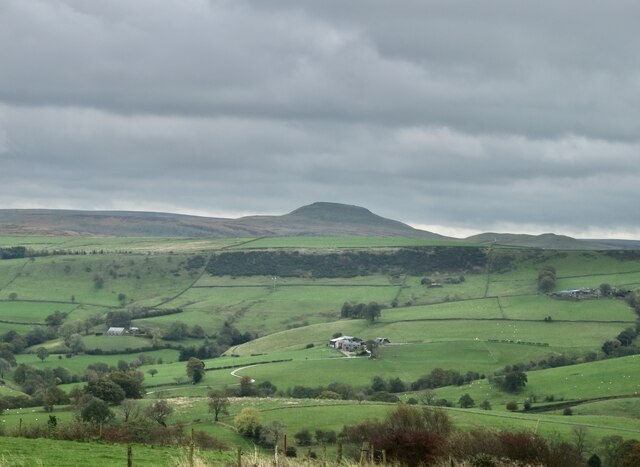
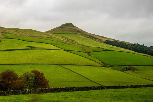
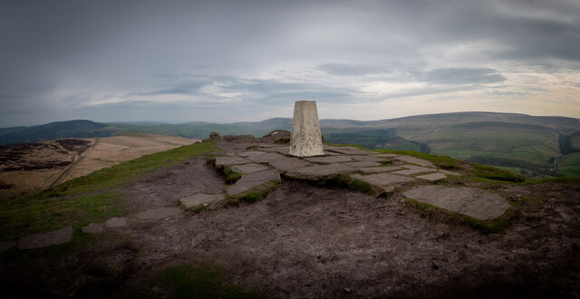
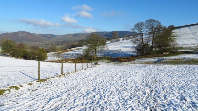
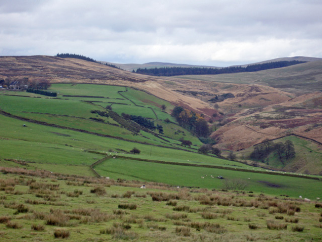
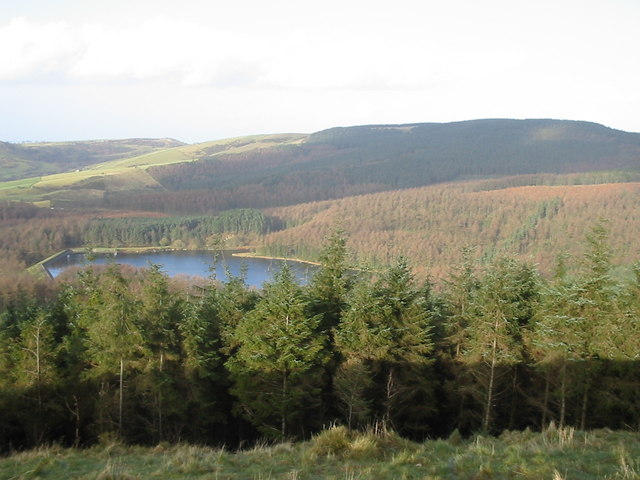
Oaken Clough is a picturesque valley located in the county of Cheshire, England. Nestled between the towns of Macclesfield and Bollington, this idyllic rural area is renowned for its natural beauty and tranquil atmosphere. The valley is surrounded by rolling hills and lush green meadows, creating a stunning backdrop for visitors and residents alike.

One of the standout features of Oaken Clough is its meandering stream that runs through its heart. This stream, known as the Oaken Clough Brook, adds to the charm of the valley as it cascades over rocks and creates small waterfalls along its course. The brook is home to a variety of wildlife, including trout and water birds, making it a popular spot for nature enthusiasts.

The valley also boasts a network of walking trails, allowing visitors to explore its scenic surroundings. These trails wind through ancient woodlands and open fields, providing stunning views of the Cheshire countryside. There are several picnic areas and benches strategically placed along the paths, inviting visitors to take a moment to relax and enjoy the tranquil surroundings.

Oaken Clough is also known for its rich history. The valley was once home to several mills that played a significant role in the area's industrial past. Today, some remnants of these mills can still be seen, adding a touch of historical charm to the landscape.

Overall, Oaken Clough is a hidden gem in Cheshire, offering a peaceful retreat from the bustling towns nearby. With its natural beauty, walking trails, and historical significance, it is a must-visit destination for those seeking a tranquil escape in the heart of the English countryside.

If you have any feedback on the listing, please let us know in the comments section below.

Oaken Clough Images

Images are sourced within 2km of 53.219272/-2.0583379 or Grid Reference SJ9669. Thanks to Geograph Open Source API. All images are credited.

Shutlingsloe From Croker Hill
Shutlingsloe
From Croker Hill
Shutlingsloe, Peak District Viewed from the A54, on the edge of the Peak District in Cheshire.
Shutlingsloe, Peak District
Viewed from the A54, on the edge of the Peak District in Cheshire.
Shutlingsloe & Croker Hill from Whetstone Ridge A clear sunny morning with a cold air inversion over the Cheshire Plain. The hills beyond are just into Wales.
Shutlingsloe & Croker Hill from Whetstone Ridge
A clear sunny morning with a cold air inversion over the Cheshire Plain. The hills beyond are just into Wales.
View towards Shutlingsloe from Tegg's Nose visitor centre The distance between the two is 4.5km as the crow flies.
View towards Shutlingsloe from Tegg's Nose visitor centre
The distance between the two is 4.5km as the crow flies.
Shutlingsloe from near Crag Hall, Wildboarclough
Shuttlingsloe Summit Panno Class: Ethel, Hump, Dodd (500-599m), Dewey  ( <span class="nowrap"><a title="https://www.hill-bagging.co.uk/mountaindetails.php?qu=S&rf=3644" rel="nofollow ugc noopener" href="https://www.hill-bagging.co.uk/mountaindetails.php?qu=S&rf=3644">Link</a><img style="margin-left:2px;" alt="External link" title="External link - shift click to open in new window" src="https://s1.geograph.org.uk/img/external.png" width="10" height="10"/></span> )

Trigpoint ( <span class="nowrap"><a title="http://www.trigpointinguk.com/trigs/trig-details.php?t=5970" rel="nofollow ugc noopener" href="http://www.trigpointinguk.com/trigs/trig-details.php?t=5970">Link</a><img style="margin-left:2px;" alt="External link" title="External link - shift click to open in new window" src="https://s1.geograph.org.uk/img/external.png" width="10" height="10"/></span> )
Shuttlingsloe Summit Panno
Class: Ethel, Hump, Dodd (500-599m), Dewey ( LinkExternal link ) Trigpoint ( LinkExternal link )
Following the Gritstone Trail northeast of Higher Sutton
On Shutlingsloe - first rays of sunlight on trig point An early morning start to get to the summit of Shutlingsloe to get the sunrise.
On Shutlingsloe - first rays of sunlight on trig point
An early morning start to get to the summit of Shutlingsloe to get the sunrise.
Early morning - path north from Shutlingsloe
View from Shutlingsloe towards Jodrell Bank The large dish of a radio telescope can be seen right in the centre of the picture on the horizon. Taken from the 506m hill looking due west.
View from Shutlingsloe towards Jodrell Bank
The large dish of a radio telescope can be seen right in the centre of the picture on the horizon. Taken from the 506m hill looking due west.
Pond on moors near Oakenclough The uplands east of Macclesfield have some wonderful views across the hills. This pond is adjacent to a public footpath from the Hanging Gate pub in Sutton across the moor into Wildboarclough. The large hill in the background is Shutlingsloe - the 'Matterhorn of the Peak'.
Pond on moors near Oakenclough
The uplands east of Macclesfield have some wonderful views across the hills. This pond is adjacent to a public footpath from the Hanging Gate pub in Sutton across the moor into Wildboarclough. The large hill in the background is Shutlingsloe - the 'Matterhorn of the Peak'.
Sutton from the moor At the edge of the moor there is a fine view over Sutton and on to Macclesfield
Sutton from the moor
At the edge of the moor there is a fine view over Sutton and on to Macclesfield
Shutlingsloe Taken from Macclesfield forest footpath
Shutlingsloe
Taken from Macclesfield forest footpath
Hollinset Farm with the ever-present Sutton Common transmitter on the horizon
Hollinset Farm
with the ever-present Sutton Common transmitter on the horizon
Nab End Farm on the steep Withenshaw Lane.
Nab End Farm
on the steep Withenshaw Lane.
The view northwards from Shutlingsloe Macclesfield Forest and beyond
The view northwards from Shutlingsloe
Macclesfield Forest and beyond
Wincle - Wild Boar Inn Wincle: SJ 9593 6716 @ 050° - Wild Boar PH on the A54. Shut at lunchtimes on weekdays - whatever the sign may say! (and we were thirsty).
Wincle - Wild Boar Inn
Wincle: SJ 9593 6716 @ 050° - Wild Boar PH on the A54. Shut at lunchtimes on weekdays - whatever the sign may say! (and we were thirsty).
Sutton - view from Cessbank Common Sutton: SJ 9580 6811 @ 030° - view from Cessbank Common up the valley of Highmoor Brook.
Sutton - view from Cessbank Common
Sutton: SJ 9580 6811 @ 030° - view from Cessbank Common up the valley of Highmoor Brook.
Show me another place!

Oaken Clough is located at Grid Ref: SJ9669 (Lat: 53.219272, Lng: -2.0583379)

Unitary Authority: Cheshire East

Police Authority: Cheshire

What 3 Words

///allowable.fetch.pepper. Near Macclesfield, Cheshire

Nearby Locations

High Moor Oaken Clough

Related Wikis

Shutlingsloe

Shutlingsloe is a hill near the village of Wildboarclough, in the east of the county of Cheshire. It stands to the south of Macclesfield Forest, on the...

Macclesfield Forest

Macclesfield Forest is an area of woodland, predominantly conifer plantation, located around 3 mi (5 km) south east of Macclesfield in the civil parish...

Trentabank Reservoir

Trentabank Reservoir is within Macclesfield Forest, partly in the Peak District National Park, in England, and is home to rich unimproved uplands and...

Wildboarclough

Wildboarclough ( WIL-bə-kluf) is a village in the civil parish of Macclesfield Forest and Wildboarclough, in the Cheshire East district, in the ceremonial...

St Saviour's Church, Wildboarclough

St Saviour's Church is in the village of Wildboarclough, Cheshire, England. It is an active Anglican parish church in the deanery of Macclesfield, the...

Macclesfield Forest and Wildboarclough

Macclesfield Forest and Wildboarclough is a civil parish in the unitary authority of Cheshire East and the ceremonial county of Cheshire, England. It...

Allgreave

Allgreave is a village in Cheshire, England. It lies on the A54 (Buxton to Congleton) road, near to the border with Staffordshire. Allgreave Methodist...

Crag Hall

Crag Hall is a country house east of the village of Wildboarclough, Cheshire, England and owned by the Earl of Derby. == Description == It was built in...

Nearby Amenities

Located within 500m of 53.219272,-2.0583379
Barrier: stile
Foot: yes
Lat/Long: 53.2214689/-2.0596181
Barrier: stile
Foot: yes
Lat/Long: 53.2200818/-2.0582029
Barrier: stile
Foot: yes
Lat/Long: 53.2155033/-2.0568721
The data included in this document is from www.openstreetmap.org. The data is made available under ODbL.

Have you been to Oaken Clough?

Leave your review of Oaken Clough below (or comments, questions and feedback).