Lane Bottom

Valley in Yorkshire

England

Lane Bottom

Clapper Bridge Bridge now repaired after collapse some time ago.
Clapper Bridge Credit: Stephen Shaw

Lane Bottom is a picturesque valley located in the county of Yorkshire, England. Nestled amidst the rolling hills and lush greenery, this quaint village offers a tranquil and idyllic setting for its residents and visitors. The valley is situated in the northern part of the county, near the larger towns of Skipton and Keighley.

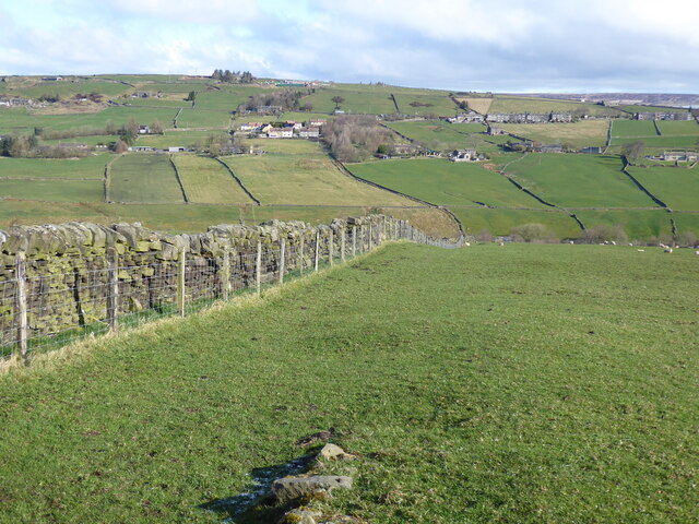
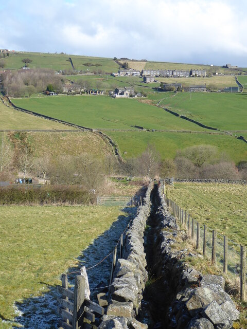
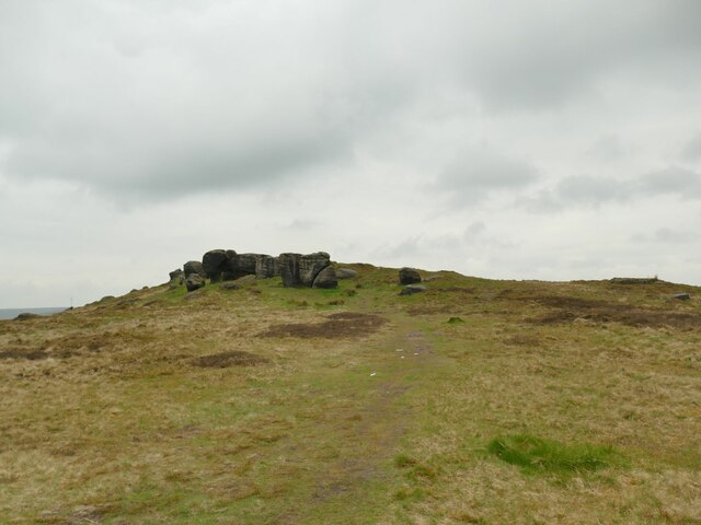
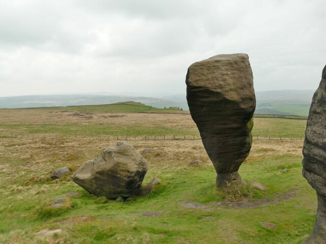
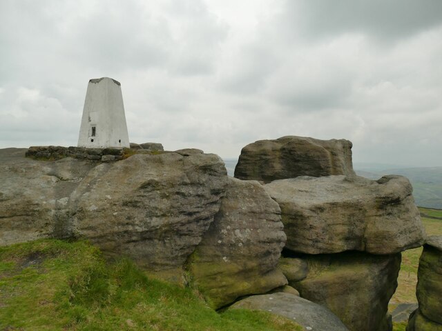
The landscape of Lane Bottom is characterized by its verdant meadows, meandering streams, and charming stone houses that dot the countryside. The valley is encompassed by hills on either side, providing a sense of seclusion and isolation from the bustling outside world. The area is known for its natural beauty, with stunning vistas and panoramic views that captivate the senses.

Despite its rural setting, Lane Bottom boasts a close-knit community that takes pride in its heritage and traditions. The village is home to a small but vibrant population, with residents known for their warmth and hospitality. The local economy primarily revolves around agriculture, with farming being a prominent occupation for many inhabitants.

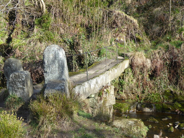
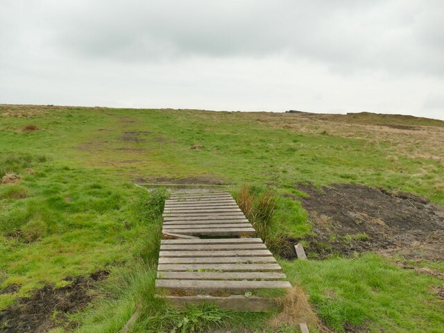
Outdoor enthusiasts will find ample opportunities for exploration and recreation in Lane Bottom. The valley is intersected by numerous walking paths and trails, allowing visitors to immerse themselves in the breathtaking countryside. Wildlife is abundant in the area, with a variety of birds, mammals, and plant species calling Lane Bottom their home.

Overall, Lane Bottom in Yorkshire offers a serene and picturesque escape from the fast-paced modern world. Its natural beauty, charming community, and rural tranquility make it an appealing destination for those seeking solace in the heart of the English countryside.

If you have any feedback on the listing, please let us know in the comments section below.

Lane Bottom Images

Images are sourced within 2km of 53.744355/-2.0785648 or Grid Reference SD9427. Thanks to Geograph Open Source API. All images are credited.

Clapper Bridge Bridge now repaired after collapse some time ago.
Clapper Bridge
Bridge now repaired after collapse some time ago.
OS Bench Mark OS cut bench mark from the first, 19th century, levelling, on flat rock close to the trig point. There is no sign of a pivot or rivet. The BM is shown on the 1853 6" OS map but not on subsequent editions, nor on any 25" maps. Marked as 1434.7 feet above old datum
OS Bench Mark
OS cut bench mark from the first, 19th century, levelling, on flat rock close to the trig point. There is no sign of a pivot or rivet. The BM is shown on the 1853 6" OS map but not on subsequent editions, nor on any 25" maps. Marked as 1434.7 feet above old datum
The Pennine Way near Badger Fields Farm
The Pennine Way on Pry Hill
The Pennine Way descending Pry Hill
The Pennine Way crossing Colden Water
Above Greenhurst Hey The farm commands a fine view over the upper Calder Valley although this was a dull day. Most of the length of this track to the farm and beyond is surfaced with these upside-down concrete railway sleepers, a good choice as they will neither rot nor rut and are probably not very susceptible to frost damage. The track is a public footpath.
Above Greenhurst Hey
The farm commands a fine view over the upper Calder Valley although this was a dull day. Most of the length of this track to the farm and beyond is surfaced with these upside-down concrete railway sleepers, a good choice as they will neither rot nor rut and are probably not very susceptible to frost damage. The track is a public footpath.
Bridleway below Windy Harbour Farm The track forms part of the Todmorden Centenary Way.
Bridleway below Windy Harbour Farm
The track forms part of the Todmorden Centenary Way.
The Wizard of Whirlaw An odd carving in the style of the Easter Island sculptures, by a stile alongside the Todmorden Centenary Way. At one time there was a 'junior' version alongside <a href="https://www.geograph.org.uk/photo/2878250">SD9326 : Scary face at Windy Harbour</a> that is no longer present.

Thanks to a local blogger Paul Knights, I found this is titled 'the Wizard of Whirlaw', carved by Mike Williams and inspired by the 1959 book of the same name by local author Billy Holt.
The Wizard of Whirlaw
An odd carving in the style of the Easter Island sculptures, by a stile alongside the Todmorden Centenary Way. At one time there was a 'junior' version alongside SD9326 : Scary face at Windy Harbour that is no longer present. Thanks to a local blogger Paul Knights, I found this is titled 'the Wizard of Whirlaw', carved by Mike Williams and inspired by the 1959 book of the same name by local author Billy Holt.
Mast Farm, Windy Harbour Lane Although now called a 'farm', the security fence and the name give away the fact that this was the control building for an adjacent mast (still shown on the Explorer map) that has been removed in recent years.
Mast Farm, Windy Harbour Lane
Although now called a 'farm', the security fence and the name give away the fact that this was the control building for an adjacent mast (still shown on the Explorer map) that has been removed in recent years.
Start of a footpath off Eastwood Road The boardwalk over a sometimes boggy patch within metres of leaving the road was not a good sign, but it had been a fairly dry winter and spring, and the going was good across Bridestones Moor.
Start of a footpath off Eastwood Road
The boardwalk over a sometimes boggy patch within metres of leaving the road was not a good sign, but it had been a fairly dry winter and spring, and the going was good across Bridestones Moor.
Approaching the Bridestones The moor contains several gritstone outcrops generically known as the Bridestones, some of them having individual names. This is the first significant outcrop approaching from the east.
Approaching the Bridestones
The moor contains several gritstone outcrops generically known as the Bridestones, some of them having individual names. This is the first significant outcrop approaching from the east.
The Bottleneck on Bridestones Moor The moor contains several gritstone outcrops generically known as the Bridestones, some of them having individual names. This is perhaps the most distinctive individual rock. <a href="https://www.geograph.org.uk/photo/5350930">SD9326 : The Bride Stone, Todmorden</a> shows the other side and another contributor gives us the geological detail at <a href="https://www.geograph.org.uk/photo/4105934">SD9326 : The Bride Stone</a>.
The Bottleneck on Bridestones Moor
The moor contains several gritstone outcrops generically known as the Bridestones, some of them having individual names. This is perhaps the most distinctive individual rock. SD9326 : The Bride Stone, Todmorden shows the other side and another contributor gives us the geological detail at SD9326 : The Bride Stone.
Bridestones triangulation pillar Given a height of 437 or 438 metres on modern maps, though these trig points were more important for their location on plan than the precise elevation.  The 1907 1:2500 map shows it 20 metres further west, a big enough  discrepancy at that scale to suggest it was in fact relocated at some time.
Bridestones triangulation pillar
Given a height of 437 or 438 metres on modern maps, though these trig points were more important for their location on plan than the precise elevation. The 1907 1:2500 map shows it 20 metres further west, a big enough discrepancy at that scale to suggest it was in fact relocated at some time.
Pole Hill Navigational Aid For Manchester Airport
Pole Hill Navigational Aid
For Manchester Airport
Hebble Hole Bridge Across Colden Water
Hebble Hole Bridge
Across Colden Water
Strines Bridge A packhorse bridge across Colden Water
Strines Bridge
A packhorse bridge across Colden Water
Rodmer Clough Mill Dam The wheel pit in the old mill can still be seen below the dam
Rodmer Clough Mill Dam
The wheel pit in the old mill can still be seen below the dam
Show me another place!

Lane Bottom is located at Grid Ref: SD9427 (Lat: 53.744355, Lng: -2.0785648)

Division: West Riding

Unitary Authority: Calderdale

Police Authority: West Yorkshire

What 3 Words

///depend.measuring.studs. Near Todmorden, West Yorkshire

Related Wikis

Blackshaw

Blackshaw is a civil parish in the Calderdale metropolitan borough of West Yorkshire, England. It contains the village of Blackshaw Head. According to...

South Pennines Regional Park

The South Pennines Regional Park (or South Pennines Park) is a proposed national park that would cover the South Pennines area in Northern England, encompassing...

Colden, West Yorkshire

Colden is a hamlet in the civil parish of Heptonstall in Calderdale, West Yorkshire, England. Historically part of the West Riding of Yorkshire, the hamlet...

Eastwood (L&Y) railway station

Eastwood Railway Station served the village of Eastwood in the civil parish of Todmorden, West Yorkshire, England. The station opened with the line on...

Eastwood, West Yorkshire

Eastwood is a place within the civil parish of Todmorden and Metropolitan Borough of Calderdale, in West Yorkshire, England. It lies 8 miles (12.9 km)...

Heptonstall

Heptonstall is a small village and civil parish within the Calderdale borough of West Yorkshire, England, historically part of the West Riding of Yorkshire...

Stansfield Hall railway station

Stansfield Hall railway station (English: ) was the second station in Stansfield, Todmorden in West Yorkshire, England and was situated on the Copy Pit...

Mons Mill, Todmorden

Mons Mill, Todmorden, is a former cotton spinning mill in Todmorden, Calderdale, West Yorkshire, England built for the Hare Spinning Company Limited. It...

Nearby Amenities

Located within 500m of 53.744355,-2.0785648
Bus Stop
The Long Causeway
Local Ref: 45024637
Naptan AtcoCode: 450024637
Naptan Bearing: W
Naptan BusStopType: CUS
Naptan CommonName: The Long Causeway
Naptan Indicator: Stop 45024637
Naptan Landmark: Cow Side Farm
Naptan PlusbusZoneRef: LEEDS
Naptan ShortCommonName: Moss Hill Lane
Naptan Street: The Long Causeway
Naptan Verified: no
Source: naptan_import
Lat/Long: 53.7442238/-2.0763903
Bus Stop
The Long Causeway
Local Ref: 45024638
Naptan AtcoCode: 450024638
Naptan Bearing: W
Naptan BusStopType: CUS
Naptan CommonName: The Long Causeway
Naptan Crossing: Brackenshaw Head
Naptan Indicator: Stop 45024638
Naptan Landmark: Moss Hall Low Farm
Naptan PlusbusZoneRef: LEEDS
Naptan ShortCommonName: Brackenshaw Head
Naptan Street: The Long Causeway
Naptan Verified: no
Source: naptan_import
Lat/Long: 53.7439414/-2.0821668
Generator Source: wind
Power: generator
Lat/Long: 53.7451182/-2.0824554
Barrier: stile
Lat/Long: 53.7422141/-2.0816669
The data included in this document is from www.openstreetmap.org. The data is made available under ODbL.

Have you been to Lane Bottom?

Leave your review of Lane Bottom below (or comments, questions and feedback).