Swineshead Clough

Valley in Lancashire

England

Swineshead Clough

Rochdale Canal at Gauxholme View from Rochdale to Leeds railway
Rochdale Canal at Gauxholme Credit: Raymond Knapman

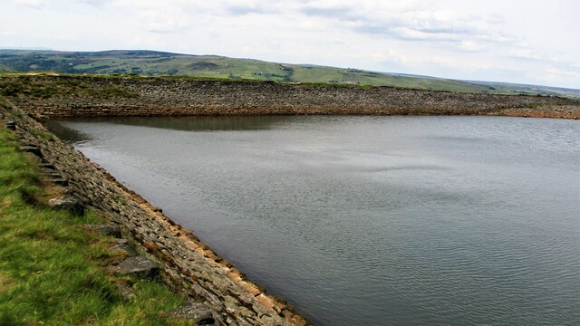
Swineshead Clough is a picturesque valley located in the county of Lancashire, England. Nestled within the expansive countryside, it stretches across a vast area of land, offering visitors breathtaking views of its natural beauty. The clough is situated in close proximity to the village of Swineshead, which adds to its charm and accessibility.

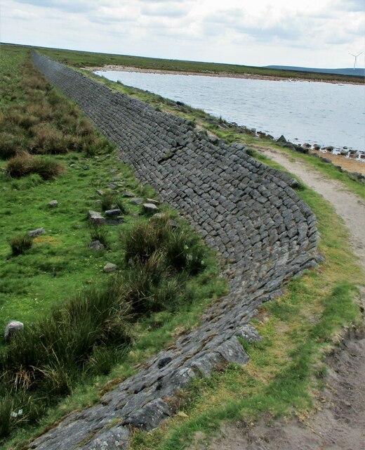
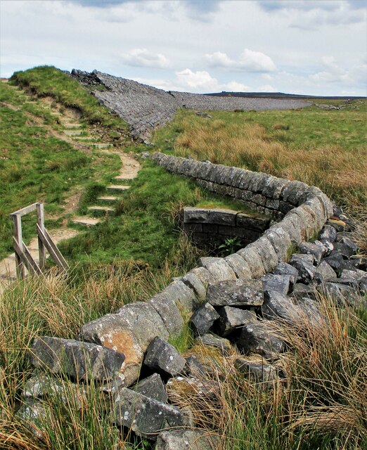
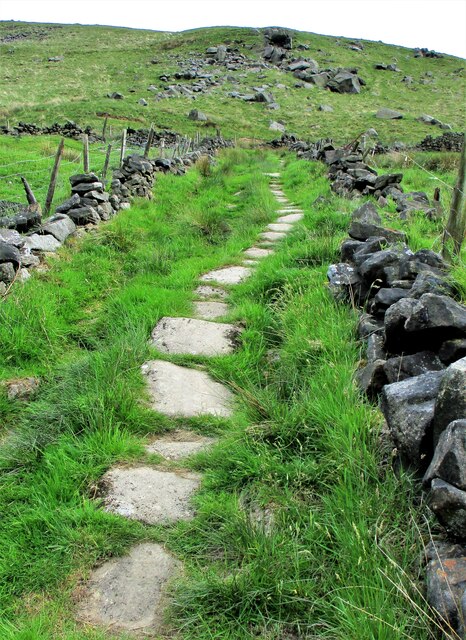
The valley is characterized by its lush greenery, rolling hills, and meandering streams that flow through its heart. It boasts a diverse range of flora and fauna, making it a haven for nature lovers and wildlife enthusiasts. The vibrant colors of wildflowers dotting the landscape during the spring and summer months add an additional touch of beauty to the already stunning scenery.

Swineshead Clough is a popular destination for outdoor activities such as hiking, walking, and birdwatching. Its well-maintained trails offer visitors the opportunity to explore the valley at their own pace, immersing themselves in the tranquility of nature. The clough is home to a variety of bird species, including the elusive kingfisher, which can often be spotted along the water's edge.

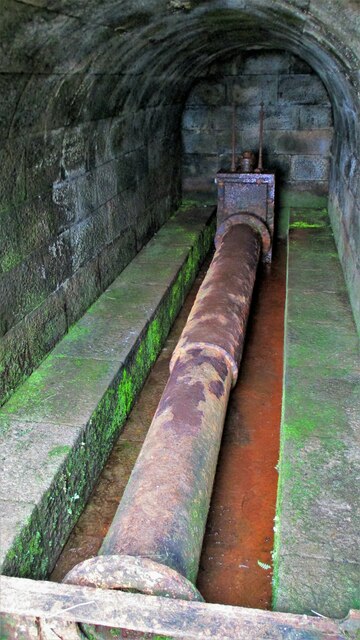
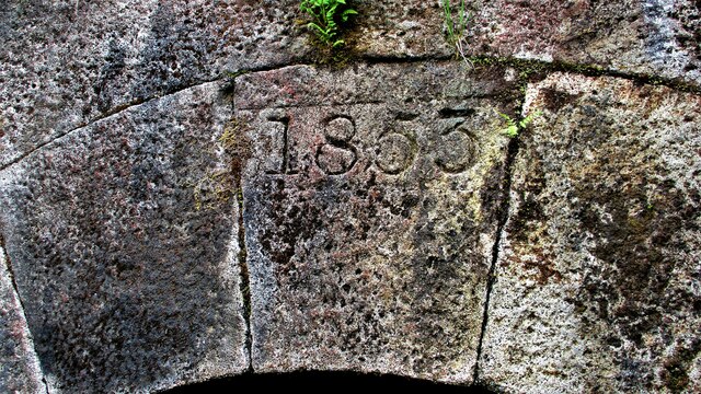
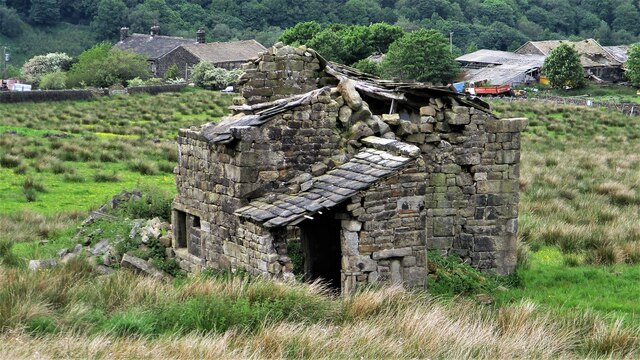
The valley also holds historical significance, with remnants of ancient settlements and structures scattered throughout the area. These remnants serve as a reminder of the rich heritage and cultural heritage of the region.

In conclusion, Swineshead Clough in Lancashire is a captivating valley that captivates visitors with its natural beauty, abundant wildlife, and historical significance. Whether seeking a serene retreat or an adventure in the great outdoors, this valley offers something for everyone.

If you have any feedback on the listing, please let us know in the comments section below.

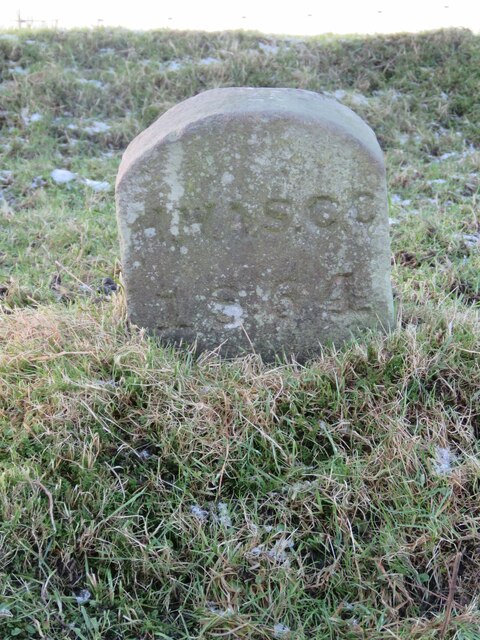
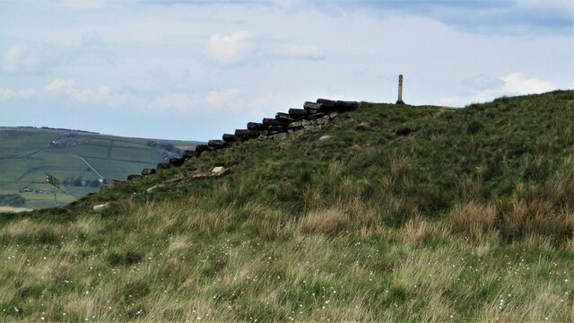
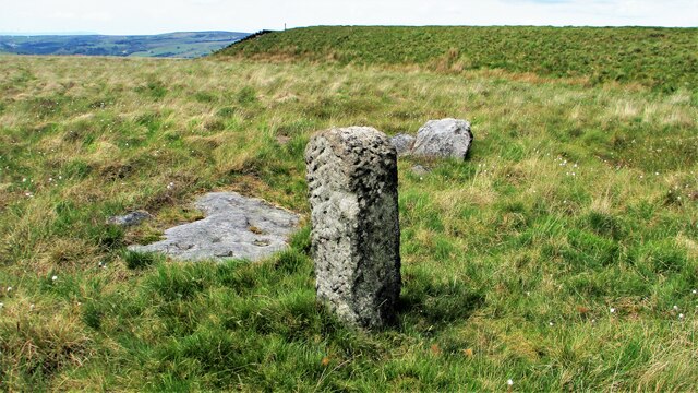
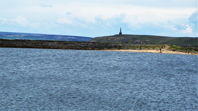
Swineshead Clough Images

Images are sourced within 2km of 53.705967/-2.1023976 or Grid Reference SD9323. Thanks to Geograph Open Source API. All images are credited.

Rochdale Canal at Gauxholme View from Rochdale to Leeds railway
Rochdale Canal at Gauxholme
View from Rochdale to Leeds railway
Burnley Road, Todmorden View from Rochdale to Leeds railway
Burnley Road, Todmorden
View from Rochdale to Leeds railway
Sunlight on Todmorden from ridge south of Stoodley Pike Monument
Old Boundary Marker near Flailcroft, Todmorden Chapelry Boundary Marker beside a footpath north of Flailcroft. Todmorden parish. Inscribed H W A S C C / 1864 for Harley Wood All Saints Consolidated Chapelry. See  <span class="nowrap"><a title="https://www.thegazette.co.uk/London/issue/22908/page/5170" rel="nofollow ugc noopener" href="https://www.thegazette.co.uk/London/issue/22908/page/5170">Link</a><img style="margin-left:2px;" alt="External link" title="External link - shift click to open in new window" src="https://s1.geograph.org.uk/img/external.png" width="10" height="10"/></span>.

Milestone Society National ID: YW_TOD10pb
Old Boundary Marker near Flailcroft, Todmorden
Chapelry Boundary Marker beside a footpath north of Flailcroft. Todmorden parish. Inscribed H W A S C C / 1864 for Harley Wood All Saints Consolidated Chapelry. See LinkExternal link. Milestone Society National ID: YW_TOD10pb
Lower Knowl A work in progress
Lower Knowl
A work in progress
Swineshead Farm View from Lower Knowl
Swineshead Farm
View from Lower Knowl
Lower Knowl A farmhouse hopefully work in progress
Lower Knowl
A farmhouse hopefully work in progress
Steps at Gaddings Dam Steps at western corner of dam showing daylight through them
Steps at Gaddings Dam
Steps at western corner of dam showing daylight through them
Langfield Common Boundary Stone Stone with L on face away from camera, nothing discernible on other. Gaddings Dam steps in background
Langfield Common Boundary Stone
Stone with L on face away from camera, nothing discernible on other. Gaddings Dam steps in background
Costa del Todmordo The beach in Gaddings Dam, a very popular spot for Todmorden folk. Stoodley Pike Monument in the background
Costa del Todmordo
The beach in Gaddings Dam, a very popular spot for Todmorden folk. Stoodley Pike Monument in the background
Gaddings Dam The stone inner face of the dam. Gaddings is maintained by a local Group with Friends support.
Gaddings Dam
The stone inner face of the dam. Gaddings is maintained by a local Group with Friends support.
Gaddings Dam Outlet Pipe The culvert in the North West dam wall
Gaddings Dam Outlet Pipe
The culvert in the North West dam wall
Gaddings Dam Outlet Culvert Keystone 1853 datestone on outlet culvert in North West dam wall
Gaddings Dam Outlet Culvert Keystone
1853 datestone on outlet culvert in North West dam wall
Gaddings Dam (East) Wall The dam wall that separates the East & West dams. The East dam has been drained by United Utilities. The West dam is maintained by a local support group
Gaddings Dam (East) Wall
The dam wall that separates the East & West dams. The East dam has been drained by United Utilities. The West dam is maintained by a local support group
Breach in Gaddings Dam (East) The breach in the dam wall that runs along Langfield Edge. This appears to be at the former outlet culvert which has been re-configured
Breach in Gaddings Dam (East)
The breach in the dam wall that runs along Langfield Edge. This appears to be at the former outlet culvert which has been re-configured
Outlet Drain from Gaddings Dam (East) The stone lined channel that takes water over Langfield Edge. This dam was reportedly built for the Rochdale Canal and there is no obvious route to it other than through the dams at Lumbutts and down Lumbutts Clough.
Outlet Drain from Gaddings Dam (East)
The stone lined channel that takes water over Langfield Edge. This dam was reportedly built for the Rochdale Canal and there is no obvious route to it other than through the dams at Lumbutts and down Lumbutts Clough.
Causey Stones up Moor Lane Track south of Top O Th Rough towards Rake End
Causey Stones up Moor Lane
Track south of Top O Th Rough towards Rake End
Derelict Top O Th Rough Viewed from Moor Lane
Derelict Top O Th Rough
Viewed from Moor Lane
Show me another place!

Swineshead Clough is located at Grid Ref: SD9323 (Lat: 53.705967, Lng: -2.1023976)

Unitary Authority: Calderdale

Police Authority: West Yorkshire

What 3 Words

///sharper.paintings.readings. Near Todmorden, West Yorkshire

Related Wikis

Todmorden Unitarian Church

Todmorden Unitarian Church is a Unitarian church located in Honey Hole Road, Todmorden, West Yorkshire, England (grid reference SD935239). Built in honour...

Dobroyd Castle

Dobroyd Castle is an important historic building above the town of Todmorden, West Yorkshire, England. It was built for John Fielden, local mill owner...

Todmorden

Todmorden ( TOD-mər-dən; locally ) is a market town and civil parish in the Upper Calder Valley in Calderdale, West Yorkshire, England. It is 17 miles...

Todmorden railway station

Todmorden railway station serves the town of Todmorden in West Yorkshire, England, originally on the Yorkshire and Lancashire border. It was built by the...

Todmorden Town Hall

Todmorden Town Hall is a municipal building in Halifax Road, Todmorden, West Yorkshire, England. The town hall, which is the meeting place of Todmorden...

Todmorden Markets

Todmorden Markets consist of an indoor market held in the Public Market Hall and an outdoor open air market held to the front of the Public Market Hall...

Todmorden bus station

Todmorden bus station serves the town of Todmorden, West Yorkshire, England. The bus station is owned and managed by West Yorkshire Metro and was opened...

Walsden railway station

Walsden railway station (; WOLZ-dən) serves the village of Walsden, Todmorden in West Yorkshire, England, on the edge of the Pennines. It is served by...

Nearby Amenities

Located within 500m of 53.705967,-2.1023976
Seamark Type: gate
Waterway: lock_gate
Lat/Long: 53.7085277/-2.1040527
Seamark Type: gate
Waterway: lock_gate
Lat/Long: 53.7083188/-2.1042135
Seamark Type: gate
Waterway: lock_gate
Lat/Long: 53.7053227/-2.1082052
Seamark Type: gate
Waterway: lock_gate
Lat/Long: 53.7070935/-2.1054293
Seamark Type: gate
Waterway: lock_gate
Lat/Long: 53.7069207/-2.105673
Seamark Type: gate
Waterway: lock_gate
Lat/Long: 53.7058936/-2.1074009
Seamark Type: gate
Waterway: lock_gate
Lat/Long: 53.7060595/-2.1071259
Seamark Type: gate
Waterway: lock_gate
Lat/Long: 53.7055081/-2.1079676
Seamark Type: gate
Waterway: lock_gate
Lat/Long: 53.7041356/-2.1087637
Seamark Type: gate
Waterway: lock_gate
Lat/Long: 53.7043512/-2.1087294
Bus Stop
Rochdale Road Safeway
Bus: yes
Local Ref: 45018924
Naptan AtcoCode: 450018924
Naptan Bearing: S
Naptan CommonName: Rochdale Road Safeway
Naptan Crossing: Dobroyd Road
Naptan Indicator: Stop 45018924
Naptan Landmark: Safeway Superstore
Naptan PlusbusZoneRef: LEEDS
Naptan ShortCommonName: Dobroyd Road
Naptan Street: Rochdale Road
Naptan Verified: no
Public Transport: platform
Source: naptan_import
Lat/Long: 53.7102199/-2.1020393
Bus Stop
Rochdale Road
Bus: yes
Local Ref: 45018925
Naptan AtcoCode: 450018925
Naptan Bearing: N
Naptan CommonName: Rochdale Road
Naptan Crossing: Dobroyd Road
Naptan Indicator: Stop 45018925
Naptan Landmark: Morrisons
Naptan PlusbusZoneRef: LEEDS
Naptan ShortCommonName: Dobroyd Road
Naptan Street: Rochdale Road
Naptan Verified: no
Public Transport: platform
Source: naptan_import
Lat/Long: 53.7102793/-2.1021781
Bus Stop
Rochdale Road
Bus: yes
Local Ref: 45018926
Naptan AtcoCode: 450018926
Naptan Bearing: N
Naptan CommonName: Rochdale Road
Naptan Crossing: Laneside Street
Naptan Indicator: Stop 45018926
Naptan Landmark: Elec Sub Station
Naptan PlusbusZoneRef: LEEDS
Naptan ShortCommonName: Laneside Street
Naptan Street: Rochdale Road
Naptan Verified: no
Public Transport: platform
Source: naptan_import
Lat/Long: 53.7086796/-2.1028716
Bus Stop
Rochdale Road
Bus: yes
Local Ref: 45018927
Naptan AtcoCode: 450018927
Naptan Bearing: S
Naptan CommonName: Rochdale Road
Naptan Crossing: Bar Street
Naptan Indicator: Stop 45018927
Naptan PlusbusZoneRef: LEEDS
Naptan ShortCommonName: Bar Street
Naptan Street: Rochdale Road
Naptan Verified: no
Public Transport: platform
Source: naptan_import
Lat/Long: 53.707963/-2.1030185
Bus Stop
Rochdale Road Knowlwood Road
Bus: yes
Local Ref: 45018928
Naptan AtcoCode: 450018928
Naptan Bearing: SW
Naptan CommonName: Rochdale Road Knowlwood Road
Naptan Crossing: Knowlwood Road
Naptan Indicator: Stop 45018928
Naptan Landmark: Woodpecker Inn PH
Naptan PlusbusZoneRef: LEEDS
Naptan ShortCommonName: Knowlwood Road
Naptan Street: Rochdale Road
Naptan Verified: no
Public Transport: platform
Source: naptan_import
Lat/Long: 53.7067666/-2.1041367
Bus Stop
Rochdale Road Little Holme Street
Bus: yes
Local Ref: 45018929
Naptan AtcoCode: 450018929
Naptan Bearing: NE
Naptan CommonName: Rochdale Road Little Holme Street
Naptan Crossing: Little Holme Street
Naptan Indicator: Stop 45018929
Naptan Landmark: Woodpecker PH
Naptan Notes: OSR taken place 17Advert panels fitted on 1/2/08.
Naptan PlusbusZoneRef: LEEDS
Naptan ShortCommonName: Little Holme Street
Naptan Street: Rochdale Road
Naptan Verified: no
Public Transport: platform
Source: naptan_import
Lat/Long: 53.7066942/-2.1046213
Bus Stop
Rochdale Road Bacup Road
Bus: yes
Local Ref: 45018930
Naptan AtcoCode: 450018930
Naptan Bearing: SW
Naptan CommonName: Rochdale Road Bacup Road
Naptan Crossing: Bacup Road
Naptan Indicator: Stop 45018930
Naptan PlusbusZoneRef: LEEDS
Naptan ShortCommonName: Bacup Road
Naptan Street: Rochdale Road
Naptan Verified: no
Public Transport: platform
Source: naptan_import
Lat/Long: 53.7052274/-2.1066324
Bus Stop
Rochdale Road Bacup Road
Bus: yes
Local Ref: 45018931
Naptan AtcoCode: 450018931
Naptan Bearing: NE
Naptan CommonName: Rochdale Road Bacup Road
Naptan Crossing: Bacup Road
Naptan Indicator: Stop 45018931
Naptan PlusbusZoneRef: LEEDS
Naptan ShortCommonName: Bacup Road
Naptan Street: Rochdale Road
Naptan Verified: no
Public Transport: platform
Source: naptan_import
Lat/Long: 53.7052182/-2.1068596
Bus Stop
Rochdale Road
Bus: yes
Local Ref: 45018932
Naptan AtcoCode: 450018932
Naptan Bearing: NW
Naptan CommonName: Rochdale Road
Naptan Crossing: Nr Bacup Road
Naptan Indicator: Stop 45018932
Naptan PlusbusZoneRef: LEEDS
Naptan ShortCommonName: Knowlwood Bottom
Naptan Street: Rochdale Road
Naptan Verified: no
Public Transport: platform
Source: naptan_import
Lat/Long: 53.7031686/-2.1070514
Bus Stop
Rochdale Road
Bus: yes
Local Ref: 45018933
Naptan AtcoCode: 450018933
Naptan Bearing: S
Naptan CommonName: Rochdale Road
Naptan Crossing: Nr-At Hollins Road
Naptan Indicator: Stop 45018933
Naptan PlusbusZoneRef: LEEDS
Naptan ShortCommonName: Hollins Road
Naptan Street: Rochdale Road
Naptan Verified: no
Public Transport: platform
Source: naptan_import
Lat/Long: 53.7029622/-2.1067327
Bus Stop
Lumbutts Road Old Lane
Bus: yes
Local Ref: 45018962
Naptan AtcoCode: 450018962
Naptan Bearing: NE
Naptan CommonName: Lumbutts Road Old Lane
Naptan Crossing: Old Lane
Naptan Indicator: Stop 45018962
Naptan PlusbusZoneRef: LEEDS
Naptan ShortCommonName: Old Lane
Naptan Street: Lumbutts Road
Naptan Verified: no
Public Transport: platform
Source: naptan_import
Lat/Long: 53.7041222/-2.1051911
Bus Stop
Lumbutts Road Lumbutts
Bus: yes
Local Ref: 45018963
Naptan AtcoCode: 450018963
Naptan Bearing: E
Naptan CommonName: Lumbutts Road Lumbutts
Naptan Crossing: Adj Swinehead Lane
Naptan Indicator: Stop 45018963
Naptan PlusbusZoneRef: LEEDS
Naptan ShortCommonName: Swineshead Lane
Naptan Street: Lumbutts Road
Naptan Verified: no
Public Transport: platform
Source: naptan_import
Lat/Long: 53.7050714/-2.0998302
Bus Stop
Knowlwood Road Swineshead Road
Bus: yes
Local Ref: 45018983
Naptan AtcoCode: 450018983
Naptan Bearing: S
Naptan CommonName: Knowlwood Road Swineshead Road
Naptan Crossing: Swineshead Road
Naptan Indicator: Stop 45018983
Naptan Notes: OSR taken place 050106
Naptan PlusbusZoneRef: LEEDS
Naptan ShortCommonName: Swineshead Road
Naptan Street: Knowlwood Road
Naptan Verified: no
Public Transport: platform
Source: naptan_import
Lat/Long: 53.7066589/-2.1038637
Bus Stop
Knowlwood Road Hill Place
Bus: yes
Local Ref: 45018984
Naptan AtcoCode: 450018984
Naptan Bearing: SW
Naptan CommonName: Knowlwood Road Hill Place
Naptan Crossing: Hill Place
Naptan Indicator: Stop 45018984
Naptan Landmark: Shade Junior & Infant School
Naptan PlusbusZoneRef: LEEDS
Naptan ShortCommonName: Knowlwood Road
Naptan Street: Knowlwood Road
Naptan Verified: no
Public Transport: platform
Source: naptan_import
Lat/Long: 53.7055885/-2.1048457
Bus Stop
Knowlwood Road
Bus: yes
Local Ref: 45018985
Naptan AtcoCode: 450018985
Naptan Bearing: NE
Naptan CommonName: Knowlwood Road
Naptan Crossing: Nr-Opp Lumbutts Road (Shade Side)
Naptan Indicator: Stop 45018985
Naptan Landmark: Flats
Naptan PlusbusZoneRef: LEEDS
Naptan ShortCommonName: Knowlwood Road
Naptan Street: Knowlwood Road
Naptan Verified: no
Public Transport: platform
Source: naptan_import
Lat/Long: 53.7050934/-2.105708
Bus Stop
Knowlwood Road
Bus: yes
Local Ref: 45018986
Naptan AtcoCode: 450018986
Naptan Bearing: SW
Naptan CommonName: Knowlwood Road
Naptan Crossing: Nr Old Lane
Naptan Indicator: Stop 45018986
Naptan PlusbusZoneRef: LEEDS
Naptan ShortCommonName: Knowlwood Road
Naptan Street: Knowlwood Road
Naptan Verified: no
Public Transport: platform
Source: naptan_import
Lat/Long: 53.7048237/-2.1057376
Bus Stop
Knowlwood Road
Bus: yes
Local Ref: 45018987
Naptan AtcoCode: 450018987
Naptan Bearing: S
Naptan CommonName: Knowlwood Road
Naptan Crossing: Old Lane
Naptan Indicator: Stop 45018987
Naptan PlusbusZoneRef: LEEDS
Naptan ShortCommonName: Old Lane
Naptan Street: Knowlwood Road
Naptan Verified: no
Public Transport: platform
Source: naptan_import
Lat/Long: 53.7031963/-2.1062486
Bus Stop
Lumbutts Road
Bus: yes
Local Ref: 45027167
Naptan AtcoCode: 450027167
Naptan Bearing: W
Naptan BusStopType: CUS
Naptan CommonName: Lumbutts Road
Naptan Indicator: Stop 45027167
Naptan Notes: Dummy stop to support the BD status of A/n 18963
Naptan PlusbusZoneRef: LEEDS
Naptan ShortCommonName: Swineshead Lane
Naptan Street: Lumbutts Road
Naptan Verified: no
Public Transport: platform
Source: naptan_import
Lat/Long: 53.7049924/-2.0998497
Bus Stop
Knowlwood Road Old Lane
Bus: yes
Local Ref: 45050725
Naptan AtcoCode: 450050725
Naptan Bearing: N
Naptan BusStopType: CUS
Naptan CommonName: Knowlwood Road Old Lane
Naptan Indicator: Stop 45050725
Naptan PlusbusZoneRef: LEEDS
Naptan ShortCommonName: Hollins Road
Naptan Street: Knowlwood Road
Naptan Verified: no
Public Transport: platform
Source: naptan_import
Lat/Long: 53.7031872/-2.1064
Lumbutts Road Old Lane
Local Ref: 45050709
Naptan AtcoCode: 450050709
Naptan Bearing: SW
Naptan BusStopType: CUS
Naptan CommonName: Lumbutts Road Old Lane
Naptan Indicator: Stop 45050709
Naptan PlusbusZoneRef: LEEDS
Naptan ShortCommonName: Knowl Wood
Naptan Street: Lumbutts Road
Naptan Verified: no
Source: naptan_import
Lat/Long: 53.7040692/-2.1051298
Noexit: yes
Lat/Long: 53.7073285/-2.1048269
Noexit: yes
Lat/Long: 53.7069678/-2.1052932
Noexit: yes
Lat/Long: 53.7084919/-2.1038135
Pub
The Woodpecker Inn
Addr City: Todmorden
Addr Housenumber: 222
Addr Postcode: OL14 7NU
Addr Street: Rochdale Road
Internet Access: wlan
Lat/Long: 53.7067158/-2.1047233
Noexit: yes
Lat/Long: 53.7068585/-2.1054759
Parking
Lat/Long: 53.7069286/-2.1045409
Noexit: yes
Lat/Long: 53.7082117/-2.1040569
Parking
Lat/Long: 53.7076708/-2.1035901
Shade
Leisure: playground
Lat/Long: 53.7063551/-2.1044962
New Barn Garage
Shop: car_repair
Lat/Long: 53.7081825/-2.1032249
Crossing
Crossing: zebra
Kerb: lowered
Tactile Paving: yes
Lat/Long: 53.7068367/-2.1041401
Power: pole
Lat/Long: 53.707721/-2.0975369
Power: pole
Lat/Long: 53.7078154/-2.0993387
Power: pole
Lat/Long: 53.7079142/-2.1011506
Power: pole
Lat/Long: 53.7086429/-2.1033487
Power: pole
Lat/Long: 53.7087265/-2.1030851
Power: pole
Lat/Long: 53.7084379/-2.1010833
Power: pole
Lat/Long: 53.7083292/-2.1018621
Power: pole
Lat/Long: 53.7086388/-2.0995474
Power: pole
Lat/Long: 53.7088865/-2.0974687
Bench
Lat/Long: 53.7097805/-2.098827
Grit Bin
Lat/Long: 53.7098062/-2.0988441
Barrier: stile
Material: stone
Stile: stepover
Lat/Long: 53.7065101/-2.1094868
Noexit: yes
Lat/Long: 53.7063716/-2.1029175
Barrier: stile
Stile: squeezer
Lat/Long: 53.7053043/-2.1022462
Barrier: stile
Stile: stepover
Lat/Long: 53.7061595/-2.1028867
Steeltech Kinetix
Addr City: Todmorden
Addr Housename: Bridge Mill
Addr Postcode: OL14 7PW
Addr Street: Gauxholme Fold
Man Made: works
Product: steel_products
Website: https://www.steeltech-kinetix.co.uk/
Lat/Long: 53.7045457/-2.1080724
Longcroft Engineering
Addr City: Todmorden
Addr Housename: Bridge Mill
Addr Postcode: OL14 7PW
Addr Street: Gauxholme Fold
Man Made: works
Product: springs
Website: https://www.longcroftengineering.co.uk/
Lat/Long: 53.7041489/-2.1082873
Pub
Bridge End Workmens Club
Lat/Long: 53.7069845/-2.1041688
Noexit: yes
Lat/Long: 53.7083203/-2.1038887
Todmorden Bed Factory
Addr City: Todmorden
Addr Housename: Old Fire Station
Addr Postcode: OL14 7NA
Addr Street: Rochdale Road
Shop: bed
Website: https://bedfactoryoutlet.co.uk/
Lat/Long: 53.7098691/-2.1024679
Sofa Workshop
Addr City: Todmorden
Addr Housename: Old Fire Station
Addr Postcode: OL14 7NA
Addr Street: Rochdale Road
Craft: upholsterer
Shop: furniture
Lat/Long: 53.709715/-2.1025219
Noexit: yes
Lat/Long: 53.7071346/-2.105054
Noexit: yes
Lat/Long: 53.7086467/-2.1037504
Addr City: Todmorden
Addr Housenumber: 1
Addr Street: Dobroyd Court
Lat/Long: 53.7104299/-2.1023062
Addr City: Todmorden
Addr Housenumber: 3
Addr Street: Dobroyd Court
Lat/Long: 53.7103946/-2.1023158
The data included in this document is from www.openstreetmap.org. The data is made available under ODbL.

Have you been to Swineshead Clough?

Leave your review of Swineshead Clough below (or comments, questions and feedback).