Red Clough

Valley in Lancashire

England

Red Clough

Rochdale Canal at Gauxholme View from Rochdale to Leeds railway
Rochdale Canal at Gauxholme Credit: Raymond Knapman

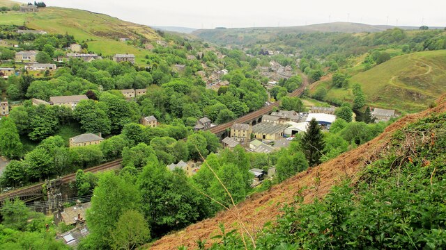
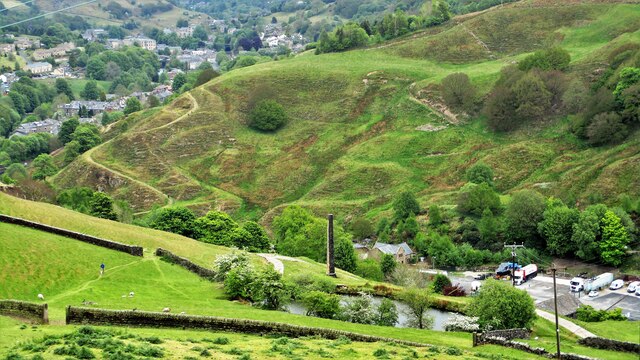
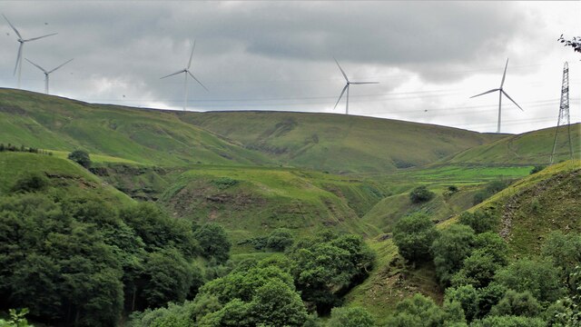
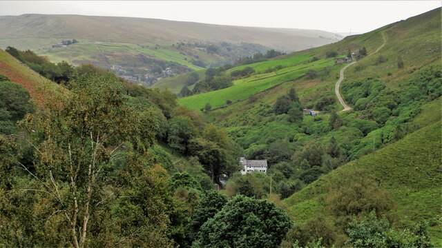
Red Clough is a small yet picturesque valley located in the Lancashire region of England. Nestled within the larger West Pennine Moors, it is known for its stunning natural beauty and tranquil atmosphere, attracting nature enthusiasts and hikers alike.

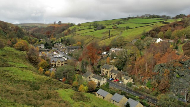
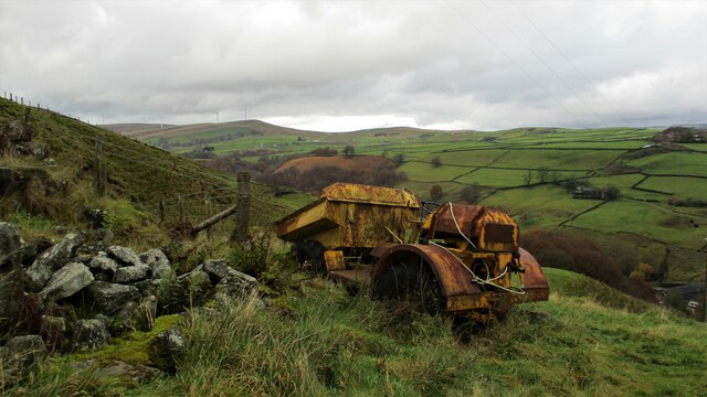
Situated just a few miles east of the town of Blackburn, Red Clough is characterized by its rolling hills, lush green fields, and meandering streams. The valley is predominantly rural, with scattered farms and a few small settlements dotting the landscape. The area is rich in biodiversity, featuring a variety of plant and animal species, including heather, bilberry, and curlew.

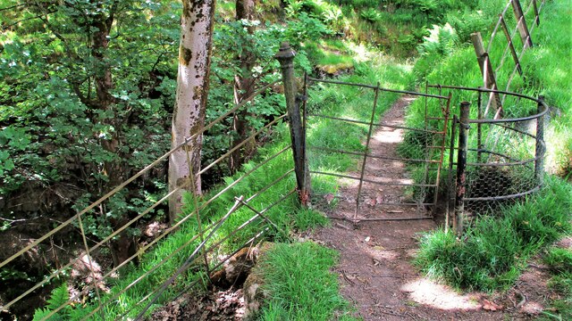
One of the main attractions of Red Clough is its extensive network of walking trails. These paths wind their way through the valley, offering visitors the opportunity to explore the area's stunning scenery. The valley is also home to several reservoirs, including Roddlesworth and Yate, which provide a peaceful retreat for fishing and birdwatching.

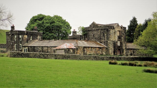
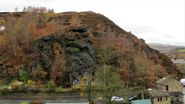
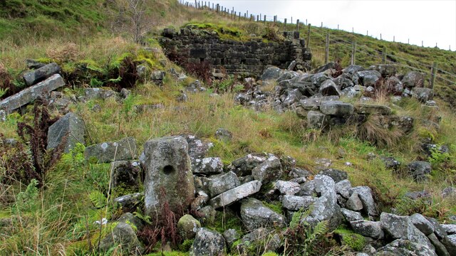
History buffs will appreciate Red Clough's historical significance. Evidence of ancient settlements and archaeological sites can be found throughout the valley, offering a glimpse into the area's past. Additionally, remnants of old mill buildings and stone bridges stand as reminders of the region's industrial heritage.

The tranquility and natural beauty of Red Clough make it an idyllic destination for those seeking a peaceful retreat or an outdoor adventure. Whether it's hiking, birdwatching, or simply enjoying the breathtaking views, visitors to Red Clough are sure to be captivated by its unspoiled charm.

If you have any feedback on the listing, please let us know in the comments section below.
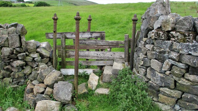
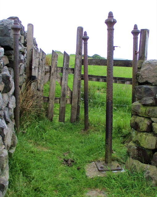
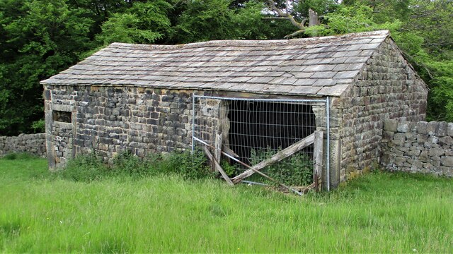
Red Clough Images

Images are sourced within 2km of 53.694152/-2.1265393 or Grid Reference SD9121. Thanks to Geograph Open Source API. All images are credited.

Rochdale Canal at Gauxholme View from Rochdale to Leeds railway
Rochdale Canal at Gauxholme
View from Rochdale to Leeds railway
Lower Knowl A work in progress
Lower Knowl
A work in progress
Lower Knowl A farmhouse hopefully work in progress
Lower Knowl
A farmhouse hopefully work in progress
Gauxholme Railway Viaduct View South over Shade & Gauxholme from Dobroyd Road
Gauxholme Railway Viaduct
View South over Shade & Gauxholme from Dobroyd Road
Model Farm to Dobroyd Castle The farm from Stones Road showing its apparent Scottish style with a central tower or keep.
Model Farm to Dobroyd Castle
The farm from Stones Road showing its apparent Scottish style with a central tower or keep.
Standing Stone No.2 at Stones A listed stone possibly prehistoric off Stones Lane. There are reportedly another 3 in the area but only No.1. is also listed. Midgelden Brook is in the valley beyond
Standing Stone No.2 at Stones
A listed stone possibly prehistoric off Stones Lane. There are reportedly another 3 in the area but only No.1. is also listed. Midgelden Brook is in the valley beyond
Centre Hill Monument A possible prehistoric stone mounted on a mill stone at Stones
Centre Hill Monument
A possible prehistoric stone mounted on a mill stone at Stones
Friths Mill Chimney View from Stones over the isolated chimney with Naze Road snaking up the other side of the valley
Friths Mill Chimney
View from Stones over the isolated chimney with Naze Road snaking up the other side of the valley
White Slack Clough View from Strines Lane to the very steep sided Cloughs South of Ramsden Clough. White Slack Clough is the one on the left, the other is unnamed
White Slack Clough
View from Strines Lane to the very steep sided Cloughs South of Ramsden Clough. White Slack Clough is the one on the left, the other is unnamed
Crag at Gauxholme View from Naze Road across the valley to the crag against Bacup Road
Crag at Gauxholme
View from Naze Road across the valley to the crag against Bacup Road
Friths Mill Chimney View from Naze Road to the isolated chimney. Bacup Road runs up the valley
Friths Mill Chimney
View from Naze Road to the isolated chimney. Bacup Road runs up the valley
Naze Farm Remains Remains on North side of Naze Road
Naze Farm Remains
Remains on North side of Naze Road
Abandoned Dumper at Naze Farm The dumper's demise must be at a later date than the farm's demise. The valley of Dulesgate Water is beyond the dumper
Abandoned Dumper at Naze Farm
The dumper's demise must be at a later date than the farm's demise. The valley of Dulesgate Water is beyond the dumper
Valley of Dulesgate Water View South East from the high level path in Gorpley Clough. The white building is Fern Cottage & Factory and the track climbs up past Dean Farm on to Inchfield Pasture.
Valley of Dulesgate Water
View South East from the high level path in Gorpley Clough. The white building is Fern Cottage & Factory and the track climbs up past Dean Farm on to Inchfield Pasture.
Kissing Gate to enter Stones Wood This style of iron work pillar is found at numerous stiles and fencing around this area of Stones & Dobroyd Castle.
Kissing Gate to enter Stones Wood
This style of iron work pillar is found at numerous stiles and fencing around this area of Stones & Dobroyd Castle.
Stile on Path above Stones Wood A stile using the decorative iron pillars common around Stones & Dobroyd Castle
Stile on Path above Stones Wood
A stile using the decorative iron pillars common around Stones & Dobroyd Castle
Gate & Iron Pillars in Mellings Clough Another set of pillars that are common around Stones & Dobroyd Castle. This set now appear to have little use being replaced by woodwork and wire fencing
Gate & Iron Pillars in Mellings Clough
Another set of pillars that are common around Stones & Dobroyd Castle. This set now appear to have little use being replaced by woodwork and wire fencing
Field Barn in Mellings Clough Farm building straddling the field wall
Field Barn in Mellings Clough
Farm building straddling the field wall
Show me another place!

Red Clough is located at Grid Ref: SD9121 (Lat: 53.694152, Lng: -2.1265393)

Unitary Authority: Calderdale

Police Authority: West Yorkshire

What 3 Words

///occur.prevents.keen. Near Walsden, West Yorkshire

Related Wikis

Walsden railway station

Walsden railway station (; WOLZ-dən) serves the village of Walsden, Todmorden in West Yorkshire, England, on the edge of the Pennines. It is served by...

Walsden

Walsden (; WOLZ-dən) is a large village in the civil parish of Todmorden in the Metropolitan Borough of Calderdale, West Yorkshire, England. It was historically...

Dobroyd Castle

Dobroyd Castle is an important historic building above the town of Todmorden, West Yorkshire, England. It was built for John Fielden, local mill owner...

Summit Tunnel

Summit Tunnel in England is one of the world's oldest railway tunnels. It was constructed between 1838 and 1841 by the Manchester and Leeds Railway Company...

Nearby Amenities

Located within 500m of 53.694152,-2.1265393
Design: barrel
Power: tower
Lat/Long: 53.6899355/-2.1247036
Design: barrel
Power: tower
Lat/Long: 53.691951/-2.1260008
Design: barrel
Power: tower
Lat/Long: 53.6940431/-2.1273914
Design: barrel
Power: tower
Lat/Long: 53.6960406/-2.1286679
Design: barrel
Power: tower
Lat/Long: 53.698065/-2.1299673
Ford: yes
Lat/Long: 53.6920606/-2.1255739
The data included in this document is from www.openstreetmap.org. The data is made available under ODbL.

Have you been to Red Clough?

Leave your review of Red Clough below (or comments, questions and feedback).