Hell Gill

Valley in Yorkshire Craven

England

Hell Gill

Clapper Bridge Across the Malham Beck
Clapper Bridge Credit: Kevin Waterhouse

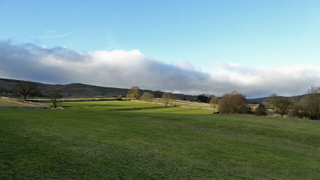
Hell Gill is a picturesque valley located in Yorkshire, England. Nestled within the stunning landscape of the Yorkshire Dales National Park, it offers visitors a unique and awe-inspiring experience. The valley is situated near the charming village of Hawes, and it is renowned for its natural beauty and dramatic scenery.

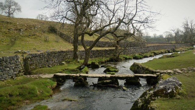
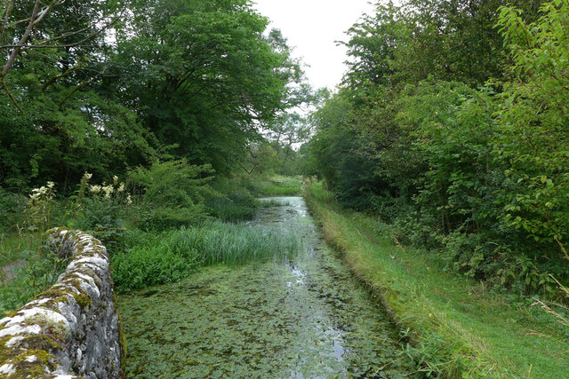
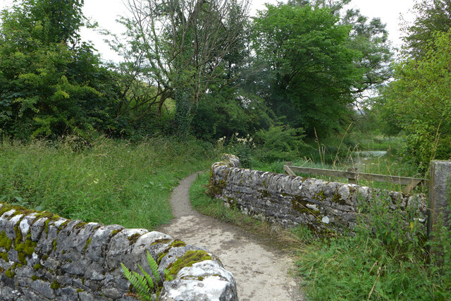
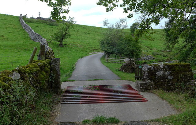
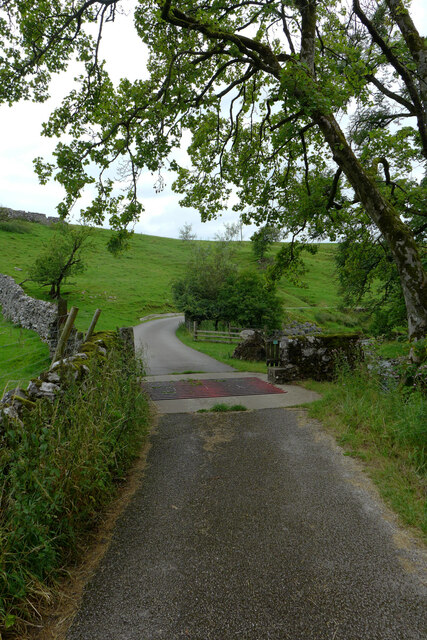
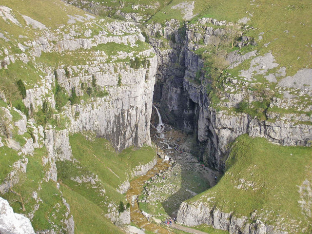
Surrounded by towering limestone cliffs and rugged moorland, Hell Gill is a haven for nature enthusiasts and hikers. The valley is carved by the Hell Gill Beck, a pristine stream that cascades down the rocky slopes, creating a series of mesmerizing waterfalls and pools. The sound of rushing water and the sight of the lush vegetation that lines the gill adds to its ethereal charm.

The name "Hell Gill" may evoke images of a fiery underworld, but it actually stems from the Old Norse word "hellir," meaning a hidden or secret place. This description is fitting, as the valley feels like a hidden gem, tucked away from the hustle and bustle of modern life.

Exploring Hell Gill is an adventure in itself, as the terrain can be challenging. Steep and narrow paths wind through the valley, requiring a moderate level of fitness and sturdy footwear. However, the rewards are worth the effort, with breathtaking vistas at every turn.

With its untouched natural beauty and tranquil atmosphere, Hell Gill is a must-visit destination for those seeking solace in nature and a glimpse into the enchanting landscapes of Yorkshire.

If you have any feedback on the listing, please let us know in the comments section below.
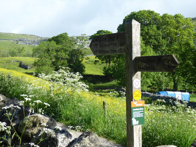
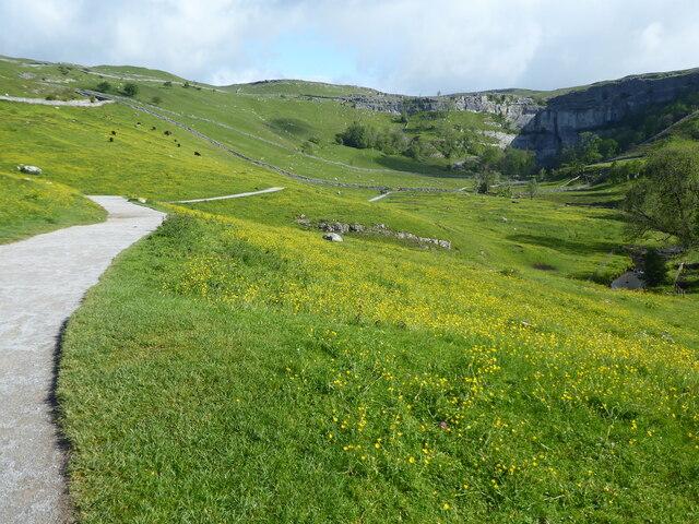
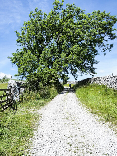
Hell Gill Images

Images are sourced within 2km of 54.060462/-2.1335189 or Grid Reference SD9162. Thanks to Geograph Open Source API. All images are credited.

Clapper Bridge Across the Malham Beck
Clapper Bridge
Across the Malham Beck
The Pennine Way near Town Head
The Pennine Way near High Barn
Limestone-chipped road climbing out of Malham The road climbs among fields heading for a cluster of named barns to the west of Malham.
Limestone-chipped road climbing out of Malham
The road climbs among fields heading for a cluster of named barns to the west of Malham.
Mill leat, Scalegill Mill, Kirkby Malham
Footbridge over the mill leat, Scalegill Mill, Kirkby Malham
Cattle grid on the road to Scalegill Mill, Kirkby Malham
Malham Cove - Malhamdale View of the path leading from Malham village to Malham Cove, a limestone-walled amphitheatre - seen from the precipice of the limestone pavement above the Cove.
<span class="nowrap"><a title="www.malhamdale.com" rel="nofollow ugc noopener" href="http://www.malhamdale.com">Link</a><img style="margin-left:2px;" alt="External link" title="External link - shift click to open in new window" src="https://s1.geograph.org.uk/img/external.png" width="10" height="10"/></span>
Malham Cove - Malhamdale
View of the path leading from Malham village to Malham Cove, a limestone-walled amphitheatre - seen from the precipice of the limestone pavement above the Cove. LinkExternal link
Malhamdale - Drystone Walling Limestone stones have been used in the formation of this old walling system above Malham village.
<span class="nowrap"><a title="www.malhamdale.com" rel="nofollow ugc noopener" href="http://www.malhamdale.com">Link</a><img style="margin-left:2px;" alt="External link" title="External link - shift click to open in new window" src="https://s1.geograph.org.uk/img/external.png" width="10" height="10"/></span>
Malhamdale - Drystone Walling
Limestone stones have been used in the formation of this old walling system above Malham village. LinkExternal link
The approach to Malham Cove Malham Cove is one of the sights of the Dales. It rises vertically for 250 feet above its base and extends 1,000 feet round the head of the valley. It is part of the Craven Fault system and is the finest limestone circle in Britain. The path is part of the Pennine Way.
The approach to Malham Cove
Malham Cove is one of the sights of the Dales. It rises vertically for 250 feet above its base and extends 1,000 feet round the head of the valley. It is part of the Craven Fault system and is the finest limestone circle in Britain. The path is part of the Pennine Way.
On the way to Malham Cove
Which way now?
Which way now?
Ancient field system remains View of the lynchets to the east of the National Park car park
Ancient field system remains
View of the lynchets to the east of the National Park car park
Cows on the path to Malham Cove
Farleyates Laithe Farleyates Laithe on Gordale Lane.
Farleyates Laithe
Farleyates Laithe on Gordale Lane.
Cross Field Knotts
Cross Field Knotts
Show me another place!

Hell Gill is located at Grid Ref: SD9162 (Lat: 54.060462, Lng: -2.1335189)

Division: West Riding

Administrative County: North Yorkshire

District: Craven

Police Authority: North Yorkshire

What 3 Words

///defends.headings.winded. Near Hellifield, North Yorkshire

Related Wikis

Friar Garth Farmhouse

Friar Garth Farmhouse is a Grade II listed building in Malham, North Yorkshire, England. It was listed as an historic site by English Heritage on 13 September...

Malham

Malham is a village and civil parish in the Craven district of North Yorkshire, England. Before 20th century boundary changes, the village was part of...

Gordale Scar

Gordale Scar is a limestone ravine 1 mile (1.6 km) north-east of Malham, North Yorkshire, England. It contains two waterfalls and has overhanging limestone...

Hanlith

Hanlith is a small village and civil parish in the Craven district of North Yorkshire, England. It is situated near Kirkby Malham and the tourist attraction...

Nearby Amenities

Located within 500m of 54.060462,-2.1335189
Barrier: kissing_gate
Lat/Long: 54.0603153/-2.1409485
Bench
Material: stone
Seats: 1
Source: GPS survey
Lat/Long: 54.0604025/-2.1408507
Low Ridding Lathe
Building: barn
Fixme: does this still exist? Difficult to see on aerial imagery due to trees
Source: OS sheet 133, publ.1852
Lat/Long: 54.059559/-2.135258
Natural: sinkhole
Note: may be old quarrying activity
Source: EsriWorldImageryClarity
Lat/Long: 54.0573166/-2.1331281
Willy's Brow
Place: locality
Lat/Long: 54.0620416/-2.137078
Wedber Brow
Place: locality
Lat/Long: 54.0635985/-2.1381655
Power: pole
Source: Bing
Lat/Long: 54.0648178/-2.1345274
Power: pole
Source: Bing
Lat/Long: 54.0642682/-2.1350176
Power: pole
Source: Bing
Lat/Long: 54.0636745/-2.1355753
Power: pole
Source: Bing
Lat/Long: 54.0631356/-2.1360396
Power: pole
Source: Bing
Lat/Long: 54.0623957/-2.1367115
Power: pole
Source: Bing
Lat/Long: 54.0622435/-2.1376842
Power: pole
Source: Bing
Lat/Long: 54.0621019/-2.1386076
Power: pole
Source: Bing
Lat/Long: 54.0619314/-2.1397049
The data included in this document is from www.openstreetmap.org. The data is made available under ODbL.

Have you been to Hell Gill?

Leave your review of Hell Gill below (or comments, questions and feedback).