The Dingle

Valley in Staffordshire

England

The Dingle

Woodland in Baggeridge Country Park, near Sedgley These woods are by the road north of the visitor centre near Gospel End. 
Baggeridge Country Park is an attractive area of countryside near Dudley and Wolverhampton. It was formerly the Baggeridge Colliery. Together with part of the original Himley Estate of the Earls of Dudley, the whole site has been transformed into 150 acres of attractive country park, including woodland, lakes, and open grassed areas.
Woodland in Baggeridge Country Park, near Sedgley Credit: Roger Kidd

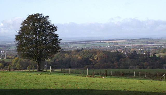
The Dingle, located in Staffordshire, England, is a picturesque valley renowned for its natural beauty and tranquil atmosphere. Nestled within the heart of the Staffordshire Moorlands, this enchanting valley attracts visitors from far and wide.

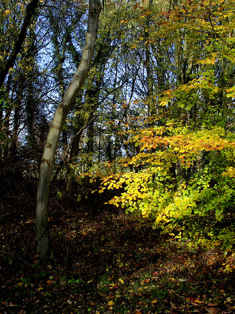
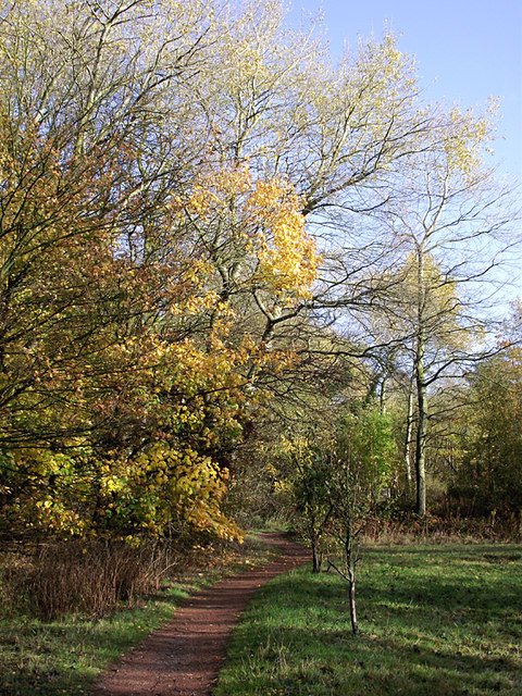
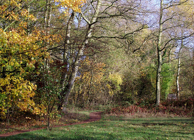
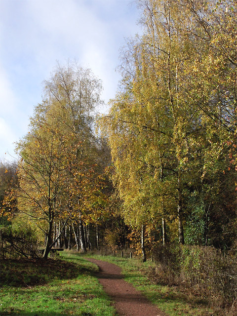
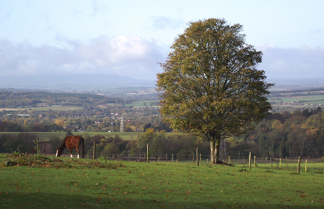
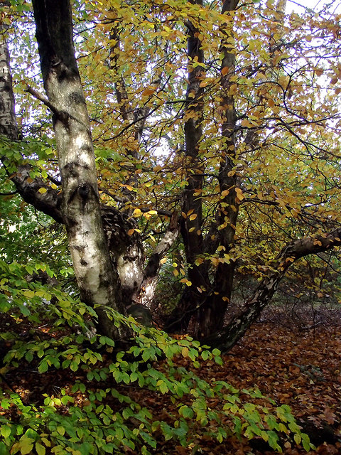
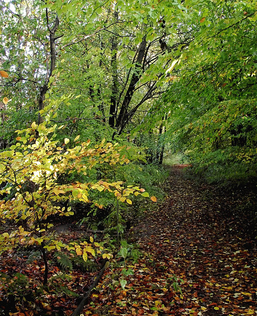
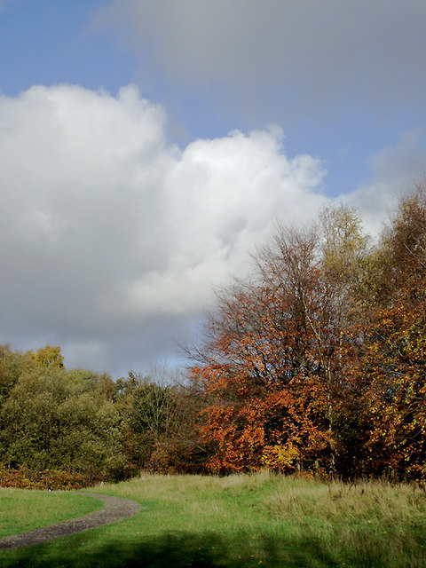
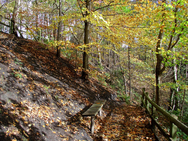
The Dingle is characterized by its lush greenery, rolling hills, and meandering streams. The valley is home to a diverse range of flora and fauna, with ancient woodlands, wildflower meadows, and abundant wildlife. Walking through the Dingle, one can encounter various species of birds, butterflies, and small mammals, making it a haven for nature enthusiasts and wildlife photographers.

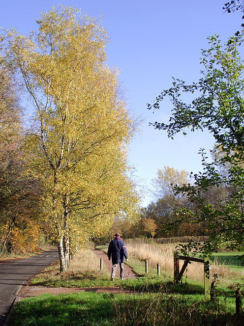
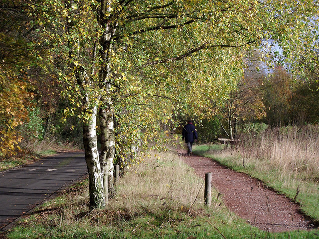
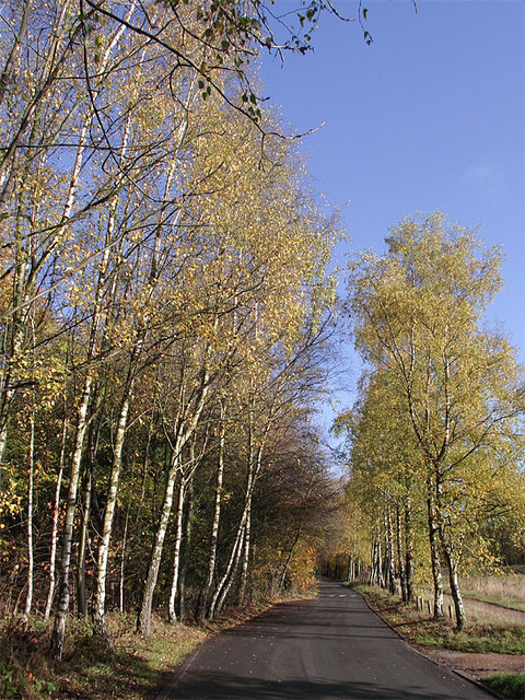
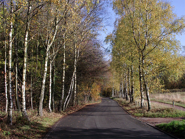
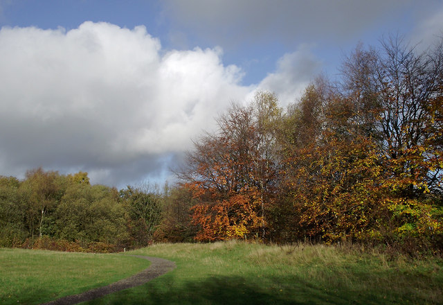
The valley offers a myriad of walking trails and paths, allowing visitors to explore its stunning landscapes at their own pace. These trails lead to breathtaking viewpoints, from where one can admire panoramic vistas of the surrounding countryside. Additionally, the Dingle is intersected by several streams and rivers, providing opportunities for fishing and water-based activities.

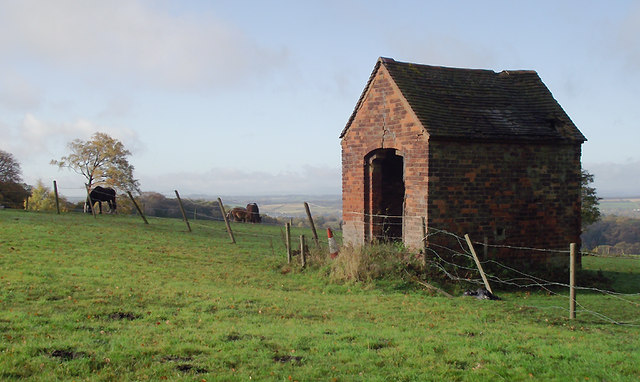
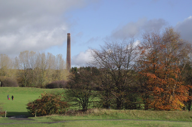
For those seeking a peaceful retreat, the Dingle boasts several secluded picnic spots and benches, where visitors can relax and take in the tranquil ambiance. The valley is also home to a range of historical landmarks, including a restored watermill and remnants of an ancient castle, providing a glimpse into the area's rich heritage.

The Dingle is not only a natural paradise but also a site of cultural significance. It hosts various events and festivals throughout the year, attracting a diverse range of artists, musicians, and performers. These events showcase local talent and celebrate the region's cultural heritage, creating a vibrant and inclusive atmosphere for all.

In conclusion, the Dingle in Staffordshire is a captivating valley that offers a harmonious blend of natural beauty, recreational activities, and cultural experiences. Its idyllic landscapes and rich biodiversity make it a must-visit destination for nature lovers and those seeking an escape from the hustle and bustle of everyday life.

If you have any feedback on the listing, please let us know in the comments section below.

The Dingle Images

Images are sourced within 2km of 52.529657/-2.1316057 or Grid Reference SO9192. Thanks to Geograph Open Source API. All images are credited.

Woodland in Baggeridge Country Park, near Sedgley These woods are by the road north of the visitor centre near Gospel End. 
Baggeridge Country Park is an attractive area of countryside near Dudley and Wolverhampton. It was formerly the Baggeridge Colliery. Together with part of the original Himley Estate of the Earls of Dudley, the whole site has been transformed into 150 acres of attractive country park, including woodland, lakes, and open grassed areas.
Woodland in Baggeridge Country Park, near Sedgley
These woods are by the road north of the visitor centre near Gospel End. Baggeridge Country Park is an attractive area of countryside near Dudley and Wolverhampton. It was formerly the Baggeridge Colliery. Together with part of the original Himley Estate of the Earls of Dudley, the whole site has been transformed into 150 acres of attractive country park, including woodland, lakes, and open grassed areas.
 Baggeridge Country Park, near Sedgley The road links the car parks to Woodhouse Lane (A463) near Gospel End. The Upper Meadow is on the right.

Baggeridge Country Park is an attractive area of countryside near Dudley and Wolverhampton. It was formerly the Baggeridge Colliery. Together with part of the original Himley Estate of the Earls of Dudley, the whole site has been transformed into 150 acres of attractive country park, including woodland, lakes, and open grassed areas. <span class="nowrap"><a title="http://www.sstaffs.gov.uk/default.aspx?page=12695" rel="nofollow ugc noopener" href="http://www.sstaffs.gov.uk/default.aspx?page=12695">Link</a><img style="margin-left:2px;" alt="External link" title="External link - shift click to open in new window" src="https://s1.geograph.org.uk/img/external.png" width="10" height="10"/></span>
Baggeridge Country Park, near Sedgley
The road links the car parks to Woodhouse Lane (A463) near Gospel End. The Upper Meadow is on the right. Baggeridge Country Park is an attractive area of countryside near Dudley and Wolverhampton. It was formerly the Baggeridge Colliery. Together with part of the original Himley Estate of the Earls of Dudley, the whole site has been transformed into 150 acres of attractive country park, including woodland, lakes, and open grassed areas. LinkExternal link
 Baggeridge Country Park, near Sedgley The road links the car parks to Woodhouse Lane (A463) near Gospel End. The Upper Meadow is off to the right.
Baggeridge Country Park, near Sedgley
The road links the car parks to Woodhouse Lane (A463) near Gospel End. The Upper Meadow is off to the right.
The Road to Gospel End near Sedgley The private road is in Baggeridge Country Park and links the car parks to Woodhouse Lane (A463) near Gospel End.
The Road to Gospel End near Sedgley
The private road is in Baggeridge Country Park and links the car parks to Woodhouse Lane (A463) near Gospel End.
The Road to Gospel End near Sedgley The private road is in Baggeridge Country Park and links the car parks to Woodhouse Lane (A463) near Gospel End.
The Road to Gospel End near Sedgley
The private road is in Baggeridge Country Park and links the car parks to Woodhouse Lane (A463) near Gospel End.
Pathway in Baggeridge Country Park near Sedgley This is at the north end of Upper Meadow, looking towards Gospel End.
Pathway in Baggeridge Country Park near Sedgley
This is at the north end of Upper Meadow, looking towards Gospel End.
Pathway in Baggeridge Country Park near Sedgley This is at the north end of Upper Meadow, looking towards Gospel End.
Pathway in Baggeridge Country Park near Sedgley
This is at the north end of Upper Meadow, looking towards Gospel End.
Pathway in Baggeridge Country Park near Sedgley This is at the north end of Upper Meadow, looking away from Gospel End. The driveway from the A453 Wodehouse Road passes through the birch trees on the right.
Pathway in Baggeridge Country Park near Sedgley
This is at the north end of Upper Meadow, looking away from Gospel End. The driveway from the A453 Wodehouse Road passes through the birch trees on the right.
Farmland and woodland near Gospel End, Staffordshire Looking towards Wombourne past deciduous woodland at The Foxhills. Beyond the nearby fields is the wide valley occupied by the Smestow Brook.
Farmland and woodland near Gospel End, Staffordshire
Looking towards Wombourne past deciduous woodland at The Foxhills. Beyond the nearby fields is the wide valley occupied by the Smestow Brook.
Pasture and woodland near Gospel End, Staffordshire Looking towards Wombourne past deciduous woodland at The Foxhills. Beyond the nearby fields is the wide valley occupied by the Smestow Brook.
Pasture and woodland near Gospel End, Staffordshire
Looking towards Wombourne past deciduous woodland at The Foxhills. Beyond the nearby fields is the wide valley occupied by the Smestow Brook.
Farm outhouse in pasture near Gospel End, Staffordshire Beyond the nearby fields is the wide valley occupied by the Smestow Brook.
Farm outhouse in pasture near Gospel End, Staffordshire
Beyond the nearby fields is the wide valley occupied by the Smestow Brook.
Woodland in Baggeridge Country Park near Sedgley This is by a partly overgrown track north-east of Heather Cottage.
Woodland in Baggeridge Country Park near Sedgley
This is by a partly overgrown track north-east of Heather Cottage.
Woodland track in Baggeridge Country Path The track north-east from Heather Cottage is not all as well defined as this.
Woodland track in Baggeridge Country Path
The track north-east from Heather Cottage is not all as well defined as this.
Woodland in Baggeridge Country Park near Sedgley This is by the Events Field south of the tea rooms.
Woodland in Baggeridge Country Park near Sedgley
This is by the Events Field south of the tea rooms.
Woodland in Baggeridge Country Park near Sedgley This is by the Events Field south of the tea rooms.
Woodland in Baggeridge Country Park near Sedgley
This is by the Events Field south of the tea rooms.
Baggeridge Country Park near Sedgley Looking across the Events Field towards the chimney of the Baggeridge Brickworks.
Baggeridge Country Park near Sedgley
Looking across the Events Field towards the chimney of the Baggeridge Brickworks.
Woodland bench in Baggeridge Country Park near Sedgley This is on the waymarked route down Jake's Ladder, a very steep (and precarious in wet autumn weather) stepped route down to the pools. That this land was formerly a coal mine is evident from the high amount of coal dust in the soil on the bank.
Woodland bench in Baggeridge Country Park near Sedgley
This is on the waymarked route down Jake's Ladder, a very steep (and precarious in wet autumn weather) stepped route down to the pools. That this land was formerly a coal mine is evident from the high amount of coal dust in the soil on the bank.
Woodland bench in Baggeridge Country Park near Sedgley This is on the waymarked route down Jake's Ladder, a very steep (and precarious in wet autumn weather, never mind ice and snow!) stepped route down to the pools. That this land was formerly a coal mine is evident from the high amount of coal dust in the soil on the bank. It is much steeper behind the camera. :-)
Woodland bench in Baggeridge Country Park near Sedgley
This is on the waymarked route down Jake's Ladder, a very steep (and precarious in wet autumn weather, never mind ice and snow!) stepped route down to the pools. That this land was formerly a coal mine is evident from the high amount of coal dust in the soil on the bank. It is much steeper behind the camera. :-)
Show me another place!

The Dingle is located at Grid Ref: SO9192 (Lat: 52.529657, Lng: -2.1316057)

Unitary Authority: Dudley

Police Authority: West Midlands

What 3 Words

///head.mental.congratulations. Near Wombourn, Staffordshire

Nearby Locations

Ruiton The Dingle

Related Wikis

Cotwall End Valley

Cotwall End Valley is a local nature reserve in West Midlands, England. It is about a mile south of Sedgley, in the Metropolitan Borough of Dudley. It...

Ellowes Hall

Ellowes Hall was a stately home located in Sedgley, Staffordshire (now West Midlands). It was built in 1821 in parkland near Lower Gornal village as the...

Ellowes Hall Sports College

Ellowes Hall Sports College (formerly Ellowes Hall School) is a comprehensive secondary school and sixth form situated on Stickley Lane in Lower Gornal...

Gornal, West Midlands

Gornal is a village and electoral ward in the Dudley Metropolitan Borough, in the West Midlands of England. It encompasses the three historical villages...

Nearby Amenities

Located within 500m of 52.529657,-2.1316057
Barrier: stile
Foot: yes
Source: survey
Lat/Long: 52.5294575/-2.1285641
Barrier: stile
Foot: yes
Lat/Long: 52.5319277/-2.126
Barrier: stile
Foot: yes
Lat/Long: 52.53252/-2.1262214
Barrier: cycle_barrier
Lat/Long: 52.5319188/-2.1300896
Barrier: bollard
Foot: yes
Lat/Long: 52.5305136/-2.1253924
Barrier: bollard
Foot: yes
Lat/Long: 52.5305063/-2.1252466
The Sugarwell
Drinking Water: no
Natural: spring
Source: survey;OS
Lat/Long: 52.5285419/-2.1253815
Barrier: kissing_gate
Foot: yes
Lat/Long: 52.5286599/-2.1256551
Generator Method: photovoltaic
Generator Output Electricity: yes
Generator Source: solar
Generator Type: solar_photovoltaic_panel
Location: roof
Power: generator
Lat/Long: 52.5262187/-2.1269059
Generator Method: photovoltaic
Generator Output Electricity: yes
Generator Source: solar
Generator Type: solar_photovoltaic_panel
Location: roof
Power: generator
Lat/Long: 52.5274149/-2.1266323
Generator Method: photovoltaic
Generator Output Electricity: yes
Generator Source: solar
Generator Type: solar_photovoltaic_panel
Location: roof
Power: generator
Lat/Long: 52.5254338/-2.1314228
Generator Method: photovoltaic
Generator Output Electricity: yes
Generator Source: solar
Generator Type: solar_photovoltaic_panel
Location: roof
Power: generator
Lat/Long: 52.525442/-2.1315569
Generator Method: photovoltaic
Generator Output Electricity: yes
Generator Source: solar
Generator Type: solar_photovoltaic_panel
Location: roof
Power: generator
Lat/Long: 52.5254893/-2.1318761
Generator Method: photovoltaic
Generator Output Electricity: yes
Generator Source: solar
Generator Type: solar_photovoltaic_panel
Location: roof
Power: generator
Lat/Long: 52.5254974/-2.1320102
Generator Method: photovoltaic
Generator Output Electricity: yes
Generator Source: solar
Generator Type: solar_photovoltaic_panel
Location: roof
Power: generator
Lat/Long: 52.5257553/-2.1321631
Generator Method: photovoltaic
Generator Output Electricity: yes
Generator Source: solar
Generator Type: solar_photovoltaic_panel
Location: roof
Power: generator
Lat/Long: 52.5257651/-2.1322757
Generator Method: photovoltaic
Generator Output Electricity: yes
Generator Source: solar
Generator Type: solar_photovoltaic_panel
Location: roof
Power: generator
Lat/Long: 52.5257732/-2.1324259
Generator Method: photovoltaic
Generator Output Electricity: yes
Generator Source: solar
Generator Type: solar_photovoltaic_panel
Location: roof
Power: generator
Lat/Long: 52.5255774/-2.1328148
Generator Method: photovoltaic
Generator Output Electricity: yes
Generator Source: solar
Generator Type: solar_photovoltaic_panel
Location: roof
Power: generator
Lat/Long: 52.5251874/-2.1323562
Barrier: kissing_gate
Material: metal
Lat/Long: 52.5261331/-2.1308287
Man Made: mineshaft
Source: OS
Lat/Long: 52.5292658/-2.1284899
Man Made: mineshaft
Source: OS
Lat/Long: 52.5298406/-2.1315707
The data included in this document is from www.openstreetmap.org. The data is made available under ODbL.

Have you been to The Dingle?

Leave your review of The Dingle below (or comments, questions and feedback).