Teesdale

Valley in Yorkshire

England

Teesdale

Fence with gate and sculpture The gate is approached by a bridleway which joins an estate road beyond. Pedestrians can avoid opening the gate by using a stile that isn't obvious in the image - it passes through the sculpture going behind the left hand sheep and pillar.
Fence with gate and sculpture Credit: Trevor Littlewood

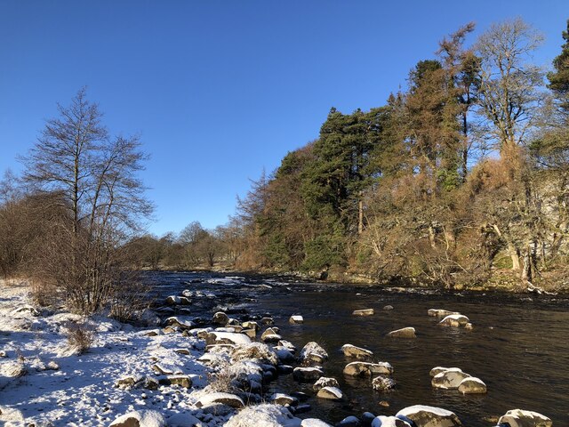
Teesdale is a picturesque valley located in the northern part of Yorkshire, England. It is named after the River Tees, which flows through the valley, adding to its natural beauty. Teesdale is renowned for its stunning landscapes, charming villages, and rich history.

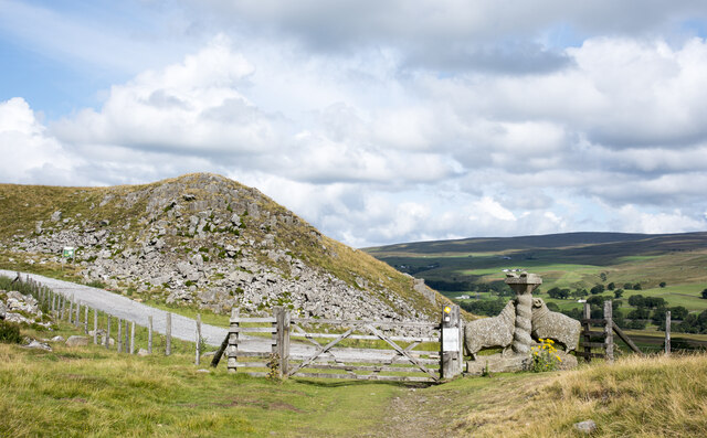
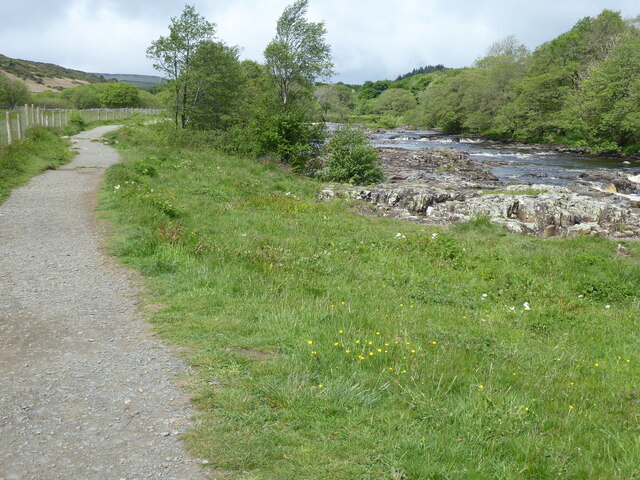
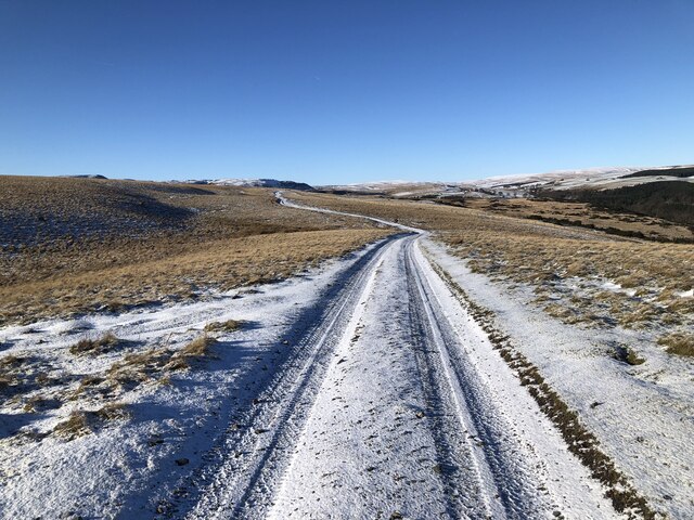
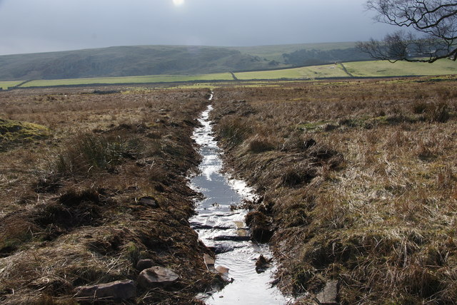
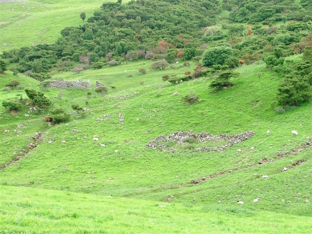
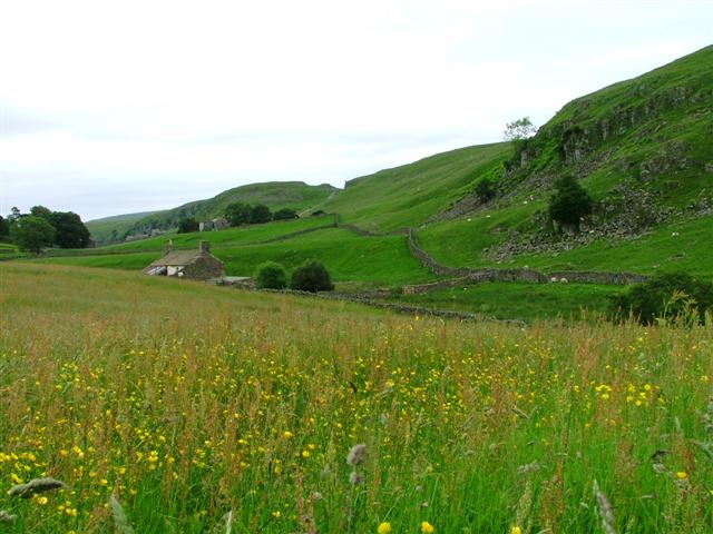
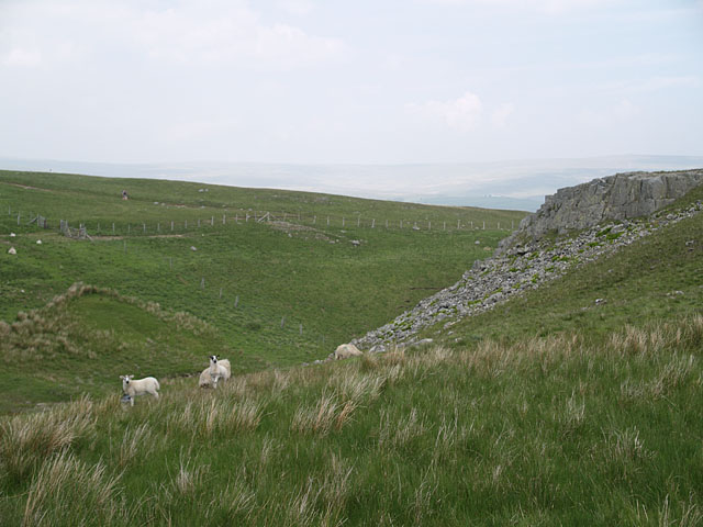
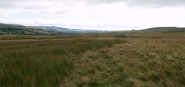
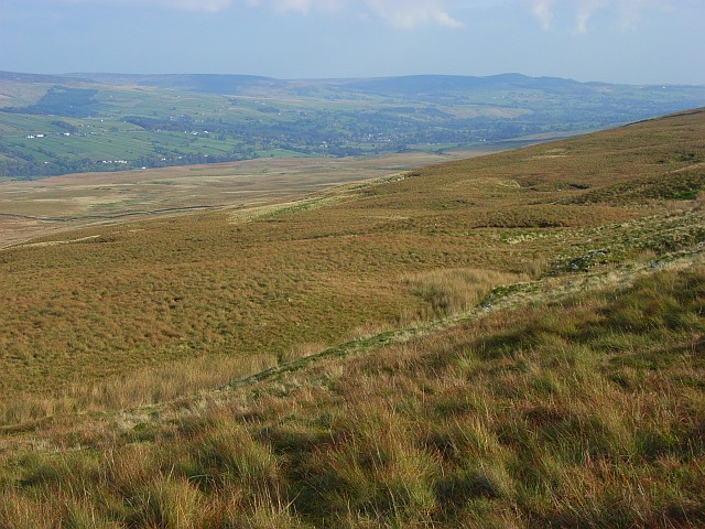
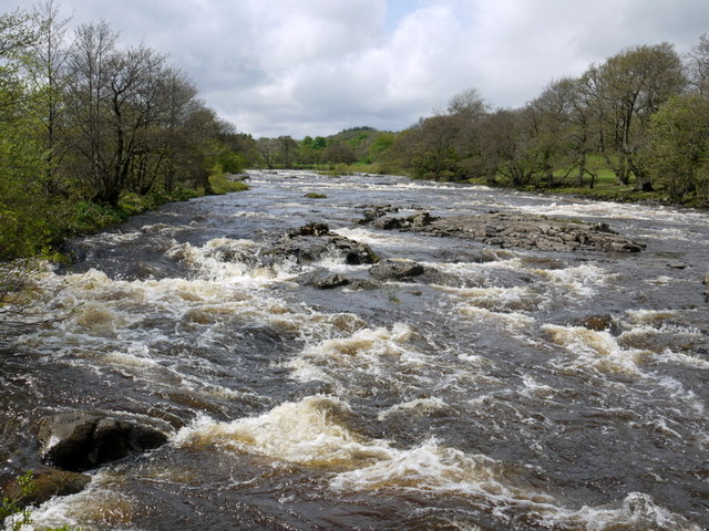
The valley is nestled within the North Pennines Area of Outstanding Natural Beauty, making it a popular destination for nature enthusiasts and outdoor activities. The rolling hills, meandering river, and expansive moorlands create a breathtaking setting for hiking, cycling, fishing, and birdwatching. The famous Pennine Way, a long-distance footpath, passes through the valley, attracting many walkers and hikers.

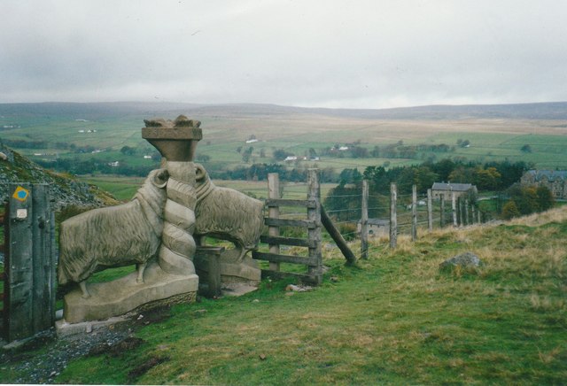
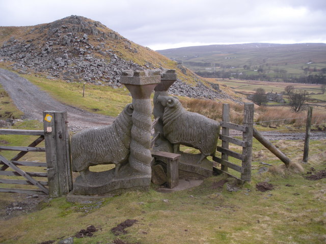
Teesdale is dotted with several picturesque villages, such as Middleton-in-Teesdale and Barnard Castle. These villages offer a glimpse into traditional rural life, with their stone cottages, quaint shops, and welcoming pubs. Barnard Castle, in particular, is known for its historic castle ruins, which date back to the 12th century, and its charming market town atmosphere.

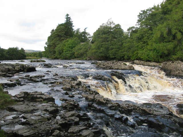
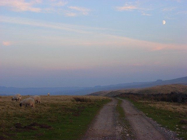
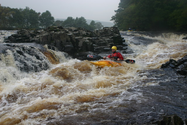
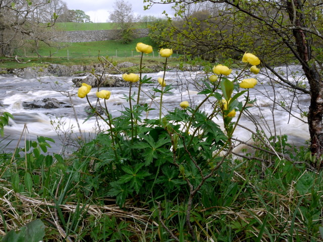
The valley is also home to a variety of wildlife, including red grouse, curlews, and black grouse. In spring, Teesdale is carpeted with vibrant wildflowers, creating a stunning display of colors. The High Force, a dramatic waterfall cascading down a limestone gorge, is another popular attraction in the area.

In addition to its natural beauty, Teesdale boasts a rich cultural heritage. The Bowes Museum, located in Barnard Castle, houses an impressive collection of artwork and historical artifacts. It is a must-visit for art enthusiasts and history buffs alike.

Overall, Teesdale offers a perfect blend of natural splendor, traditional charm, and cultural richness, making it a must-see destination for visitors to Yorkshire.

If you have any feedback on the listing, please let us know in the comments section below.

Teesdale Images

Images are sourced within 2km of 54.637481/-2.1412005 or Grid Reference NY9026. Thanks to Geograph Open Source API. All images are credited.

Fence with gate and sculpture The gate is approached by a bridleway which joins an estate road beyond. Pedestrians can avoid opening the gate by using a stile that isn't obvious in the image - it passes through the sculpture going behind the left hand sheep and pillar.
Fence with gate and sculpture
The gate is approached by a bridleway which joins an estate road beyond. Pedestrians can avoid opening the gate by using a stile that isn't obvious in the image - it passes through the sculpture going behind the left hand sheep and pillar.
The Pennine Way near Hield House
River Tees above Low Force
Track across Low Currick Rigg The bridleway follows the well kept track that provides access across the moor for farming and shooting.
Track across Low Currick Rigg
The bridleway follows the well kept track that provides access across the moor for farming and shooting.
Lamb Sculpture and stile named Moor or Less see 
<span class="nowrap"><a title="http://pmsa.cch.kcl.ac.uk/pmsa-database/10078/" rel="nofollow ugc noopener" href="http://pmsa.cch.kcl.ac.uk/pmsa-database/10078/">Link</a><img style="margin-left:2px;" alt="External link" title="External link - shift click to open in new window" src="https://s1.geograph.org.uk/img/external.png" width="10" height="10"/></span>
Lamb Sculpture and stile named Moor or Less
see LinkExternal link
Small Waterfall on the River Tees A few hundred yards up-river from Low Force.
Small Waterfall on the River Tees
A few hundred yards up-river from Low Force.
Drainage channel in Teesdale The land on the south side of the River Tees retains a lot of water. The footpath which forms part of the Pennine Way has been well constructed to avoid any damp problems.
Drainage channel in Teesdale
The land on the south side of the River Tees retains a lot of water. The footpath which forms part of the Pennine Way has been well constructed to avoid any damp problems.
Ruined Sheepfolds
Ruined Sheepfolds
Mire House Looking south east towards Holwick Scar
Mire House
Looking south east towards Holwick Scar
Moor or Less Stile and sculpture combined at the western end of Holwick Scars.
Moor or Less
Stile and sculpture combined at the western end of Holwick Scars.
Valley of Scar Beck Valley at the western end of Holwick Scars.
Walker visible on the hillside opposite is on the bridleway from Low Currick Rigg.
Valley of Scar Beck
Valley at the western end of Holwick Scars. Walker visible on the hillside opposite is on the bridleway from Low Currick Rigg.
View southeast from Hawk Rigg 2 photos stitched together.
Kirkcarrion can be seen on the horizon at right of centre.
View southeast from Hawk Rigg
2 photos stitched together. Kirkcarrion can be seen on the horizon at right of centre.
Lingy Hills An ironically grassy slope.
Lingy Hills
An ironically grassy slope.
Track and sheep, Holwick The bridleway west of Holwick. The clump of trees at Kirkcarrion <a href="https://www.geograph.org.uk/gridref/NY9323">NY9323</a> can be seen on the hillside to the right.
Track and sheep, Holwick
The bridleway west of Holwick. The clump of trees at Kirkcarrion NY9323 can be seen on the hillside to the right.
Sheep Stile at Holwick
The upper part of Salmon Leap Fall (aka The Dogleg) on the Tees Clive Hall of Swaledale Outdoor Club running Salmon Leap Falls (also known as the Dogleg), a grade IV rapid on the River Tees, at a nice winter level. Entry down the ramp behind Clive's helmet and directly in front of the kayak in the background, avoiding rocks then turning sharply right into the main flow which is very bouncy. Clive is about to go over a drop into a boily pool, from which <a href="https://www.geograph.org.uk/photo/2157487">NY8928 : The Middle drop, Dogleg rapid (Salmon Leap) on the Upper Tees</a> is the bit most likely to catch people out.
The upper part of Salmon Leap Fall (aka The Dogleg) on the Tees
Clive Hall of Swaledale Outdoor Club running Salmon Leap Falls (also known as the Dogleg), a grade IV rapid on the River Tees, at a nice winter level. Entry down the ramp behind Clive's helmet and directly in front of the kayak in the background, avoiding rocks then turning sharply right into the main flow which is very bouncy. Clive is about to go over a drop into a boily pool, from which NY8928 : The Middle drop, Dogleg rapid (Salmon Leap) on the Upper Tees is the bit most likely to catch people out.
River Tees between High and Low Force
Globe Flowers (Trollius europaeus) by River Tees
Show me another place!

Teesdale is located at Grid Ref: NY9026 (Lat: 54.637481, Lng: -2.1412005)

Division: North Riding

Unitary Authority: County Durham

Police Authority: Durham

What 3 Words

///imposes.reflector.watched. Near Holwick, Co. Durham

Related Wikis

Holwick

Holwick is a small village in Teesdale, County Durham (district), England. Located in the Pennine hills, it consists of a few houses spread along a road...

Newbiggin, Teesdale

Newbiggin is a village and civil parish in County Durham, England. At the 2011 census the parish had a population of 146. It is situated on the north side...

Low Force

Low Force is an 18-foot (5.5m) high set of falls on the River Tees, England, UK. Further upstream is the High Force waterfall. Low Force is also the site...

Bowlees

Bowlees is a small village in County Durham, England. It is situated near Newbiggin, on the other side of Teesdale from Holwick. The visitor centre in...

Nearby Amenities

Located within 500m of 54.637481,-2.1412005
Holwick
Place: hamlet
Wikidata: Q1879714
Wikipedia: en:Holwick
Lat/Long: 54.6379614/-2.1484195
Barrier: stile
Foot: yes
Material: wood
Stile: stepover
Lat/Long: 54.6410156/-2.1405618
Hungry Hall
Building: yes
Place: isolated_dwelling
Source: OS 1:25k
Wikidata: Q26453843
Lat/Long: 54.6338957/-2.138638
Barrier: stile
Foot: yes
Lat/Long: 54.6402766/-2.1351644
Barrier: stile
Foot: yes
Lat/Long: 54.640733/-2.137152
Barrier: stile
Foot: yes
Material: wood
Stile: stepover
Lat/Long: 54.6411549/-2.1414596
Barrier: kissing_gate
Foot: yes
Lat/Long: 54.6410123/-2.1399441
Ford: yes
Lat/Long: 54.641523/-2.1425393
Barrier: stile
Foot: yes
Lat/Long: 54.6417217/-2.1428677
Shielings and tracks on Holwick Scars
HE Ref: 1019458
Designation: scheduled_monument
Historic: archaeological_site
Wikidata: Q17675912
Lat/Long: 54.6339182/-2.1427792
Low Way Farm
Place: farm
Source Name: OS OpenData StreetView
Lat/Long: 54.6357998/-2.1390671
Ford: yes
Lat/Long: 54.6362704/-2.1443825
The data included in this document is from www.openstreetmap.org. The data is made available under ODbL.

Have you been to Teesdale?

Leave your review of Teesdale below (or comments, questions and feedback).