Copy Clough

Valley in Lancashire

England

Copy Clough

Shawforth:  Moss Side Street The houses are numbered consecutively 3 to 13.
Shawforth: Moss Side Street Credit: Dr Neil Clifton

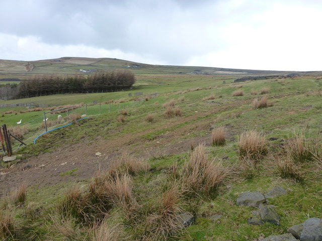
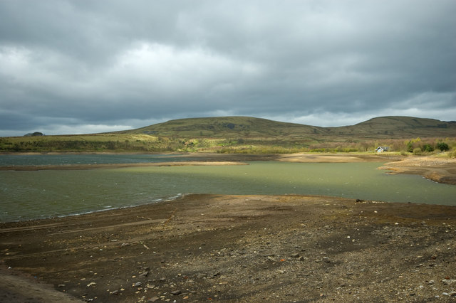
Copy Clough is a small valley located in Lancashire, a county in northwest England. It is situated in the southern part of the county, near the town of Burnley. The valley is characterized by its picturesque and serene surroundings, offering visitors a peaceful escape from the hustle and bustle of city life.

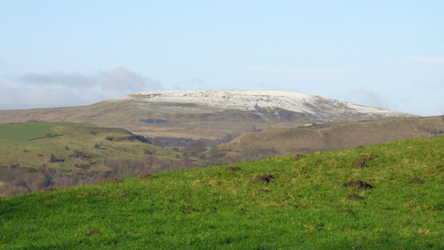
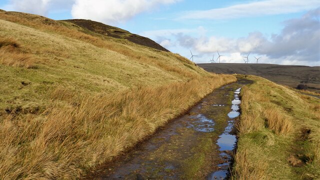
The valley is named after the stream that runs through it, known as Copy Clough Brook. The brook meanders through the valley, creating a soothing and tranquil atmosphere. The area is known for its lush greenery, with dense woodlands and rolling hills surrounding the valley.

Copy Clough is a popular destination for nature enthusiasts and hikers, offering a range of walking trails that allow visitors to explore the beauty of the area. The valley is home to a diverse range of flora and fauna, including various species of birds, mammals, and plants. It provides an ideal habitat for wildlife, making it a haven for nature lovers.

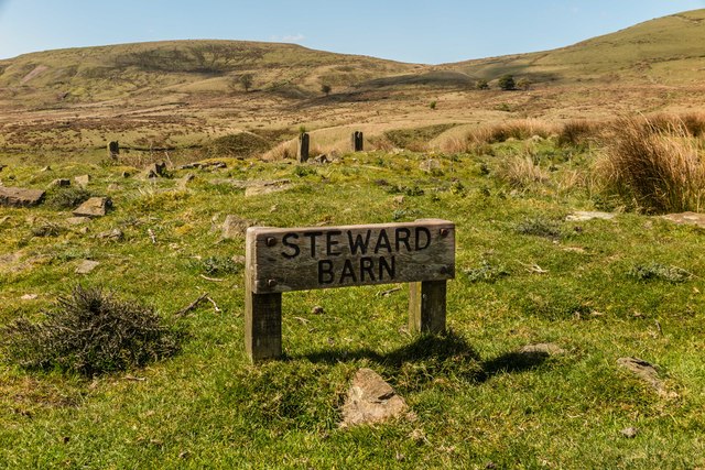
The valley also has historical significance, with remnants of old industrial infrastructure still visible in the area. It was once a thriving hub of the textile industry, with mills and factories dotting the landscape. Although many of these structures have now been repurposed or demolished, they serve as a reminder of the valley's industrial past.

Overall, Copy Clough is a charming and tranquil valley in Lancashire, offering visitors a chance to connect with nature and explore the region's history.

If you have any feedback on the listing, please let us know in the comments section below.
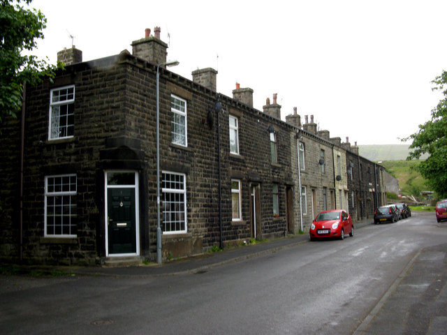
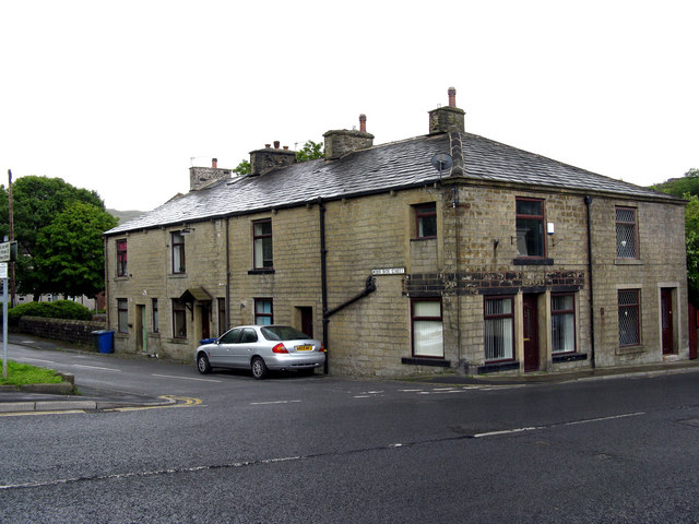
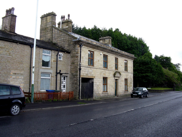
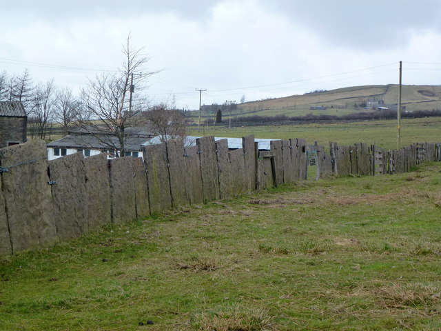
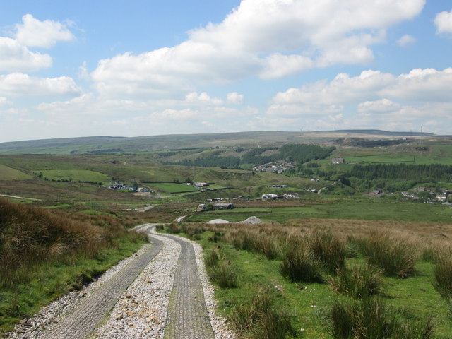
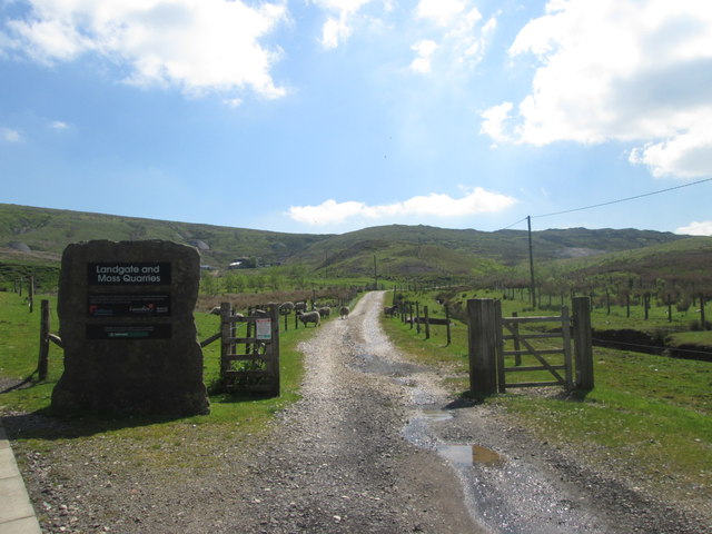
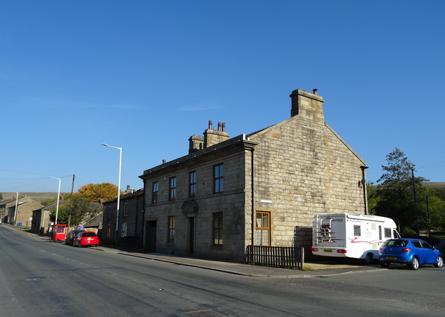
Copy Clough Images

Images are sourced within 2km of 53.672882/-2.1379643 or Grid Reference SD9019. Thanks to Geograph Open Source API. All images are credited.

Shawforth:  Moss Side Street The houses are numbered consecutively 3 to 13.
Shawforth: Moss Side Street
The houses are numbered consecutively 3 to 13.
Shawforth:  Moss Side Street There are only these three doors on this side of Moss Side Street:  The middle door has a '1' on it, the other two have no numbers. Where No 2 is, is anybody's guess.  Numbers 3 to 13, consecutive, are on the other side of the street.
Shawforth: Moss Side Street
There are only these three doors on this side of Moss Side Street: The middle door has a '1' on it, the other two have no numbers. Where No 2 is, is anybody's guess. Numbers 3 to 13, consecutive, are on the other side of the street.
Shawforth:  Former 'Red Lion' This former pub is now just plain 232 Market Street, but its former name is perpetuated by the bus stop - 'Red Lion, Shawforth'.
Shawforth: Former 'Red Lion'
This former pub is now just plain 232 Market Street, but its former name is perpetuated by the bus stop - 'Red Lion, Shawforth'.
Rough pasture and wood east of Shawforth
Vaccary Walling at Lower Trough
Descending to Shawforth from Knowsley
Entrance to the restored quarries
Houses on Market Street (A671), Shawforth
Elizabeth II postbox on Market Street, Shawforth Postbox No. OL12 118.

See <a href="https://www.geograph.org.uk/photo/5938773">SD8920 : Market Street, Shawforth</a> for contrast.
Elizabeth II postbox on Market Street, Shawforth
Postbox No. OL12 118. See SD8920 : Market Street, Shawforth for contrast.
Market Street, Shawforth Showing position of Postbox No. OL12 118.

See <a href="https://www.geograph.org.uk/photo/5938772">SD8920 : Elizabeth II postbox on Market Street, Shawforth</a> for postbox.
Market Street, Shawforth
Showing position of Postbox No. OL12 118. See SD8920 : Elizabeth II postbox on Market Street, Shawforth for postbox.
Terraced housing on Market Street, Shawforth
Snow on Brown Wardle Hill Viewed from above the Hollingworth Lake Visitor Centre showing the valley between Birch Hill and East Hill in the middle ground of the photo
Snow on Brown Wardle Hill
Viewed from above the Hollingworth Lake Visitor Centre showing the valley between Birch Hill and East Hill in the middle ground of the photo
Route of old Tramway The route to Cartridge Nook Colliery
Route of old Tramway
The route to Cartridge Nook Colliery
Paved farm track to Hud Clough Middle Hill is in the distance
Paved farm track to Hud Clough
Middle Hill is in the distance
Depression, possibly an old bell pit?
Watergrove History Wall, greater (northern) part The Watergrove History Wall, situated on the east side of Watergrove Reservoir at the southern end of the reservoir, includes several date stones from Watergrove village buildings and surrounding farmsteads that were demolished during the construction of Rochdale Corporation's Watergrove Reservoir in the 1930s.

The image is a composite of 18 photographs produced using Microsoft's ICE (Image Composite Editor) software.

The wall is approximately 170 ft long; this image is the northern 110 ft part.  The wall is divided by adjacent fencing.

The 60 ft lesser (southern) part of the wall is illustrated in the Geograph:

                  <a title="https://www.geograph.org.uk/photo/5163265" href="https://www.geograph.org.uk/photo/5163265">Link</a>
Watergrove History Wall, greater (northern) part
The Watergrove History Wall, situated on the east side of Watergrove Reservoir at the southern end of the reservoir, includes several date stones from Watergrove village buildings and surrounding farmsteads that were demolished during the construction of Rochdale Corporation's Watergrove Reservoir in the 1930s. The image is a composite of 18 photographs produced using Microsoft's ICE (Image Composite Editor) software. The wall is approximately 170 ft long; this image is the northern 110 ft part. The wall is divided by adjacent fencing. The 60 ft lesser (southern) part of the wall is illustrated in the Geograph: Link
Watergrove History Wall, lesser (southern) part The Watergrove History Wall, situated on the east side of Watergrove Reservoir at the southern end of the reservoir, includes several date stones from Watergrove village buildings and surrounding farmsteads that were demolished during the construction of Rochdale Corporation's Watergrove Reservoir in the 1930s.

The image is a composite of 6 photographs produced using Microsoft's ICE (Image Composite Editor) software.

The wall is approximately 170 ft long; this image is the southern 60 ft part.  The wall is divided by adjacent fencing.

The 110 ft greater (northern) part of the wall is illustrated in the Geograph:

       <a title="https://www.geograph.org.uk/photo/5163240" href="https://www.geograph.org.uk/photo/5163240">Link</a>
Watergrove History Wall, lesser (southern) part
The Watergrove History Wall, situated on the east side of Watergrove Reservoir at the southern end of the reservoir, includes several date stones from Watergrove village buildings and surrounding farmsteads that were demolished during the construction of Rochdale Corporation's Watergrove Reservoir in the 1930s. The image is a composite of 6 photographs produced using Microsoft's ICE (Image Composite Editor) software. The wall is approximately 170 ft long; this image is the southern 60 ft part. The wall is divided by adjacent fencing. The 110 ft greater (northern) part of the wall is illustrated in the Geograph: Link
Steward Barn The remains of Steward Barn above Watergrove Reservoir.
Steward Barn
The remains of Steward Barn above Watergrove Reservoir.
Show me another place!

Copy Clough is located at Grid Ref: SD9019 (Lat: 53.672882, Lng: -2.1379643)

Unitary Authority: Rochdale

Police Authority: Greater Manchester

What 3 Words

///hardback.midwinter.drawn. Near Wardle, Manchester

Related Wikis

Brown Wardle Hill

Brown Wardle is a hill between the village of Wardle, Greater Manchester and the town of Whitworth, Lancashire, England. The summit is on the border of...

Watergrove Reservoir

Watergrove Reservoir is a reservoir close to Wardle in the Metropolitan Borough of Rochdale, within Greater Manchester, England. Rochdale Corporation...

Shawforth railway station

Shawforth railway station served Shawforth near Bacup, Rossendale, Lancashire, England, from 1881 until closure in 1947. == References == Suggitt, Gordon...

Shawforth

Shawforth ( SHAW-fərth) is a ward in the township of Whitworth within the Rossendale borough of Lancashire, England. It lies amongst the South Pennines...

Facit railway station

Facit railway station served Facit near Whitworth, Rossendale, Lancashire, England, from 1870 until closure to passengers in 1947 and freight in 1963....

Whitworth, Lancashire

Whitworth is a town and civil parish in Rossendale, Lancashire, England, amongst the foothills of the Pennines between Bacup, to the north, and Rochdale...

Wardle, Greater Manchester

Wardle (; pop. 7,092) is a village near Littleborough within the Metropolitan Borough of Rochdale, in Greater Manchester, England. It lies amongst the...

Britannia, Lancashire

Britannia is a suburb of Bacup in the Rossendale borough of Lancashire, England. It lies on the course of two major roads and has a school and a nature...

Nearby Amenities

Located within 500m of 53.672882,-2.1379643
Wall Nook Farm
Ruins: farmhouse
Lat/Long: 53.6758367/-2.1354997
Higher Slack Farm
Ruins: farmhouse
Lat/Long: 53.6722389/-2.1353187
Hades Hill Farm
Ruins: farmhouse
Lat/Long: 53.673134/-2.14237
Higher Hades Farm
Ruins: farmhouse
Lat/Long: 53.6728621/-2.1455148
Dry Bank Farm
Ruins: farmhouse
Lat/Long: 53.6747461/-2.142075
Ford: yes
Lat/Long: 53.6711796/-2.1351227
The data included in this document is from www.openstreetmap.org. The data is made available under ODbL.

Have you been to Copy Clough?

Leave your review of Copy Clough below (or comments, questions and feedback).