Whimsey Cleugh

Valley in Durham

England

Whimsey Cleugh

Building at White Edge Quarry White Edge is the upper part of a slope above Middle Hope, a tributary valley of the River Wear; the location is close to the watershed with Rook Hope. White Edge Quarry is a small affair and well grassed-over now.
The distant high point is Black Hill, across Middle Hope.
Building at White Edge Quarry Credit: Trevor Littlewood

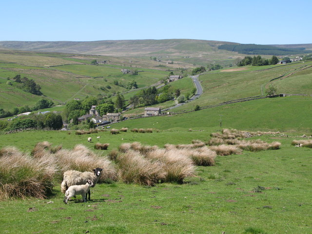
Whimsey Cleugh, Durham (Valley), is a picturesque village located in the northeast of England. Nestled in the Durham Dales, this charming hamlet is renowned for its tranquil and idyllic setting. The village is situated in a valley, surrounded by rolling hills, lush green meadows, and meandering streams, creating a postcard-perfect landscape.

Whimsey Cleugh is a small community with a population of around 300 residents. The village boasts a rich history that dates back centuries, evident in its well-preserved architecture and historic landmarks. The centerpiece of the village is the Whimsey Cleugh Manor, a stunning 17th-century manor house that stands as a testament to the village's past.

The village is a haven for nature lovers and outdoor enthusiasts. The surrounding countryside offers ample opportunities for hiking, cycling, and birdwatching. The nearby Cleugh Woods, a designated nature reserve, is a haven for wildlife and features a network of walking trails that showcase the area's natural beauty.

In terms of amenities, Whimsey Cleugh has a small but thriving community. The village is home to a local pub, The Cleugh Inn, where villagers and visitors alike can enjoy a pint of traditional ale and savor hearty, homemade meals. Additionally, a village shop provides essential groceries and everyday necessities.

Whimsey Cleugh is also known for its warm and welcoming community spirit. Regular events and gatherings, such as the annual summer fair and Christmas market, bring villagers together and foster a strong sense of camaraderie.

In conclusion, Whimsey Cleugh, Durham (Valley), is a charming and picturesque village set amidst stunning natural surroundings. With its rich history, abundant outdoor activities, and close-knit community, it offers a peaceful and fulfilling lifestyle for its residents.

If you have any feedback on the listing, please let us know in the comments section below.

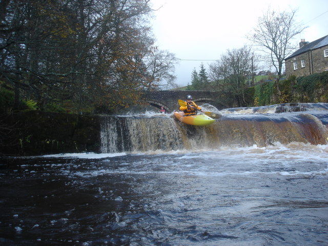
Whimsey Cleugh Images

Images are sourced within 2km of 54.781056/-2.1655668 or Grid Reference NY8942. Thanks to Geograph Open Source API. All images are credited.

Building at White Edge Quarry White Edge is the upper part of a slope above Middle Hope, a tributary valley of the River Wear; the location is close to the watershed with Rook Hope. White Edge Quarry is a small affair and well grassed-over now.
The distant high point is Black Hill, across Middle Hope.
Building at White Edge Quarry
White Edge is the upper part of a slope above Middle Hope, a tributary valley of the River Wear; the location is close to the watershed with Rook Hope. White Edge Quarry is a small affair and well grassed-over now. The distant high point is Black Hill, across Middle Hope.
The upper valley of Middlehope Burn A view looking west, further up the valley, is shown in <a href="https://www.geograph.org.uk/photo/6297932">NY8941 : The upper valley of Middlehope Burn (2)</a> (taken in April 2019). Shows the location of the <a href="https://www.geograph.org.uk/photo/7235938">NY8941 : Sheepfold by Middlehope Burn</a>.
The upper valley of Middlehope Burn
A view looking west, further up the valley, is shown in NY8941 : The upper valley of Middlehope Burn (2) (taken in April 2019). Shows the location of the NY8941 : Sheepfold by Middlehope Burn.
The site of Hodgson's House See <a href="https://www.geograph.org.uk/photo/5796002">NY8241 : Whitestone House</a>. In her book, Christine Ruskin gives records of occupation of Hodgson's House from the 1861 and 1871 censuses, but does not say when the house finally became vacant. Apparently, some of the stones were used to build a bungalow in Haswicks (on the south side of the River Wear opposite Westgate).
The site of Hodgson's House
See NY8241 : Whitestone House. In her book, Christine Ruskin gives records of occupation of Hodgson's House from the 1861 and 1871 censuses, but does not say when the house finally became vacant. Apparently, some of the stones were used to build a bungalow in Haswicks (on the south side of the River Wear opposite Westgate).
The site of Hodgson's House (2) See <a href="https://www.geograph.org.uk/photo/7235926">NY8941 : The site of Hodgson's House</a>.
The site of Hodgson's House (2)
The valley of Middlehope Burn above Middlehope Lodge Shows the location of the <a href="https://www.geograph.org.uk/photo/7235938">NY8941 : Sheepfold by Middlehope Burn</a>.
The valley of Middlehope Burn above Middlehope Lodge
Shows the location of the NY8941 : Sheepfold by Middlehope Burn.
The valley of Middlehope Burn above Middlehope Lodge (2) Shows the location of the <a href="https://www.geograph.org.uk/photo/7235938">NY8941 : Sheepfold by Middlehope Burn</a>.
The valley of Middlehope Burn above Middlehope Lodge (2)
Shows the location of the NY8941 : Sheepfold by Middlehope Burn.
Sheepfold by Middlehope Burn
Foxgloves and sheepfold by Middlehope Burn
Sheepfold by Middlehope Burn (2) It's not obvious from a distance, but this sheepfold has a very unusual shape - it's pointed at the far end, has an internal wall that divides the space into one small and one large area, and has an "arm" leading out from the entrance - see the map and satellite image <span class="nowrap"><a title="https://wtp2.appspot.com/wheresthepath.htm?lat=54.763973&lon=-2.169615&lz=16&rz=20&lt=OS&rt=satellite&lov=None&rov=None&lgrat=UK1000&rgrat=None" rel="nofollow ugc noopener" href="https://wtp2.appspot.com/wheresthepath.htm?lat=54.763973&lon=-2.169615&lz=16&rz=20&lt=OS&rt=satellite&lov=None&rov=None&lgrat=UK1000&rgrat=None">Link</a><img style="margin-left:2px;" alt="External link" title="External link - shift click to open in new window" src="https://s1.geograph.org.uk/img/external.png" width="10" height="10"/></span> and <a href="https://www.geograph.org.uk/photo/7236880">NY8941 : The valley of Middlehope Burn below White Edge</a>.
Sheepfold by Middlehope Burn (2)
It's not obvious from a distance, but this sheepfold has a very unusual shape - it's pointed at the far end, has an internal wall that divides the space into one small and one large area, and has an "arm" leading out from the entrance - see the map and satellite image LinkExternal link and NY8941 : The valley of Middlehope Burn below White Edge.
Foxgloves and sheepfold by Middlehope Burn (2)
The valley of Middlehope Burn below White Edge Shows the location of the <a href="https://www.geograph.org.uk/photo/7235938">NY8941 : Sheepfold by Middlehope Burn</a>.
The valley of Middlehope Burn below White Edge
Shows the location of the NY8941 : Sheepfold by Middlehope Burn.
Sheepfold by Middlehope Burn (3)
Sheepfold by Middlehope Burn - detail See <a href="https://www.geograph.org.uk/photo/7236871">NY8941 : Sheepfold by Middlehope Burn (2)</a>.
Sheepfold by Middlehope Burn - detail
The upper valley of Middlehope Burn
Groverake Mine The Lodging Shop and Stables buildings are on the right.
Groverake Mine
The Lodging Shop and Stables buildings are on the right.
Groverake Mine See here for close-up view of the information board: <a href="https://www.geograph.org.uk/photo/7310523">NY8944 : Information board, Groverake Mine</a>
Groverake Mine
See here for close-up view of the information board: NY8944 : Information board, Groverake Mine
Information board, Groverake Mine Groverake or Grove Rake. Shown on old maps as Groove Rake; probably from the nearby stream, Groove Rake Sike, or the heavily mined area of moorland of the same name where the stream rises. The lead miners’ term 'rake' applies to a major vertical or near-vertical mineralised vein.

Grove Rake is the site of a 19th century lead mine, though it was mined for fluorspar in the 20th century. At least six shafts and many ore hushes have been destroyed by later quarrying The site was worked from 1760 to 1985.
Keys to the Past (D4835): <span class="nowrap"><a title="https://keystothepast.info/search-records/results-of-search/results-of-search-2/Site-Details/?PRN=D4835" rel="nofollow ugc noopener" href="https://keystothepast.info/search-records/results-of-search/results-of-search-2/Site-Details/?PRN=D4835">Link</a><img style="margin-left:2px;" alt="External link" title="External link - shift click to open in new window" src="https://s1.geograph.org.uk/img/external.png" width="10" height="10"/></span>
Information board, Groverake Mine
Groverake or Grove Rake. Shown on old maps as Groove Rake; probably from the nearby stream, Groove Rake Sike, or the heavily mined area of moorland of the same name where the stream rises. The lead miners’ term 'rake' applies to a major vertical or near-vertical mineralised vein. Grove Rake is the site of a 19th century lead mine, though it was mined for fluorspar in the 20th century. At least six shafts and many ore hushes have been destroyed by later quarrying The site was worked from 1760 to 1985. Keys to the Past (D4835): LinkExternal link
Pony Stables & Firestone Mine Incline, Groverake Groverake or Grove Rake. Shown on old maps as Groove Rake; probably from the nearby stream, Groove Rake Sike, or the heavily mined area of moorland of the same name where the stream rises. The lead miners’ term 'rake' applies to a major vertical or near-vertical mineralised vein.

Grove Rake is the site of a 19th century lead mine, though it was mined for fluorspar in the 20th century. At least six shafts and many ore hushes have been destroyed by later quarrying The site was worked from 1760 to 1985.
Keys to the Past (D4835): <span class="nowrap"><a title="https://keystothepast.info/search-records/results-of-search/results-of-search-2/Site-Details/?PRN=D4835" rel="nofollow ugc noopener" href="https://keystothepast.info/search-records/results-of-search/results-of-search-2/Site-Details/?PRN=D4835">Link</a><img style="margin-left:2px;" alt="External link" title="External link - shift click to open in new window" src="https://s1.geograph.org.uk/img/external.png" width="10" height="10"/></span>
Pony Stables & Firestone Mine Incline, Groverake
Groverake or Grove Rake. Shown on old maps as Groove Rake; probably from the nearby stream, Groove Rake Sike, or the heavily mined area of moorland of the same name where the stream rises. The lead miners’ term 'rake' applies to a major vertical or near-vertical mineralised vein. Grove Rake is the site of a 19th century lead mine, though it was mined for fluorspar in the 20th century. At least six shafts and many ore hushes have been destroyed by later quarrying The site was worked from 1760 to 1985. Keys to the Past (D4835): LinkExternal link
Show me another place!

Whimsey Cleugh is located at Grid Ref: NY8942 (Lat: 54.781056, Lng: -2.1655668)

Unitary Authority: County Durham

Police Authority: Durham

What 3 Words

///tiny.ribcage.pining. Near Stanhope, Co. Durham

Nearby Locations

Whimsey Cleugh

Related Wikis

Lintzgarth

Lintzgarth is a village in the civil parish of Stanhope, in County Durham, England. It is situated to the west of Rookhope. The Lintzgarth smeltmill was...

Slit Woods

Slitt Woods is a Site of Special Scientific Interest in the Wear Valley district of County Durham, England. It occupies the valley of Middlehope Burn,...

West Rigg Open Cutting

West Rigg Open Cutting is a Site of Special Scientific Interest in the Wear Valley district of west County Durham, England. It is a disused ironstone...

East Blackdene

East Blackdene is a hamlet in the civil parish of Stanhope, in County Durham, England. It is situated to the north of the River Wear, on the opposite side...

Cowshill

Cowshill is a village in the civil parish of Stanhope, in County Durham, England. It is situated at the top of Weardale, between Lanehead and Wearhead...

Copthill

Copthill is a village in the civil parish of Stanhope, in County Durham, England. It is situated on the north side of Weardale, between Cowshill and Cornriggs...

Allenheads

Allenheads is a former mining village in the Pennines to the north of Weardale in Northumberland, England. Lead extraction was the settlement's industry...

West Blackdene

West Blackdene is a village in the civil parish of Stanhope, in County Durham, England. It is situated to the north of the River Wear, opposite Ireshopeburn...

Have you been to Whimsey Cleugh?

Leave your review of Whimsey Cleugh below (or comments, questions and feedback).