Lower Bridge Clough

Valley in Lancashire Rossendale

England

Lower Bridge Clough

Waterbarn Baptist Chapel at risk The Grade II listed building appears at risk of collapse viewed from Brandwood Road
Waterbarn Baptist Chapel at risk Credit: Kevin Waterhouse

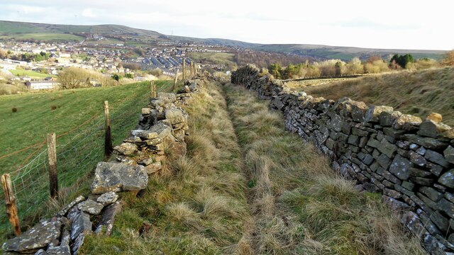
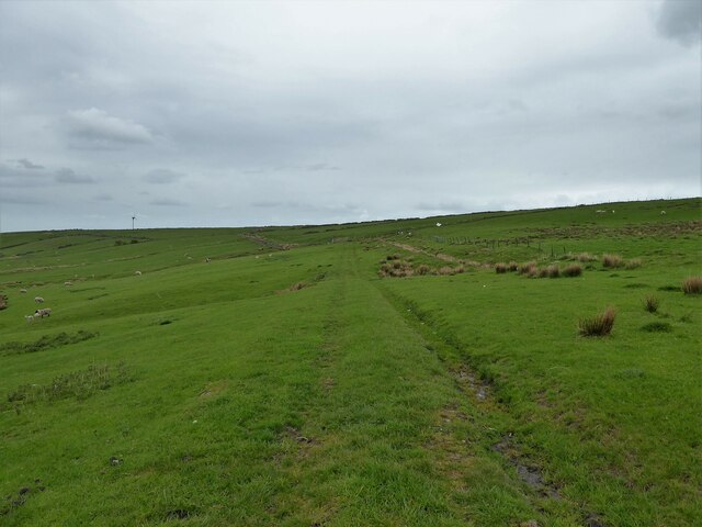
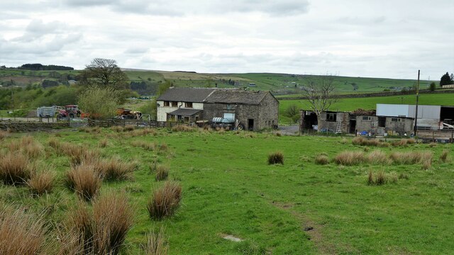
Lower Bridge Clough is a picturesque valley located in Lancashire, England. Nestled in the heart of the Rossendale Valley, it is renowned for its natural beauty and tranquil surroundings. The valley is named after the clough, or gorge, that runs through it, and is a popular spot for outdoor enthusiasts and nature lovers.

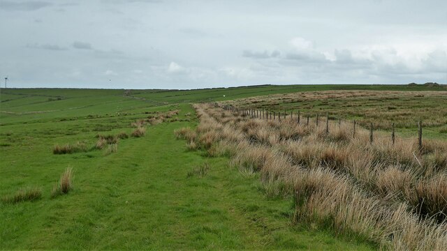
The landscape of Lower Bridge Clough is characterized by rolling hills, verdant meadows, and dense woodlands. The clough itself is a prominent feature, with its steep sides and flowing stream, adding to the charm of the area. The stream is a tributary of the River Irwell, which further enhances the beauty and diversity of the valley.

The valley boasts an abundance of wildlife, making it an ideal location for birdwatching and nature walks. Visitors can spot a variety of bird species, including kingfishers, herons, and woodpeckers, as well as other creatures such as rabbits, squirrels, and deer.

Lower Bridge Clough offers a range of outdoor activities for all ages and abilities. The valley is crisscrossed by a network of footpaths and bridleways, allowing visitors to explore the area on foot or by bike. The clough also provides opportunities for rock climbing and abseiling for those seeking a more adventurous experience.

For those looking to relax and take in the scenery, there are several picnic areas dotted throughout the valley, providing a perfect spot for a leisurely lunch or a quiet moment of reflection.

Overall, Lower Bridge Clough is a hidden gem in Lancashire, offering a peaceful retreat amidst stunning natural beauty. Whether you are an avid hiker, a wildlife enthusiast, or simply seeking a break from the hustle and bustle of city life, this valley is a must-visit destination.

If you have any feedback on the listing, please let us know in the comments section below.

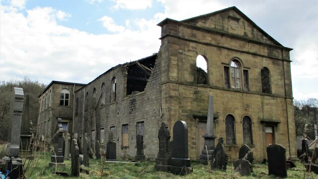
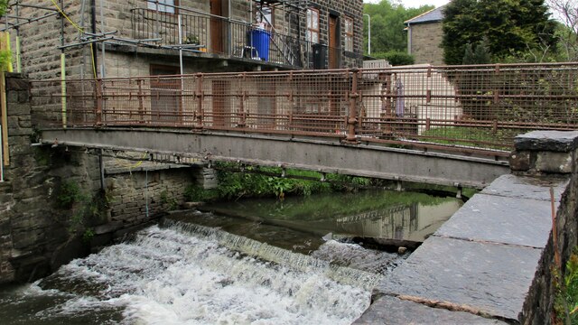
Lower Bridge Clough Images

Images are sourced within 2km of 53.708178/-2.2358242 or Grid Reference SD8423. Thanks to Geograph Open Source API. All images are credited.

Waterbarn Baptist Chapel at risk The Grade II listed building appears at risk of collapse viewed from Brandwood Road
Waterbarn Baptist Chapel at risk
The Grade II listed building appears at risk of collapse viewed from Brandwood Road
Footbridge over the River Irwell, Waterbarn This metal bridge connects Waterbarn Lane with Newchurch Road
Footbridge over the River Irwell, Waterbarn
This metal bridge connects Waterbarn Lane with Newchurch Road
Tunstead Holy Trinity Church
Start of walled path On an ill-defined route down from Brex Height to Bacup, the start of a definite path
Start of walled path
On an ill-defined route down from Brex Height to Bacup, the start of a definite path
Walled path to Honey Hole
Site of tramway overbridge Across the walled path from Honey Hole. The tramway was from Stacksteads Colliery to coal staithes on Booth Road.
Site of tramway overbridge
Across the walled path from Honey Hole. The tramway was from Stacksteads Colliery to coal staithes on Booth Road.
Snow blower on farm At Lower Mow Graine Farm, is the blower for the upland farm use or for the nearby golf course?
Snow blower on farm
At Lower Mow Graine Farm, is the blower for the upland farm use or for the nearby golf course?
Track on the hillside above Brex Farm The track runs along the side of  the fenced off rough open access land
Track on the hillside above Brex Farm
The track runs along the side of the fenced off rough open access land
Track on the hillside above Middle Brex Farm The track continues past the wind turbine on the horizon to Far and Middle Bank End
Track on the hillside above Middle Brex Farm
The track continues past the wind turbine on the horizon to Far and Middle Bank End
Lower Bridge Clough Upland farm viewed from old path around Hey Meadow
Lower Bridge Clough
Upland farm viewed from old path around Hey Meadow
Old walled track to Byrom Gap On old OS maps this is Pilling Barn Lane heading to Byram Gate
Old walled track to Byrom Gap
On old OS maps this is Pilling Barn Lane heading to Byram Gate
Bus on Booth Lane, Stacksteads - 1981 This was part of the 'back road' service along the Rossendale Valley. The bus is Rossendale Transport 54, a Leyland Leopard with East Lancs bodywork, new in 1968.

This is one of a series of views featuring buses in the 60s, 70s, and 80s. <a title="https://www.geograph.org.uk/search.php?i=137652761" href="https://www.geograph.org.uk/search.php?i=137652761">Link</a>
Bus on Booth Lane, Stacksteads - 1981
This was part of the 'back road' service along the Rossendale Valley. The bus is Rossendale Transport 54, a Leyland Leopard with East Lancs bodywork, new in 1968. This is one of a series of views featuring buses in the 60s, 70s, and 80s. Link
Newchurch Road, Stacksteads A view down the A861 "Newchurch" Road, in Stacksteads, Rossendale, Lancashire.
Newchurch Road, Stacksteads
A view down the A861 "Newchurch" Road, in Stacksteads, Rossendale, Lancashire.
Grave of Methuselah Yates "The Huntsman" St Nicholas, Church Lane, Newchurch in Rossendale, Lancashire "Erected by Rossendale Hunt"
Grave of Methuselah Yates "The Huntsman" St Nicholas, Church Lane, Newchurch in Rossendale, Lancashire
"Erected by Rossendale Hunt"
Grave of Methuselah Yates "The Huntsman" St Nicholas, Church Lane, Newchurch in Rossendale, Lancashire
Grave of Methuselah Yates "The Huntsman" St Nicholas, Church Lane, Newchurch in Rossendale, Lancashire In Newchurch graveyard there is a tomb with the stone figure of a hound on top of it. The inscription reads:

"Sacred to the Memory of Old Thu (Methuselah) Yates died 27th February 1864, aged 78.  He was huntsman of Harriers for 50 years.  Five and twenty of them were with the Rossendale Hunt"
Grave of Methuselah Yates "The Huntsman" St Nicholas, Church Lane, Newchurch in Rossendale, Lancashire
In Newchurch graveyard there is a tomb with the stone figure of a hound on top of it. The inscription reads: "Sacred to the Memory of Old Thu (Methuselah) Yates died 27th February 1864, aged 78. He was huntsman of Harriers for 50 years. Five and twenty of them were with the Rossendale Hunt"
Old Street, Newchurch, Rossendale Part of the Haslingden-Todmorden turnpike road built 1795
Old Street, Newchurch, Rossendale
Part of the Haslingden-Todmorden turnpike road built 1795
House, Old Street, Newchurch
Show me another place!

Lower Bridge Clough is located at Grid Ref: SD8423 (Lat: 53.708178, Lng: -2.2358242)

Administrative County: Lancashire

District: Rossendale

Police Authority: Lancashire

What 3 Words

///regulates.cheetahs.rezoning. Near Bacup, Lancashire

Related Wikis

Rossendale (UK Parliament constituency)

Rossendale was a parliamentary constituency in the Lancashire, England. Created in 1885, it elected one Member of Parliament (MP) to the House of Commons...

Rossendale and Darwen (UK Parliament constituency)

Rossendale and Darwen is a constituency in Lancashire represented in the House of Commons of the UK Parliament since 2010 by Jake Berry, the former Chairman...

Whitewell Brook

Whitewell Brook is a minor river in Lancashire, England. It is 4.34 miles (6.99 km) long and has a catchment area of 7.67 square miles (19.86 km2).The...

Lumb, Rawtenstall

Lumb is a small village in the Rossendale district of Lancashire, England. It lies in the valley of the Whitewell Brook, 3 miles (5 km) north east of Rawtenstall...

Nearby Amenities

Located within 500m of 53.708178,-2.2358242
Entrance: yes
Lat/Long: 53.7074219/-2.2430428
Turning Loop
Lat/Long: 53.7103457/-2.2383748
Designation: public_footpath
Foot: designated
Prow Ref: Bacup FP 122
Lat/Long: 53.7098554/-2.2296419
The data included in this document is from www.openstreetmap.org. The data is made available under ODbL.

Have you been to Lower Bridge Clough?

Leave your review of Lower Bridge Clough below (or comments, questions and feedback).