Coxgreen Dingle

Valley in Staffordshire South Staffordshire

England

Coxgreen Dingle

Field and footpath  near Tuckhill in Shropshire The public footpath leads through the cereal crop towards Nicholl's Covert and Four Ashes.
Field and footpath near Tuckhill in Shropshire Credit: Roger Kidd

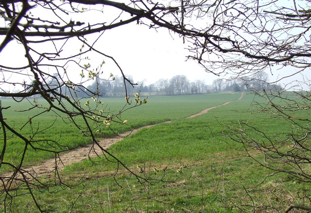
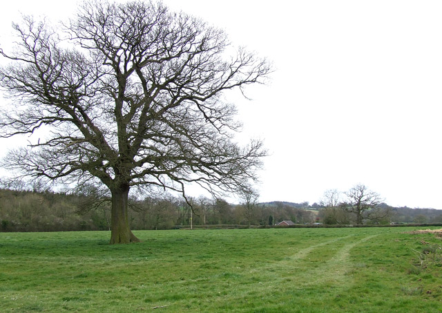
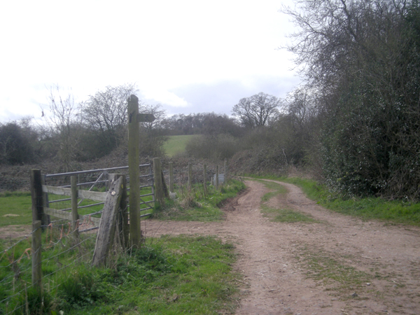
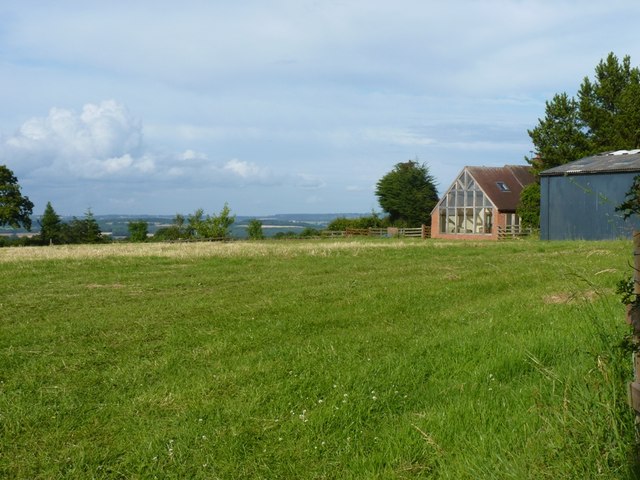
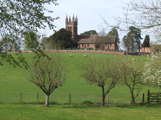
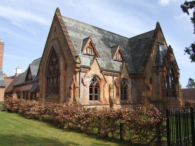
Coxgreen Dingle, located in Staffordshire, England, is a picturesque valley that showcases the natural beauty of the region. Nestled within the rolling hills and scenic countryside, this tranquil dingle provides a serene escape from the hustle and bustle of everyday life.

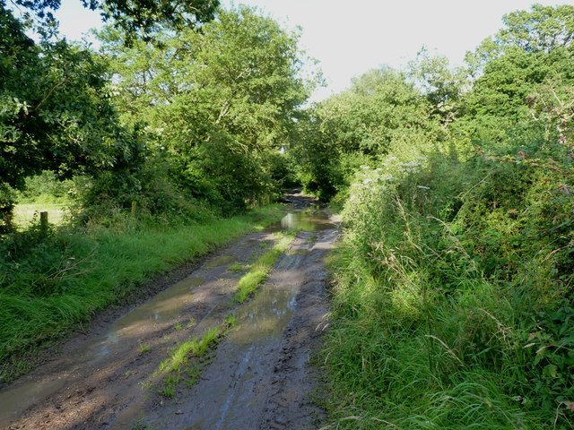
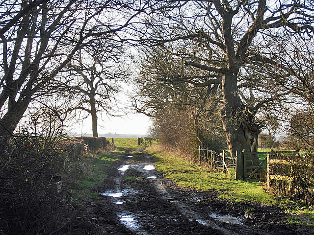
The dingle is characterized by its lush greenery, with a variety of trees, plants, and wildflowers adorning its landscape. The gentle babbling of the nearby stream adds to the peaceful ambiance, creating a sense of harmony and tranquility.

Coxgreen Dingle is a popular destination for nature enthusiasts and hikers, offering a network of walking trails that meander through the valley. These trails provide opportunities for visitors to explore the diverse flora and fauna that call this area home.

The dingle is also home to a rich array of wildlife, including various species of birds, small mammals, and insects. Birdwatchers can spot a range of avian species, from colorful songbirds to majestic birds of prey.

The stunning vistas and natural beauty of Coxgreen Dingle make it an ideal spot for photography enthusiasts, who can capture the enchanting scenery throughout the changing seasons.

Visitors to Coxgreen Dingle can also enjoy a picnic or simply relax in the peaceful surroundings, immersing themselves in the tranquility of nature. The valley's idyllic setting offers a respite from the noise and stress of modern life, allowing visitors to unwind and reconnect with the natural world.

If you have any feedback on the listing, please let us know in the comments section below.

Coxgreen Dingle Images

Images are sourced within 2km of 52.479437/-2.2820666 or Grid Reference SO8086. Thanks to Geograph Open Source API. All images are credited.

Field and footpath  near Tuckhill in Shropshire The public footpath leads through the cereal crop towards Nicholl's Covert and Four Ashes.
Field and footpath near Tuckhill in Shropshire
The public footpath leads through the cereal crop towards Nicholl's Covert and Four Ashes.
Public Footpath near Tuckhill, Shropshire Looking out of Nicholl's Covert, the path is well defined climbing through the cereal crop towards Tuckhill.
Public Footpath near Tuckhill, Shropshire
Looking out of Nicholl's Covert, the path is well defined climbing through the cereal crop towards Tuckhill.
Beauty Bank Farmhouse west of Coxgreen in Staffordshire Just over into Shropshire, this farmhouse has been expertly renovated and extended, including the use of local sandstone materials. Superb!
Beauty Bank Farmhouse west of Coxgreen in Staffordshire
Just over into Shropshire, this farmhouse has been expertly renovated and extended, including the use of local sandstone materials. Superb!
Grazing Land near Lindridge, Shropshire
Lane junction near Lindridge
Meeting of several farm tracks
Footpath near Tuckhill, Shropshire The public footpath across the fields leads through Nicholl's Covert to Four Ashes.
Footpath near Tuckhill, Shropshire
The public footpath across the fields leads through Nicholl's Covert to Four Ashes.
A458 west of Four Ashes
Barrets - a couple of abandoned barns Two abandoned barns of different ages adjacent to the bridleway between The Hollies and Filletts farms.
Barrets - a couple of abandoned barns
Two abandoned barns of different ages adjacent to the bridleway between The Hollies and Filletts farms.
The entrance to Lindridge Farm
Towards High Barns Farm from the lane near Lindridge Grazing land west of High Barns Farm.
Towards High Barns Farm from the lane near Lindridge
Grazing land west of High Barns Farm.
Barn conversion just off Batfield Lane
A badly boggy bit The generally good bridleway between The Hollies and Filletts farms is rather let down by this boggy, muddy section in the woods.
A badly boggy bit
The generally good bridleway between The Hollies and Filletts farms is rather let down by this boggy, muddy section in the woods.
Farm track in winter
Enville Hall Grade II listed 16C&17C hall built by the Grey family, Earls of Stamford and Warrington. The extensive estate comprises 6500acres at Enville.
Enville Hall
Grade II listed 16C&17C hall built by the Grey family, Earls of Stamford and Warrington. The extensive estate comprises 6500acres at Enville.
View to Enville Church Quintessential English village church near to Enville Hall with sheep grazing the fields. The church is largely Norman built on to an earlier Saxon foundation. The tower dates from the mid 1870s and is  a late commission by George Gilbert Scott the renowned architect of churches, cathedrals and St Pancras Station.
View to Enville Church
Quintessential English village church near to Enville Hall with sheep grazing the fields. The church is largely Norman built on to an earlier Saxon foundation. The tower dates from the mid 1870s and is a late commission by George Gilbert Scott the renowned architect of churches, cathedrals and St Pancras Station.
Former Enville School School in the estate village erected by the Countess of Stamford and Warrington in the 1860s.
Former Enville School
School in the estate village erected by the Countess of Stamford and Warrington in the 1860s.
Gateway at Enville Hall The gate in the brick wall surrounding the hall leads into the landscaped gardens.
Gateway at Enville Hall
The gate in the brick wall surrounding the hall leads into the landscaped gardens.
Show me another place!

Coxgreen Dingle is located at Grid Ref: SO8086 (Lat: 52.479437, Lng: -2.2820666)

Administrative County: Staffordshire

District: South Staffordshire

Police Authority: Staffordshire

What 3 Words

///cakes.scoop.funky. Near Romsley, Shropshire

Related Wikis

Great Fountain, Enville

The Great Fountain, Enville, was a fountain created in the mid-19th century by the Earl of Stamford in the middle of a lake on his Enville Hall estate...

Enville, Staffordshire

Enville is a village and civil parish in rural Staffordshire, England, on the A458 road between Stourbridge and Bridgnorth. Enville is in the South Staffordshire...

Enville Hall

Enville Hall is an English Tudor country house in the village of Enville, Staffordshire. It is a Grade II listed building.The house has a 16th and 17th...

West Midlands (region)

The West Midlands is one of nine official regions of England at the first level of International Territorial Level for statistical purposes. It covers...

Six Ashes

Six Ashes is a small village in Shropshire, England, on the Shropshire side of the border with Staffordshire. == See also == Tripartite Indenture ��2...

Mid Severn Sandstone Plateau

The Mid Severn Sandstone Plateau is a rural landscape and one of the natural regions of central England, straddling the border between the counties of...

Bobbington

Bobbington is a village and civil parish in the South Staffordshire district of Staffordshire, England, about 5 miles (8.0 km) west of Wombourne. According...

Coton, Alveley, Shropshire

Coton is located northeast of Alveley, Shropshire and was associated with the manor Coton Hall. The ancestors of General Robert E. Lee left Coton near...

Nearby Amenities

Located within 500m of 52.479437,-2.2820666
The data included in this document is from www.openstreetmap.org. The data is made available under ODbL.

Have you been to Coxgreen Dingle?

Leave your review of Coxgreen Dingle below (or comments, questions and feedback).