Belford Hope

Valley in Roxburghshire

Scotland

Belford Hope

View from Hownam Steeple Over the headwaters of the Hownam Burn.
View from Hownam Steeple Credit: Richard Webb

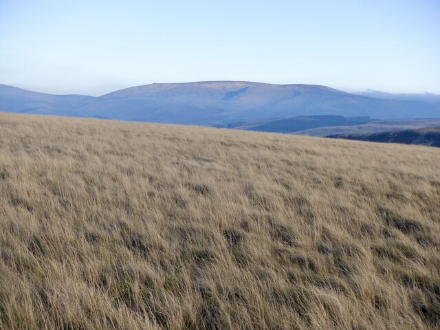
Belford Hope is a picturesque valley located in Roxburghshire, a historic county in the Scottish Borders region of Scotland. Situated amidst rolling hills and verdant landscapes, this tranquil valley offers a magnificent natural setting for visitors to enjoy.

The valley derives its name from the nearby small village of Belford, which is located at the southern end of the valley. Belford Hope is renowned for its stunning scenery, with a meandering river flowing through the heart of the valley, surrounded by lush greenery and a diverse range of flora and fauna. The valley is also home to several walking trails and nature reserves, making it a popular destination for outdoor enthusiasts and nature lovers.

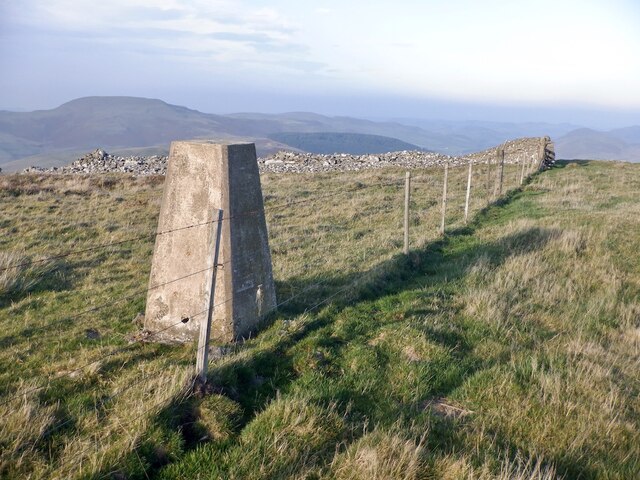
Belford Hope is known for its rich history, with several archaeological sites and ancient ruins scattered throughout the area. These remnants from the past offer a fascinating glimpse into the valley's historic significance and the lives of its previous inhabitants.

The valley is also a haven for wildlife, with a variety of bird species, including golden eagles, ospreys, and pheasants, frequently spotted in the area. Additionally, red deer, badgers, and rabbits can often be seen roaming the valley's fields and woodlands.

For those seeking a peaceful retreat or a chance to immerse themselves in nature's beauty, Belford Hope in Roxburghshire is an idyllic destination. Its serene landscapes, rich history, and abundant wildlife make it a truly remarkable place to visit.

If you have any feedback on the listing, please let us know in the comments section below.

Belford Hope Images

Images are sourced within 2km of 55.472375/-2.3052404 or Grid Reference NT8019. Thanks to Geograph Open Source API. All images are credited.

View from Hownam Steeple Over the headwaters of the Hownam Burn.
View from Hownam Steeple
Over the headwaters of the Hownam Burn.
South Cote from Hownam Law The derelict South Cote as captured by telephoto lens from just below the summit on Howman Law.
South Cote from Hownam Law
The derelict South Cote as captured by telephoto lens from just below the summit on Howman Law.
View to The Schill The border ridge beyond See Few as seen from Windy Law. Clear here but to the south the ridge was holding back a lot of cloud formed by a south easterly. It was astonishingly warm.
View to The Schill
The border ridge beyond See Few as seen from Windy Law. Clear here but to the south the ridge was holding back a lot of cloud formed by a south easterly. It was astonishingly warm.
The Street Climb over Craik Moor.
The Street
Climb over Craik Moor.
Berry Hills Craik Moor, Cheviot Hills.
Berry Hills
Craik Moor, Cheviot Hills.
Craik Moor The Street follows a fence dividing grass from heather.
Craik Moor
The Street follows a fence dividing grass from heather.
Cairn, Berry Hills Some stones from the antiquity have been used to form a more recent cairn.
Cairn, Berry Hills
Some stones from the antiquity have been used to form a more recent cairn.
The Street
The Street
Head of Cribs Hope Scree lined deep defile off Craik Moor.
Head of Cribs Hope
Scree lined deep defile off Craik Moor.
The Street, Craik Moor
A fence on Craik Moor View to The Cheviot.
A fence on Craik Moor
View to The Cheviot.
Track on Craik Moor Linking the summit easily to The Street.
Track on Craik Moor
Linking the summit easily to The Street.
Grass on Craik Moor Quite a lot of pheasants here, possibly fewer later on as gunfire was heard about an hour later. The Cheviot is in the background.
Grass on Craik Moor
Quite a lot of pheasants here, possibly fewer later on as gunfire was heard about an hour later. The Cheviot is in the background.
Fence on Craik Moor In the background a mass of cloud has formed on the English side of the ridge, where moist and very warm air has been pushed up on a southeasterly.
Fence on Craik Moor
In the background a mass of cloud has formed on the English side of the ridge, where moist and very warm air has been pushed up on a southeasterly.
Stone on Craik Moor
Stone on Craik Moor
Craik Moor View towards the summit and triangulation pillar.
Craik Moor
View towards the summit and triangulation pillar.
Craik Moor triangulation pillar At the site of another fortified enclosure with steep slopes beyond. Worth going a little further north to find a gate if needed and a very fine view.
Craik Moor triangulation pillar
At the site of another fortified enclosure with steep slopes beyond. Worth going a little further north to find a gate if needed and a very fine view.
Show me another place!

Belford Hope is located at Grid Ref: NT8019 (Lat: 55.472375, Lng: -2.3052404)

Unitary Authority: The Scottish Borders

Police Authority: The Lothians and Scottish Borders

What 3 Words

///fund.foreheads.wiggles. Near Kirknewton, Northumberland

Nearby Locations

The Kip Belford Hope

Related Wikis

Mowhaugh

Mowhaugh is a hamlet and farm steading near the Calroust Burn and the Bowmont Water, near Morebattle, in the Scottish Borders area of Scotland, and in...

Hownam

Hownam or Hounam is a small village and parish situated 8 miles east of Jedburgh in the Scottish Borders area of Scotland, near the Anglo-Scottish border...

Morebattle

Morebattle is a village in the Scottish Borders area of Scotland, on the B6401, seven miles south of Kelso, Scottish Borders, beside the Kale Water, a...

Windy Gyle

Windy Gyle is a mountain in the Cheviot Hills range, on the border between England and Scotland. Like the other hills in the area, it is rounded and grass...

Nearby Amenities

Located within 500m of 55.472375,-2.3052404
The Kip
Natural: peak
Lat/Long: 55.4726651/-2.3130843
The data included in this document is from www.openstreetmap.org. The data is made available under ODbL.

Have you been to Belford Hope?

Leave your review of Belford Hope below (or comments, questions and feedback).