Snuffmill Dingle

Valley in Worcestershire Wyre Forest

England

Snuffmill Dingle

Bewdley, including Severn Valley Guest House Part of the town of Bewdley taken from 'Bewdley North' railway viaduct looking towards the river. In view is the Severn Valley Guest House and part of the 'Red Lion'
Bewdley, including Severn Valley Guest House Credit: Rob Newman

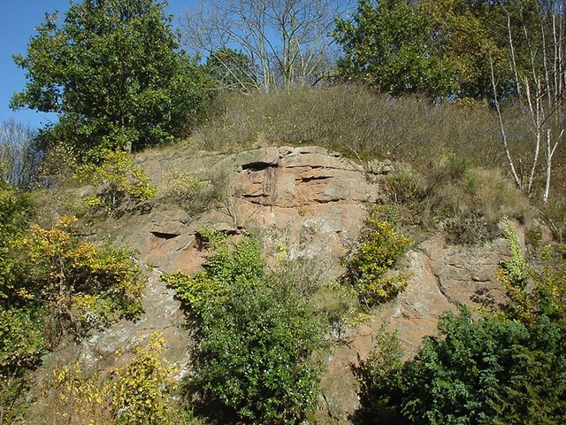
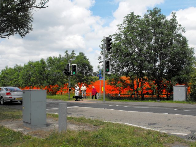
Snuffmill Dingle, located in Worcestershire, is a picturesque valley nestled in the heart of the English countryside. Spread over an area of approximately 30 hectares, this enchanting dingle is renowned for its natural beauty and tranquil surroundings, making it a popular destination for nature lovers and outdoor enthusiasts.

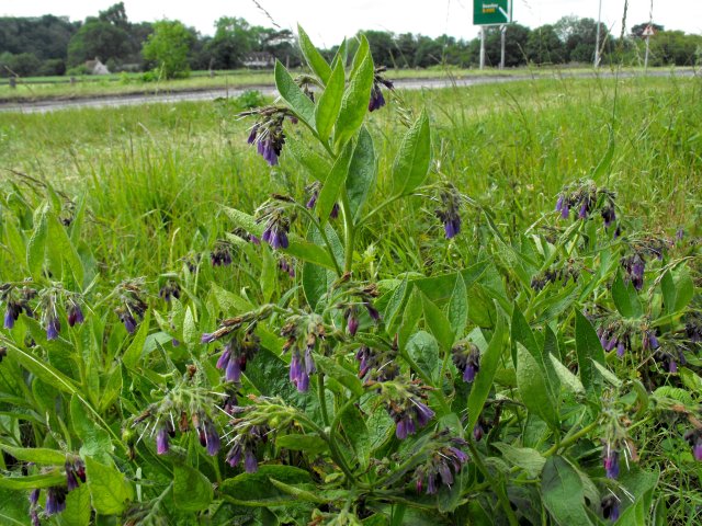
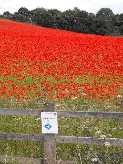
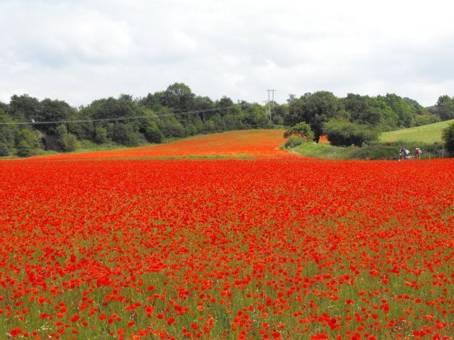
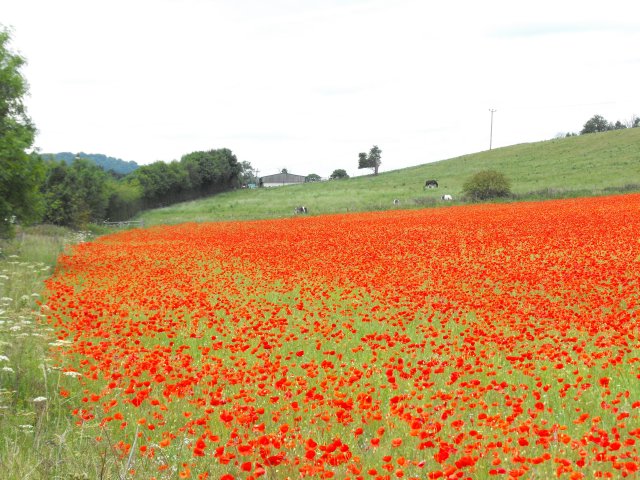
The dingle is blessed with a diverse range of flora and fauna, offering a captivating display of colors throughout the year. From vibrant wildflowers and ancient woodland to babbling brooks and small waterfalls, Snuffmill Dingle truly epitomizes the charm of the English countryside. The valley is home to a variety of tree species, including oak, beech, and birch, which provide a haven for numerous bird species and other wildlife.

Visitors to Snuffmill Dingle can enjoy leisurely walks along the well-maintained footpaths that wind through the valley, taking in the sights and sounds of the natural surroundings. The dingle also features several picnic areas, allowing visitors to relax and enjoy a meal amidst the peaceful ambiance.

In addition to its natural beauty, Snuffmill Dingle also holds historical significance. The remains of an old snuff mill, which was used to grind tobacco leaves, can still be seen within the valley, offering a glimpse into the area's industrial past.

Overall, Snuffmill Dingle in Worcestershire is a haven of tranquility and natural splendor, offering visitors a chance to escape the hustle and bustle of modern life and immerse themselves in the beauty of the English countryside.

If you have any feedback on the listing, please let us know in the comments section below.

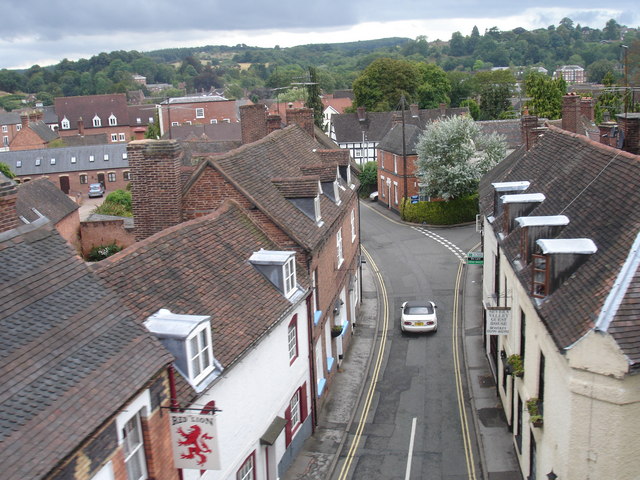
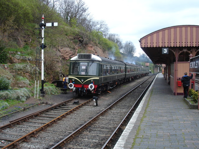
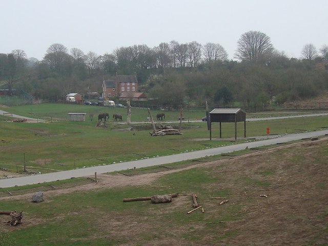
Snuffmill Dingle Images

Images are sourced within 2km of 52.368539/-2.3227766 or Grid Reference SO7874. Thanks to Geograph Open Source API. All images are credited.
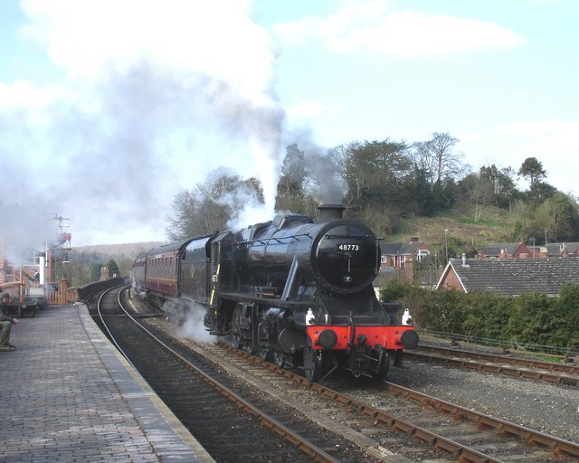
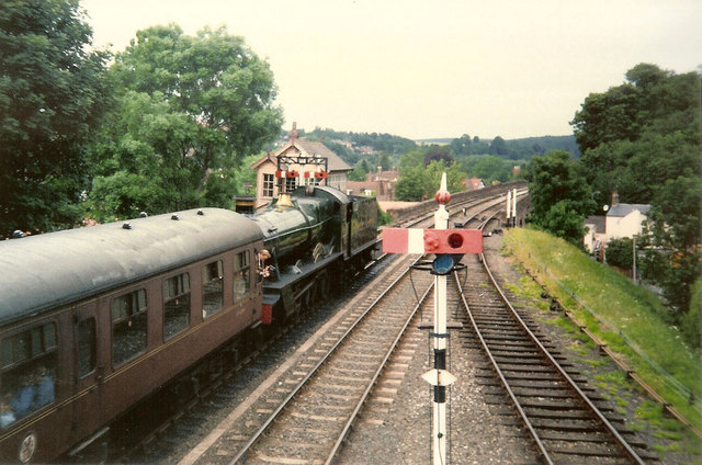
Bewdley, including Severn Valley Guest House Part of the town of Bewdley taken from 'Bewdley North' railway viaduct looking towards the river. In view is the Severn Valley Guest House and part of the 'Red Lion'
Bewdley, including Severn Valley Guest House
Part of the town of Bewdley taken from 'Bewdley North' railway viaduct looking towards the river. In view is the Severn Valley Guest House and part of the 'Red Lion'
48773 entering Bewdley Station, SVR Stanier 8F 2-8-0 No 48773, owned by the Stanier 8F Locomotive Society who bought the locomotive from British Railways in 1968, enters Bewdley Station with a Severn Valley Railway train from Bridgnorth to Kidderminster Town. The train is crossing Bewdley North Viaduct on its way into the station.
48773 entering Bewdley Station, SVR
Stanier 8F 2-8-0 No 48773, owned by the Stanier 8F Locomotive Society who bought the locomotive from British Railways in 1968, enters Bewdley Station with a Severn Valley Railway train from Bridgnorth to Kidderminster Town. The train is crossing Bewdley North Viaduct on its way into the station.
Rock Siding, Bewdley Station A diesel multiple unit occupies the track known as 'Rock Siding' at Bewdley Station, Severn Valley Railway
Rock Siding, Bewdley Station
A diesel multiple unit occupies the track known as 'Rock Siding' at Bewdley Station, Severn Valley Railway
Elephant Enclosure, West Midlands Safari Park Viewed from the railway line beside the Safari Park, this is the elephant enclosure.
Elephant Enclosure, West Midlands Safari Park
Viewed from the railway line beside the Safari Park, this is the elephant enclosure.
Bewdley Bridge in 1987 The bridge carries the B4195 road over the River Severn. The large red brick house over the bridge on the left hand side stands in Severn Street South. The church tower is that of St Anne's.
Bewdley Bridge in 1987
The bridge carries the B4195 road over the River Severn. The large red brick house over the bridge on the left hand side stands in Severn Street South. The church tower is that of St Anne's.
Rock Outcrop, Bewdley This outcrop of sandstone rock forms the northern boundary of Bewdley station
Rock Outcrop, Bewdley
This outcrop of sandstone rock forms the northern boundary of Bewdley station
Trains Pass at Bewdley BR Standard Pacific No 71000 "Duke of Gloucester" [left] and 'Manor' class 4-6-0 No 7812 "Erlestoke Manor" pass at Bewdley station.
Trains Pass at Bewdley
BR Standard Pacific No 71000 "Duke of Gloucester" [left] and 'Manor' class 4-6-0 No 7812 "Erlestoke Manor" pass at Bewdley station.
Bewdley station on the Severn Valley Railway
Poppies at Blackstone, Worcestershire I was not alone in finding the sight of this field bright red with poppies difficult to drive past, the Blackstone car park opposite was full.

A poster on the fence says,
"This is one of three fields owned by Worcestershire Wildlife Trust. This year it is being left fallow.
Its diverse and colourful weeds are indicative of low input agriculture. By using minimal herbicides we get this beautiful flush of annual wildflowers such as the poppy. We'll leave the field fallow in rotation to help reduce the nutrient levels in the soil. This will allow the land to gradually become heathland, a very threatened habitat in the county.
Several rare arable plants have been recorded in these fields and insects are abundant."
A report on this site from the Worcestershire Wildlife Trust website <span class="nowrap"><a title="https://web.archive.org/web/20110614140450/http://www.worcswildlifetrust.co.uk/index.php?section=news&id=3740" rel="nofollow ugc noopener" href="https://web.archive.org/web/20110614140450/http://www.worcswildlifetrust.co.uk/index.php?section=news&id=3740">Archive Link</a><img style="margin-left:2px;" alt="External link" title="External link - shift click to open in new window" src="https://s1.geograph.org.uk/img/external.png" width="10" height="10"/></span>
Poppies at Blackstone, Worcestershire
I was not alone in finding the sight of this field bright red with poppies difficult to drive past, the Blackstone car park opposite was full. A poster on the fence says, "This is one of three fields owned by Worcestershire Wildlife Trust. This year it is being left fallow. Its diverse and colourful weeds are indicative of low input agriculture. By using minimal herbicides we get this beautiful flush of annual wildflowers such as the poppy. We'll leave the field fallow in rotation to help reduce the nutrient levels in the soil. This will allow the land to gradually become heathland, a very threatened habitat in the county. Several rare arable plants have been recorded in these fields and insects are abundant." A report on this site from the Worcestershire Wildlife Trust website Archive LinkExternal link
Poppies at Blackstone, Worcestershire An area on one side of the field has been roped off for use by visitors so they can feel they are surrounded by the poppies.
Poppies at Blackstone, Worcestershire
An area on one side of the field has been roped off for use by visitors so they can feel they are surrounded by the poppies.
Poppies at Blackstone, Worcestershire I was not alone in finding the sight of this field bright red with poppies difficult to drive past, the Blackstone car park opposite was full.

A poster on the fence says,
"This is one of three fields owned by Worcestershire Wildlife Trust. This year it is being left fallow.
Its diverse and colourful weeds are indicative of low input agriculture. By using minimal herbicides we get this beautiful flush of annual wildflowers such as the poppy. We'll leave the field fallow in rotation to help reduce the nutrient levels in the soil. This will allow the land to gradually become heathland, a very threatened habitat in the county.
Several rare arable plants have been recorded in these fields and insects are abundant."
A report on this site from the Worcestershire Wildlife Trust website <span class="nowrap"><a title="https://web.archive.org/web/20110614140450/http://www.worcswildlifetrust.co.uk/index.php?section=news&id=3740" rel="nofollow ugc noopener" href="https://web.archive.org/web/20110614140450/http://www.worcswildlifetrust.co.uk/index.php?section=news&id=3740">Archive Link</a><img style="margin-left:2px;" alt="External link" title="External link - shift click to open in new window" src="https://s1.geograph.org.uk/img/external.png" width="10" height="10"/></span>
Poppies at Blackstone, Worcestershire
I was not alone in finding the sight of this field bright red with poppies difficult to drive past, the Blackstone car park opposite was full. A poster on the fence says, "This is one of three fields owned by Worcestershire Wildlife Trust. This year it is being left fallow. Its diverse and colourful weeds are indicative of low input agriculture. By using minimal herbicides we get this beautiful flush of annual wildflowers such as the poppy. We'll leave the field fallow in rotation to help reduce the nutrient levels in the soil. This will allow the land to gradually become heathland, a very threatened habitat in the county. Several rare arable plants have been recorded in these fields and insects are abundant." A report on this site from the Worcestershire Wildlife Trust website Archive LinkExternal link
Comfrey by the A456 at Blackstone It wasn't just the poppies <a title="https://www.geograph.org.uk/snippet/5338" href="https://www.geograph.org.uk/snippet/5338">Link</a> which caught my eye.
Comfrey by the A456 at Blackstone
It wasn't just the poppies Link which caught my eye.
I can see them quite well from here... I was not alone in finding the sight of this field bright red with poppies difficult to drive past, the Blackstone car park opposite was full.

A poster on the fence says,
"This is one of three fields owned by Worcestershire Wildlife Trust. This year it is being left fallow.
Its diverse and colourful weeds are indicative of low input agriculture. By using minimal herbicides we get this beautiful flush of annual wildflowers such as the poppy. We'll leave the field fallow in rotation to help reduce the nutrient levels in the soil. This will allow the land to gradually become heathland, a very threatened habitat in the county.
Several rare arable plants have been recorded in these fields and insects are abundant."
A report on this site from the Worcestershire Wildlife Trust website <span class="nowrap"><a title="https://web.archive.org/web/20110614140450/http://www.worcswildlifetrust.co.uk/index.php?section=news&id=3740" rel="nofollow ugc noopener" href="https://web.archive.org/web/20110614140450/http://www.worcswildlifetrust.co.uk/index.php?section=news&id=3740">Archive Link</a><img style="margin-left:2px;" alt="External link" title="External link - shift click to open in new window" src="https://s1.geograph.org.uk/img/external.png" width="10" height="10"/></span>
I can see them quite well from here...
I was not alone in finding the sight of this field bright red with poppies difficult to drive past, the Blackstone car park opposite was full. A poster on the fence says, "This is one of three fields owned by Worcestershire Wildlife Trust. This year it is being left fallow. Its diverse and colourful weeds are indicative of low input agriculture. By using minimal herbicides we get this beautiful flush of annual wildflowers such as the poppy. We'll leave the field fallow in rotation to help reduce the nutrient levels in the soil. This will allow the land to gradually become heathland, a very threatened habitat in the county. Several rare arable plants have been recorded in these fields and insects are abundant." A report on this site from the Worcestershire Wildlife Trust website Archive LinkExternal link
Poppies at Blackstone, Worcestershire
Poppies at Blackstone, Worcestershire The horses in the next field seem unimpressed.
Poppies at Blackstone, Worcestershire
The horses in the next field seem unimpressed.
Pedestrian crossing on A456 at Blackstone The crossing (a fairly recent development for National Cycle Route 45 I think) was getting a lot of use as people parked in the Blackstone Country Park car park and crossed the road to view the poppies.
Pedestrian crossing on A456 at Blackstone
The crossing (a fairly recent development for National Cycle Route 45 I think) was getting a lot of use as people parked in the Blackstone Country Park car park and crossed the road to view the poppies.
Bewdley Leisure Centre, Stourport Road, Bewdley Bewdley Leisure Centre is on the edge of Bewdley. It is owned by Wyre Forest District Council, but the facilities are managed for them by a firm called D C Leisure. At this centre facilities include badminton, five-a-side football, group exercise classes, basketball, volleyball, martial arts, and much else. There are also two football pitches, a rugby pitch and an artificial cricket wicket.

D C Leisure's contract to manage this centre, and other centres in Kidderminster and Stourport-on-Severn expires in 2013. Because of rising management and maintenance costs, the District Council are looking at other arrangements. They seem minded to hand over the Bewdley Leisure Centre to community groups or organisations. This presumably is what the current Government's "Big Society" is all about. It will be interesting to see if any groups come forward to run what is in effect a business, and running a facility this size would surely require some paid staff, or maybe volunteers will do everything. Although how a community group can cope with increasing management and maintenance costs, when the council can't, isn't immediately obvious.

<a href="https://www.geograph.org.uk/photo/2465462">SO7974 : Bewdley Leisure Centre sign, Stourport Road, Bewdley</a>.
Bewdley Leisure Centre, Stourport Road, Bewdley
Bewdley Leisure Centre is on the edge of Bewdley. It is owned by Wyre Forest District Council, but the facilities are managed for them by a firm called D C Leisure. At this centre facilities include badminton, five-a-side football, group exercise classes, basketball, volleyball, martial arts, and much else. There are also two football pitches, a rugby pitch and an artificial cricket wicket. D C Leisure's contract to manage this centre, and other centres in Kidderminster and Stourport-on-Severn expires in 2013. Because of rising management and maintenance costs, the District Council are looking at other arrangements. They seem minded to hand over the Bewdley Leisure Centre to community groups or organisations. This presumably is what the current Government's "Big Society" is all about. It will be interesting to see if any groups come forward to run what is in effect a business, and running a facility this size would surely require some paid staff, or maybe volunteers will do everything. Although how a community group can cope with increasing management and maintenance costs, when the council can't, isn't immediately obvious. SO7974 : Bewdley Leisure Centre sign, Stourport Road, Bewdley.
Show me another place!

Snuffmill Dingle is located at Grid Ref: SO7874 (Lat: 52.368539, Lng: -2.3227766)

Administrative County: Worcestershire

District: Wyre Forest

Police Authority: West Mercia

What 3 Words

///barrel.door.solution. Near Bewdley, Worcestershire

Related Wikis

A456 road

Known as the Hagley Road in Birmingham, the A456 is a main road in England running between Central Birmingham and Woofferton, Shropshire, south of Ludlow...

Tickenhill Palace

Tickenhill Palace (also known as Tickenhill House or Tickenhall Manor) is a historic building in Bewdley, Worcestershire, England. It is a grade II* listed...
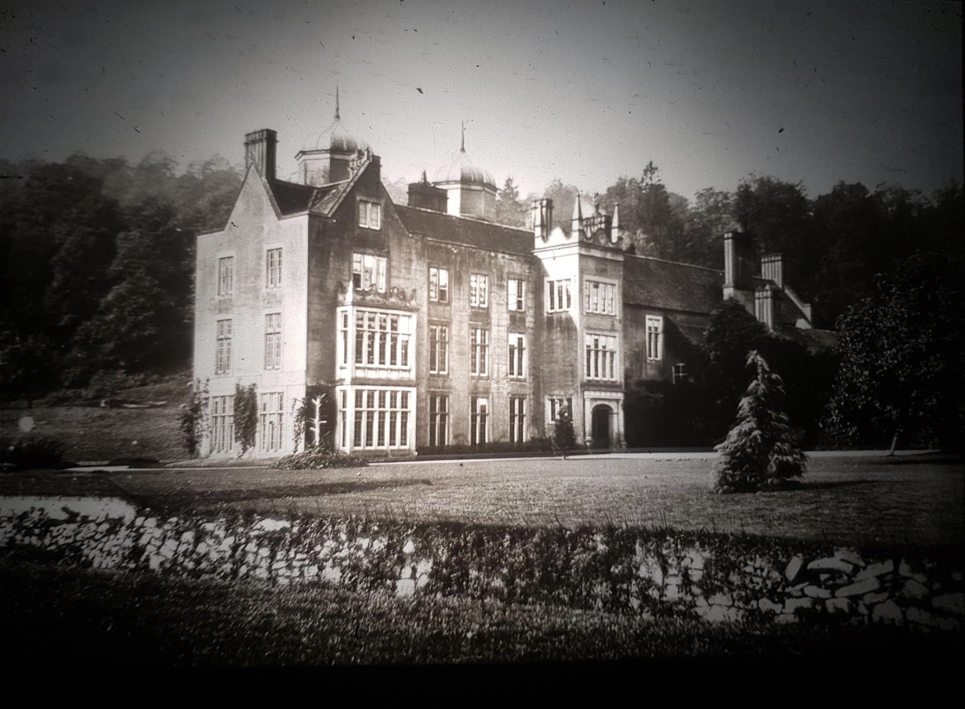
Ribbesford House

Ribbesford House is a historic English mansion in Ribbesford, near Bewdley, Worcestershire. The house and its surrounding estate have a history dating...

Bewdley Guildhall

Bewdley Guildhall is a municipal building in Load Street in Bewdley, Worcestershire, England. The structure, which is the meeting place of Bewdley Town...
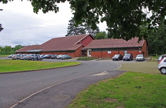
Nearby Amenities

Located within 500m of 52.368539,-2.3227766
Barrier: kissing_gate
Foot: yes
Lat/Long: 52.3705605/-2.3166091
Noexit: yes
Lat/Long: 52.3705806/-2.3204058
Noexit: yes
Lat/Long: 52.3709749/-2.3203272
Tourism: viewpoint
Lat/Long: 52.3682743/-2.3187296
Barrier: kissing_gate
Foot: yes
Lat/Long: 52.3702435/-2.3166159
Barrier: kissing_gate
Foot: yes
Lat/Long: 52.3682541/-2.3161415
Information: map
Tourism: information
Lat/Long: 52.3704278/-2.3164913
Generator Method: photovoltaic
Generator Output Electricity: yes
Generator Source: solar
Generator Type: solar_photovoltaic_panel
Location: roof
Power: generator
Lat/Long: 52.3648169/-2.326878
Generator Method: photovoltaic
Generator Output Electricity: yes
Generator Source: solar
Generator Type: solar_photovoltaic_panel
Location: roof
Power: generator
Lat/Long: 52.3728253/-2.3244506
Generator Method: photovoltaic
Generator Output Electricity: yes
Generator Source: solar
Generator Type: solar_photovoltaic_panel
Location: roof
Power: generator
Lat/Long: 52.3728138/-2.324625
Generator Method: photovoltaic
Generator Output Electricity: yes
Generator Source: solar
Generator Type: solar_photovoltaic_panel
Location: roof
Power: generator
Lat/Long: 52.372524/-2.323418
Generator Method: photovoltaic
Generator Output Electricity: yes
Generator Source: solar
Generator Type: solar_photovoltaic_panel
Location: roof
Power: generator
Lat/Long: 52.372935/-2.3221412
Generator Method: photovoltaic
Generator Output Electricity: yes
Generator Source: solar
Generator Type: solar_photovoltaic_panel
Location: roof
Power: generator
Lat/Long: 52.3728973/-2.3223129
Generator Method: photovoltaic
Generator Output Electricity: yes
Generator Source: solar
Generator Type: solar_photovoltaic_panel
Location: roof
Power: generator
Lat/Long: 52.3718526/-2.3211193
Generator Method: photovoltaic
Generator Output Electricity: yes
Generator Source: solar
Generator Type: solar_photovoltaic_panel
Location: roof
Power: generator
Lat/Long: 52.3705916/-2.3207599
Generator Method: photovoltaic
Generator Output Electricity: yes
Generator Source: solar
Generator Type: solar_photovoltaic_panel
Location: roof
Power: generator
Lat/Long: 52.3697204/-2.3217416
Generator Method: photovoltaic
Generator Output Electricity: yes
Generator Source: solar
Generator Type: solar_photovoltaic_panel
Location: roof
Power: generator
Lat/Long: 52.3702968/-2.3226884
Generator Method: photovoltaic
Generator Output Electricity: yes
Generator Source: solar
Generator Type: solar_photovoltaic_panel
Location: roof
Power: generator
Lat/Long: 52.370007/-2.3223209
Generator Method: photovoltaic
Generator Output Electricity: yes
Generator Source: solar
Generator Type: solar_photovoltaic_panel
Location: roof
Power: generator
Lat/Long: 52.3709781/-2.3229244
Generator Method: photovoltaic
Generator Output Electricity: yes
Generator Source: solar
Generator Type: solar_photovoltaic_panel
Location: roof
Power: generator
Lat/Long: 52.37115/-2.3235065
Generator Method: photovoltaic
Generator Output Electricity: yes
Generator Source: solar
Generator Type: solar_photovoltaic_panel
Location: roof
Power: generator
Lat/Long: 52.3719737/-2.3234555
Generator Method: photovoltaic
Generator Output Electricity: yes
Generator Source: solar
Generator Type: solar_photovoltaic_panel
Location: roof
Power: generator
Lat/Long: 52.3719197/-2.3233858
Generator Method: photovoltaic
Generator Output Electricity: yes
Generator Source: solar
Generator Type: solar_photovoltaic_panel
Location: roof
Power: generator
Lat/Long: 52.3717346/-2.3263094
The data included in this document is from www.openstreetmap.org. The data is made available under ODbL.

Have you been to Snuffmill Dingle?

Leave your review of Snuffmill Dingle below (or comments, questions and feedback).