Tyley Bottom

Valley in Gloucestershire Stroud

England

Tyley Bottom

Square Pear A sculpture by Richard Cresswell in the garden at Newark House, an exhibit in 'Sculpture in the Garden 2021'
Square Pear Credit: Graham Hogg

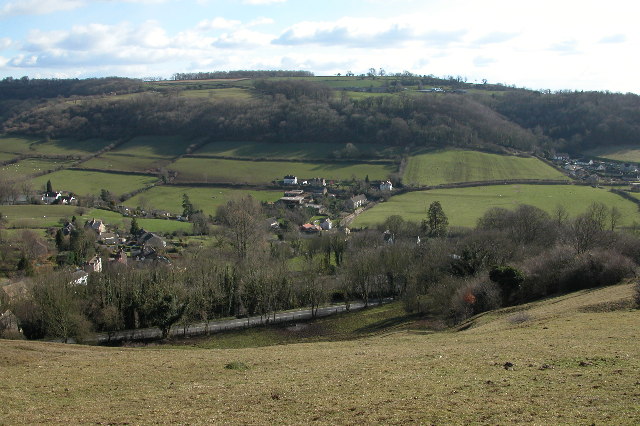
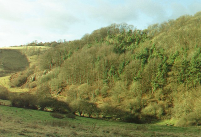
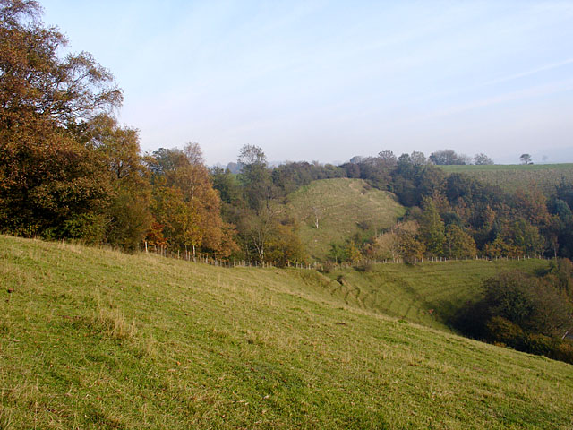
Tyley Bottom, located in Gloucestershire, England, is a picturesque valley surrounded by rolling hills and lush green landscapes. Situated in the Cotswold Area of Outstanding Natural Beauty, this idyllic rural area offers breathtaking views and a tranquil atmosphere.

The valley is named after the small hamlet of Tyley, which is nestled within the bottom of the valley. Tyley is a small community that consists of a handful of houses and farms, giving it a charming and close-knit feel. The residents of Tyley Bottom primarily engage in agricultural activities such as farming and livestock rearing, contributing to the area's rural character.

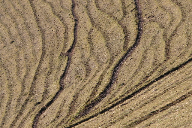
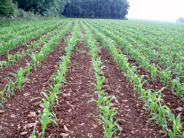
The land in Tyley Bottom is fertile, making it suitable for farming. The valley is blessed with a moderate climate, allowing for a variety of crops to flourish. The rich soil supports the growth of crops like wheat, barley, and oats, while the fields are dotted with grazing sheep and cattle.

The valley is crisscrossed by a network of footpaths and bridleways, making it a popular destination for walkers and hikers. These paths allow visitors to explore the stunning countryside and take in the natural beauty of the area. The valley is also home to an abundance of wildlife, including various bird species, rabbits, and deer.

Overall, Tyley Bottom is a hidden gem in Gloucestershire, offering visitors a chance to escape the hustle and bustle of city life and immerse themselves in the beauty of the English countryside. Whether it's a leisurely stroll through the fields or simply enjoying the tranquility of the surroundings, Tyley Bottom provides a peaceful retreat for nature enthusiasts and those seeking a break from urban living.

If you have any feedback on the listing, please let us know in the comments section below.

Tyley Bottom Images

Images are sourced within 2km of 51.650689/-2.3177064 or Grid Reference ST7894. Thanks to Geograph Open Source API. All images are credited.

Square Pear A sculpture by Richard Cresswell in the garden at Newark House, an exhibit in 'Sculpture in the Garden 2021'
Square Pear
A sculpture by Richard Cresswell in the garden at Newark House, an exhibit in 'Sculpture in the Garden 2021'
Cyclamen and fallen leaves In the grounds of Newark House
Cyclamen and fallen leaves
In the grounds of Newark House
Newark House A grade II listed building built as a hunting lodge by Sir Nicholas Poyntz in the mid 1500s and extended and remodelled several times over the next 400 years. It was given to National Trust in 1949.
Newark House
A grade II listed building built as a hunting lodge by Sir Nicholas Poyntz in the mid 1500s and extended and remodelled several times over the next 400 years. It was given to National Trust in 1949.
Stone Stile, Ozleworth Park To the left of the main gates to the Old Rectory, on Gloucestershire footpath NOZ2 (listed as a Bridleway). Off Blacksmiths Hill.
Stone Stile, Ozleworth Park
To the left of the main gates to the Old Rectory, on Gloucestershire footpath NOZ2 (listed as a Bridleway). Off Blacksmiths Hill.
Crinkle-crankle wall at Newark Park A description is contained in the collection <a title="https://www.geograph.org.uk/gallery/crinkle_crankle_or_serpentine_walls_15374" href="https://www.geograph.org.uk/gallery/crinkle_crankle_or_serpentine_walls_15374">Link</a>
Crinkle-crankle wall at Newark Park
A description is contained in the collection Link
Crinkle-crankle wall at Newark Park A collection featuring these walls <a title="https://www.geograph.org.uk/gallery/crinkle_crankle_or_serpentine_walls_15374" href="https://www.geograph.org.uk/gallery/crinkle_crankle_or_serpentine_walls_15374">Link</a>
Crinkle-crankle wall at Newark Park
A collection featuring these walls Link
Terracettes on Coombe Hill, Wotton-under-Edge Terracettes, unusual naturally formed strips in the steep hillside on Coombe Hill above Wotton-under-Edge.
Terracettes on Coombe Hill, Wotton-under-Edge
Terracettes, unusual naturally formed strips in the steep hillside on Coombe Hill above Wotton-under-Edge.
Coombe The village of Coombe viewed from Coombe Hill
Coombe
The village of Coombe viewed from Coombe Hill
View of Coombe Hill A view across Coombe Hill, above Wotton-Under-Edge.  The hillside has unusual terrace-like lines, these are known as terracettes and are a natural geographical feature.
View of Coombe Hill
A view across Coombe Hill, above Wotton-Under-Edge. The hillside has unusual terrace-like lines, these are known as terracettes and are a natural geographical feature.
Ozleworth (Glos) St Nicholas of Myra's Church Difficult to find but a delightful walk to this church vested in the Churches Conservation Trust
Ozleworth (Glos) St Nicholas of Myra's Church
Difficult to find but a delightful walk to this church vested in the Churches Conservation Trust
St Nicholas of Myra, Ozleworth
Newark Park Originally a 16th century hunting lodge but remodelled in the 18th century. in the care of the National Trust
Newark Park
Originally a 16th century hunting lodge but remodelled in the 18th century. in the care of the National Trust
Tyley Bottom, nr Wotton-under-Edge Looking west across one of the many deep coombes that cut far into this part of the Cotswold scarp, to Golden Knoll Wood.
Tyley Bottom, nr Wotton-under-Edge
Looking west across one of the many deep coombes that cut far into this part of the Cotswold scarp, to Golden Knoll Wood.
Lines of maize
Lines of maize
Choices To the left lies the lane to Ozleworth Bottom, to the right the lane to Newark Park.  In the middle is Goose Green radio station mast.
Choices
To the left lies the lane to Ozleworth Bottom, to the right the lane to Newark Park. In the middle is Goose Green radio station mast.
Strip Lynchets on Coombe Hill Strip Lynchets are medieval farming terraces, found here on the slopes of Coombe Hill.
Strip Lynchets on Coombe Hill
Strip Lynchets are medieval farming terraces, found here on the slopes of Coombe Hill.
Cattle on Coombe Hill
Coombe Hill lower slopes
Show me another place!

Tyley Bottom is located at Grid Ref: ST7894 (Lat: 51.650689, Lng: -2.3177064)

Administrative County: Gloucestershire

District: Stroud

Police Authority: Gloucestershire

What 3 Words

///ridiculed.questions.comforted. Near Wotton-under-Edge, Gloucestershire

Related Wikis

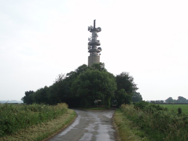
Wotton-under-Edge BT Tower

Wotton-under-Edge Tower is a 76.2 metres ( 250 ft) tall telecommunication tower built of reinforced concrete at Wotton-under-Edge in Gloucestershire, UK...

Coombe, Gloucestershire

Coombe is a settlement in the English county of Gloucestershire. It is adjacent to the town of Wotton-under-Edge. The town name can also be found spelled...
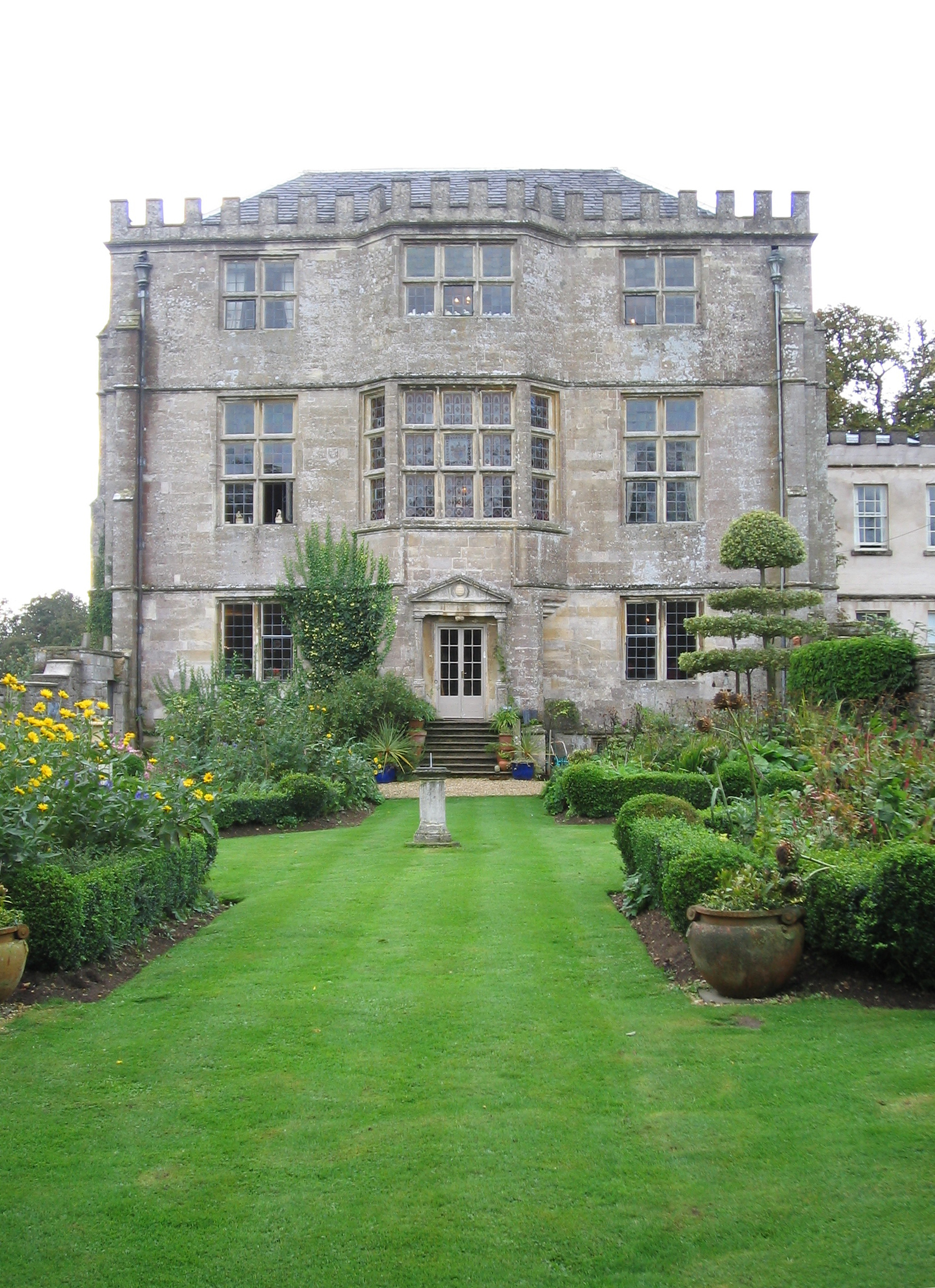
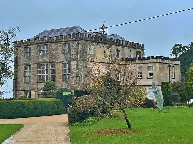
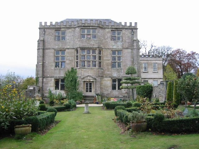
Newark Park

Newark Park is a Grade I listed country house of Tudor origins located near the village of Ozleworth, Wotton-under-Edge, Gloucestershire. The house sits...

Ozleworth

Ozleworth is a village and civil parish in Gloucestershire, England, approximately 30 km (19 mi) south of Gloucester. It lies in the Cotswolds, an Area...

Nearby Amenities

Located within 500m of 51.650689,-2.3177064
Ford: yes
Lat/Long: 51.6527979/-2.3130354
Fixme: culvert, bridge, or ford? survey needed
Lat/Long: 51.6479919/-2.3218461
Bench
Backrest: no
Material: stone
Lat/Long: 51.6528223/-2.3115513
Watering Place
Lat/Long: 51.6528583/-2.3117777
The data included in this document is from www.openstreetmap.org. The data is made available under ODbL.

Have you been to Tyley Bottom?

Leave your review of Tyley Bottom below (or comments, questions and feedback).