Cooper Cleuch

Valley in Roxburghshire

Scotland

Cooper Cleuch

Old milestone This stone is opposite the northern end of the farm buildings just near the sharp corner.   Travelling past this stone westwards leads to what is now the A68 Carter Bar road at Edgerstone.   However it is also another way to Towford, Nether Hindhope and Upper Hindhope and the old drovers' route to England.
Old milestone Credit: Chris Minto

Cooper Cleuch is a picturesque valley located in the county of Roxburghshire, Scotland. Situated in the southern part of the country, it is surrounded by the stunning landscapes of the Scottish Borders. The valley is situated near the village of Hawick, which is approximately 6 miles away.

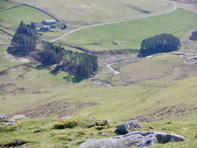
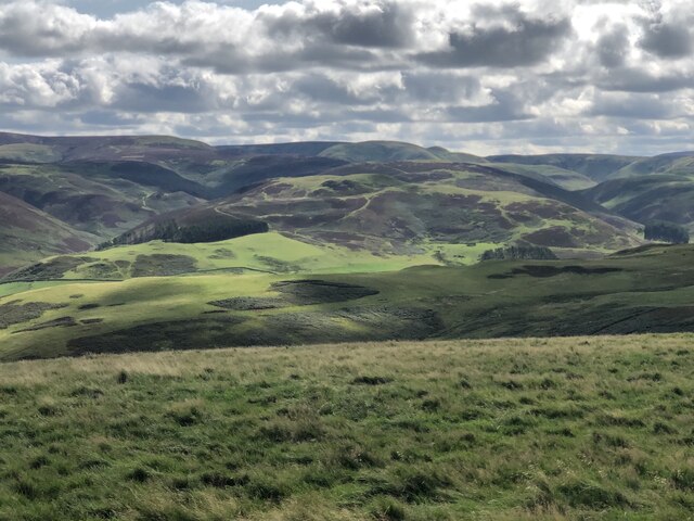
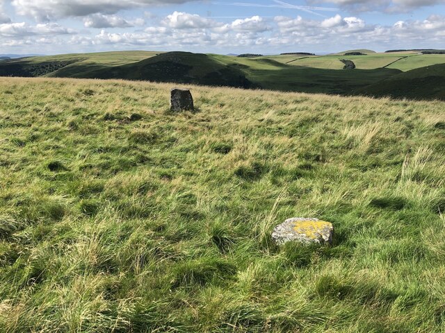
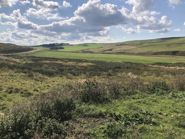
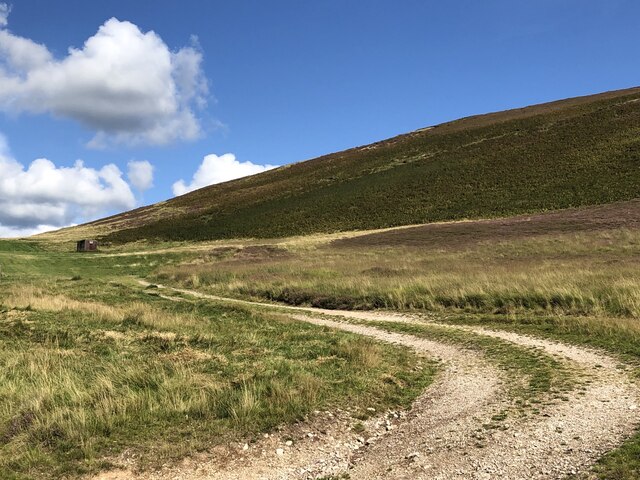
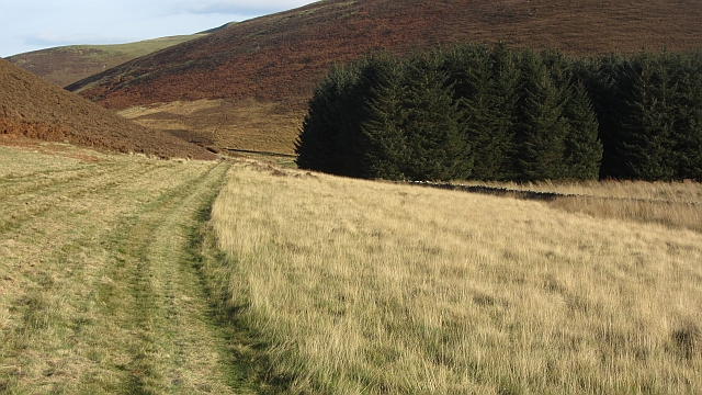
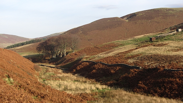
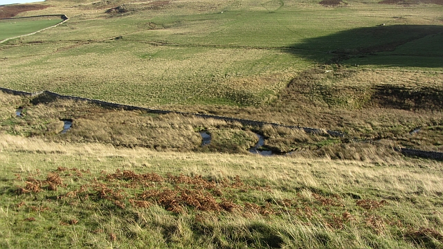
Cooper Cleuch is renowned for its natural beauty, with rolling hills, lush green meadows, and a tranquil river that gently winds through the valley. The area is a haven for outdoor enthusiasts, offering numerous opportunities for walking, hiking, and cycling. The valley is also home to a diverse range of wildlife, including red squirrels, otters, and various bird species.

Historically, Cooper Cleuch was an important area for sheep farming, with many farms dotting the landscape. However, in recent years, the agricultural industry has declined, and the valley has become more popular as a tourist destination. Visitors can explore the charming villages nearby, such as Hawick, which offers a rich history and a vibrant cultural scene.

Cooper Cleuch provides a peaceful retreat for those seeking a break from the hustle and bustle of city life. Its idyllic setting and breathtaking scenery make it a perfect destination for nature lovers and those looking to immerse themselves in the beauty of the Scottish countryside.

If you have any feedback on the listing, please let us know in the comments section below.

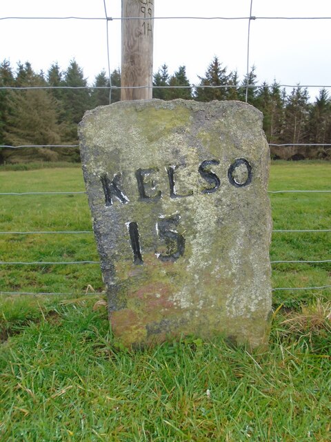
Cooper Cleuch Images

Images are sourced within 2km of 55.426758/-2.3511045 or Grid Reference NT7714. Thanks to Geograph Open Source API. All images are credited.

Old milestone This stone is opposite the northern end of the farm buildings just near the sharp corner.   Travelling past this stone westwards leads to what is now the A68 Carter Bar road at Edgerstone.   However it is also another way to Towford, Nether Hindhope and Upper Hindhope and the old drovers' route to England.
Old milestone
This stone is opposite the northern end of the farm buildings just near the sharp corner. Travelling past this stone westwards leads to what is now the A68 Carter Bar road at Edgerstone. However it is also another way to Towford, Nether Hindhope and Upper Hindhope and the old drovers' route to England.
Kale Water Beneath Chatto Craig.
Kale Water
Beneath Chatto Craig.
Humblemoor Hill View from Tronshaw Hill. Border ridge beyond.
Humblemoor Hill
View from Tronshaw Hill. Border ridge beyond.
Standing stone, Chatto Hill May be a survivor from a removed cairn.
Standing stone, Chatto Hill
May be a survivor from a removed cairn.
Rough grazing, foot of Butter Cleuch Kale Water glen, Cheviot Hills.
Rough grazing, foot of Butter Cleuch
Kale Water glen, Cheviot Hills.
Foot of Humblemoor Hill
Beside the Kale Water Wetland pasture beside the Kale Water near Pennymuir Bridge.
Beside the Kale Water
Wetland pasture beside the Kale Water near Pennymuir Bridge.
Road to Buchtrig A single track road climbs from the Kale Water over a pass to the farm at Buchtrig.
Road to Buchtrig
A single track road climbs from the Kale Water over a pass to the farm at Buchtrig.
Humblemoor View along the ridge towards Hownam. The distant hill is Hownam Law.
Humblemoor
View along the ridge towards Hownam. The distant hill is Hownam Law.
Humblemoor Some bracken has been mown beside Common Cleuch
Humblemoor
Some bracken has been mown beside Common Cleuch
Path beside the Capehope Burn The path shown on the map does not exist all the way through to The Yett, but it is still easy to get through.
Path beside the Capehope Burn
The path shown on the map does not exist all the way through to The Yett, but it is still easy to get through.
Capehope Burn Looking downstream towards a group of beech trees.
Capehope Burn
Looking downstream towards a group of beech trees.
Yett  Burn Meanders in the Yett Burn.
Yett Burn
Meanders in the Yett Burn.
Humblemoor Moorland slopes above the Kale Water.
Humblemoor
Moorland slopes above the Kale Water.
Path of Humblemoor Hill A bend in a path on a bracken covered hillside.
Path of Humblemoor Hill
A bend in a path on a bracken covered hillside.
Wet pasture beside the Kale Water Grazing land for sheep and cattle.
Wet pasture beside the Kale Water
Grazing land for sheep and cattle.
Minor road, Towford Looking down a steep hill towards Pennymuir Bridge and Humblemoor Hill.
Minor road, Towford
Looking down a steep hill towards Pennymuir Bridge and Humblemoor Hill.
Buchtrig sign Farm sign on a road junction near Pennymuir Bridge.
Buchtrig sign
Farm sign on a road junction near Pennymuir Bridge.
Show me another place!

Cooper Cleuch is located at Grid Ref: NT7714 (Lat: 55.426758, Lng: -2.3511045)

Unitary Authority: The Scottish Borders

Police Authority: The Lothians and Scottish Borders

What 3 Words

///firebird.panther.mystified. Near Jedburgh, Scottish Borders

Related Wikis

Pennymuir Roman camps

The Pennymuir Roman camps are situated southeast of Jedburgh in the Scottish Borders area of Scotland, near the Anglo-Scottish border, in the former Roxburghshire...

Hownam

Hownam or Hounam is a small village and parish situated 8 miles east of Jedburgh in the Scottish Borders area of Scotland, near the Anglo-Scottish border...

Chew Green

Chew Green is the site of the ancient Roman encampment, commonly but erroneously called Ad Fines (Latin: The Limits) on the 1885-1900 edition of the Ordnance...

Mowhaugh

Mowhaugh is a hamlet and farm steading near the Calroust Burn and the Bowmont Water, near Morebattle, in the Scottish Borders area of Scotland, and in...

Windy Gyle

Windy Gyle is a mountain in the Cheviot Hills range, on the border between England and Scotland. Like the other hills in the area, it is rounded and grass...

Oxnam

Oxnam (Scots: Owsenam) is a village near Jedburgh, in Roxburghshire in the Scottish Borders area of Scotland. It is a primarily residential village. The...

Edgerston

Edgerston is a village and an estate about 4 miles (6.4 km) north of the Anglo-Scottish border, and 8 miles (13 km) south of Jedburgh in the Scottish Borders...

Barrow Burn Meadows

Barrow Burn Meadows is a Site of Special Scientific Interest (SSSI) in north Northumberland, England. The site is a species-rich hay meadow of a sort now...

Nearby Amenities

Located within 500m of 55.426758,-2.3511045
Humblemoor Hill
Natural: peak
Lat/Long: 55.4278827/-2.3558706
The data included in this document is from www.openstreetmap.org. The data is made available under ODbL.

Have you been to Cooper Cleuch?

Leave your review of Cooper Cleuch below (or comments, questions and feedback).