Common Cleuch

Valley in Roxburghshire

Scotland

Common Cleuch

Old milestone This stone in front of the cottage, with the legends now painted black, was found somewhere by the farmer about 30 years ago.   It must have been originally set at about NT763140 on the way to Towford, Nether and Upper Hindhope under Hangingshaw Hill on the old drovers' route.
Old milestone Credit: Chris Minto

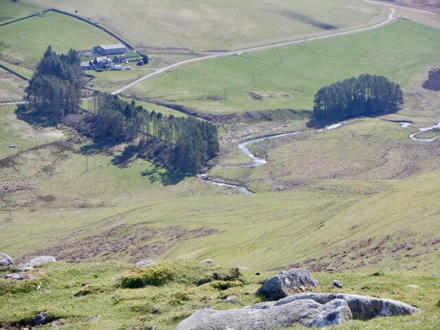
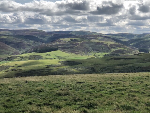
Common Cleuch is a picturesque valley located in Roxburghshire, a historic county in the Scottish Borders region of Scotland. Nestled amidst rolling hills and verdant countryside, the valley is renowned for its natural beauty and tranquil atmosphere.

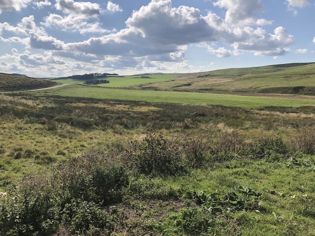
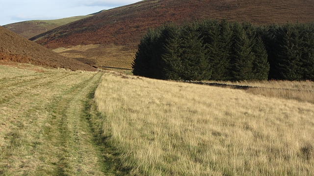
Stretching for approximately 2 miles, Common Cleuch is flanked by lush green pastures and dotted with pockets of native woodlands. The valley is crisscrossed by a meandering stream, which adds to its allure and provides a habitat for a variety of wildlife, including otters and birds.

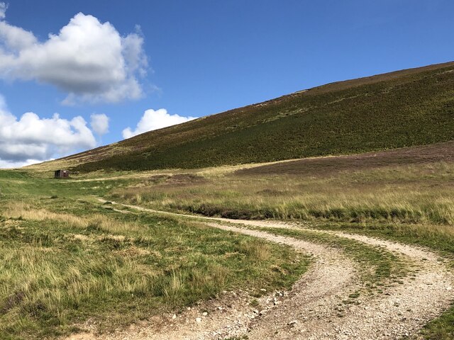
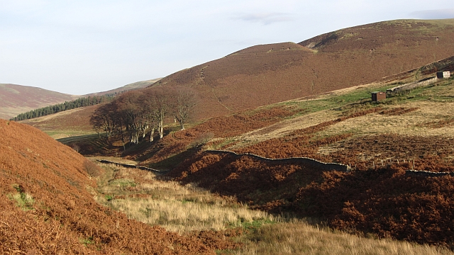
The landscape of Common Cleuch is characterized by its gently sloping hills, which offer breathtaking panoramic views of the surrounding countryside. The valley is a popular destination for hikers and nature enthusiasts, who are drawn to its scenic trails and the opportunity to explore its diverse flora and fauna.

In addition to its natural attractions, Common Cleuch is also home to a number of historical sites. The remnants of ancient settlements, including prehistoric stone circles and burial mounds, can be found scattered throughout the valley, offering a glimpse into its rich history.

Visitors to Common Cleuch can enjoy a range of outdoor activities, including walking, cycling, and fishing in the nearby rivers. The valley's idyllic setting and peaceful ambiance make it an ideal retreat for those seeking a respite from the hustle and bustle of modern life.

Overall, Common Cleuch is a captivating valley that showcases the natural beauty and cultural heritage of Roxburghshire. Its unspoiled landscapes and historical significance make it a must-visit destination for nature lovers and history enthusiasts alike.

If you have any feedback on the listing, please let us know in the comments section below.

Common Cleuch Images

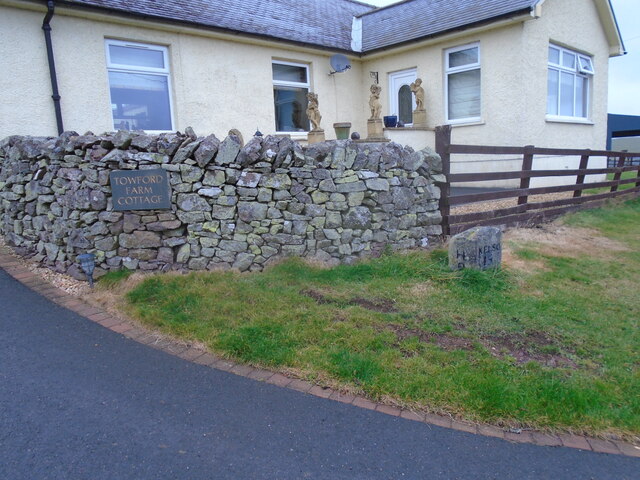
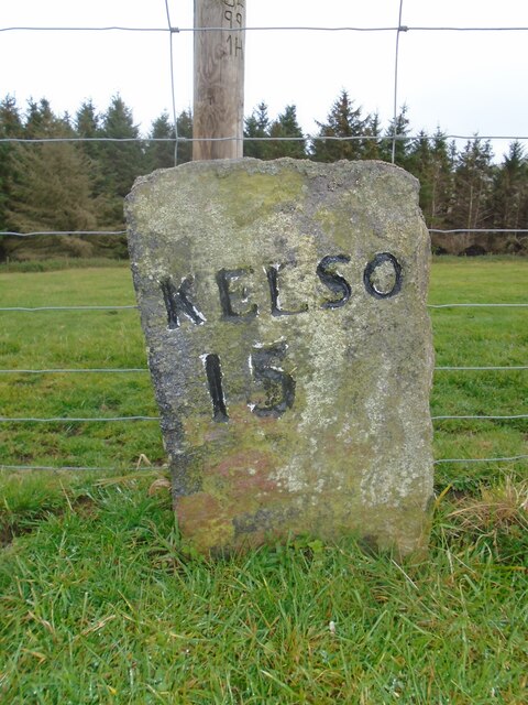
Images are sourced within 2km of 55.424493/-2.3574832 or Grid Reference NT7714. Thanks to Geograph Open Source API. All images are credited.

Old milestone This stone in front of the cottage, with the legends now painted black, was found somewhere by the farmer about 30 years ago.   It must have been originally set at about NT763140 on the way to Towford, Nether and Upper Hindhope under Hangingshaw Hill on the old drovers' route.
Old milestone
This stone in front of the cottage, with the legends now painted black, was found somewhere by the farmer about 30 years ago. It must have been originally set at about NT763140 on the way to Towford, Nether and Upper Hindhope under Hangingshaw Hill on the old drovers' route.
Old milestone This stone is opposite the northern end of the farm buildings just near the sharp corner.   Travelling past this stone westwards leads to what is now the A68 Carter Bar road at Edgerstone.   However it is also another way to Towford, Nether Hindhope and Upper Hindhope and the old drovers' route to England.
Old milestone
This stone is opposite the northern end of the farm buildings just near the sharp corner. Travelling past this stone westwards leads to what is now the A68 Carter Bar road at Edgerstone. However it is also another way to Towford, Nether Hindhope and Upper Hindhope and the old drovers' route to England.
Kale Water Beneath Chatto Craig.
Kale Water
Beneath Chatto Craig.
Humblemoor Hill View from Tronshaw Hill. Border ridge beyond.
Humblemoor Hill
View from Tronshaw Hill. Border ridge beyond.
Rough grazing, foot of Butter Cleuch Kale Water glen, Cheviot Hills.
Rough grazing, foot of Butter Cleuch
Kale Water glen, Cheviot Hills.
Foot of Humblemoor Hill
Field, Pennymuir Site of a pair of Roman camps on Dere Street.
Field, Pennymuir
Site of a pair of Roman camps on Dere Street.
Beside the Kale Water Wetland pasture beside the Kale Water near Pennymuir Bridge.
Beside the Kale Water
Wetland pasture beside the Kale Water near Pennymuir Bridge.
Road to Buchtrig A single track road climbs from the Kale Water over a pass to the farm at Buchtrig.
Road to Buchtrig
A single track road climbs from the Kale Water over a pass to the farm at Buchtrig.
Humblemoor View along the ridge towards Hownam. The distant hill is Hownam Law.
Humblemoor
View along the ridge towards Hownam. The distant hill is Hownam Law.
Humblemoor Some bracken has been mown beside Common Cleuch
Humblemoor
Some bracken has been mown beside Common Cleuch
Path beside the Capehope Burn The path shown on the map does not exist all the way through to The Yett, but it is still easy to get through.
Path beside the Capehope Burn
The path shown on the map does not exist all the way through to The Yett, but it is still easy to get through.
Capehope Burn Looking downstream towards a group of beech trees.
Capehope Burn
Looking downstream towards a group of beech trees.
Humblemoor Moorland slopes above the Kale Water.
Humblemoor
Moorland slopes above the Kale Water.
Path of Humblemoor Hill A bend in a path on a bracken covered hillside.
Path of Humblemoor Hill
A bend in a path on a bracken covered hillside.
Wet pasture beside the Kale Water Grazing land for sheep and cattle.
Wet pasture beside the Kale Water
Grazing land for sheep and cattle.
Minor road, Towford Looking down a steep hill towards Pennymuir Bridge and Humblemoor Hill.
Minor road, Towford
Looking down a steep hill towards Pennymuir Bridge and Humblemoor Hill.
Buchtrig sign Farm sign on a road junction near Pennymuir Bridge.
Buchtrig sign
Farm sign on a road junction near Pennymuir Bridge.
Show me another place!

Common Cleuch is located at Grid Ref: NT7714 (Lat: 55.424493, Lng: -2.3574832)

Unitary Authority: The Scottish Borders

Police Authority: The Lothians and Scottish Borders

What 3 Words

///adapt.dilute.organist. Near Jedburgh, Scottish Borders

Related Wikis

Nearby Amenities

Located within 500m of 55.424493,-2.3574832
Humblemoor Hill
Natural: peak
Lat/Long: 55.4278827/-2.3558706
Buchtrig
Place: hamlet
Lat/Long: 55.4208258/-2.3565332
Barrier: cattle_grid
Lat/Long: 55.4212337/-2.3605256
Power: pole
Lat/Long: 55.4217217/-2.3632887
Power: pole
Lat/Long: 55.4216296/-2.362184
Power: pole
Lat/Long: 55.4215975/-2.3617231
Power: pole
Lat/Long: 55.4215551/-2.3611
Power: pole
Lat/Long: 55.4214484/-2.3598125
Power: pole
Lat/Long: 55.4213315/-2.358628
Power: pole
Lat/Long: 55.4212643/-2.3576958
Power: pole
Lat/Long: 55.4212102/-2.3569697
The data included in this document is from www.openstreetmap.org. The data is made available under ODbL.

Have you been to Common Cleuch?

Leave your review of Common Cleuch below (or comments, questions and feedback).