Park Dingle

Valley in Worcestershire Wyre Forest

England

Park Dingle

Severn Valley Railway - Stanier mogul at Bewdley No. 2968 is the only survivor of 40 2-6-0 moguls designed by William Stanier at the LMS railway. It was built in 1934 and arrived at the Severn Valley Railway in 1973. If first entered service on the line in 1990 and following major overhauls re-entered service again in 2002 and 2023. It is seen approaching Bewdley and the driver is about to hand the token to the signalman. This was definitely dusk and the light was very poor.
Severn Valley Railway - Stanier mogul at Bewdley Credit: Chris Allen

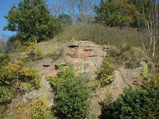
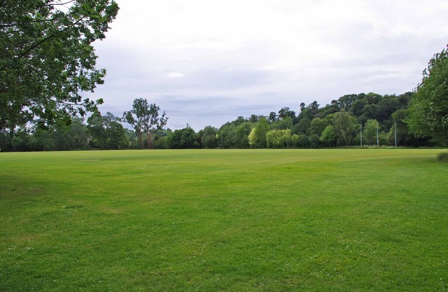
Park Dingle, Worcestershire, also known as Valley, is a picturesque location situated in the heart of the county. It is a valley surrounded by rolling hills and lush greenery, offering visitors a tranquil and serene experience.

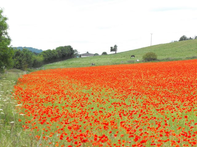
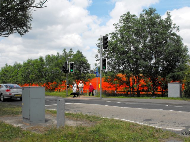
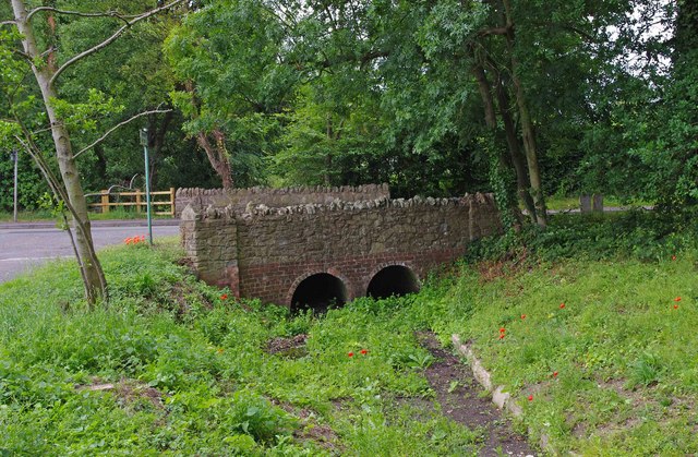
The park is famous for its stunning natural beauty and is a popular destination for nature lovers and outdoor enthusiasts. It boasts an extensive network of walking trails, which meander through woodlands, meadows, and along the banks of the River Severn. These trails provide visitors with breathtaking views of the surrounding landscape and ample opportunities for wildlife spotting.

Park Dingle is home to a diverse range of flora and fauna, making it a haven for nature enthusiasts. The valley's woodlands are filled with ancient trees, including oak, beech, and ash, which provide shelter to a variety of bird species. Visitors may also spot small mammals such as rabbits, foxes, and badgers, as well as reptiles like grass snakes and common lizards.

In addition to its natural beauty, Park Dingle offers a range of recreational activities. The park features well-maintained picnic areas, perfect for enjoying a leisurely lunch surrounded by nature. Fishing is also a popular pastime in the area, with the river providing opportunities for anglers to catch species such as trout and perch.

Overall, Park Dingle, Worcestershire, is a hidden gem that offers visitors a chance to escape the hustle and bustle of everyday life and immerse themselves in the beauty of nature. Whether it's taking a peaceful walk, enjoying a picnic, or indulging in some fishing, this picturesque valley has something to offer for everyone.

If you have any feedback on the listing, please let us know in the comments section below.

Park Dingle Images

Images are sourced within 2km of 52.368401/-2.3270936 or Grid Reference SO7774. Thanks to Geograph Open Source API. All images are credited.
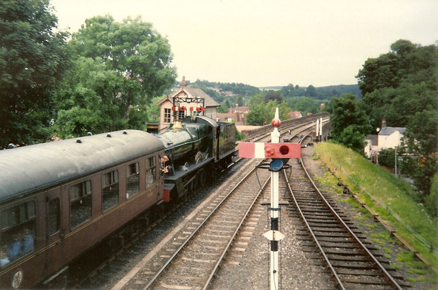
Severn Valley Railway - Stanier mogul at Bewdley No. 2968 is the only survivor of 40 2-6-0 moguls designed by William Stanier at the LMS railway. It was built in 1934 and arrived at the Severn Valley Railway in 1973. If first entered service on the line in 1990 and following major overhauls re-entered service again in 2002 and 2023. It is seen approaching Bewdley and the driver is about to hand the token to the signalman. This was definitely dusk and the light was very poor.
Severn Valley Railway - Stanier mogul at Bewdley
No. 2968 is the only survivor of 40 2-6-0 moguls designed by William Stanier at the LMS railway. It was built in 1934 and arrived at the Severn Valley Railway in 1973. If first entered service on the line in 1990 and following major overhauls re-entered service again in 2002 and 2023. It is seen approaching Bewdley and the driver is about to hand the token to the signalman. This was definitely dusk and the light was very poor.
Bewdley, including Severn Valley Guest House Part of the town of Bewdley taken from 'Bewdley North' railway viaduct looking towards the river. In view is the Severn Valley Guest House and part of the 'Red Lion'
Bewdley, including Severn Valley Guest House
Part of the town of Bewdley taken from 'Bewdley North' railway viaduct looking towards the river. In view is the Severn Valley Guest House and part of the 'Red Lion'
48773 entering Bewdley Station, SVR Stanier 8F 2-8-0 No 48773, owned by the Stanier 8F Locomotive Society who bought the locomotive from British Railways in 1968, enters Bewdley Station with a Severn Valley Railway train from Bridgnorth to Kidderminster Town. The train is crossing Bewdley North Viaduct on its way into the station.
48773 entering Bewdley Station, SVR
Stanier 8F 2-8-0 No 48773, owned by the Stanier 8F Locomotive Society who bought the locomotive from British Railways in 1968, enters Bewdley Station with a Severn Valley Railway train from Bridgnorth to Kidderminster Town. The train is crossing Bewdley North Viaduct on its way into the station.
Rock Siding, Bewdley Station A diesel multiple unit occupies the track known as 'Rock Siding' at Bewdley Station, Severn Valley Railway
Rock Siding, Bewdley Station
A diesel multiple unit occupies the track known as 'Rock Siding' at Bewdley Station, Severn Valley Railway
Bewdley Bridge in 1987 The bridge carries the B4195 road over the River Severn. The large red brick house over the bridge on the left hand side stands in Severn Street South. The church tower is that of St Anne's.
Bewdley Bridge in 1987
The bridge carries the B4195 road over the River Severn. The large red brick house over the bridge on the left hand side stands in Severn Street South. The church tower is that of St Anne's.
Rock Outcrop, Bewdley This outcrop of sandstone rock forms the northern boundary of Bewdley station
Rock Outcrop, Bewdley
This outcrop of sandstone rock forms the northern boundary of Bewdley station
Trains Pass at Bewdley BR Standard Pacific No 71000 "Duke of Gloucester" [left] and 'Manor' class 4-6-0 No 7812 "Erlestoke Manor" pass at Bewdley station.
Trains Pass at Bewdley
BR Standard Pacific No 71000 "Duke of Gloucester" [left] and 'Manor' class 4-6-0 No 7812 "Erlestoke Manor" pass at Bewdley station.
Bewdley station on the Severn Valley Railway
Poppies at Blackstone, Worcestershire An area on one side of the field has been roped off for use by visitors so they can feel they are surrounded by the poppies.
Poppies at Blackstone, Worcestershire
An area on one side of the field has been roped off for use by visitors so they can feel they are surrounded by the poppies.
Poppies at Blackstone, Worcestershire I was not alone in finding the sight of this field bright red with poppies difficult to drive past, the Blackstone car park opposite was full.

A poster on the fence says,
"This is one of three fields owned by Worcestershire Wildlife Trust. This year it is being left fallow.
Its diverse and colourful weeds are indicative of low input agriculture. By using minimal herbicides we get this beautiful flush of annual wildflowers such as the poppy. We'll leave the field fallow in rotation to help reduce the nutrient levels in the soil. This will allow the land to gradually become heathland, a very threatened habitat in the county.
Several rare arable plants have been recorded in these fields and insects are abundant."
A report on this site from the Worcestershire Wildlife Trust website <span class="nowrap"><a title="https://web.archive.org/web/20110614140450/http://www.worcswildlifetrust.co.uk/index.php?section=news&id=3740" rel="nofollow ugc noopener" href="https://web.archive.org/web/20110614140450/http://www.worcswildlifetrust.co.uk/index.php?section=news&id=3740">Archive Link</a><img style="margin-left:2px;" alt="External link" title="External link - shift click to open in new window" src="https://s1.geograph.org.uk/img/external.png" width="10" height="10"/></span>
Poppies at Blackstone, Worcestershire
I was not alone in finding the sight of this field bright red with poppies difficult to drive past, the Blackstone car park opposite was full. A poster on the fence says, "This is one of three fields owned by Worcestershire Wildlife Trust. This year it is being left fallow. Its diverse and colourful weeds are indicative of low input agriculture. By using minimal herbicides we get this beautiful flush of annual wildflowers such as the poppy. We'll leave the field fallow in rotation to help reduce the nutrient levels in the soil. This will allow the land to gradually become heathland, a very threatened habitat in the county. Several rare arable plants have been recorded in these fields and insects are abundant." A report on this site from the Worcestershire Wildlife Trust website Archive LinkExternal link
Comfrey by the A456 at Blackstone It wasn't just the poppies <a title="https://www.geograph.org.uk/snippet/5338" href="https://www.geograph.org.uk/snippet/5338">Link</a> which caught my eye.
Comfrey by the A456 at Blackstone
It wasn't just the poppies Link which caught my eye.
Poppies at Blackstone, Worcestershire The horses in the next field seem unimpressed.
Poppies at Blackstone, Worcestershire
The horses in the next field seem unimpressed.
Pedestrian crossing on A456 at Blackstone The crossing (a fairly recent development for National Cycle Route 45 I think) was getting a lot of use as people parked in the Blackstone Country Park car park and crossed the road to view the poppies.
Pedestrian crossing on A456 at Blackstone
The crossing (a fairly recent development for National Cycle Route 45 I think) was getting a lot of use as people parked in the Blackstone Country Park car park and crossed the road to view the poppies.
Bewdley Leisure Centre, Stourport Road, Bewdley Bewdley Leisure Centre is on the edge of Bewdley. It is owned by Wyre Forest District Council, but the facilities are managed for them by a firm called D C Leisure. At this centre facilities include badminton, five-a-side football, group exercise classes, basketball, volleyball, martial arts, and much else. There are also two football pitches, a rugby pitch and an artificial cricket wicket.

D C Leisure's contract to manage this centre, and other centres in Kidderminster and Stourport-on-Severn expires in 2013. Because of rising management and maintenance costs, the District Council are looking at other arrangements. They seem minded to hand over the Bewdley Leisure Centre to community groups or organisations. This presumably is what the current Government's "Big Society" is all about. It will be interesting to see if any groups come forward to run what is in effect a business, and running a facility this size would surely require some paid staff, or maybe volunteers will do everything. Although how a community group can cope with increasing management and maintenance costs, when the council can't, isn't immediately obvious.

<a href="https://www.geograph.org.uk/photo/2465462">SO7974 : Bewdley Leisure Centre sign, Stourport Road, Bewdley</a>.
Bewdley Leisure Centre, Stourport Road, Bewdley
Bewdley Leisure Centre is on the edge of Bewdley. It is owned by Wyre Forest District Council, but the facilities are managed for them by a firm called D C Leisure. At this centre facilities include badminton, five-a-side football, group exercise classes, basketball, volleyball, martial arts, and much else. There are also two football pitches, a rugby pitch and an artificial cricket wicket. D C Leisure's contract to manage this centre, and other centres in Kidderminster and Stourport-on-Severn expires in 2013. Because of rising management and maintenance costs, the District Council are looking at other arrangements. They seem minded to hand over the Bewdley Leisure Centre to community groups or organisations. This presumably is what the current Government's "Big Society" is all about. It will be interesting to see if any groups come forward to run what is in effect a business, and running a facility this size would surely require some paid staff, or maybe volunteers will do everything. Although how a community group can cope with increasing management and maintenance costs, when the council can't, isn't immediately obvious. SO7974 : Bewdley Leisure Centre sign, Stourport Road, Bewdley.
Bewdley Leisure Centre sign, Stourport Road, Bewdley The sign is by the entrance to the centre.

<a href="https://www.geograph.org.uk/photo/2465449">SO7974 : Bewdley Leisure Centre, Stourport Road, Bewdley</a>.
Bewdley Leisure Centre sign, Stourport Road, Bewdley
The sign is by the entrance to the centre. SO7974 : Bewdley Leisure Centre, Stourport Road, Bewdley.
Sports field behind Bewdley Leisure Centre, Bewdley It's not clear if the field is part of the centre, or belongs to the adjoining school. Possibly it is used by both.
Sports field behind Bewdley Leisure Centre, Bewdley
It's not clear if the field is part of the centre, or belongs to the adjoining school. Possibly it is used by both.
Bridge carrying Stourport Road over a stream, Bewdley This bridge carries Stourport Road over a very small stream, which was virtually dry when photographed. The stream is culverted in places, and discharges into the nearby River Severn.
Bridge carrying Stourport Road over a stream, Bewdley
This bridge carries Stourport Road over a very small stream, which was virtually dry when photographed. The stream is culverted in places, and discharges into the nearby River Severn.
Show me another place!

Park Dingle is located at Grid Ref: SO7774 (Lat: 52.368401, Lng: -2.3270936)

Administrative County: Worcestershire

District: Wyre Forest

Police Authority: West Mercia

What 3 Words

///linked.ended.fiery. Near Bewdley, Worcestershire

Nearby Locations

Park Dingle Hawthorn Bush

Related Wikis

A456 road

Known as the Hagley Road in Birmingham, the A456 is a main road in England running between Central Birmingham and Woofferton, Shropshire, south of Ludlow...

Tickenhill Palace

Tickenhill Palace (also known as Tickenhill House or Tickenhall Manor) is a historic building in Bewdley, Worcestershire, England. It is a grade II* listed...

Ribbesford

Ribbesford is a village and civil parish in the Wyre Forest District of Worcestershire, England. At the 2001 census it had a population of 237.Notable...
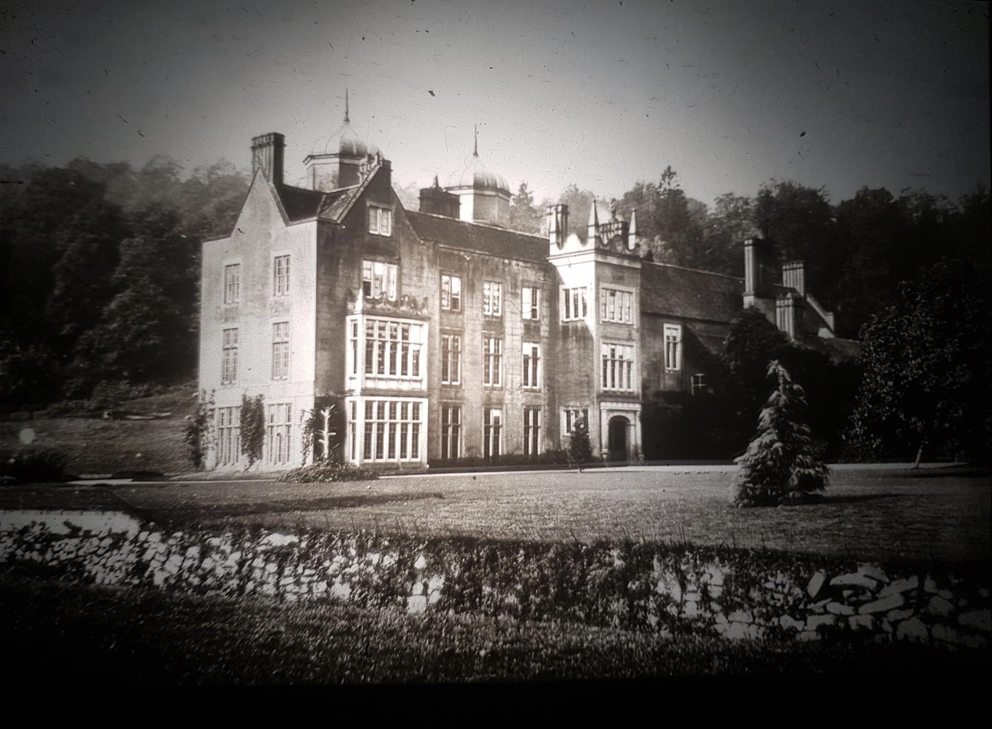
Ribbesford House

Ribbesford House is a historic English mansion in Ribbesford, near Bewdley, Worcestershire. The house and its surrounding estate have a history dating...

Bewdley Guildhall

Bewdley Guildhall is a municipal building in Load Street in Bewdley, Worcestershire, England. The structure, which is the meeting place of Bewdley Town...

Bewdley Museum

Bewdley Museum is a museum in the town of Bewdley in Worcestershire, England. It is managed by the Wyre Forest District Council. == History == The Bewdley...

Bewdley

Bewdley ( pronunciation) is a town and civil parish in the Wyre Forest District in Worcestershire, England on the banks of the River Severn. It is in the...
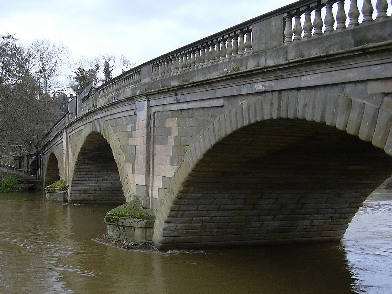
Bewdley Bridge

Bewdley Bridge is a three-span masonry arch bridge over the River Severn at Bewdley, Worcestershire, designed by civil engineer Thomas Telford. The two...

Nearby Amenities

Located within 500m of 52.368401,-2.3270936
Bus Stop
Wyre Hill
Bus: yes
Naptan AtcoCode: 2000G101000
Naptan Bearing: SW
Naptan CommonName: Wyre Hill
Naptan Indicator: Adj
Naptan NaptanCode: wocgjwmt
Naptan PlusbusZoneRef: KDRMNST
Naptan Street: Wyre Hill
Naptan Verified: no
Public Transport: platform
Source: naptan_import
Lat/Long: 52.371944/-2.3297879
Barrier: stile
Lat/Long: 52.3654897/-2.3294791
Generator Method: photovoltaic
Generator Output Electricity: yes
Generator Source: solar
Generator Type: solar_photovoltaic_panel
Location: roof
Power: generator
Lat/Long: 52.3648169/-2.326878
Generator Method: photovoltaic
Generator Output Electricity: yes
Generator Source: solar
Generator Type: solar_photovoltaic_panel
Location: roof
Power: generator
Lat/Long: 52.3705916/-2.3207599
Generator Method: photovoltaic
Generator Output Electricity: yes
Generator Source: solar
Generator Type: solar_photovoltaic_panel
Location: roof
Power: generator
Lat/Long: 52.3697204/-2.3217416
Generator Method: photovoltaic
Generator Output Electricity: yes
Generator Source: solar
Generator Type: solar_photovoltaic_panel
Location: roof
Power: generator
Lat/Long: 52.3702968/-2.3226884
Generator Method: photovoltaic
Generator Output Electricity: yes
Generator Source: solar
Generator Type: solar_photovoltaic_panel
Location: roof
Power: generator
Lat/Long: 52.370007/-2.3223209
Generator Method: photovoltaic
Generator Output Electricity: yes
Generator Source: solar
Generator Type: solar_photovoltaic_panel
Location: roof
Power: generator
Lat/Long: 52.3709781/-2.3229244
Generator Method: photovoltaic
Generator Output Electricity: yes
Generator Source: solar
Generator Type: solar_photovoltaic_panel
Location: roof
Power: generator
Lat/Long: 52.37115/-2.3235065
Generator Method: photovoltaic
Generator Output Electricity: yes
Generator Source: solar
Generator Type: solar_photovoltaic_panel
Location: roof
Power: generator
Lat/Long: 52.3719737/-2.3234555
Generator Method: photovoltaic
Generator Output Electricity: yes
Generator Source: solar
Generator Type: solar_photovoltaic_panel
Location: roof
Power: generator
Lat/Long: 52.3719197/-2.3233858
Generator Method: photovoltaic
Generator Output Electricity: yes
Generator Source: solar
Generator Type: solar_photovoltaic_panel
Location: roof
Power: generator
Lat/Long: 52.3717346/-2.3263094
Generator Method: photovoltaic
Generator Output Electricity: yes
Generator Source: solar
Generator Type: solar_photovoltaic_panel
Location: roof
Power: generator
Lat/Long: 52.3722095/-2.3293832
Generator Method: photovoltaic
Generator Output Electricity: yes
Generator Source: solar
Generator Type: solar_photovoltaic_panel
Location: roof
Power: generator
Lat/Long: 52.3704164/-2.3325589
Generator Method: photovoltaic
Generator Output Electricity: yes
Generator Source: solar
Generator Type: solar_photovoltaic_panel
Location: roof
Power: generator
Lat/Long: 52.370626/-2.3313493
Generator Method: photovoltaic
Generator Output Electricity: yes
Generator Source: solar
Generator Type: solar_photovoltaic_panel
Location: roof
Power: generator
Lat/Long: 52.3714481/-2.3313573
Crossing
Crossing: uncontrolled
Crossing Island: no
Crossing Markings: zebra
Crossing Ref: zebra
Tactile Paving: yes
Lat/Long: 52.3723642/-2.3279159
The data included in this document is from www.openstreetmap.org. The data is made available under ODbL.

Have you been to Park Dingle?

Leave your review of Park Dingle below (or comments, questions and feedback).