Murder Combe

Valley in Somerset Mendip

England

Murder Combe

Egford Hill Downhill towards Frome.
Egford Hill Credit: Wayland Smith

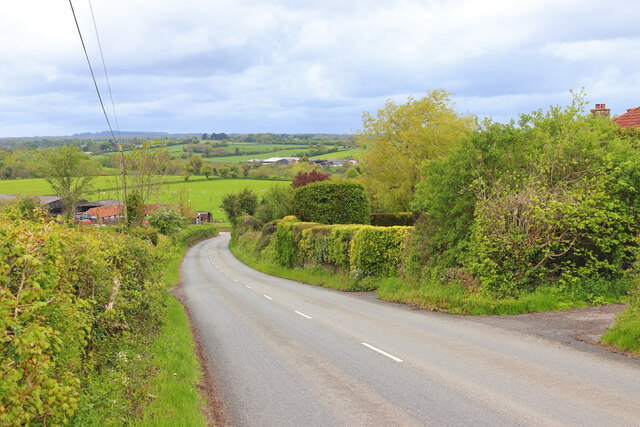
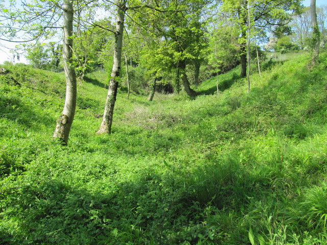
Murder Combe, Somerset, is a picturesque valley located in the southwestern part of England. Nestled within the rolling hills of Somerset, this tranquil and enchanting area is known for its stunning natural beauty and rich historical background.

The name "Murder Combe" may raise eyebrows, but it is rooted in its fascinating history rather than any sinister connotation. Combe means "valley" in Old English, and the prefix "Murder" is derived from the word "mordre," which historically referred to a plot of land or an estate. Therefore, Murder Combe essentially means "Valley Estate" in the local dialect.

The valley is surrounded by lush greenery, with meandering streams and cascading waterfalls adding to its charm. The landscape is dotted with ancient woodlands, where a variety of flora and fauna thrive. Visitors can expect to see a diverse range of wildlife, including deer, badgers, and numerous bird species.

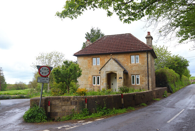
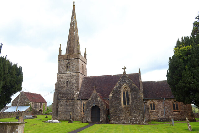
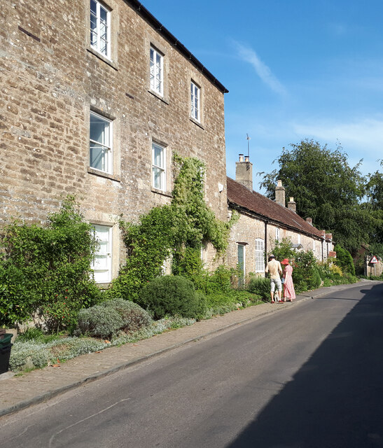
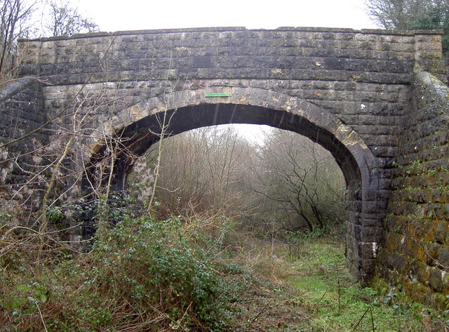
Murder Combe is also steeped in history, with evidence of human habitation dating back thousands of years. Archaeological discoveries have uncovered remnants of Iron Age settlements and Roman artifacts in the area. Additionally, the valley is home to several historic structures, such as medieval churches and farmhouses, which provide a glimpse into the region's past.

Today, Murder Combe offers a peaceful escape from the hustle and bustle of city life. Its stunning natural landscapes and historical significance make it a popular destination for nature enthusiasts, history buffs, and those seeking tranquility amidst the beauty of the English countryside.

If you have any feedback on the listing, please let us know in the comments section below.

Murder Combe Images

Images are sourced within 2km of 51.234851/-2.3682001 or Grid Reference ST7448. Thanks to Geograph Open Source API. All images are credited.
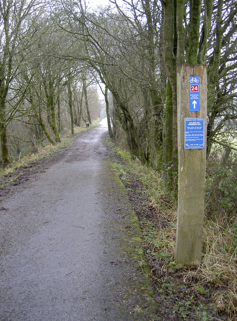
Egford Hill Downhill towards Frome.
Egford Hill
Downhill towards Frome.
Lower Whatley Isolated dwelling at Lower Whatley.
Lower Whatley
Isolated dwelling at Lower Whatley.
Whatley Church Church at Whatley.
Whatley Church
Church at Whatley.
Old Milestone West of Whatley Crossroads The Milestone is located on grass verge and hedge on the South of the road.  Parish of Whatley (Mendip District). Metal plate attached to stone post, Frome square iron plate design, erected by the Frome turnpike trust in the 18th Century. An earlier photograph can be found here: <a title="https://www.geograph.org.uk/photo/6051504" href="https://www.geograph.org.uk/photo/6051504">Link</a> 

Inscription reads:-  
FROME / 3 / WELLS / 12 

Grade II listed. List Entry Number: 1295398 <span class="nowrap"><a title="https://historicengland.org.uk/listing/the-list/list-entry/1295398" rel="nofollow ugc noopener" href="https://historicengland.org.uk/listing/the-list/list-entry/1295398">Link</a><img style="margin-left:2px;" alt="External link" title="External link - shift click to open in new window" src="https://s1.geograph.org.uk/img/external.png" width="10" height="10"/></span> 

Milestone Society National ID: SO_FRWL03
Old Milestone West of Whatley Crossroads
The Milestone is located on grass verge and hedge on the South of the road.  Parish of Whatley (Mendip District). Metal plate attached to stone post, Frome square iron plate design, erected by the Frome turnpike trust in the 18th Century. An earlier photograph can be found here: Link  Inscription reads:- FROME / 3 / WELLS / 12 Grade II listed. List Entry Number: 1295398 LinkExternal link Milestone Society National ID: SO_FRWL03
Cottages in Selwood Street
Bed of the abandoned Dorset and Somerset Canal The Dorset and Somerset canal was intended to ascend Barrow Hill using a flight of five boat lifts.  Counting from the bottom, there is no evidence that work ever commenced on the first lift.  The other four were never completed, and their chambers, set into the hillside, are overgrown and in various states of dereliction.  This image was taken in the short section of canal above the third lift and looks northwest towards the chamber of the fourth.
Bed of the abandoned Dorset and Somerset Canal
The Dorset and Somerset canal was intended to ascend Barrow Hill using a flight of five boat lifts. Counting from the bottom, there is no evidence that work ever commenced on the first lift. The other four were never completed, and their chambers, set into the hillside, are overgrown and in various states of dereliction. This image was taken in the short section of canal above the third lift and looks northwest towards the chamber of the fourth.
Flowers Farm Bridge Another small pedestrian bridge over the old railway bridge. Today it's Route 24 on the National Cycle Network, but it was originally a GWR branch line from Radstock to Frome, built in 1854 to Brunel's Broad Gauge initially, and carried coal from the local mines. A year later it began carrying passengers too.
But as the viability declined passengers were stopped in 1958; freight soldiered on until the line closed completely in 1988. It made a natural cyclepath which has a tarmac surface only recently completed, but the old rails remain for much of its length.
An old fashioned benchmark still exists at the foot of the arch - see <a href="https://www.geograph.org.uk/photo/3329128">ST7450 : Projecting Bracket at Barrow Hill</a>.
Flowers Farm Bridge
Another small pedestrian bridge over the old railway bridge. Today it's Route 24 on the National Cycle Network, but it was originally a GWR branch line from Radstock to Frome, built in 1854 to Brunel's Broad Gauge initially, and carried coal from the local mines. A year later it began carrying passengers too. But as the viability declined passengers were stopped in 1958; freight soldiered on until the line closed completely in 1988. It made a natural cyclepath which has a tarmac surface only recently completed, but the old rails remain for much of its length. An old fashioned benchmark still exists at the foot of the arch - see ST7450 : Projecting Bracket at Barrow Hill.
Projecting Bracket at Barrow Hill The old Radstock-Frome railway line was opened in the mid-1850s, but this Ordnance Survey benchmark was installed in the early part of the 1900s. It is fairly common on the railways of the area but the type itself was replaced by the Flush Bracket shortly after the start of the Second Geodetic Levelling. Indeed, it appears to be a collector's item as the Conduit Bridge item (some 1.5Km to the west) has been removed. See <a href="https://www.geograph.org.uk/photo/3329125">ST7450 : Flowers Farm Bridge</a> a wider location view, <a href="https://www.geograph.org.uk/photo/3328700">ST7350 : Lost!</a> for the missing mark and <span class="nowrap"><a title="http://www.bench-marks.org.uk/bm2234" rel="nofollow ugc noopener" href="http://www.bench-marks.org.uk/bm2234">Link</a><img style="margin-left:2px;" alt="External link" title="External link - shift click to open in new window" src="https://s1.geograph.org.uk/img/external.png" width="10" height="10"/></span> for the entry in the Benchmark Database.
Projecting Bracket at Barrow Hill
The old Radstock-Frome railway line was opened in the mid-1850s, but this Ordnance Survey benchmark was installed in the early part of the 1900s. It is fairly common on the railways of the area but the type itself was replaced by the Flush Bracket shortly after the start of the Second Geodetic Levelling. Indeed, it appears to be a collector's item as the Conduit Bridge item (some 1.5Km to the west) has been removed. See ST7450 : Flowers Farm Bridge a wider location view, ST7350 : Lost! for the missing mark and LinkExternal link for the entry in the Benchmark Database.
Any which way More old-time enamel pointing fingers, adorning the undersides of bridges along the Colliers' Way. This one is Flowers Farm Bridge, with more to be enjoyed at <a href="https://www.geograph.org.uk/photo/3329146">ST7151 : Is it me?</a>.
Any which way
More old-time enamel pointing fingers, adorning the undersides of bridges along the Colliers' Way. This one is Flowers Farm Bridge, with more to be enjoyed at ST7151 : Is it me?.
Gate to the field A simple gate opposite Flowers Farm Bridge - see [[[3329125]] - that allows non-motorised passage to the other field on the other side of the railway. See also <a href="https://www.geograph.org.uk/photo/3330254">ST7450 : For all travellers</a> for the cattle grid here.
Gate to the field
A simple gate opposite Flowers Farm Bridge - see [[[3329125]] - that allows non-motorised passage to the other field on the other side of the railway. See also ST7450 : For all travellers for the cattle grid here.
For all travellers Despite a simple cyclepath running alongside the old railway line, these gates are clearly designed to control a variety of wheeled, two-legged and four-legged users through. The adjoining bridge crossing the line is not one for motorised traffic as it leads to a field. See <a href="https://www.geograph.org.uk/photo/3330247">ST7450 : Gate to the field</a> for the gate and [[[3329125]] for the little bridge.
For all travellers
Despite a simple cyclepath running alongside the old railway line, these gates are clearly designed to control a variety of wheeled, two-legged and four-legged users through. The adjoining bridge crossing the line is not one for motorised traffic as it leads to a field. See ST7450 : Gate to the field for the gate and [[[3329125]] for the little bridge.
Onwards to Bucklands Bridge National Route 24, leading eventually to Frome. Permission is granted to travel along it!
Onwards to Bucklands Bridge
National Route 24, leading eventually to Frome. Permission is granted to travel along it!
Church of St Mary Magdalene, Great Elm Looking northeast towards the Church of St Mary Magdalene at Great Elm.  Nave and chancel date from the 12th century, and the saddleback roofed tower from the 13th century.  The east window and the south nave windows are 19th century additions in the Decorated style, while the south chancel window is in the perpendicular style (presumably dating from the 15th century).  A war memorial stands just outside the south door.
Church of St Mary Magdalene, Great Elm
Looking northeast towards the Church of St Mary Magdalene at Great Elm. Nave and chancel date from the 12th century, and the saddleback roofed tower from the 13th century. The east window and the south nave windows are 19th century additions in the Decorated style, while the south chancel window is in the perpendicular style (presumably dating from the 15th century). A war memorial stands just outside the south door.
Lime Kiln Two in Vallis Vale Certainly there were two limekilns reported as operating just downstream from Bedlam alongside the Mells Stream in the 1840s. One is shown above and this is a different one. <a title="https://www.geograph.org.uk/photo/836657" href="https://www.geograph.org.uk/photo/836657">Link</a> For detailed information see <span class="nowrap"><a title="http://www.bgs.ac.uk/mendips/more_info/east_mendip_quarries_history.htm" rel="nofollow ugc noopener" href="http://www.bgs.ac.uk/mendips/more_info/east_mendip_quarries_history.htm">Link</a><img style="margin-left:2px;" alt="External link" title="External link - shift click to open in new window" src="https://s1.geograph.org.uk/img/external.png" width="10" height="10"/></span>
Lime Kiln Two in Vallis Vale
Certainly there were two limekilns reported as operating just downstream from Bedlam alongside the Mells Stream in the 1840s. One is shown above and this is a different one. Link For detailed information see LinkExternal link
Lockup, Gay Street, Mells Built in the 17C.
Lockup, Gay Street, Mells
Built in the 17C.
Houses in Mells
Houses in Mells
Approaching Great Elm from the west
Fields near Hapsford
Show me another place!

Murder Combe is located at Grid Ref: ST7448 (Lat: 51.234851, Lng: -2.3682001)

Administrative County: Somerset

District: Mendip

Police Authority: Avon and Somerset

What 3 Words

///pursue.assure.ruby. Near Frome, Somerset

Related Wikis

Tedbury Camp

Tedbury Camp is a multivallate Iron Age promontory hill fort defended by two parallel banks near Great Elm, Somerset, England. == Background == Hill forts...

Old Iron Works, Mells

Old Iron Works, Mells (Fussells' Lower Works) (grid reference ST738488) is a 0.25 hectare biological Site of Special Scientific Interest, in the Wadbury...
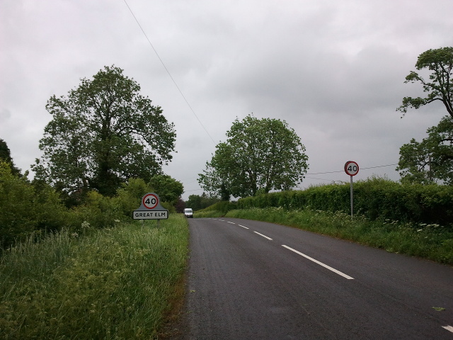
Great Elm

Great Elm is a village and civil parish between Mells and Frome in the Mendip district of Somerset, England. The parish includes the hamlet of Hapsford...

Wadbury Camp

Wadbury Camp is a promontory fort in Somerset, England that protected the mining district of the Mendip Hills in pre-Roman times. It seems to have been...

Whatley, Mendip

Whatley is a small rural village and civil parish about 2.5 miles (4 km) west of Frome in the English county of Somerset. The parish lies south of Mells...

Vallis Vale

Vallis Vale (grid reference ST755490) is a 23.9 hectare biological and geological Site of Special Scientific Interest near Great Elm in Somerset, notified...

Church of St George, Whatley

The Anglican Church of St George in Whatley, within the English county of Somerset, dates from the 14th century. It is a Grade II* listed building.Parts...

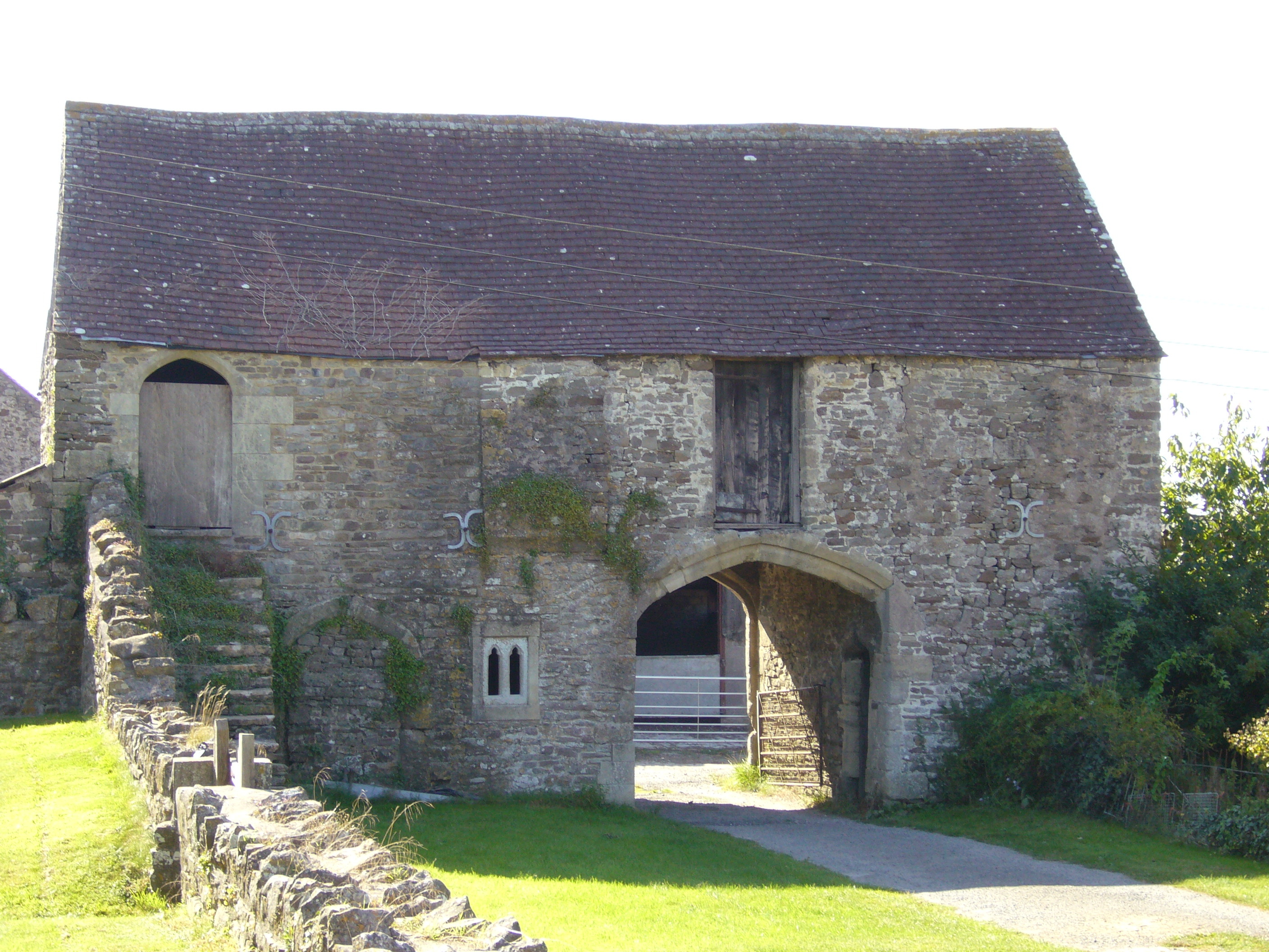
Manor Farmhouse Gatehouse, Whatley

The Manor Farmhouse Gatehouse in Whatley, Somerset, England, was built around 1500 and has been designated as a Grade I listed building.The two-storey...

Nearby Amenities

Located within 500m of 51.234851,-2.3682001
Railway: switch
Lat/Long: 51.2343479/-2.3710561
Railway: switch
Lat/Long: 51.2344895/-2.3705973
Railway: crossing
Lat/Long: 51.2379586/-2.363615
Railway: buffer_stop
Lat/Long: 51.2342083/-2.3712565
Railway: switch
Lat/Long: 51.2341433/-2.3714637
Railway: buffer_stop
Lat/Long: 51.2345711/-2.3703137
The data included in this document is from www.openstreetmap.org. The data is made available under ODbL.

Have you been to Murder Combe?

Leave your review of Murder Combe below (or comments, questions and feedback).