Wadbury Valley

Valley in Somerset Mendip

England

Wadbury Valley

Stone Stile on Park Hill near Mells A stone stile beside the road on Park Hill near Mells.
The stile leads onto a public footpath that goes down to Mells.
Photograph taken at the bend in the road where Park Hill becomes Conduit Hill.
Stone Stile on Park Hill near Mells Credit: Kevin Pearson

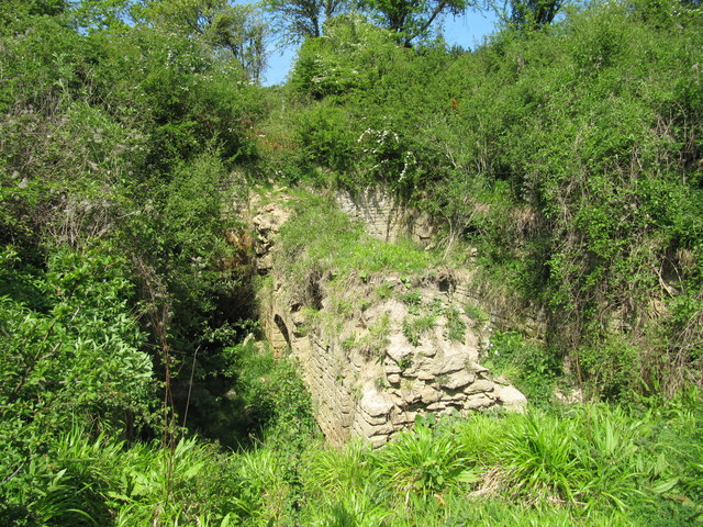
Wadbury Valley, located in Somerset, England, is a picturesque valley renowned for its natural beauty and tranquil surroundings. Nestled between rolling hills and bordered by the River Wad, it offers visitors a serene escape from the hustle and bustle of everyday life.

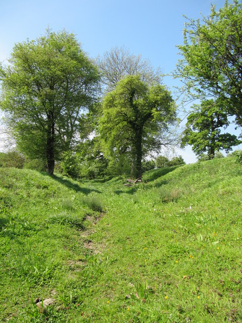
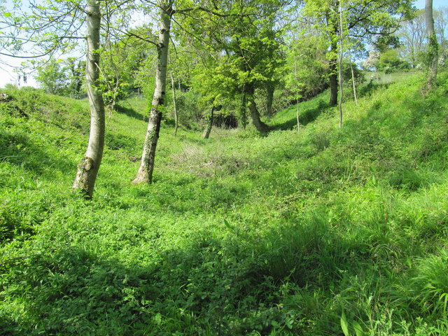
The valley is characterized by its lush green meadows, dotted with colorful wildflowers during the spring and summer months. The River Wad, which meanders through the valley, adds to its charm with its crystal-clear waters and gentle babbling sounds, creating a peaceful ambiance.

Wadbury Valley is a haven for wildlife enthusiasts, as it is home to a diverse array of flora and fauna. Visitors can spot various species of birds, including kingfishers and herons, as well as small mammals such as badgers and foxes. The valley is also known for its rich biodiversity, with a wide range of plant species thriving in its fertile soil.

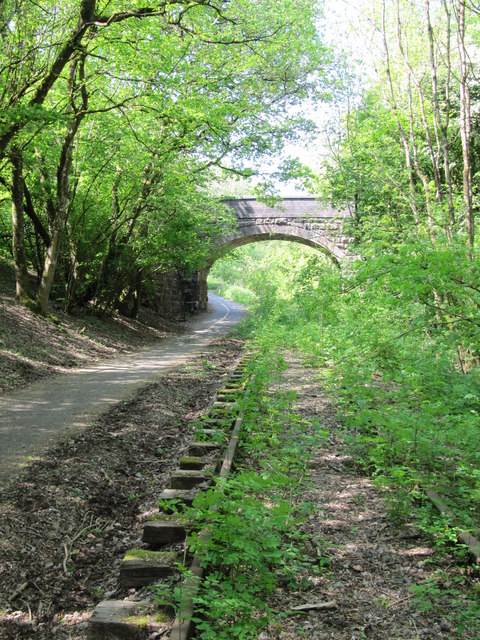
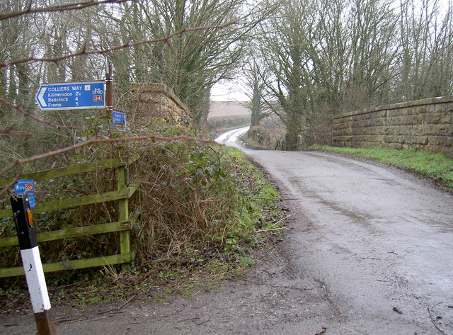
The valley offers numerous walking trails and footpaths, allowing visitors to explore its beauty at their own pace. One popular trail leads to a viewpoint at the top of a hill, providing breathtaking panoramic views of the entire valley. There are also picnic areas where visitors can relax and enjoy the tranquil surroundings.

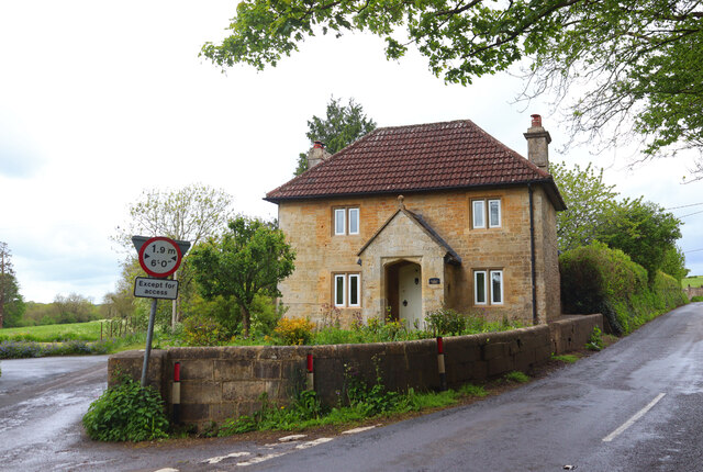
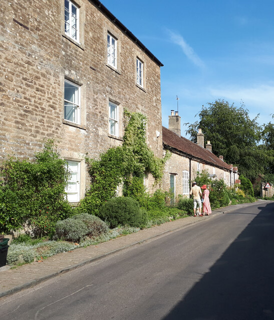
In addition to its natural beauty, Wadbury Valley is steeped in history. The nearby village of Wadbury boasts a medieval church and a few historic buildings, giving visitors a glimpse into the area's past.

Overall, Wadbury Valley offers a perfect blend of natural splendor, wildlife, and history, making it a must-visit destination for nature lovers and those seeking a peaceful retreat in the heart of Somerset.

If you have any feedback on the listing, please let us know in the comments section below.

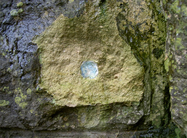
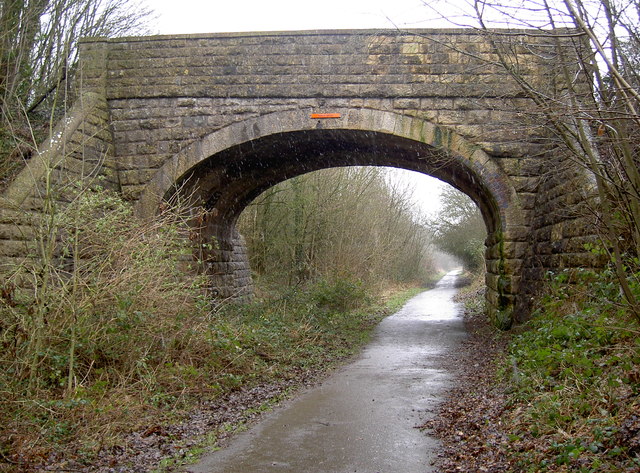
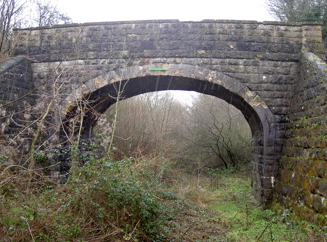
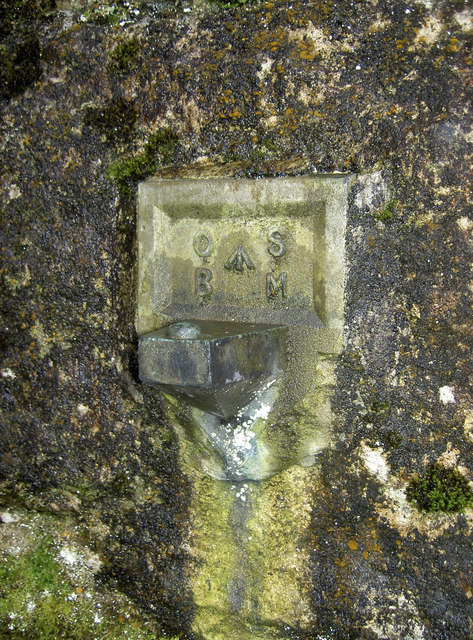
Wadbury Valley Images

Images are sourced within 2km of 51.239407/-2.3720182 or Grid Reference ST7448. Thanks to Geograph Open Source API. All images are credited.

Stone Stile on Park Hill near Mells A stone stile beside the road on Park Hill near Mells.
The stile leads onto a public footpath that goes down to Mells.
Photograph taken at the bend in the road where Park Hill becomes Conduit Hill.
Stone Stile on Park Hill near Mells
A stone stile beside the road on Park Hill near Mells. The stile leads onto a public footpath that goes down to Mells. Photograph taken at the bend in the road where Park Hill becomes Conduit Hill.
Lower Whatley Isolated dwelling at Lower Whatley.
Lower Whatley
Isolated dwelling at Lower Whatley.
Whatley Church Church at Whatley.
Whatley Church
Church at Whatley.
Old Milestone West of Whatley Crossroads The Milestone is located on grass verge and hedge on the South of the road.  Parish of Whatley (Mendip District). Metal plate attached to stone post, Frome square iron plate design, erected by the Frome turnpike trust in the 18th Century. An earlier photograph can be found here: <a title="https://www.geograph.org.uk/photo/6051504" href="https://www.geograph.org.uk/photo/6051504">Link</a> 

Inscription reads:-  
FROME / 3 / WELLS / 12 

Grade II listed. List Entry Number: 1295398 <span class="nowrap"><a title="https://historicengland.org.uk/listing/the-list/list-entry/1295398" rel="nofollow ugc noopener" href="https://historicengland.org.uk/listing/the-list/list-entry/1295398">Link</a><img style="margin-left:2px;" alt="External link" title="External link - shift click to open in new window" src="https://s1.geograph.org.uk/img/external.png" width="10" height="10"/></span> 

Milestone Society National ID: SO_FRWL03
Old Milestone West of Whatley Crossroads
The Milestone is located on grass verge and hedge on the South of the road.  Parish of Whatley (Mendip District). Metal plate attached to stone post, Frome square iron plate design, erected by the Frome turnpike trust in the 18th Century. An earlier photograph can be found here: Link  Inscription reads:- FROME / 3 / WELLS / 12 Grade II listed. List Entry Number: 1295398 LinkExternal link Milestone Society National ID: SO_FRWL03
Cottages in Selwood Street
Course of the Dorset and Somerset Canal Looking west along the bed of the abandoned Dorset and Somerset Canal, constructed in about 1798, but never completed or opened.  This section of the canal was intended to form part of a branch extending to Nettlebridge for the purpose of transporting coal from the Somerset coal field.
Course of the Dorset and Somerset Canal
Looking west along the bed of the abandoned Dorset and Somerset Canal, constructed in about 1798, but never completed or opened. This section of the canal was intended to form part of a branch extending to Nettlebridge for the purpose of transporting coal from the Somerset coal field.
Remains of a balance lock on the Dorset and Somerset Canal In 1798 the Somerset ironmaster James Fussell patented a "Balance Lock for Raising or Lowering Boats, &c.".  A canal lift to his design was built and demonstrated at this site in 1800, when it successfully raised boats by about 20 feet up to the summit level of the Nettlebridge branch of the Dorset and Somerset Canal.  Following the trial, construction of several more balance locks was begun at nearby Barrow Hill, but work on the canal was abandoned when funds ran out, and the locks were never completed.  This balance lock was the subject of an archaeological excavation in about 2005, but nature is now taking over the site again.
Remains of a balance lock on the Dorset and Somerset Canal
In 1798 the Somerset ironmaster James Fussell patented a "Balance Lock for Raising or Lowering Boats, &c.". A canal lift to his design was built and demonstrated at this site in 1800, when it successfully raised boats by about 20 feet up to the summit level of the Nettlebridge branch of the Dorset and Somerset Canal. Following the trial, construction of several more balance locks was begun at nearby Barrow Hill, but work on the canal was abandoned when funds ran out, and the locks were never completed. This balance lock was the subject of an archaeological excavation in about 2005, but nature is now taking over the site again.
Brick Kiln Farm Bridge Bridge carrying Wanwards Lane across the Frome to Radstock railway (closed to passenger traffic in 1959, and to goods in 1968). It now crosses The Colliers Way (part of National Cycle Network Route 24), though the overgrown railway tracks are still in place.
Brick Kiln Farm Bridge
Bridge carrying Wanwards Lane across the Frome to Radstock railway (closed to passenger traffic in 1959, and to goods in 1968). It now crosses The Colliers Way (part of National Cycle Network Route 24), though the overgrown railway tracks are still in place.
Bed of the abandoned Dorset and Somerset Canal The Dorset and Somerset canal was intended to ascend Barrow Hill using a flight of five boat lifts.  Counting from the bottom, there is no evidence that work ever commenced on the first lift.  The other four were never completed, and their chambers, set into the hillside, are overgrown and in various states of dereliction.  This image was taken in the short section of canal above the third lift and looks northwest towards the chamber of the fourth.
Bed of the abandoned Dorset and Somerset Canal
The Dorset and Somerset canal was intended to ascend Barrow Hill using a flight of five boat lifts. Counting from the bottom, there is no evidence that work ever commenced on the first lift. The other four were never completed, and their chambers, set into the hillside, are overgrown and in various states of dereliction. This image was taken in the short section of canal above the third lift and looks northwest towards the chamber of the fourth.
Benchmark on Conduit Bridge An old cutmark, as listed in the Benchmark Database: <span class="nowrap"><a title="http://www.bench-marks.org.uk/bm31101" rel="nofollow ugc noopener" href="http://www.bench-marks.org.uk/bm31101">Link</a><img style="margin-left:2px;" alt="External link" title="External link - shift click to open in new window" src="https://s1.geograph.org.uk/img/external.png" width="10" height="10"/></span> , on the east wall of the old railway bridge. See <a href="https://www.geograph.org.uk/photo/3328696">ST7350 : A choice of routes</a> for a wider view and <a href="https://www.geograph.org.uk/photo/3328700">ST7350 : Lost!</a> for where an old projecting bracket used to be below.
Benchmark on Conduit Bridge
An old cutmark, as listed in the Benchmark Database: LinkExternal link , on the east wall of the old railway bridge. See ST7350 : A choice of routes for a wider view and ST7350 : Lost! for where an old projecting bracket used to be below.
A choice of routes The small road bridge over the old railway not leads down to the cycle path. A benchmark can be found on the eastern wall of the bridge - see <a href="https://www.geograph.org.uk/photo/3328688">ST7350 : Benchmark on Conduit Bridge</a> - but a projecting bracket in the structure of the bridge itself has not enjoyed a similar fate. See <a href="https://www.geograph.org.uk/photo/3328700">ST7350 : Lost!</a>.
A choice of routes
The small road bridge over the old railway not leads down to the cycle path. A benchmark can be found on the eastern wall of the bridge - see ST7350 : Benchmark on Conduit Bridge - but a projecting bracket in the structure of the bridge itself has not enjoyed a similar fate. See ST7350 : Lost!.
Lost! This scar in the stonework of the railway bridge appears to be the remains of an old projecting bracket. It has clearly been removed, by fair means or foul! This part of the old Colliers' Way railway has become a popular cycle path and has a number of these types dotted along it - see <span class="nowrap"><a title="http://www.bench-marks.org.uk/bm2507" rel="nofollow ugc noopener" href="http://www.bench-marks.org.uk/bm2507">Link</a><img style="margin-left:2px;" alt="External link" title="External link - shift click to open in new window" src="https://s1.geograph.org.uk/img/external.png" width="10" height="10"/></span> for the listing in the Benchmark Database and <a href="https://www.geograph.org.uk/photo/3328716">ST7350 : Conduit Bridge</a> for a wider view of the bridge.
Lost!
This scar in the stonework of the railway bridge appears to be the remains of an old projecting bracket. It has clearly been removed, by fair means or foul! This part of the old Colliers' Way railway has become a popular cycle path and has a number of these types dotted along it - see LinkExternal link for the listing in the Benchmark Database and ST7350 : Conduit Bridge for a wider view of the bridge.
Conduit Bridge The Colliers Way - Route 24 of Sustrans National Cycle Network - is part of the route that links Midsomer Norton to Frome. Originally it was the Somersetshire Coal Canal before the railway took over, but today is a popular and peaceful cyclepath. A benchmark used to be in the stonework of the left abutment but has been lost now - see <a href="https://www.geograph.org.uk/photo/3328700">ST7350 : Lost!</a>. 
Also see <span class="nowrap"><a title="http://www.colliersway.co.uk/index.php" rel="nofollow ugc noopener" href="http://www.colliersway.co.uk/index.php">Link</a><img style="margin-left:2px;" alt="External link" title="External link - shift click to open in new window" src="https://s1.geograph.org.uk/img/external.png" width="10" height="10"/></span> for the local information.
Conduit Bridge
The Colliers Way - Route 24 of Sustrans National Cycle Network - is part of the route that links Midsomer Norton to Frome. Originally it was the Somersetshire Coal Canal before the railway took over, but today is a popular and peaceful cyclepath. A benchmark used to be in the stonework of the left abutment but has been lost now - see ST7350 : Lost!. Also see LinkExternal link for the local information.
Flowers Farm Bridge Another small pedestrian bridge over the old railway bridge. Today it's Route 24 on the National Cycle Network, but it was originally a GWR branch line from Radstock to Frome, built in 1854 to Brunel's Broad Gauge initially, and carried coal from the local mines. A year later it began carrying passengers too.
But as the viability declined passengers were stopped in 1958; freight soldiered on until the line closed completely in 1988. It made a natural cyclepath which has a tarmac surface only recently completed, but the old rails remain for much of its length.
An old fashioned benchmark still exists at the foot of the arch - see <a href="https://www.geograph.org.uk/photo/3329128">ST7450 : Projecting Bracket at Barrow Hill</a>.
Flowers Farm Bridge
Another small pedestrian bridge over the old railway bridge. Today it's Route 24 on the National Cycle Network, but it was originally a GWR branch line from Radstock to Frome, built in 1854 to Brunel's Broad Gauge initially, and carried coal from the local mines. A year later it began carrying passengers too. But as the viability declined passengers were stopped in 1958; freight soldiered on until the line closed completely in 1988. It made a natural cyclepath which has a tarmac surface only recently completed, but the old rails remain for much of its length. An old fashioned benchmark still exists at the foot of the arch - see ST7450 : Projecting Bracket at Barrow Hill.
Projecting Bracket at Barrow Hill The old Radstock-Frome railway line was opened in the mid-1850s, but this Ordnance Survey benchmark was installed in the early part of the 1900s. It is fairly common on the railways of the area but the type itself was replaced by the Flush Bracket shortly after the start of the Second Geodetic Levelling. Indeed, it appears to be a collector's item as the Conduit Bridge item (some 1.5Km to the west) has been removed. See <a href="https://www.geograph.org.uk/photo/3329125">ST7450 : Flowers Farm Bridge</a> a wider location view, <a href="https://www.geograph.org.uk/photo/3328700">ST7350 : Lost!</a> for the missing mark and <span class="nowrap"><a title="http://www.bench-marks.org.uk/bm2234" rel="nofollow ugc noopener" href="http://www.bench-marks.org.uk/bm2234">Link</a><img style="margin-left:2px;" alt="External link" title="External link - shift click to open in new window" src="https://s1.geograph.org.uk/img/external.png" width="10" height="10"/></span> for the entry in the Benchmark Database.
Projecting Bracket at Barrow Hill
The old Radstock-Frome railway line was opened in the mid-1850s, but this Ordnance Survey benchmark was installed in the early part of the 1900s. It is fairly common on the railways of the area but the type itself was replaced by the Flush Bracket shortly after the start of the Second Geodetic Levelling. Indeed, it appears to be a collector's item as the Conduit Bridge item (some 1.5Km to the west) has been removed. See ST7450 : Flowers Farm Bridge a wider location view, ST7350 : Lost! for the missing mark and LinkExternal link for the entry in the Benchmark Database.
Anyone know who 'H' is? Stonemasons' marks are common enough, but it seems like one man had put in plenty of work here.
Anyone know who 'H' is?
Stonemasons' marks are common enough, but it seems like one man had put in plenty of work here.
Enamel fingers Route 24 has plenty of artworks along its length, including a series of these fingers on rusty sheets which are high under the bridges. They recreate a bye-gone era when such styles were prevalent. See <a href="https://www.geograph.org.uk/photo/3330196">ST7549 : A curious mixture</a> for another example.
Enamel fingers
Route 24 has plenty of artworks along its length, including a series of these fingers on rusty sheets which are high under the bridges. They recreate a bye-gone era when such styles were prevalent. See ST7549 : A curious mixture for another example.
Any which way More old-time enamel pointing fingers, adorning the undersides of bridges along the Colliers' Way. This one is Flowers Farm Bridge, with more to be enjoyed at <a href="https://www.geograph.org.uk/photo/3329146">ST7151 : Is it me?</a>.
Any which way
More old-time enamel pointing fingers, adorning the undersides of bridges along the Colliers' Way. This one is Flowers Farm Bridge, with more to be enjoyed at ST7151 : Is it me?.
Show me another place!

Wadbury Valley is located at Grid Ref: ST7448 (Lat: 51.239407, Lng: -2.3720182)

Administrative County: Somerset

District: Mendip

Police Authority: Avon and Somerset

What 3 Words

///sweeping.wheat.sadly. Near Frome, Somerset

Related Wikis

Tedbury Camp

Tedbury Camp is a multivallate Iron Age promontory hill fort defended by two parallel banks near Great Elm, Somerset, England. == Background == Hill forts...

Wadbury Camp

Wadbury Camp is a promontory fort in Somerset, England that protected the mining district of the Mendip Hills in pre-Roman times. It seems to have been...

Old Iron Works, Mells

Old Iron Works, Mells (Fussells' Lower Works) (grid reference ST738488) is a 0.25 hectare biological Site of Special Scientific Interest, in the Wadbury...

Great Elm

Great Elm is a village and civil parish between Mells and Frome in the Mendip district of Somerset, England. The parish includes the hamlet of Hapsford...

Mells, Somerset

Mells is a village and civil parish in Somerset, England, near the town of Frome. == Vobster == The parish includes the village of Vobster, which had a...
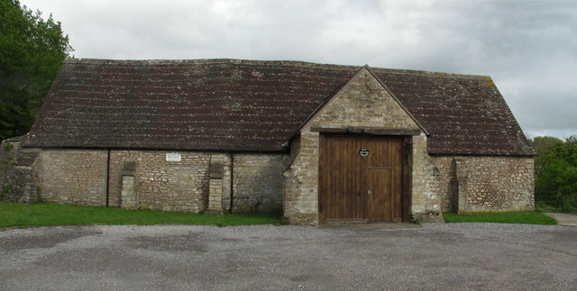
Mells Village Hall

Mells Village Hall in Mells, Somerset, England was built in the 14th century as a tithe barn and now serves as the village hall. It is a Grade II* listed...
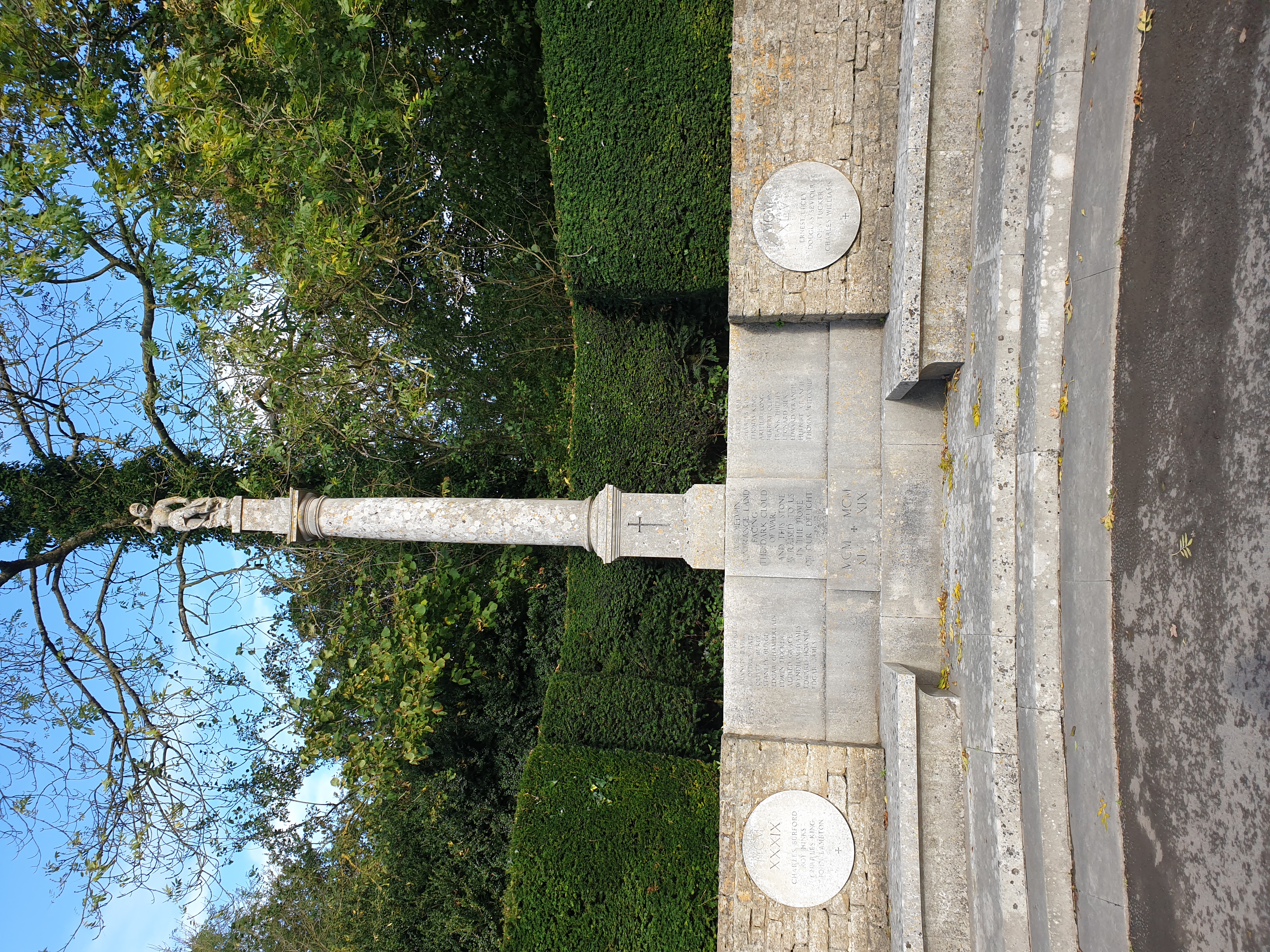
Mells War Memorial

Mells War Memorial is a First World War memorial by Sir Edwin Lutyens in the village of Mells in the Mendip Hills of Somerset, south-western England. Unveiled...

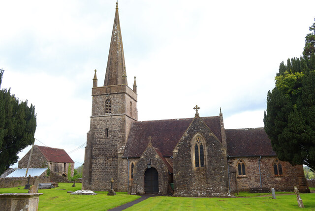
St Andrew's Church, Mells

St Andrew's Church is a Church of England parish church located in the village of Mells in the English county of Somerset. The church is a grade I listed...

Nearby Amenities

Located within 500m of 51.239407,-2.3720182
Fussells Iron Works (ruins)
Historic: archaeological_site
Lat/Long: 51.238622/-2.376169
The data included in this document is from www.openstreetmap.org. The data is made available under ODbL.

Have you been to Wadbury Valley?

Leave your review of Wadbury Valley below (or comments, questions and feedback).