West Cleugh

Valley in Northumberland

England

West Cleugh

Green Bothy A basic shelter maintained by volunteers of the Mountain Bothies Association with permission of the landowner.
Green Bothy Credit: Booga

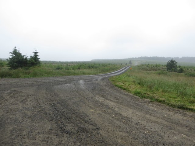
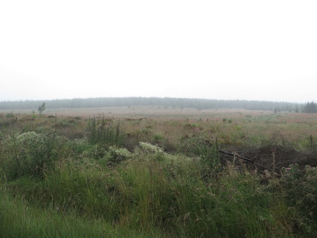
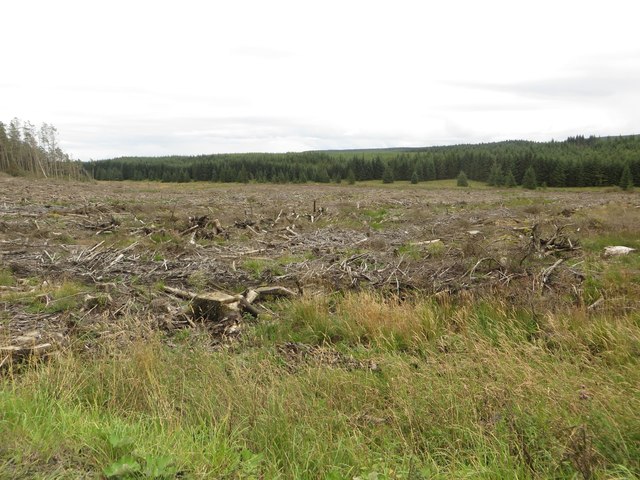
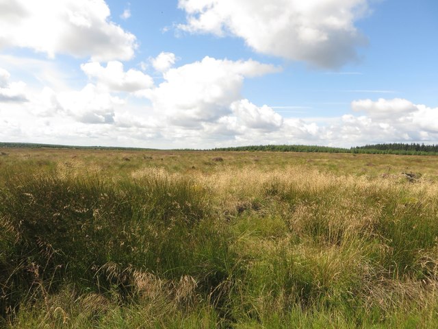
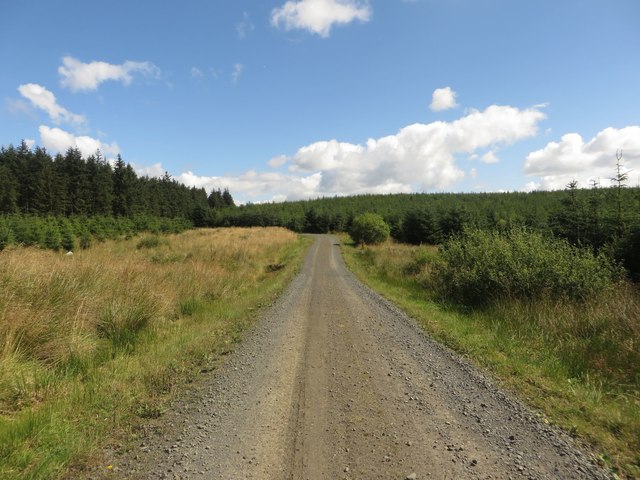
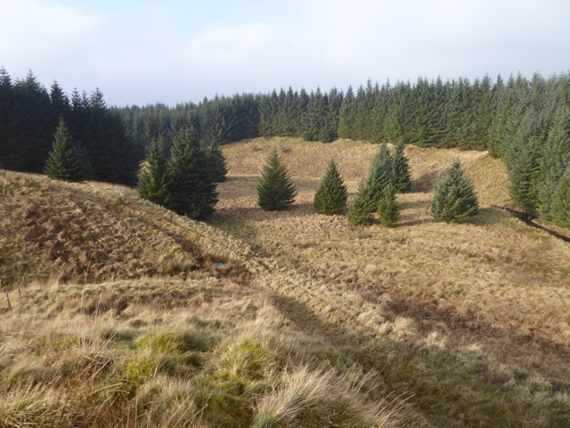
West Cleugh is a picturesque valley located in the county of Northumberland, England. Situated within the North Pennines Area of Outstanding Natural Beauty, it offers visitors a serene and unspoiled setting surrounded by rolling hills and lush countryside.

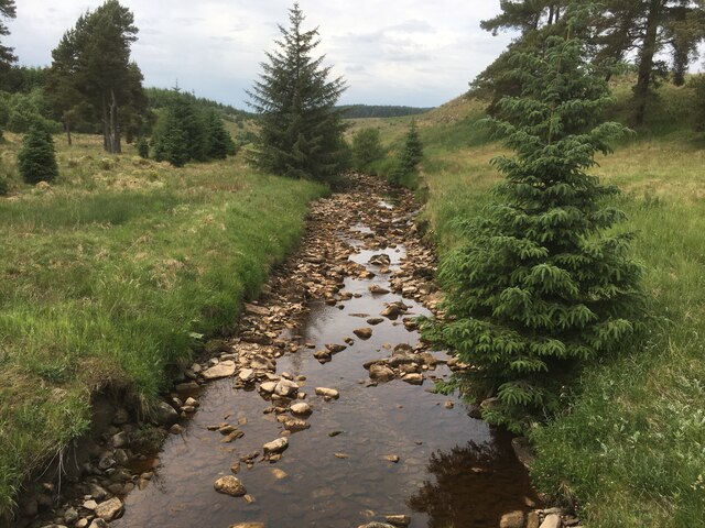
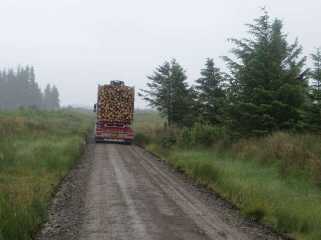
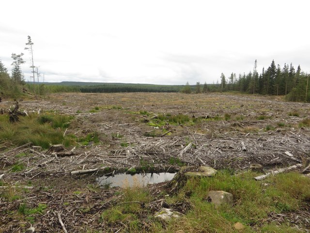
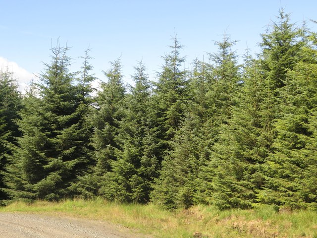
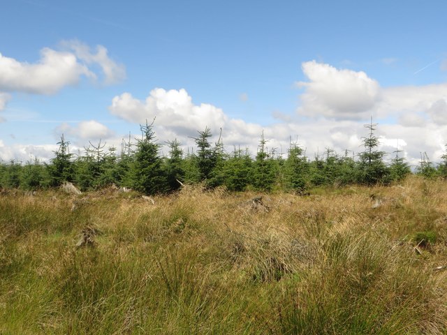
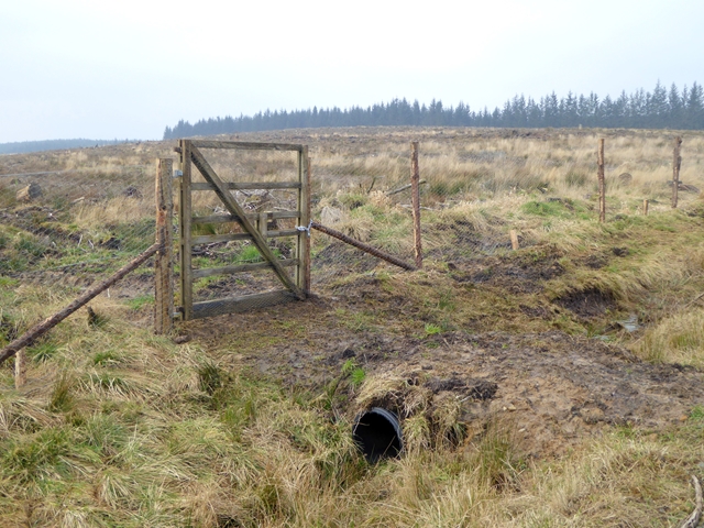
The valley is characterized by its charming rural landscape, with meandering streams, green meadows, and patches of dense woodland. It is home to a diverse range of flora and fauna, making it a haven for nature enthusiasts and wildlife lovers. Visitors can expect to encounter a variety of bird species, including buzzards, curlews, and lapwings, as well as rabbits, hares, and roe deer.

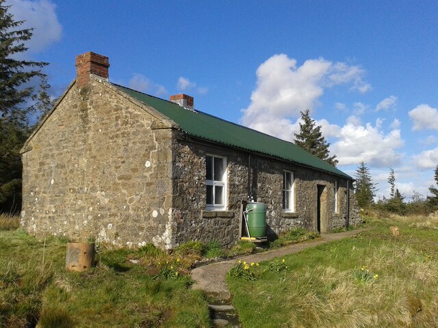
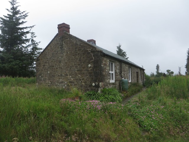
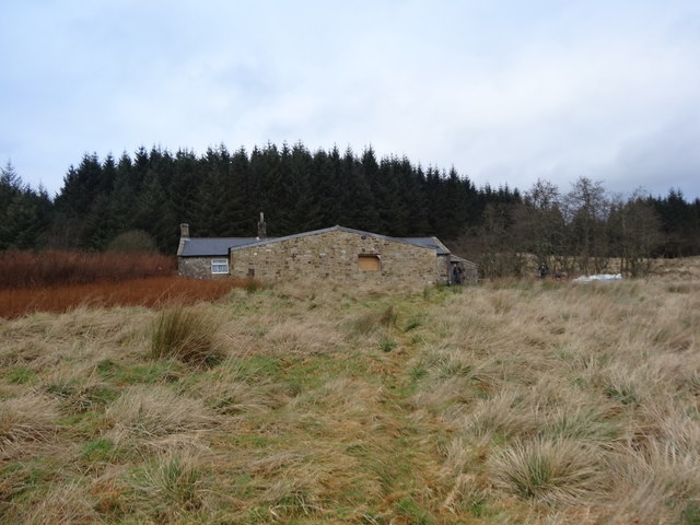
The village of West Cleugh itself is small and quaint, with a handful of traditional stone cottages and a quaint church. The local community is close-knit and welcoming, offering a glimpse into rural English life. The village is accessible via narrow country lanes, adding to its secluded charm.

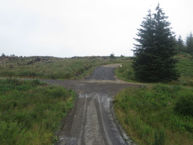
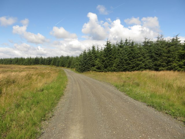
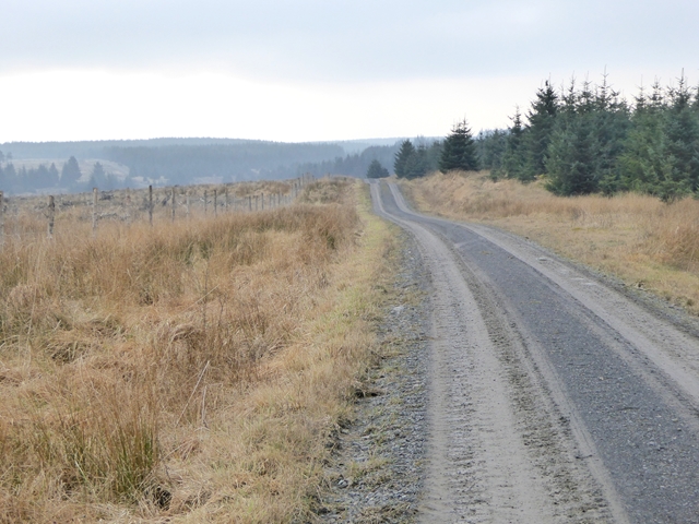
For those seeking outdoor activities, West Cleugh offers plenty of opportunities for walking, hiking, and cycling. The valley is crisscrossed by a network of footpaths and trails, allowing visitors to explore its scenic beauty. The nearby River West Allen provides additional recreational options, including fishing and canoeing.

In summary, West Cleugh in Northumberland is a hidden gem, offering a peaceful and idyllic retreat for those looking to escape the hustle and bustle of modern life. Its natural beauty, charming village, and outdoor pursuits make it a perfect destination for nature lovers and outdoor enthusiasts alike.

If you have any feedback on the listing, please let us know in the comments section below.

West Cleugh Images

Images are sourced within 2km of 55.108898/-2.4335184 or Grid Reference NY7279. Thanks to Geograph Open Source API. All images are credited.

Green Bothy A basic shelter maintained by volunteers of the Mountain Bothies Association with permission of the landowner.
Green Bothy
A basic shelter maintained by volunteers of the Mountain Bothies Association with permission of the landowner.
Chirdon Burn
Chirdon Burn
Track junction in Wark Forest A junction of forest tracks in Wark Forest.
Track junction in Wark Forest
A junction of forest tracks in Wark Forest.
Bothy at Green An isolated bothy amongst the innumerable trees of Wark Forest.
Bothy at Green
An isolated bothy amongst the innumerable trees of Wark Forest.
Track junction near Gowany Knowe A junction of forestry tracks to the south of Gowany Knowe. The track heads off across a relatively empty area of the forest.
Track junction near Gowany Knowe
A junction of forestry tracks to the south of Gowany Knowe. The track heads off across a relatively empty area of the forest.
Timber lorry in Wark Forest A loaded timber lorry travelling along one of the forest tracks in Wark Forest.
Timber lorry in Wark Forest
A loaded timber lorry travelling along one of the forest tracks in Wark Forest.
Cleared plantation around Whaup Sike A large cleared area of plantation in Wark Forest.
Cleared plantation around Whaup Sike
A large cleared area of plantation in Wark Forest.
Clear felled area, Wark Forest A large area of clear felled trees within Wark Forest.
Clear felled area, Wark Forest
A large area of clear felled trees within Wark Forest.
Clear felled area of forest, Wark Forest A large area of trees have been clear felled leaving a large vacant area within Wark Forest.
Clear felled area of forest, Wark Forest
A large area of trees have been clear felled leaving a large vacant area within Wark Forest.
Forest track, Wark Forest A forest track in Wark Forest. The area on the left is devoid of trees, whilst the edge of a dense block of trees is on the right side of the track.
Forest track, Wark Forest
A forest track in Wark Forest. The area on the left is devoid of trees, whilst the edge of a dense block of trees is on the right side of the track.
Unplanted area, Wark Forest A large boggy area free of trees in Wark Forest.
Unplanted area, Wark Forest
A large boggy area free of trees in Wark Forest.
Trees, Wark Forest A dense plantation of trees in Wark Forest beside one of the many forestry tracks.
Trees, Wark Forest
A dense plantation of trees in Wark Forest beside one of the many forestry tracks.
Forest track, Wark Forest A forest track in Wark Forest with a wide gap on either edge before the densely planted trees take over.
Forest track, Wark Forest
A forest track in Wark Forest with a wide gap on either edge before the densely planted trees take over.
Young trees, Wark Forest A large block of young trees in Wark Forest beside one of the many forest tracks.
Young trees, Wark Forest
A large block of young trees in Wark Forest beside one of the many forest tracks.
Chirdon Head Outdoor Centre On a previous visit in August 2008 we wondered if this was an outdoor centre but couldn't find any information about.  Since then a large extension has been built but not quite finished.  It belongs to the Cramlington Volunteer Youth Project.
<span class="nowrap"><a title="http://cvyp-ltd.com/activities/289/chirdon-head-ooutdoor-centre-retreat/" rel="nofollow ugc noopener" href="http://cvyp-ltd.com/activities/289/chirdon-head-ooutdoor-centre-retreat/">Link</a><img style="margin-left:2px;" alt="External link" title="External link - shift click to open in new window" src="https://s1.geograph.org.uk/img/external.png" width="10" height="10"/></span>
Chirdon Head Outdoor Centre
On a previous visit in August 2008 we wondered if this was an outdoor centre but couldn't find any information about. Since then a large extension has been built but not quite finished. It belongs to the Cramlington Volunteer Youth Project. LinkExternal link
Forest road in Kielder Forest Heading south towards Irish Bridge. The enclosure on the left is presumably a new plantation protected by fence from the depredations of deer.
Forest road in Kielder Forest
Heading south towards Irish Bridge. The enclosure on the left is presumably a new plantation protected by fence from the depredations of deer.
Gate into young plantation The enclosure  is presumably a new plantation protected by fence from the depredations of deer.
Gate into young plantation
The enclosure is presumably a new plantation protected by fence from the depredations of deer.
The Clint Burn In Kielder Forest; a tributary of the Chirdon Burn.
The Clint Burn
In Kielder Forest; a tributary of the Chirdon Burn.
Show me another place!

West Cleugh is located at Grid Ref: NY7279 (Lat: 55.108898, Lng: -2.4335184)

Unitary Authority: Northumberland

Police Authority: Northumbria

What 3 Words

///drainage.romantics.blinks. Near Bellingham, Northumberland

Nearby Locations

West Cleugh East Cleugh

Related Wikis

Wark Forest

Wark Forest is the southern part of Kielder Forest in Northumberland, England. Wark Forest is found within the south-west tip of Northumberland National...

Churnsike Lodge

Churnsike Lodge is an early Victorian hunting lodge situated in the parish of Greystead, West Northumberland, England. Constructed in 1850 by the Charlton...

Dally Castle

Dally Castle is a ruined 13th-century stone motte-and-bailey fortress in Northumberland, and one of the first hall houses in Northumberland. It lies 5...
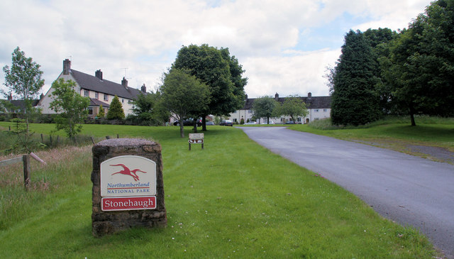
Stonehaugh

Stonehaugh is a small settlement in Northumberland about 5 miles (8 km) west of Wark on Tyne and 4 Roman miles (6 km) north of Hadrian's Wall. It was purpose...

Falstone Bridge

Falstone Bridge is a stone bridge across the River North Tyne at Falstone in Northumberland. == History == The bridge, which has three stone arches, was...

Falstone railway station

Falstone railway station is a former railway station that served the hamlet of Falstone, in Northumberland, England. == History == The station was on the...

Greystead

Greystead is a village and civil parish in Northumberland, England west of Bellingham. The population as of the 2011 census was less than 100. It shares...
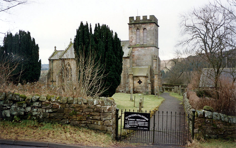
Falstone

Falstone is a small village in Northumberland, England, just east of Kielder Water. The village is 8 miles (13 km) from the Anglo–Scottish border. The...

Nearby Amenities

Located within 500m of 55.108898,-2.4335184
Clintburn
Place: locality
Lat/Long: 55.1118739/-2.4288365
Natural: peak
Lat/Long: 55.1125384/-2.4341506
The data included in this document is from www.openstreetmap.org. The data is made available under ODbL.

Have you been to West Cleugh?

Leave your review of West Cleugh below (or comments, questions and feedback).