Cuttock Clough

Valley in Yorkshire Ribble Valley

England

Cuttock Clough

Waddington Fell Mast
Waddington Fell Mast Credit: thejackrustles

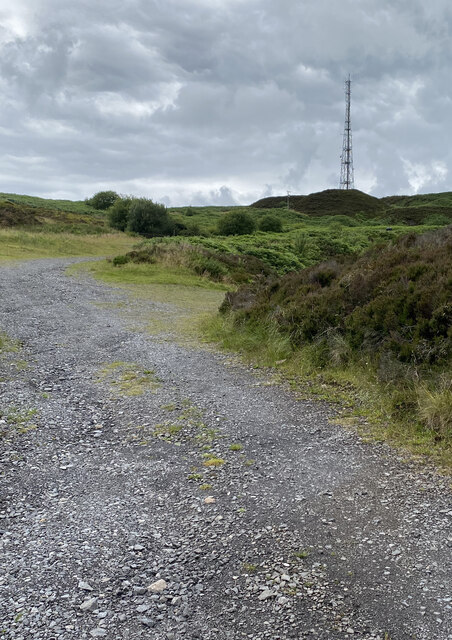
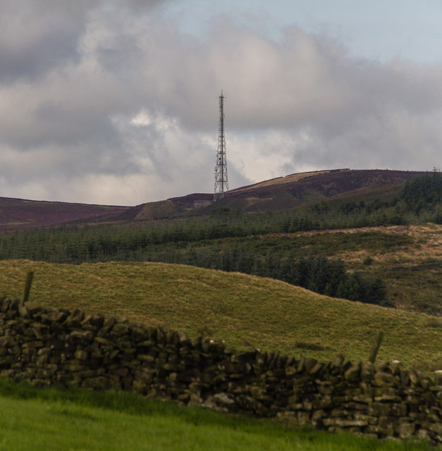
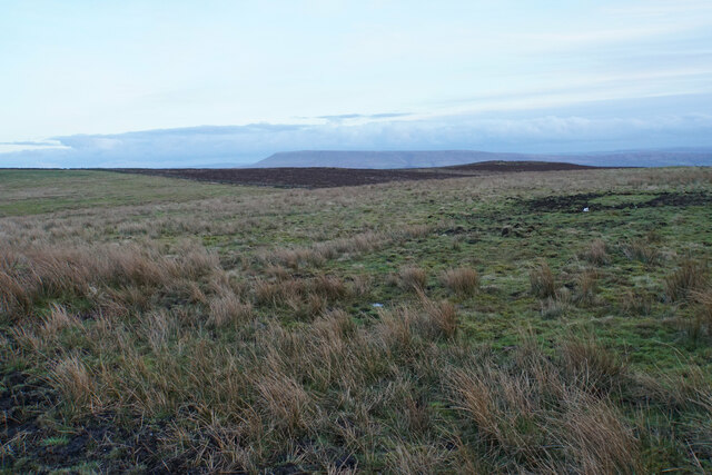
Cuttock Clough is a picturesque valley located in the county of Yorkshire, England. Situated in the rugged Pennine Hills, this valley is a hidden gem for nature lovers and outdoor enthusiasts. The clough is nestled within the larger South Pennines Area of Outstanding Natural Beauty, offering breathtaking views and a tranquil escape from urban life.

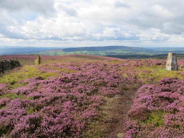
The valley is characterized by its steep sides and dense woodland, which provides a habitat for a variety of flora and fauna. Cuttock Clough is particularly renowned for its diverse bird population, attracting birdwatchers from far and wide. Visitors can spot species such as the Eurasian curlew, the beautiful red grouse, and the elusive short-eared owl.

The clough is intersected by a meandering stream, which adds to its charm. The stream is fed by natural springs and cascades over small waterfalls, creating a soothing soundtrack as it flows through the valley. Its crystal-clear waters attract anglers who come to fish for trout and grayling.

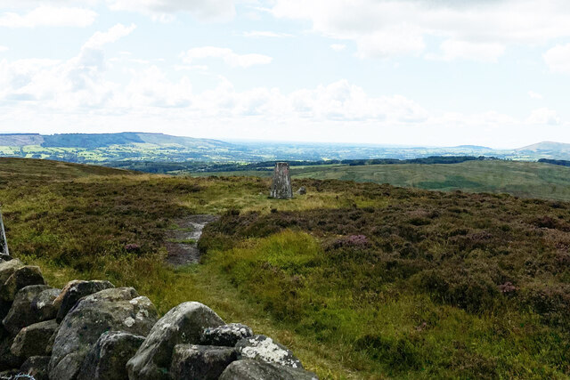
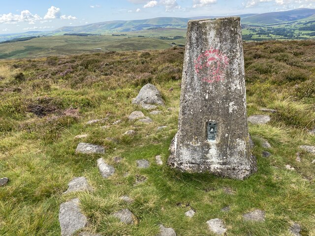
Hiking enthusiasts are drawn to Cuttock Clough due to its extensive network of walking trails. These trails offer a range of difficulty levels, from leisurely strolls along the valley floor to challenging uphill climbs that reward hikers with panoramic vistas. The clough is also intersected by the famous Pennine Way, a long-distance footpath that stretches over 250 miles.

Cuttock Clough truly offers a haven for those seeking solace in nature's embrace. Its unspoiled beauty and diverse wildlife make it a must-visit destination for anyone exploring the rugged landscapes of Yorkshire.

If you have any feedback on the listing, please let us know in the comments section below.

Cuttock Clough Images

Images are sourced within 2km of 53.909855/-2.4213489 or Grid Reference SD7246. Thanks to Geograph Open Source API. All images are credited.

Waddington Fell Mast
Newton Fell Trig Point
Newton Fell Trig Point Flush Bracket S4698
Waddington Fell Communications mast on Waddington Fell.
Waddington Fell
Communications mast on Waddington Fell.
View from Newton Fell Triangulation Pillar Looking south-westward.
View from Newton Fell Triangulation Pillar
Looking south-westward.
The remains of the Moorcock Inn
Eaves Hall Hotel, Waddington This is the civil service hotel where I stayed for a week or so in the summer holidays in 1983
Eaves Hall Hotel, Waddington
This is the civil service hotel where I stayed for a week or so in the summer holidays in 1983
B6478 Slaidburn Road
The Moorcock Inn from Slaidburn Road
B6478 on Waddington Fell
Eaves Hall Country House, West Bradford
Old Boundary Marker Parish Boundary Marker on moorland on Grindleton Fell, Bradford Beck. On the boundary of Grindleton and West Bradford parishes. Inscribed B and G on opposite faces.

Milestone Society National ID: YW_WBRGRI02pb
Old Boundary Marker
Parish Boundary Marker on moorland on Grindleton Fell, Bradford Beck. On the boundary of Grindleton and West Bradford parishes. Inscribed B and G on opposite faces. Milestone Society National ID: YW_WBRGRI02pb
Old Boundary Marker Parish Boundary Marker against a drystone wall on Grindleton Fell, Bradford Beck. On the boundary of Grindleton and West Bradford parishes. No inscription.

Milestone Society National ID: YW_WBRGRI03pb
Old Boundary Marker
Parish Boundary Marker against a drystone wall on Grindleton Fell, Bradford Beck. On the boundary of Grindleton and West Bradford parishes. No inscription. Milestone Society National ID: YW_WBRGRI03pb
Track on Waddington Fell Not a public footpath but I am not sure you would want to go along there in its soggy condition. The two bathtubs seem a bit superfluous.
Track on Waddington Fell
Not a public footpath but I am not sure you would want to go along there in its soggy condition. The two bathtubs seem a bit superfluous.
Rough grazing on Waddington Fell In evening light, with Pendle Hill prominent in the background. Pendle is on the other side of the Ribble Valley from here.
Rough grazing on Waddington Fell
In evening light, with Pendle Hill prominent in the background. Pendle is on the other side of the Ribble Valley from here.
Eaves Hall, West Bradford An Hotel and country club run by the CSMA (Civil Service Motoring Association) - see their website.
Eaves Hall, West Bradford
An Hotel and country club run by the CSMA (Civil Service Motoring Association) - see their website.
Bowls at Eaves Hall The building is somewhat altered since the Knolls lived here in the 16th century. Now rather grand early 20th century family home converted to hotel by the CSMA
Bowls at Eaves Hall
The building is somewhat altered since the Knolls lived here in the 16th century. Now rather grand early 20th century family home converted to hotel by the CSMA
Show me another place!

Cuttock Clough is located at Grid Ref: SD7246 (Lat: 53.909855, Lng: -2.4213489)

Division: West Riding

Administrative County: Lancashire

District: Ribble Valley

Police Authority: Lancashire

What 3 Words

///actual.statue.patrolled. Near Waddington, Lancashire

Nearby Locations

Cuttock Clough

Related Wikis

Eaves Hall

Eaves Hall was built in 1864 for John Burton (1809–1879), first son of James Burton and a wealthy cotton mill-owner.Sold by the Burtons in 1938, having...

St Helen's Church, Waddington

St Helen's Church is in the village of Waddington, Lancashire, England. It is an active Anglican parish church in the deanery of Whalley, the archdeaconry...

Waddington, Lancashire

Waddington is a small village, 2 miles (3 km) north-west of Clitheroe in the Ribble Valley, Lancashire, England. The population of the civil parish at...

Easington Fell

Easington Fell is a Marilyn in the Forest of Bowland in Lancashire, England. It has been surveyed to be 70 cm higher than a nearby fell of almost identical...

West Bradford, Lancashire

West Bradford is a village and civil parish in Lancashire, England, 2.5 miles (4 km) north of Clitheroe. The population at the 2011 census was 788. It...

Grindleton

Grindleton is a village and civil parish in the Ribble Valley district of the English county of Lancashire, formerly in the West Riding of Yorkshire. Its...

Grindletonians

The Grindletonians were a Puritan sect that arose in the town of Grindleton in Lancashire, England, in around 1610. The sect remained active in the North...

Waddow Hall

Waddow Hall is a 17th-century Grade II listed building within a 178-acre (72 ha) estate that serves as a conference and activity centre for Girlguiding...

Nearby Amenities

Located within 500m of 53.909855,-2.4213489
Ford: yes
Lat/Long: 53.9108953/-2.4225162
Generator Method: photovoltaic
Generator Output Electricity: yes
Generator Source: solar
Generator Type: solar_photovoltaic_panel
Power: generator
Lat/Long: 53.9103083/-2.4266551
Generator Method: photovoltaic
Generator Output Electricity: yes
Generator Source: solar
Generator Type: solar_photovoltaic_panel
Power: generator
Lat/Long: 53.9104202/-2.4263787
The data included in this document is from www.openstreetmap.org. The data is made available under ODbL.

Have you been to Cuttock Clough?

Leave your review of Cuttock Clough below (or comments, questions and feedback).