Great Ladies Cleugh

Valley in Berwickshire

Scotland

Great Ladies Cleugh

On Blackcleugh Rig From the track near to the highpoint of Blackcleuch Rig, looking towards Monynut Edge and Aikengall Community Wind Farm. In between a newly harvested field with the straw already baled, while over the fence the forest has been felled and replanted, though you can't quite see the saplings in this picture.
On Blackcleugh Rig Credit: Adam Ward

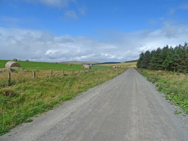
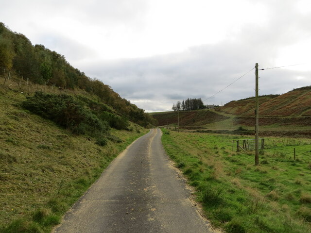
Great Ladies Cleugh is a picturesque valley located in the region of Berwickshire, Scotland. Nestled amidst the rolling hills and verdant landscapes, this valley offers a stunning natural beauty that attracts visitors from far and wide.

The name "Great Ladies Cleugh" is derived from the Old English term "clōh," which means a narrow valley or ravine. The valley is believed to have been named after the ancient noblewomen who once owned the land.

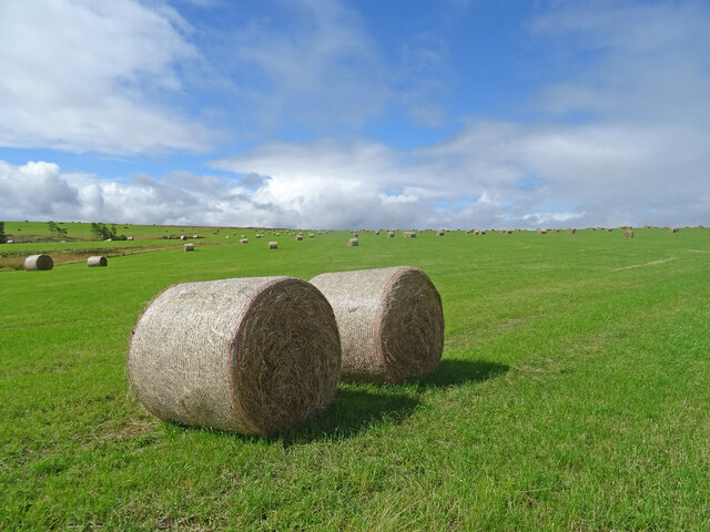
The valley is characterized by its diverse flora and fauna. Lush green meadows, vibrant wildflowers, and towering trees adorn the landscape, creating a serene and peaceful atmosphere. The valley is also home to a variety of wildlife, including deer, rabbits, and numerous bird species.

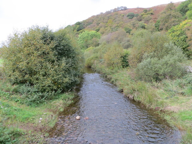
The clear and babbling streams that flow through the valley add to its natural charm. These streams are a source of freshwater for both the wildlife and the surrounding farmlands.

Great Ladies Cleugh offers several walking trails that allow visitors to explore the beauty of the valley. The trails wind through the meadows, forests, and along the streams, providing breathtaking views at every turn.

Additionally, the valley has historical significance. It is believed to have been inhabited since ancient times, with remnants of Iron Age settlements found in the area. The valley also played a role in the agricultural practices of the region, with evidence of farming activities dating back centuries.

Overall, Great Ladies Cleugh is a hidden gem in Berwickshire, offering a tranquil escape into nature, rich biodiversity, and a glimpse into the region's history.

If you have any feedback on the listing, please let us know in the comments section below.

Great Ladies Cleugh Images

Images are sourced within 2km of 55.861799/-2.4500336 or Grid Reference NT7163. Thanks to Geograph Open Source API. All images are credited.

On Blackcleugh Rig From the track near to the highpoint of Blackcleuch Rig, looking towards Monynut Edge and Aikengall Community Wind Farm. In between a newly harvested field with the straw already baled, while over the fence the forest has been felled and replanted, though you can't quite see the saplings in this picture.
On Blackcleugh Rig
From the track near to the highpoint of Blackcleuch Rig, looking towards Monynut Edge and Aikengall Community Wind Farm. In between a newly harvested field with the straw already baled, while over the fence the forest has been felled and replanted, though you can't quite see the saplings in this picture.
Track, Kirkgate Hill Track between forest and recently harvested field on the east side of Kirkgate Hill.  Hill in the distance is Spartleton.
Track, Kirkgate Hill
Track between forest and recently harvested field on the east side of Kirkgate Hill. Hill in the distance is Spartleton.
Bales, Kirkgate Hill Bales on the south-east side of Kirkgate Hill in the Scottish Borders near Cranshaws. Presumably for animal feed and have been brought here from elsewhere, given that the field does not look like its recently been harvested.
Bales, Kirkgate Hill
Bales on the south-east side of Kirkgate Hill in the Scottish Borders near Cranshaws. Presumably for animal feed and have been brought here from elsewhere, given that the field does not look like its recently been harvested.
Minor road and buildings at Nether Monynut Looking southward.
Minor road and buildings at Nether Monynut
Looking southward.
Minor road following the course of Monynut Water down the valley Looking southward.
Minor road following the course of Monynut Water down the valley
Looking southward.
Monynut Water viewed from Bushelhill Farm Bridge Looking north-westward upstream.
Monynut Water viewed from Bushelhill Farm Bridge
Looking north-westward upstream.
Ordnance Survey Cut Mark This mark can be found on the wall of a building at Nether Monynut.
The recorded details give a height of 235.1105 metres above sea level.
For more detail see : <span class="nowrap"><a title="https://www.bench-marks.org.uk/bm208282" rel="nofollow ugc noopener" href="https://www.bench-marks.org.uk/bm208282">Link</a><img style="margin-left:2px;" alt="External link" title="External link - shift click to open in new window" src="https://s1.geograph.org.uk/img/external.png" width="10" height="10"/></span>
Ordnance Survey Cut Mark
This mark can be found on the wall of a building at Nether Monynut. The recorded details give a height of 235.1105 metres above sea level. For more detail see : LinkExternal link
Clearing and Brush Wood under Laughing Law on a by road from Abbey St Bathans to Ecclaw
Clearing and Brush Wood
under Laughing Law on a by road from Abbey St Bathans to Ecclaw
Nasty bit of road nr Moneynut Water the hill is part of Laughing Law
Nasty bit of road nr Moneynut Water
the hill is part of Laughing Law
Middle Monynut, Lammermuirs View over Skinner Burn.
Middle Monynut, Lammermuirs
View over Skinner Burn.
Trees Birch trees growing at strange angle on Laughing Law at Nether Monynut, Lammermuirs
Trees
Birch trees growing at strange angle on Laughing Law at Nether Monynut, Lammermuirs
Borders Countryside Lovely view looking down the Monynut Water from slopes of Black Law in the Scottish Borders - it looks almost like a balmy spring or early summer's day, but in fact the wind chill must have been below freezing.
Borders Countryside
Lovely view looking down the Monynut Water from slopes of Black Law in the Scottish Borders - it looks almost like a balmy spring or early summer's day, but in fact the wind chill must have been below freezing.
Looking towards Black Cleugh Scottish Borders farmland and conifer plantation.
Looking towards Black Cleugh
Scottish Borders farmland and conifer plantation.
Electric Fence - Borders Style All the gates hereabouts had these blue tubes to take the electric wire back up to the top of the fence. In the distance you can see Bentyhowe Wood.
Electric Fence - Borders Style
All the gates hereabouts had these blue tubes to take the electric wire back up to the top of the fence. In the distance you can see Bentyhowe Wood.
Bright Bales. These bales of hay could be seen from over 2km away with the afternoon sun on them. Near Bushelhill Farm, Scottish Borders.
Bright Bales.
These bales of hay could be seen from over 2km away with the afternoon sun on them. Near Bushelhill Farm, Scottish Borders.
Country Road Take me home - and it did too, but thankfully not to West Virginia, only Edinburgh!
Near Nether Monynut Farm, Scottish Borders on a lovely winter day.
Country Road
Take me home - and it did too, but thankfully not to West Virginia, only Edinburgh! Near Nether Monynut Farm, Scottish Borders on a lovely winter day.
Dunter Law The triangulation pillar and forest.  Felt a lot higher than 320m today.
Dunter Law
The triangulation pillar and forest. Felt a lot higher than 320m today.
Fence on Kirkgate Hill Farmland on a plateau. A track along the high ground here may be the Kirk Gate itself.
Fence on Kirkgate Hill
Farmland on a plateau. A track along the high ground here may be the Kirk Gate itself.
Show me another place!

Great Ladies Cleugh is located at Grid Ref: NT7163 (Lat: 55.861799, Lng: -2.4500336)

Unitary Authority: The Scottish Borders

Police Authority: The Lothians and Scottish Borders

What 3 Words

///speared.spurring.vowing. Near Duns, Scottish Borders

Related Wikis

Bothwell Water

The Bothwell Water is a river in the Scottish Borders area of Scotland. It rises in the Lammermuir Hills near Caldercleugh and continues past the Upper...

Dye Water

The Dye Water (Scottish Gaelic: Uisge Dhàidh) is a river in the Lammermuir Hills in the Scottish Borders area of Scotland. It rises in the Hope Hills,...

Cranshaws Castle

Cranshaws Castle or Cranshaws Tower is a privately owned 15th-century pele situated by the village of Cranshaws in Berwickshire, Scotland. The building...

Abbey St Bathans

Abbey St Bathans (Scottish Gaelic: Abaid Bhaoithin) is a parish in the Lammermuir district of Berwickshire, in the eastern part of the Scottish Borders...

Cranshaws

Cranshaws is a village on the B6355 road, near Duns, in the Scottish Borders area of Scotland, in the former Berwickshire. Of Cranshaws Castle only the...

Crystal Rig Wind Farm

Crystal Rig Wind Farm is an operational onshore wind farm located on the Lammermuir Hills in the Scottish Borders region of Scotland. When phase 1 was...

Longformacus House

Longformacus House is a mansion near the village of Longformacus, Scottish Borders, Scotland. == History == The estate was once owned by the Earls of...

Cockburn Tower

Cockburn Tower was a small fortified house in Berwickshire, Scotland. Now little more than the outline of a foundation, it occupied a site on the southern...

Nearby Amenities

Located within 500m of 55.861799,-2.4500336
Brown Law
Ele: 305
Ele Ft: 1001
Natural: peak
Lat/Long: 55.8580585/-2.4482194
The data included in this document is from www.openstreetmap.org. The data is made available under ODbL.

Have you been to Great Ladies Cleugh?

Leave your review of Great Ladies Cleugh below (or comments, questions and feedback).