Den of Woodhead

Valley in Aberdeenshire

Scotland

Den of Woodhead

Den of Gask Minor road heading north through the Den of Gask.
Den of Gask Credit: Scott Cormie

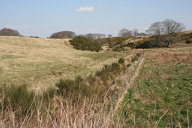
Den of Woodhead is a picturesque valley located in Aberdeenshire, Scotland. Nestled amidst the tranquil countryside, this enchanting valley is renowned for its natural beauty and charm.

Surrounded by rolling hills and dense woodlands, Den of Woodhead offers a haven of tranquility for nature enthusiasts and hikers alike. The valley is home to a diverse range of flora and fauna, including native Scottish species such as red deer, red squirrels, and various bird species. The lush greenery and vibrant wildflowers that adorn the valley create a stunning backdrop for visitors to enjoy.

The valley is traversed by a meandering river, which adds to the serenity and beauty of the landscape. The crystal-clear waters of the river are a sight to behold, and visitors can often spot salmon and trout swimming upstream during the spawning season.

Den of Woodhead is also steeped in history, with several archaeological sites scattered throughout the area. These sites provide a glimpse into the past, offering insights into the lives of the ancient inhabitants of Aberdeenshire.

For those seeking outdoor activities, the valley offers numerous hiking trails that cater to all levels of fitness. The trails range from leisurely strolls to more challenging treks, providing ample opportunities for exploration and adventure.

With its idyllic setting and rich natural heritage, Den of Woodhead is a must-visit destination for anyone seeking solace in nature or a deeper connection with Scotland's wilderness.

If you have any feedback on the listing, please let us know in the comments section below.

Den of Woodhead Images

Images are sourced within 2km of 57.499861/-2.4764373 or Grid Reference NJ7145. Thanks to Geograph Open Source API. All images are credited.

Den of Gask Minor road heading north through the Den of Gask.
Den of Gask
Minor road heading north through the Den of Gask.
Craigietocher from the north-east Looking from the road to the north-east towards Craigietocher.
Craigietocher from the north-east
Looking from the road to the north-east towards Craigietocher.
Wooded garden at Hopefield Tree-dotted garden by the roadside at Hopefield.
Wooded garden at Hopefield
Tree-dotted garden by the roadside at Hopefield.
Silo at Kingsford Silo next to a ruined steading by the roadside at Kingsford.
Silo at Kingsford
Silo next to a ruined steading by the roadside at Kingsford.
Ploughed field near Uppermill Ploughed field by the roadside at the junction to Uppermill.
Ploughed field near Uppermill
Ploughed field by the roadside at the junction to Uppermill.
C22S road at the Burn of Cliftbog The C22S heading north over the Burn of Cliftbog.
C22S road at the Burn of Cliftbog
The C22S heading north over the Burn of Cliftbog.
Scattered sheep Sheep scattered over the grassland to the north-west of Braefoot.
Scattered sheep
Sheep scattered over the grassland to the north-west of Braefoot.
Brunthall from the north Brunthall on the west side of the C22S road viewed from the north.
Brunthall from the north
Brunthall on the west side of the C22S road viewed from the north.
Burn of Gask The burn is clearly too small to have created this wide valley, which is in fact a meltwater channel carved by the melt from a glacier at the end of the last Ice Age some 10,000 years ago.
Burn of Gask
The burn is clearly too small to have created this wide valley, which is in fact a meltwater channel carved by the melt from a glacier at the end of the last Ice Age some 10,000 years ago.
Moss of Brunthall The glacial meltwater channel is wide, flat and boggy here, and iron oxides are leaching out into the Burn of Gask that drains it, giving the burn a reddish colour. In fact the water is crystal clear and the red is a deposit in the bed of the burn. Or at least it was today, after a spell of dry settled weather.
Moss of Brunthall
The glacial meltwater channel is wide, flat and boggy here, and iron oxides are leaching out into the Burn of Gask that drains it, giving the burn a reddish colour. In fact the water is crystal clear and the red is a deposit in the bed of the burn. Or at least it was today, after a spell of dry settled weather.
Corrydown Recumbent Stone Circle (1) This circle has been disturbed, and only the recumbent, the furthest right in this view, remains in its original position. See <span class="nowrap"><a title="http://canmore.rcahms.gov.uk/en/site/19197/details/corrydown/" rel="nofollow ugc noopener" href="http://canmore.rcahms.gov.uk/en/site/19197/details/corrydown/">Link</a><img style="margin-left:2px;" alt="External link" title="External link - shift click to open in new window" src="https://s1.geograph.org.uk/img/external.png" width="10" height="10"/></span> for a fuller description. <a href="https://www.geograph.org.uk/photo/4423393">NJ7044 : Corrydown Recumbent Stone Circle (2)</a>
Corrydown Recumbent Stone Circle (1)
This circle has been disturbed, and only the recumbent, the furthest right in this view, remains in its original position. See LinkExternal link for a fuller description. NJ7044 : Corrydown Recumbent Stone Circle (2)
Corrydown Recumbent Stone Circle (2) The large stone on the right is the recumbent, the only stone of the circle that is still in its original position. On its left is one of the flankers, no longer standing upright. See <span class="nowrap"><a title="http://canmore.rcahms.gov.uk/en/site/19197/details/corrydown/" rel="nofollow ugc noopener" href="http://canmore.rcahms.gov.uk/en/site/19197/details/corrydown/">Link</a><img style="margin-left:2px;" alt="External link" title="External link - shift click to open in new window" src="https://s1.geograph.org.uk/img/external.png" width="10" height="10"/></span> for a fuller description. <a href="https://www.geograph.org.uk/photo/4423399">NJ7044 : Corrydown Recumbent Stone Circle (3)</a>
Corrydown Recumbent Stone Circle (2)
The large stone on the right is the recumbent, the only stone of the circle that is still in its original position. On its left is one of the flankers, no longer standing upright. See LinkExternal link for a fuller description. NJ7044 : Corrydown Recumbent Stone Circle (3)
Corrydown Recumbent Stone Circle (3) The closest stone is the recumbent, which is the only one in its original position. Behind and to its right is one of the flankers and to its right again one of the small stones thought to have symbolised the entrance to a tomb. Another fallen stone is at the far corner of the fenced enclosure. See <span class="nowrap"><a title="http://canmore.rcahms.gov.uk/en/site/19197/details/corrydown/" rel="nofollow ugc noopener" href="http://canmore.rcahms.gov.uk/en/site/19197/details/corrydown/">Link</a><img style="margin-left:2px;" alt="External link" title="External link - shift click to open in new window" src="https://s1.geograph.org.uk/img/external.png" width="10" height="10"/></span> for a fuller description. <a href="https://www.geograph.org.uk/photo/4423405">NJ7044 : Corrydown Recumbent Stone Circle (4)</a>
Corrydown Recumbent Stone Circle (3)
The closest stone is the recumbent, which is the only one in its original position. Behind and to its right is one of the flankers and to its right again one of the small stones thought to have symbolised the entrance to a tomb. Another fallen stone is at the far corner of the fenced enclosure. See LinkExternal link for a fuller description. NJ7044 : Corrydown Recumbent Stone Circle (4)
Corrydown Recumbent Stone Circle (4) The closest stone is one of the flankers, which would originally have stood upright and would have been paired with a similar stone at the other end of the recumbent, which is visible behind it and is the only stone still in situ. See <span class="nowrap"><a title="http://canmore.rcahms.gov.uk/en/site/19197/details/corrydown/" rel="nofollow ugc noopener" href="http://canmore.rcahms.gov.uk/en/site/19197/details/corrydown/">Link</a><img style="margin-left:2px;" alt="External link" title="External link - shift click to open in new window" src="https://s1.geograph.org.uk/img/external.png" width="10" height="10"/></span> for a fuller description. <a href="https://www.geograph.org.uk/photo/4423414">NJ7044 : Corrydown Recumbent Stone Circle (5)</a>
Corrydown Recumbent Stone Circle (4)
The closest stone is one of the flankers, which would originally have stood upright and would have been paired with a similar stone at the other end of the recumbent, which is visible behind it and is the only stone still in situ. See LinkExternal link for a fuller description. NJ7044 : Corrydown Recumbent Stone Circle (5)
Corrydown Recumbent Stone Circle (5) Most of the stones of the Corrydown circle are coarse-grained conglomerate with pebble-sized white quartz clasts. This is part of the flanker. The recumbent, however, is of a different rock type. Pound coin for scale. Compare with <a href="https://www.geograph.org.uk/photo/4423423">NJ7044 : Corrydown Recumbent Stone Circle (6)</a>. See <span class="nowrap"><a title="http://canmore.rcahms.gov.uk/en/site/19197/details/corrydown/" rel="nofollow ugc noopener" href="http://canmore.rcahms.gov.uk/en/site/19197/details/corrydown/">Link</a><img style="margin-left:2px;" alt="External link" title="External link - shift click to open in new window" src="https://s1.geograph.org.uk/img/external.png" width="10" height="10"/></span> for a fuller description.
Corrydown Recumbent Stone Circle (5)
Most of the stones of the Corrydown circle are coarse-grained conglomerate with pebble-sized white quartz clasts. This is part of the flanker. The recumbent, however, is of a different rock type. Pound coin for scale. Compare with NJ7044 : Corrydown Recumbent Stone Circle (6). See LinkExternal link for a fuller description.
Corrydown Recumbent Stone Circle (6) This is part of the recumbent. Comparing it with <a href="https://www.geograph.org.uk/photo/4423414">NJ7044 : Corrydown Recumbent Stone Circle (5)</a>, it is obviously a finer-grained rock, lacking the white quartz clasts. The white quartz in the lower part of this view is the remains of a vein formed in a crack in the rock after it had formed. Pound coin for scale. See <span class="nowrap"><a title="http://canmore.rcahms.gov.uk/en/site/19197/details/corrydown/" rel="nofollow ugc noopener" href="http://canmore.rcahms.gov.uk/en/site/19197/details/corrydown/">Link</a><img style="margin-left:2px;" alt="External link" title="External link - shift click to open in new window" src="https://s1.geograph.org.uk/img/external.png" width="10" height="10"/></span> for a fuller description. <a href="https://www.geograph.org.uk/photo/4423427">NJ7044 : Corrydown Recumbent Stone Circle (7)</a>
Corrydown Recumbent Stone Circle (6)
This is part of the recumbent. Comparing it with NJ7044 : Corrydown Recumbent Stone Circle (5), it is obviously a finer-grained rock, lacking the white quartz clasts. The white quartz in the lower part of this view is the remains of a vein formed in a crack in the rock after it had formed. Pound coin for scale. See LinkExternal link for a fuller description. NJ7044 : Corrydown Recumbent Stone Circle (7)
Corrydown Recumbent Stone Circle (7) These are the remaining stones in the north arc of the circle. They have all been displaced and are lying on the ground instead of standing up. See <span class="nowrap"><a title="http://canmore.rcahms.gov.uk/en/site/19197/details/corrydown/" rel="nofollow ugc noopener" href="http://canmore.rcahms.gov.uk/en/site/19197/details/corrydown/">Link</a><img style="margin-left:2px;" alt="External link" title="External link - shift click to open in new window" src="https://s1.geograph.org.uk/img/external.png" width="10" height="10"/></span> for a fuller description.  <a href="https://www.geograph.org.uk/photo/4423432">NJ7044 : Corrydown Recumbent Stone Circle (8)</a>
Corrydown Recumbent Stone Circle (7)
These are the remaining stones in the north arc of the circle. They have all been displaced and are lying on the ground instead of standing up. See LinkExternal link for a fuller description. NJ7044 : Corrydown Recumbent Stone Circle (8)
Corrydown Recumbent Stone Circle (8) This is the reciprocal of the view in <a href="https://www.geograph.org.uk/photo/4423399">NJ7044 : Corrydown Recumbent Stone Circle (3)</a>, with the recumbent appearing taller than the flanker in front of it, and the other stones, also fallen or displaced. See <span class="nowrap"><a title="http://canmore.rcahms.gov.uk/en/site/19197/details/corrydown/" rel="nofollow ugc noopener" href="http://canmore.rcahms.gov.uk/en/site/19197/details/corrydown/">Link</a><img style="margin-left:2px;" alt="External link" title="External link - shift click to open in new window" src="https://s1.geograph.org.uk/img/external.png" width="10" height="10"/></span> for a fuller description. <a href="https://www.geograph.org.uk/photo/4423382">NJ7044 : Corrydown Recumbent Stone Circle (1)</a>
Corrydown Recumbent Stone Circle (8)
This is the reciprocal of the view in NJ7044 : Corrydown Recumbent Stone Circle (3), with the recumbent appearing taller than the flanker in front of it, and the other stones, also fallen or displaced. See LinkExternal link for a fuller description. NJ7044 : Corrydown Recumbent Stone Circle (1)
Show me another place!

Den of Woodhead is located at Grid Ref: NJ7145 (Lat: 57.499861, Lng: -2.4764373)

Unitary Authority: Aberdeenshire

Police Authority: North East

What 3 Words

///dumplings.playful.interlude. Near Turriff, Aberdeenshire

Nearby Locations

Den of Woodhead

Related Wikis

Dorlaithers Castle

Dorlaithers Castle was a castle about 2.5 miles (4.0 km) south-west of Turriff, Aberdeenshire, Scotland at Dorlaithers, south of the burn of Gask. It may...

Auchterless railway station

Auchterless railway station was a railway station in Auchterless, Aberdeenshire. It served the rural area, the estate of Towie Barclay and a settlement...

Banff and Buchan (UK Parliament constituency)

Banff and Buchan is a constituency of the House of Commons, located in the north-east of Scotland within the Aberdeenshire council area. It elects one...

Turriff railway station

Turriff railway station was a railway station in Turriff, Aberdeenshire, Scotland. It was opened in 1857 by the Banff Macduff & Turriff Junction Railway...

Nearby Amenities

Located within 500m of 57.499861,-2.4764373
Power: pole
Lat/Long: 57.5019399/-2.4829357
Power: pole
Lat/Long: 57.5013695/-2.4819768
Power: pole
Lat/Long: 57.5008332/-2.4808955
Power: pole
Lat/Long: 57.5000301/-2.4691672
Power: pole
Lat/Long: 57.5005947/-2.4684853
The data included in this document is from www.openstreetmap.org. The data is made available under ODbL.

Have you been to Den of Woodhead?

Leave your review of Den of Woodhead below (or comments, questions and feedback).