Long Gill Bank

Valley in Yorkshire Craven

England

Long Gill Bank

Boundary wall on  Blakeamaya Foggy morning.
Boundary wall on Blakeamaya Credit: steven ruffles

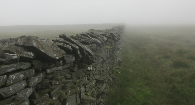
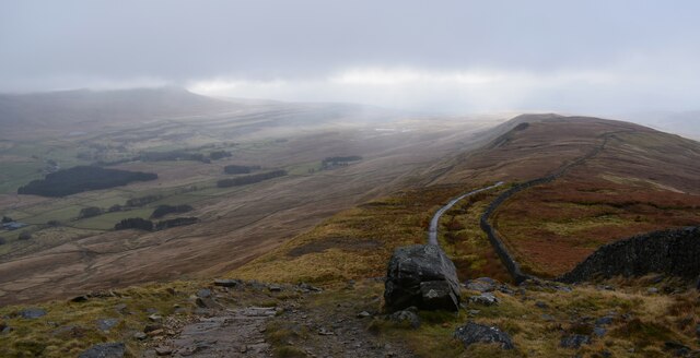
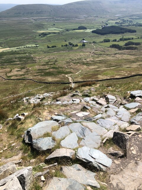
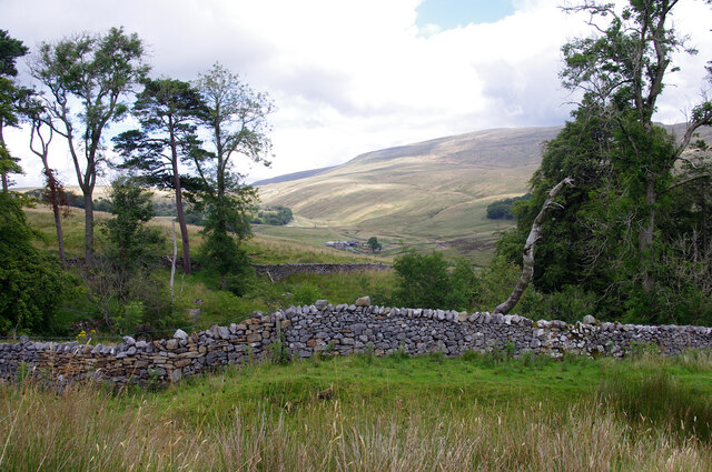
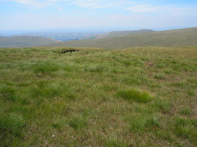
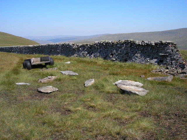
Long Gill Bank is a picturesque valley located in Yorkshire, England. Situated in the northern part of the county, it is known for its natural beauty and tranquil surroundings. The valley is surrounded by rolling hills and lush green meadows, providing a stunning backdrop for visitors.

Long Gill Bank is home to a diverse range of flora and fauna, with numerous species of birds, mammals, and plant life found within its boundaries. The valley is particularly popular among birdwatchers, who flock to the area to spot rare and migratory birds. The surrounding hills also offer opportunities for hiking and exploring, with several well-marked trails that wind through the valley and offer breathtaking views of the surrounding countryside.

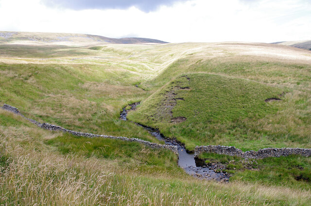
The gill itself, a small stream that runs through the valley, adds to the charm of the area. Its crystal-clear waters are home to various aquatic creatures, and its gentle babbling sound provides a soothing atmosphere for visitors seeking tranquility.

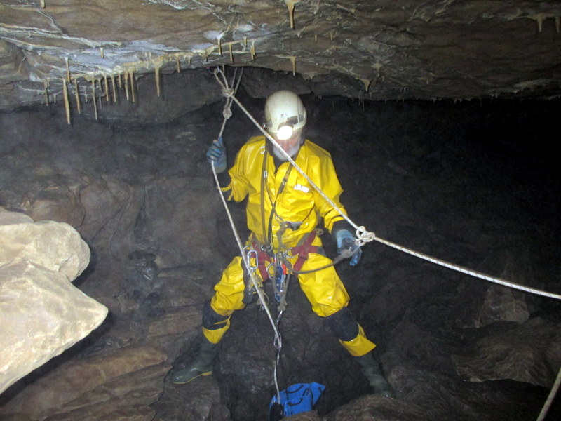
Long Gill Bank is also steeped in history, with several archaeological sites scattered throughout the area. These sites offer a glimpse into the region's past, with remnants of ancient settlements and structures still visible today.

Overall, Long Gill Bank is a haven for nature lovers and those seeking a peaceful escape from the hustle and bustle of everyday life. Its stunning landscapes, diverse wildlife, and rich history make it a must-visit destination for anyone exploring Yorkshire.

If you have any feedback on the listing, please let us know in the comments section below.

Long Gill Bank Images

Images are sourced within 2km of 54.21796/-2.4388199 or Grid Reference SD7180. Thanks to Geograph Open Source API. All images are credited.

Boundary wall on  Blakeamaya Foggy morning.
Boundary wall on Blakeamaya
Foggy morning.
The ridge from Whernside. Ingleborough in the distance.
The ridge from Whernside.
Ingleborough in the distance.
Descent from Whernside
Yordas Grains, Kingsdale Yordas Gill winds down the fellside before dropping down into Yordas Cave (out of picture, ~100m to right).
Yordas Grains, Kingsdale
Yordas Gill winds down the fellside before dropping down into Yordas Cave (out of picture, ~100m to right).
Yordas Wood, Kingsdale Looking towards Kingsdale Head. Whernside is in the background.
Yordas Wood, Kingsdale
Looking towards Kingsdale Head. Whernside is in the background.
On the Gragareth ridge Looking west towards Lunesdale in the heat haze.
On the Gragareth ridge
Looking west towards Lunesdale in the heat haze.
Work in progress The truck has been used to carry stone and equipment up the fell to repair the collapsed part of the wall at the right. No work was actually in progress on this extremely hot day.
Work in progress
The truck has been used to carry stone and equipment up the fell to repair the collapsed part of the wall at the right. No work was actually in progress on this extremely hot day.
Millstone Hagg, Gragareth At this point on the steep eastern flank of the hill large blocks of the rock appear to have slipped down a little creating fissures. This would be a tricky place in a whiteout or under snow but few people ever pass this way. The rock is millstone grit and may have been quarried (for the nearby walls?) but I saw no definite signs of this nor any actual millstones.
Millstone Hagg, Gragareth
At this point on the steep eastern flank of the hill large blocks of the rock appear to have slipped down a little creating fissures. This would be a tricky place in a whiteout or under snow but few people ever pass this way. The rock is millstone grit and may have been quarried (for the nearby walls?) but I saw no definite signs of this nor any actual millstones.
Small tarn between Gragareth and Green Hill This is on a long moorland ridge. The land falls away into Ease Gill with Crag Hill on the other side.
Small tarn between Gragareth and Green Hill
This is on a long moorland ridge. The land falls away into Ease Gill with Crag Hill on the other side.
Path to Green Hill The path leads into the slight depression between Gragareth and Green Hill, following the boundary between Lancashire and North Yorkshire. There is slightly greener grass on Green Hill than anywhere else in view.
Path to Green Hill
The path leads into the slight depression between Gragareth and Green Hill, following the boundary between Lancashire and North Yorkshire. There is slightly greener grass on Green Hill than anywhere else in view.
The col between Gragareth and Green Hill There is a soggy bit at the bottom as you might expect, but it is not large.
The col between Gragareth and Green Hill
There is a soggy bit at the bottom as you might expect, but it is not large.
The col between Gragareth and Green Hill Looking south towards Gragareth.
The col between Gragareth and Green Hill
Looking south towards Gragareth.
The Lancashire side of the ridge The land slopes down towards Ease Gill, hidden by the curve of the hill, which is the border with Cumbria.
The Lancashire side of the ridge
The land slopes down towards Ease Gill, hidden by the curve of the hill, which is the border with Cumbria.
Approaching Green Hill from the South Part of the long ridge between Gragareth and Great Coum - the wall being the county boundary between Lancashire and North Yorkshire.
Approaching Green Hill from the South
Part of the long ridge between Gragareth and Great Coum - the wall being the county boundary between Lancashire and North Yorkshire.
On a Ridge called Blakeamaya Section of the broad ridge that runs from Gragareth to Great Coum
On a Ridge called Blakeamaya
Section of the broad ridge that runs from Gragareth to Great Coum
Turbary Pasture, Gragareth A huge enclosure of rough pasture that was once a source of peat for cutting and the end destination of the Turbary Road above Kingsdale. Whernside, the highest mountain in the Yorkshire Dales soars above the dale head.
Turbary Pasture, Gragareth
A huge enclosure of rough pasture that was once a source of peat for cutting and the end destination of the Turbary Road above Kingsdale. Whernside, the highest mountain in the Yorkshire Dales soars above the dale head.
Long Gill Looking to Kingsdale Head.
Long Gill
Looking to Kingsdale Head.
Wind Haws. Looking up to the Western flanks of Whernside from the pass between Kingsdale and Deepdale.
Wind Haws.
Looking up to the Western flanks of Whernside from the pass between Kingsdale and Deepdale.
Show me another place!

Long Gill Bank is located at Grid Ref: SD7180 (Lat: 54.21796, Lng: -2.4388199)

Division: West Riding

Administrative County: North Yorkshire

District: Craven

Police Authority: North Yorkshire

What 3 Words

///grudge.canyons.makeovers. Near Ingleton, North Yorkshire

Related Wikis

Thornton in Lonsdale

Thornton in Lonsdale is a village and civil parish in the Craven District and ceremonial county of North Yorkshire in England. It is very close to the...

Yordas Cave

Yordas Cave is a solutional cave in Kingsdale, North Yorkshire, England. It has been renowned since the eighteenth century as a natural curiosity, and...

Green Hill (Lancashire)

Green Hill is a mountain or fell in north west England. Its summit is 628 metres (2,060 ft) above sea level. It is located above Cowan Bridge, Lancashire...

Jingling Pot

Jingling Pot is a limestone cave in West Kingsdale, North Yorkshire, England. Located adjacent to Jingling Beck, it is a lenticular-shaped 45-metre (148...

Aquamole Pot

Aquamole Pot is a limestone cave in West Kingsdale, North Yorkshire, England. It was originally discovered by cave divers who negotiated 168 metres (551...

Whernside

Whernside is a mountain in the Yorkshire Dales in Northern England. It is the highest of the Yorkshire Three Peaks, the other two being Ingleborough and...

Rowten Pot

Rowten Pot is one of several entrances into the 27-kilometre (17 mi) long cave system that drains Kingsdale in North Yorkshire, England. Its entrance...

Gragareth

Gragareth is a mountain straddling the border between Lancashire and North Yorkshire in England. At 627 metres (2,057 ft), its summit is the second highest...

Nearby Amenities

Located within 500m of 54.21796,-2.4388199
Passing Place
Lat/Long: 54.2200896/-2.4397762
The data included in this document is from www.openstreetmap.org. The data is made available under ODbL.

Have you been to Long Gill Bank?

Leave your review of Long Gill Bank below (or comments, questions and feedback).